-
-
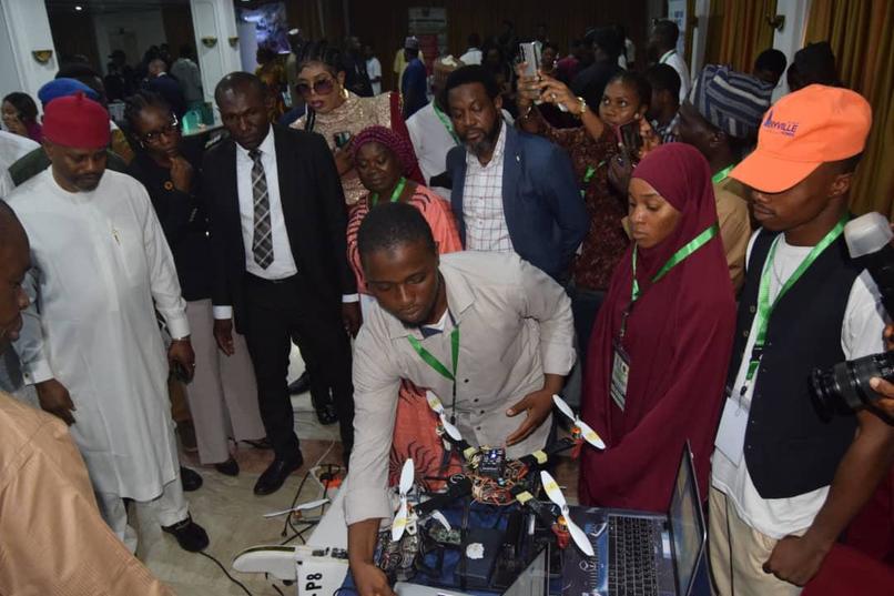
with the Minister at NextGen Innovation Challenge, 2025
-

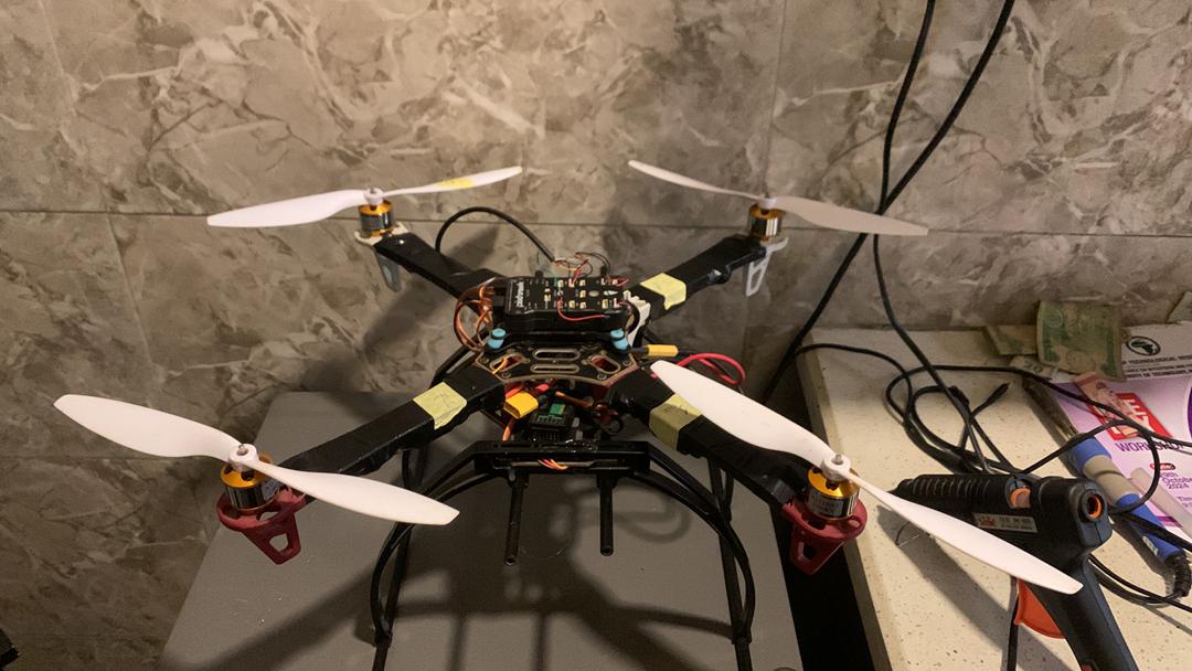
View of the First Model for short range application
-

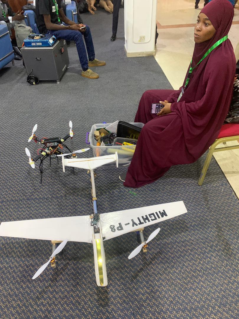
View of Second Model for Long range application.
-

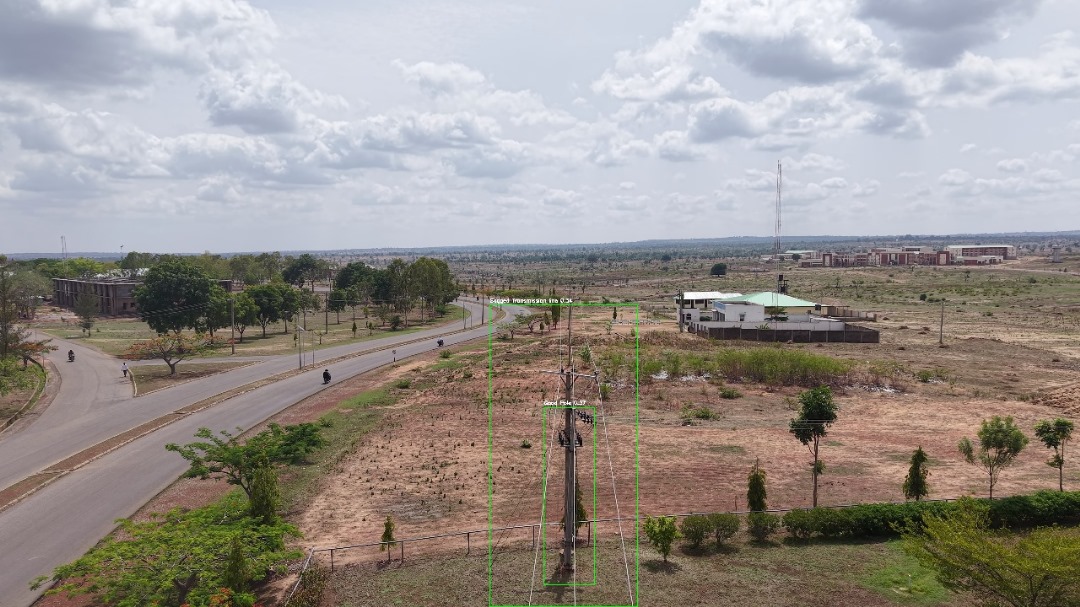
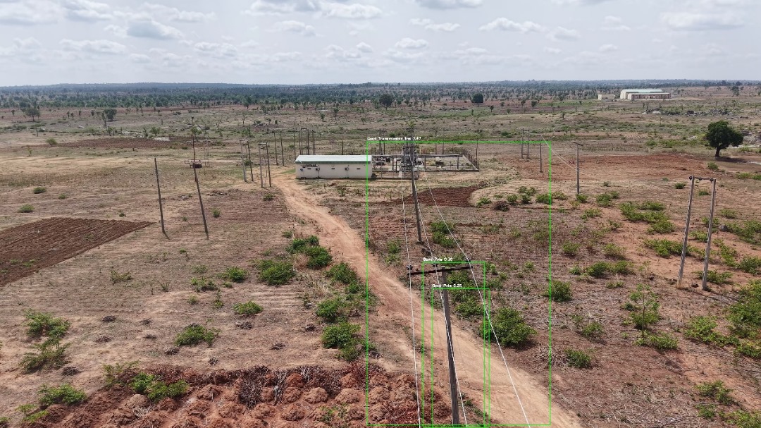
AI model identifying important parameters.
-
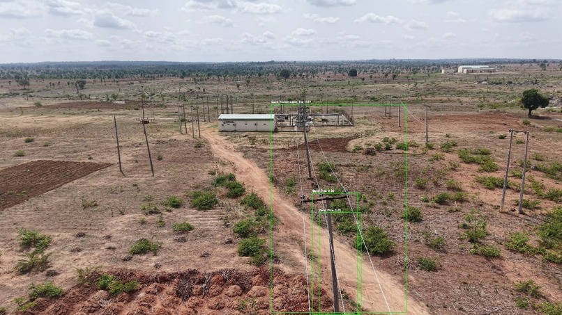
Model identifying transmission lines and conditions.

Inspiration
Growing up in Nigeria, I saw how bad infrastructure—like failing roads, collapsing rooftops, and leaning electric poles—often went unchecked until disaster struck. With limited monitoring tools and huge inspection costs, rural and underserved areas suffer the most. This inspired me to develop SkyPower, a low-cost indigenous drone system designed for real-time infrastructure monitoring.
What it does
SkyPower uses AI and drone technology to inspect public infrastructure such as roads, rooftops, towers, and power lines. It captures high-resolution images, analyzes them with a computer vision model, and detects issues like cracks, corrosion, or tilts. The data can be used by engineers and local governments to act quickly and prevent damage.
How we built it
We used a local Styrofoam for the Fixed wing Design which focuses on long range monitoring and an opensource f450 quadcopter frame which is very popular in the market, we made use of Arduino as the main Flight Controller, GPS, and gyroscope sensors to be able to balance the drone. The image data is acquired using a raspberry pi and raspberry pi camera is processed using a trained CNN model built with YoloV8 and OpenCV. We also developed a mobile-friendly interface to display inspection results using Streamlit.
Challenges we ran into
Getting stable flight and clear aerial images on a budget was tough which means we had to take as many videos and pictures as possible of infrastructures and preprocess to remove the bad ones. Training the model with limited local datasets also slowed progress. Power supply during test flights and field access to infrastructure sites were very big challenges as there was not enough battery to swap during these stages.
Accomplishments that we're proud of
We proved that with limited resources, we could still build a functioning AI-based drone system. The local assembly and vision model worked as planned, and early field tests showed promising results. We have also been able to present the idea in two events which won recognition and prices. Also we are working on publishing our work to ensure we share knowledge on what we have accomplished so far.
What we learned
We learned how combining hardware, AI, and geospatial data can empower local communities. We also deepened our understanding of drone aerodynamics and computer vision. In the business aspect, we also realized some doesn't need the hardware solution itself, but our AI system can be used to solve many challenges in all major infrastructure sector.
What's next for Sky Power
We plan to scale Sky Power nationwide, improve its model accuracy, and partner with companies, infrastructures on how we can deploy our solution in the existing system. Also, we want to discuss with schools to train youth on how to build and deploy drone solutions locally.
Built With
- arduino
- c++
- numpy
- python
- raspberry-pi
- streamlit
- yolo

Log in or sign up for Devpost to join the conversation.