We've been faced with poor city infrastructure our entire life, we wanted to build a tool that optimizes transit architecture based on agent-based simulations.
Existing systems are designed in the moment, but as populations increase and demographics continue to diversify, cities are not designed to scale along.
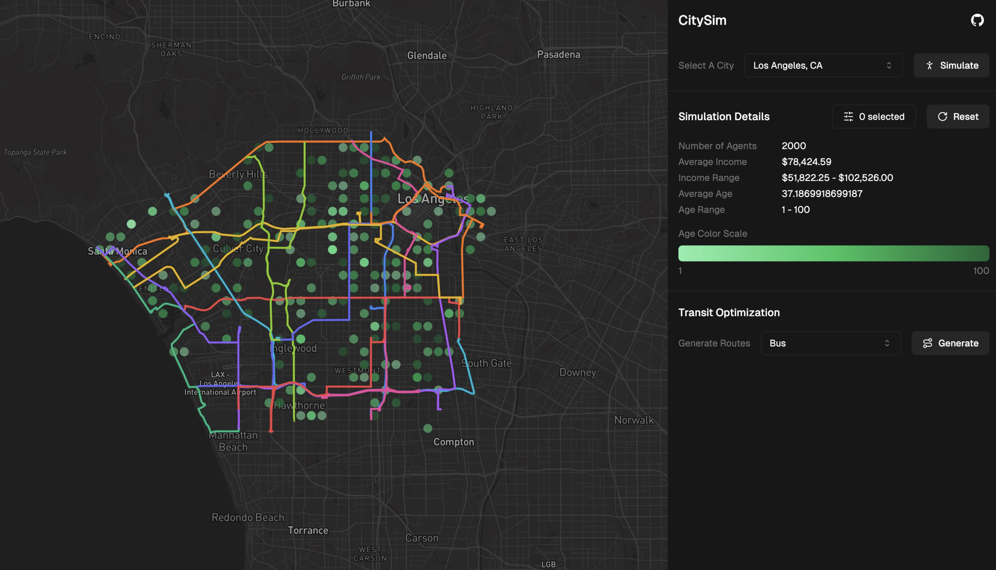
First, we scrape city census data to gain aggregate insights on demographics (ie gender, age, income) and we use Mistral to model thousands of distinct agents with different contexts, housing and jobs. We can then simulate different scenarios of city-wide transportation to identify population densities in housing, work and social districts.
The agents feeds this information into our transit optimization models, which using varying population densities and proximal policies to identify critical routes that minimize distance and maximize the accessibility for these agents.
This generates subway and bus routes, focused on population-dense areas and minimizing the loss of distance travelled by individual agents to get to where they may need to go. We use these estimations to model estimated loss in carbon emissions using the plan, using more census data.
Skyline models how we can reduce carbon emissions and design cities for the people that use them.
Built With
- nextjs
- python


Log in or sign up for Devpost to join the conversation.