-
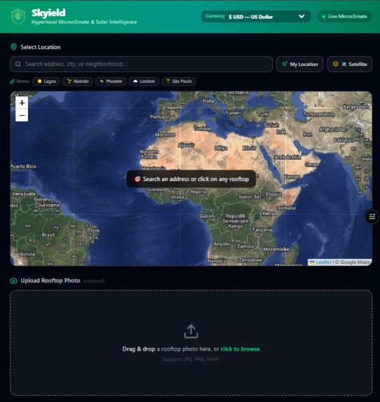
Skyield app
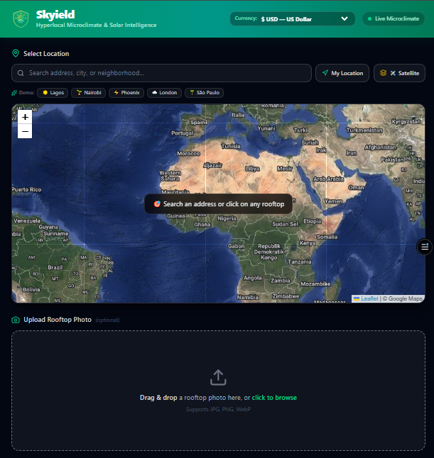
Inspiration
Over 1 billion people worldwide live in regions characterized by abundant solar radiation but burdened by volatile power grids and escalating utility costs. Despite the clear economic and ecological benefits of distributed renewable energy, residential adoption faces a massive friction point: site assessments.
Traditional solar and rainwater feasibility evaluations require manual engineering site surveys, expensive LiDAR drone scanning, and opaque hardware estimations. In many developing and peri-urban regions, this barrier excludes everyday homeowners, local businesses, and communities from transitioning to clean power.
We built Skyield to eliminate this friction. Our vision was to give anyone, anywhere on Earth the ability to drop a pin on their rooftop and receive an instant, mathematically rigorous microclimate, solar photovoltaic, hardware sizing, and rainwater harvesting feasibility assessment in seconds—tailored to their localized currency and specific property constraints—completely for free.
What it does
Skyield acts as an all-in-one, zero-latency property climate feasibility engine:
- Interactive Geospatial Pinpointing: Pinpoint any rooftop globally with Google Satellite Hybrid layers and dynamic viewport tile caching—streaming high-resolution tiles on demand and aggressively pruning off-screen cache to support low-bandwidth devices.
- Real-Time Atmospheric Telemetry: Fetches 7-day Global Horizontal Irradiance (GHI) in $\text{MJ/m}^2$, direct beam radiation, daylight duration, and precipitation metrics from Open-Meteo with scientific solar climate regression fallback.
- AI Rooftop Vision & Shading Analysis: Leverages multimodal computer vision to classify rooftop materials (e.g., galvanized metal, tile), determine usable surface area, detect localized shading obstructions (HVAC units, tree canopies), and estimate optimal installation tilt angles $\theta$.
- Customizable Hardware Configurator:
- Solar PV Modules: Select between 250W Polycrystalline (Standard), 400W Monocrystalline (High-Efficiency), or 550W Commercial Bifacial Tier-1 modules.
- Inverter Architecture: Configure Central String Inverters ($\text{ILR} = 0.90$), Hybrid Storage-Ready Inverters ($\text{ILR} = 0.85$), or Microinverters ($\text{ILR} = 1.0$) for shaded roofs.
- Quantity Mode: Auto-Fit to rooftop footprint or toggle manual panel count counters ($1 \text{ to } 100\text{ panels}$).
- Geographical Pin-Based Currency Localization: Automatically reverse-geocodes coordinates to convert all financial estimates into the host nation's local currency (e.g., Nigerian Naira $\text{₦}$, British Pounds $\text{£}$, South Korean Won $\text{₩}$, Japanese Yen $\text{¥}$, Euros $\text{€}$, etc.) with real-time manual overrides.
- Transparent NREL & IRENA Pricing Engine: Turnkey cost calculations benchmarked against official National Renewable Energy Laboratory and IRENA residential indices ($\$2.00 - \$3.40\text{/W}$ DC capacity installed).
- One-Click Feasibility Dossier Export: Generates clean, printer-friendly one-page technical reports formatted for homeowners, solar contractors, and policy planners.
Mathematical & Physical Foundations
Skyield computes clean energy and water yields using rigorous physics-based equations:
Photovoltaic Daily & Annual Energy Yield: $$E_{\text{daily}} = P_{\text{DC, total}} \times \text{GHI}{\text{avg}} \times \text{PR} \times (1 - S_f)$$ $$E{\text{annual}} = E_{\text{daily}} \times 365$$ (Where $P_{\text{DC, total}}$ is total DC array kW, $\text{GHI}_{\text{avg}}$ is solar irradiance in $\text{kWh/m}^2/\text{day}$, $\text{PR} = 0.75$ is the system performance ratio, and $S_f$ is the AI-detected shading factor).
Inverter Sizing Optimization (ILR): $$P_{\text{inv}} = \max\left(1.0\text{ kW}, \text{Round}\left(P_{\text{DC, total}} \times \text{ILR}_{\text{arch}}\right)\right)$$
Annual Rainwater Harvesting Capture: $$V_{\text{rain}} = A_{\text{usable}} \times P_{\text{annual}} \times C_r$$ (Where $P_{\text{annual}}$ is precipitation in $\text{mm}$ and $C_r = 0.85$ is the smooth roof runoff coefficient).
Carbon Offset & Tree Equivalence: $$\text{CO}2\text{ Offset (kg/yr)} = E{\text{annual}} \times 0.42\text{ kg CO}_2/\text{kWh}$$ $$\text{Trees Equivalent} = \frac{\text{CO}_2\text{ Offset}}{21.77\text{ kg CO}_2/\text{tree/yr}}$$
How we built it
- Frontend Application: Built with React, Vite, and Tailwind CSS v4 utilizing an accessible, responsive glassmorphic design system.
- Geospatial & Mapping: Implemented with Leaflet and React-Leaflet, integrating Google Maps Hybrid Satellite layers with custom viewport memory management.
- Atmospheric Telemetry & Localization: Direct browser integration with Open-Meteo Forecast APIs paired with an autonomous latitude-based atmospheric regression engine and Nominatim Reverse Geocoding for country-level currency mapping.
- AI Vision Engine: Powered by Google Gemini Multimodal Vision API for rooftop geometry classification, roof surface condition assessment, and obstruction detection.
- Hosting & Infrastructure: Deployed globally with zero-latency edge delivery via Vercel.
Challenges we ran into
- Browser Geolocation Reliability on Hardware Without GPS:
- Problem: When testing on desktop browsers without hardware GPS chips, the standard Geolocation API returned
POSITION_UNAVAILABLE(Code 2). - Solution: Implemented intelligent fallback handling that differentiates error codes and gracefully falls back to IP-based approximate coordinate resolution (
ipapi.co) when device GPS is unavailable.
- Problem: When testing on desktop browsers without hardware GPS chips, the standard Geolocation API returned
- 60fps Real-Time Slider Reactivity:
- Problem: Recalculating hardware kits, battery sizing, and financial curves using asynchronous backend roundtrips caused lag during rapid slider dragging.
- Solution: Engineered a synchronous client-side physics computation engine wrapped in React
useMemo, allowing instant 60fps re-renders across all charts, currencies, and hardware gauges without network latency.
- Print & PDF Dossier Formatting:
- Problem: Default browser printing captured map controls, zoom bars, and dark glass backgrounds, leading to unreadable prints and ink waste.
- Solution: Designed a dedicated
@media printlayout that automatically strips interactive map canvases and renders a clean, high-contrast executive property feasibility summary.
- Dynamic Currency & Geographic Conversion:
- Problem: Solar hardware costs vary significantly by region and currency exchange volatility.
- Solution: Built an internationalized exchange and reverse-geocoding engine that seamlessly maps over 20 global currencies directly to the pin location while keeping NREL standard cost-per-watt parity intact.
Accomplishments that we're proud of
- Zero-Latency Simulation: Achieved instantaneous 60fps recalculations across all hardware specifications, currency conversions, and solar charts during continuous slider adjustments.
- Global Currency Localization: Automatic country-level currency detection enabling users in Lagos ($\text{₦}$), London ($\text{£}$), Seoul ($\text{₩}$), or Tokyo ($\text{¥}$) to immediately understand their local financial return on investment.
- Resilient Multi-Tiered Architecture: Engineered an application that operates seamlessly even when third-party telemetry services are throttled, utilizing direct client-side meteorological APIs and latitude regression models.
- Comprehensive Hardware Flexibility: Supported three tiers of solar panel wattages and three distinct inverter topologies (String, Hybrid Storage, and Microinverters).
- Production-Ready Edge Deployment: Successfully packaged, built, and deployed the full application to Vercel with zero cold starts.
What we learned
- Physics-Grounded AI: Combining AI where it excels (computer vision, roof geometry classification, pattern detection) with deterministic physics and atmospheric equations produces far more accurate, trustworthy, and actionable energy forecasts than unconstrained LLM predictions alone.
- Low-Bandwidth Geospatial Engineering: Dynamic viewport tile caching and memory management are critical for ensuring satellite mapping tools remain fast and responsive in regions with limited network connectivity.
What's next for Skyield
- Automated Local Utility Tariff Sync: Integrating regional electricity rate APIs to calculate dynamic net-metering and feed-in tariff ROI down to the municipal level.
- Multi-Polygon Roof Tracing: Allowing users to draw custom multi-angle roof facets directly on satellite tiles for complex architectural layouts.
- Installer Marketplace Integration: Connecting analyzed homeowners directly with verified local solar contractors and micro-financing institutions.
Built With
- artificial-intelligence
- clean-energy
- climate-tech
- computer-vision
- environmental-science
- fastapi
- gemini-api
- geospatial
- green-tech
- javascript
- leaflet.js
- microclimate
- open-meteo
- physics-engine
- python
- rainwater-harvesting
- react
- renewable-energy
- solar-power
- sustainability
- tailwindcss
- vercel
- vite
- web-app
