-
-
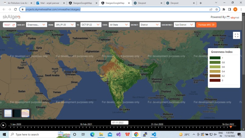
skaigeo greeness index layer
skaigeo
AI ML based geospatial platform for agriculture, banks and insurance sector
Updates

Leave feedback in the comments!
AI ML based geospatial platform for agriculture, banks and insurance sector
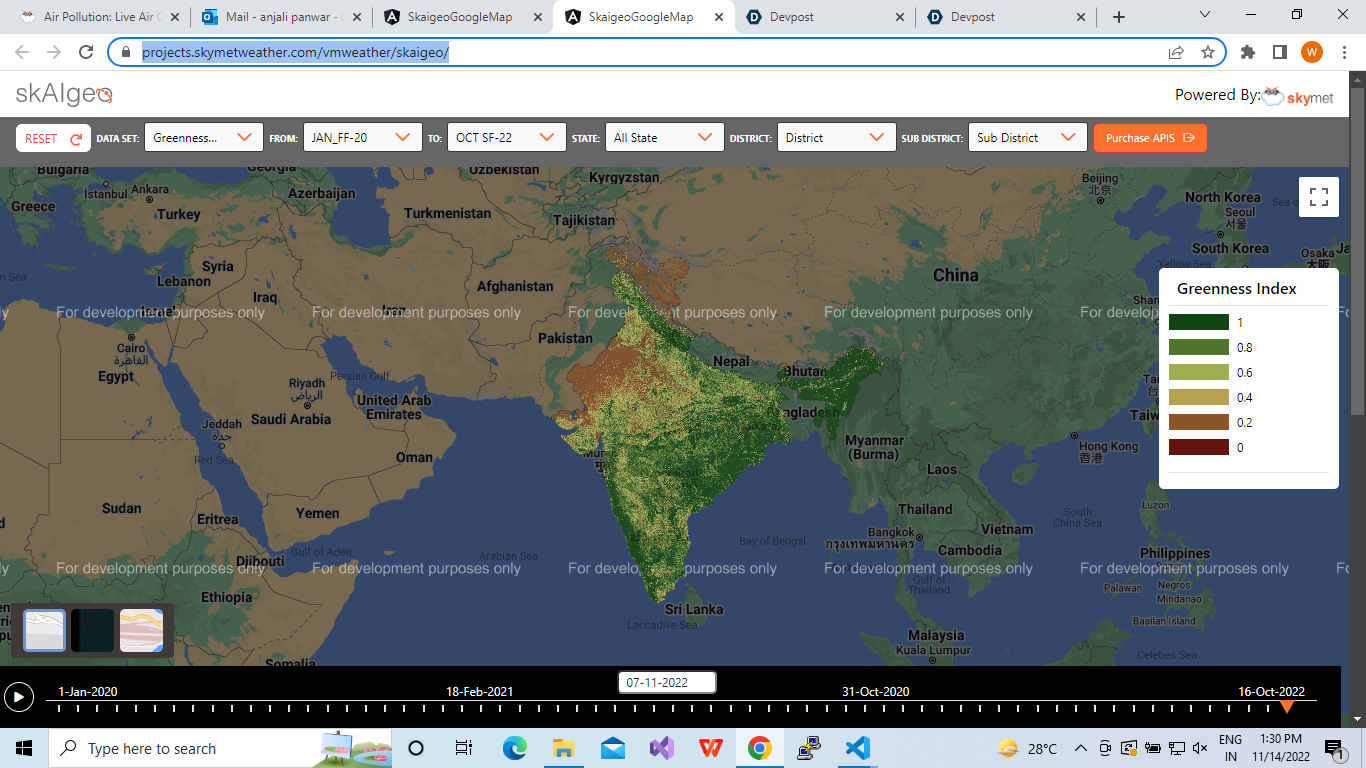
skaigeo greeness index layer
Leave feedback in the comments!
Log in or sign up for Devpost to join the conversation.