


Inspiration
Our group had a lot of brainstorming sessions! From doing something current like mapping out the Olympics, to gamifying Esri's products. Though, we kept coming back to the idea of spatial finance: The idea that geospatial data, mostly through remote sensing, can be used to inform financial decisions -- oftentimes beating the market or quarterly announcements. We thought this was a unique topic, not much explored in previous Hackathons. With increasing investments in satellites and machine learning technology to easily interpret their images, we felt a hackathon project on this couldn't be more timely.
What it does
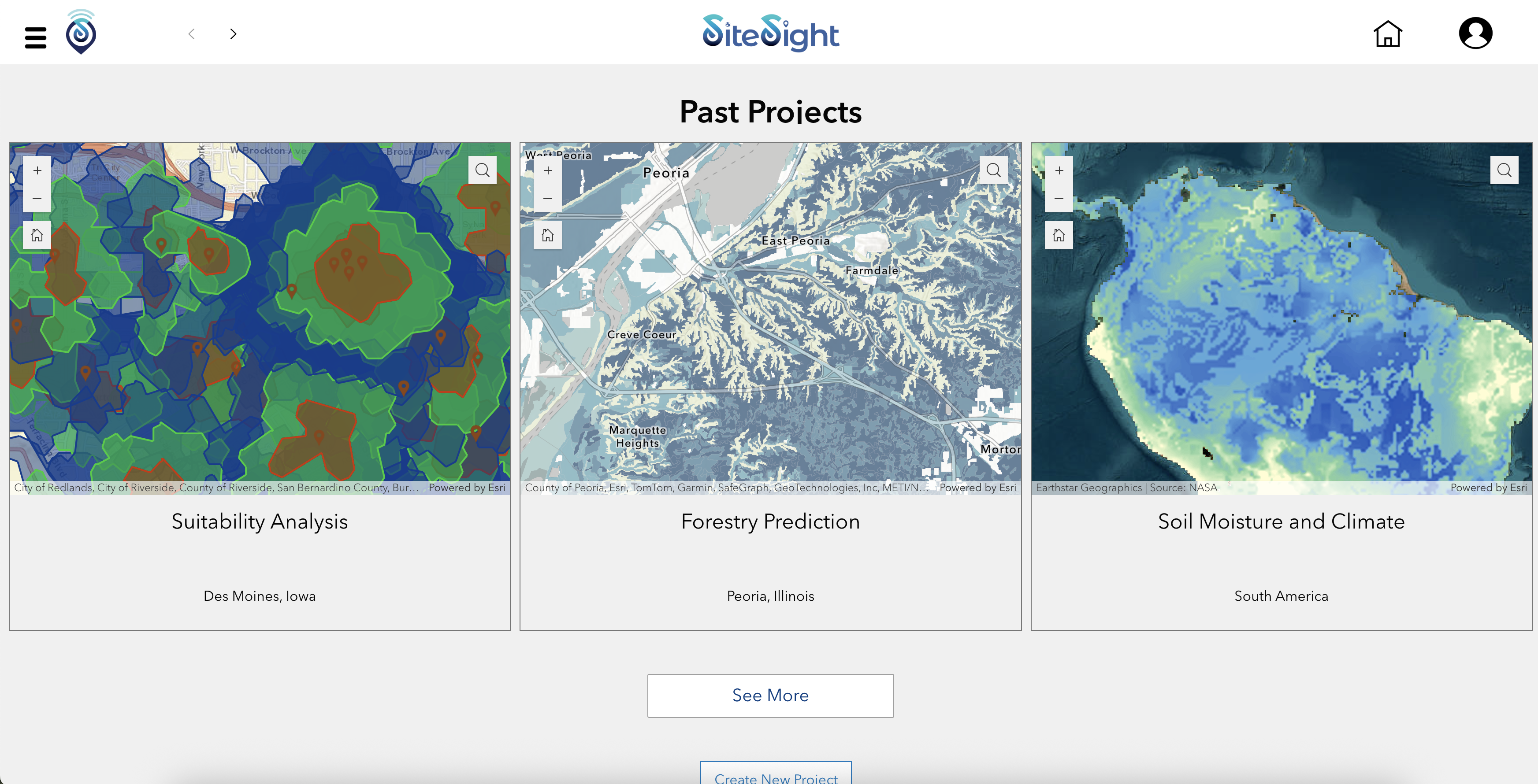
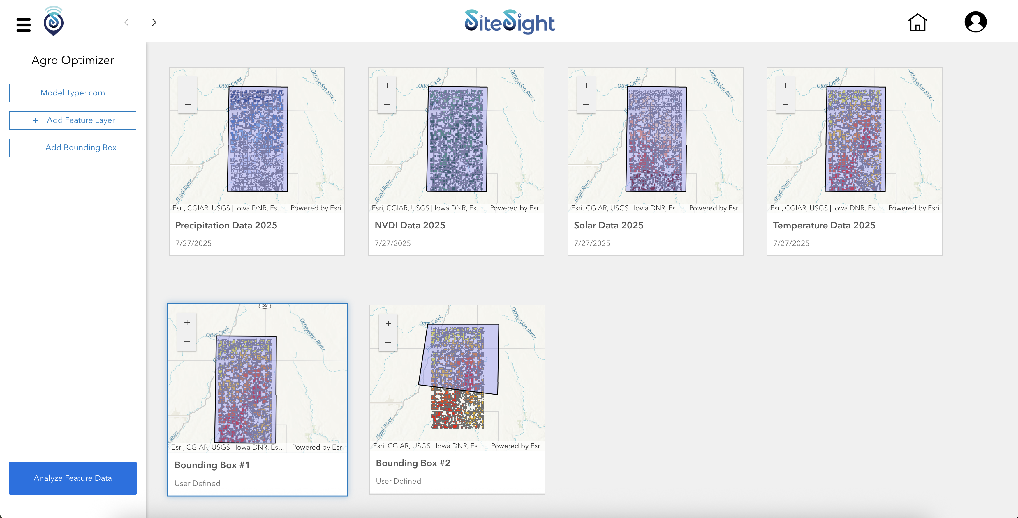
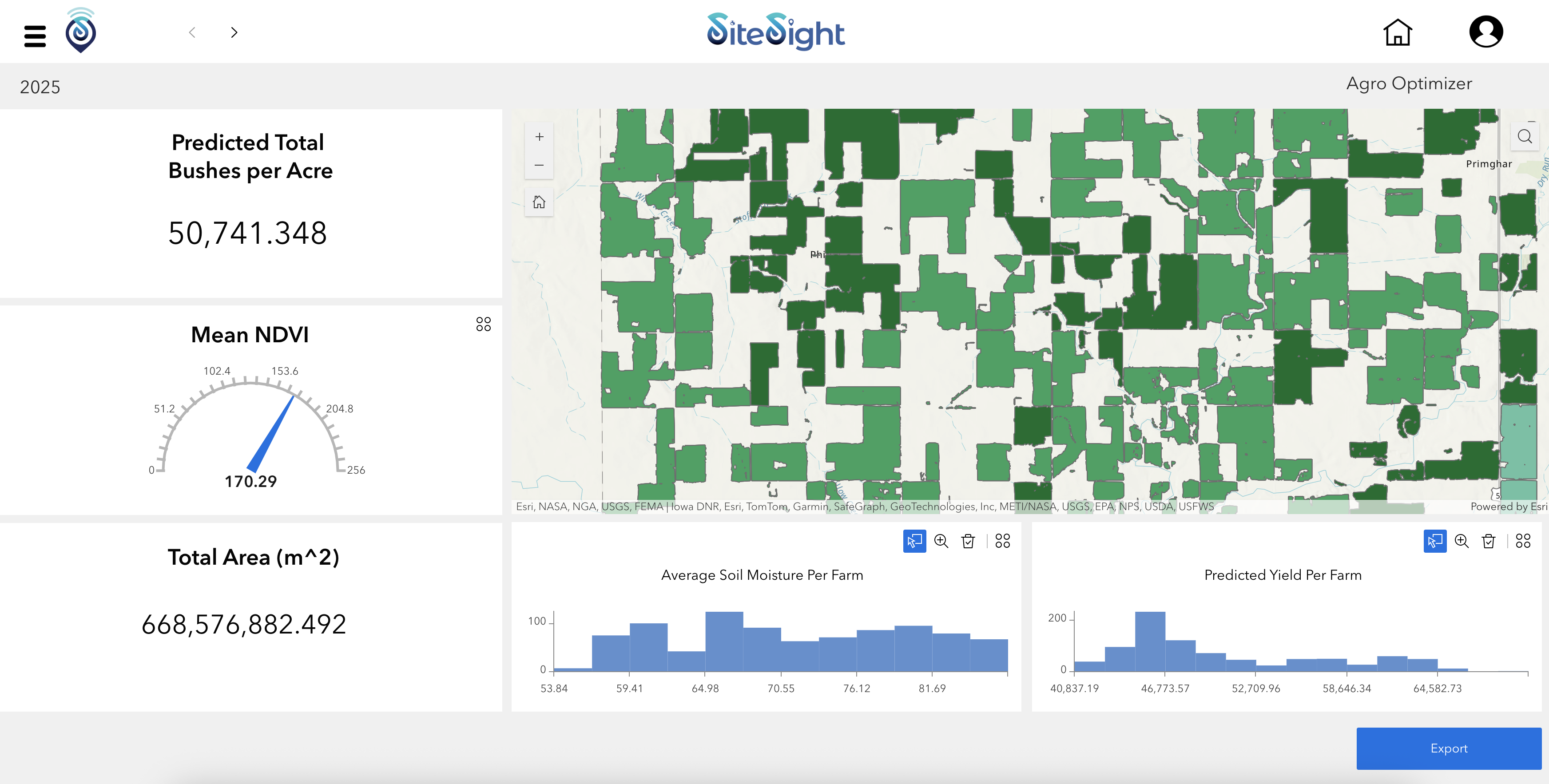
SiteSight is designed as a modular application. We hope that with more time and resources, the application could be applied to several industries and use-cases, such as using machine learning to count the number of cargo containers left in port -- as a proxy for global trade metrics -- or using change detection on lumber fields to determine the future price of pulp and wood. Given our timeframe, we focused on the agricultural industry. SiteSight's agricultural module allows users to insert an area of interest polygon, and -- using a machine learning model -- predict the average yield for those farms. The user interface supports dynamic charting of prediction results, display of feature importance, and visual mapping of risk directly onto the selected fields. It’s not just a map viewer. It’s an analytical tool built for fast, spatial decision-making.
How we built it
We trained our predictive model using field-level agricultural data from O'Brien County, IA, leveraging both spatial and environmental attributes. The training dataset included NDVI values calculated from Sentinel-2 satellite imagery accessed through Microsoft's Planetary Computer. We filtered imagery for cloud cover and date ranges aligned with the core growing season and used batch raster processing to extract vegetation metrics. Additional inputs like soil, temperature, precipitation, and solar radiation were sourced from NetCDF files and joined to cropland polygons clipped from the USA Cropland layer.
Using ArcGIS Pro, we trained a forest-based regression model (XGBoost) to estimate crop yield based on a variety of environmental variables. This model was published as a geoprocessing service to ArcGIS Enterprise, making it accessible through a secure REST endpoint. The results are visualized within an ArcGIS Experience Builder dashboard, allowing users to explore predictions and understand the impact of each variable in a clear, map-driven interface.
Challenges we ran into
Much of our time was spent wrangling data: filtering, cleaning, and joining variables from different sources into usable map layers. On top of that, we were learning as we built: figuring out how to publish geoprocessing tools to ArcGIS Enterprise and experimenting with referencing hosted layers inside web tools. It was especially challenging to turn spatial analysis into a real-time, user-facing application.
Accomplishments that we're proud of
We’re proud that we went end-to-end: from satellite imagery to machine learning to interactive web maps. We created a truly spatial-first user experience that integrates live predictions, visual feedback, and analytical transparency. Our batch prediction engine is efficient, our map visualization is dynamic, and our system is extensible. All of this was achieved without compromising usability or performance.
What we learned
We learned how to operationalize complex geospatial workflows into approachable web interfaces. We learned how to coordinate different parts of the Esri ecosystem: ArcGIS Pro, Experience Builder, and the JavaScript API, to build a cohesive tool. We also deepened our understanding of spatial machine learning and the importance of input preprocessing and metadata consistency. Finally, we learned that building something this cross-functional is as much about clarity of vision as it is about technical execution.
What's next for SiteSight
While our demo focused on agriculture, SiteSight was built with multiple industries in mind: from insurance and infrastructure to logistics and development. Anywhere land-based decisions impact financial outcomes, SiteSight can deliver predictive, geospatial intelligence. Looking ahead, we plan to integrate tools for time series analysis, anomaly detection, and SmartSite alerts that proactively flag risks and opportunities. SiteSight is evolving into a full-featured spatial finance platform, turning geospatial data into strategic foresight across sectors.
Built With
- arcgis-experience-builder
- arcgis-pro
- typescript


Log in or sign up for Devpost to join the conversation.