-
-
-

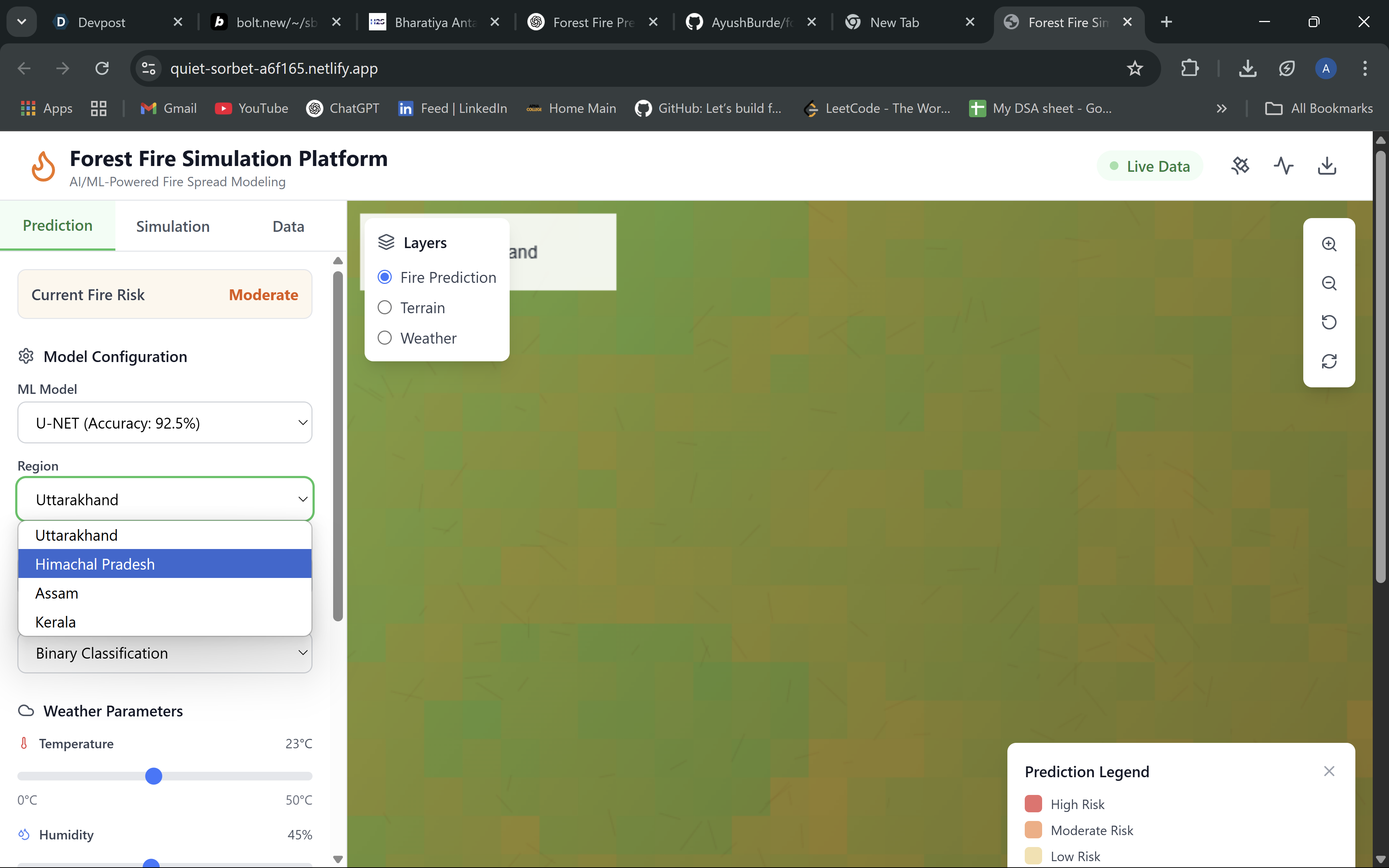
We can select the state of a country and based on that it'd give us a binary and probablistic ans if it has fire danger or not
-
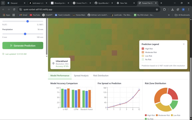
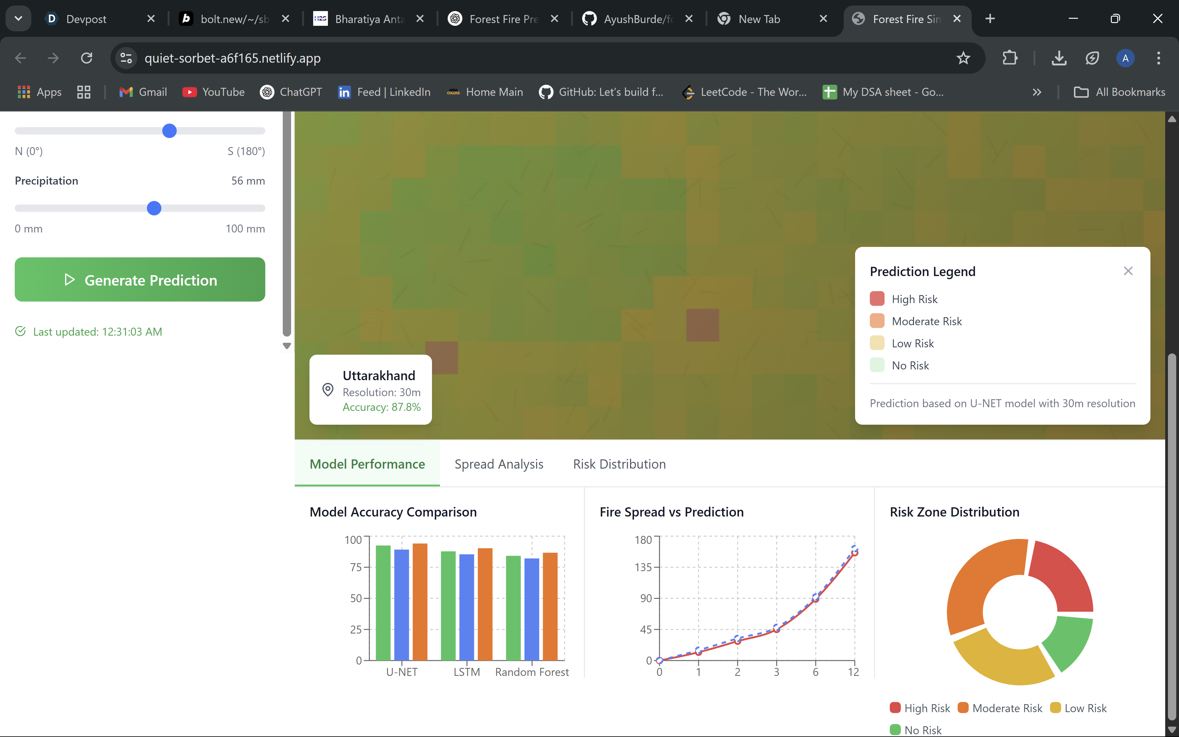
This is a modle evaluation metrics

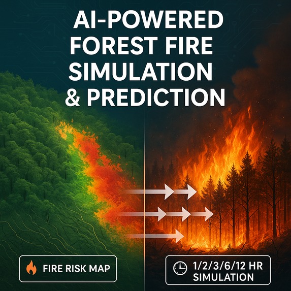
Inspiration Forest fires are one of the most destructive natural disasters—fast, unpredictable, and often devastating to both nature and human life. Regions like Uttarakhand face this risk every dry season. Despite the availability of rich satellite and weather data, we noticed that real-time fire risk forecasting and spread simulation is still not easily accessible to authorities. That sparked the idea: Can we build an AI-powered system that not only predicts where fires might happen but also shows how they might spread in the next few hours?
What it does Predicts the likelihood of forest fire the next day at a 30-meter resolution using satellite and weather data.
Generates a binary fire risk map (fire/no fire zones). Simulates fire spread from high-risk zones for 1, 2, 3, 6, and 12 hours into the future. Outputs animated fire spread maps that can help authorities prioritize response.
How we built it Data Collection & Preprocessing
Weather: ERA-5, IMD (wind, temp, humidity, rainfall) Terrain: 30m DEM from Bhoonidhi (used to calculate slope and aspect) LULC data (for fuel types) from Bhuvan/Sentinel Hub Fire history from VIIRS-SNPP Fire Prediction Model Trained a U-Net deep learning model on stacked raster inputs to generate a fire/no-fire classification map. Fire Spread Simulation Used a Cellular Automata model where each pixel updates based on wind, slope, and fuel availability.
Visualization
Created animated raster outputs to show how fires can evolve over different time intervals.
Challenges we ran into Data alignment issues: Every dataset had a different format, projection, or resolution. Standardizing everything to 30m took effort.
Sparse training labels: Real fire events are rare and inconsistent, making model training harder.
Realistic spread modeling: Simulating fire movement with natural terrain and wind was more complex than expected.
Computational overhead: Working with high-resolution rasters pushed our memory and processing limits.
Accomplishments that we're proud of Created a working AI pipeline from raw satellite data to fire prediction map.
Successfully implemented a spread simulation system using cellular automata and visualized time-based expansion.
Produced clean, interpretable outputs that can be useful for forest departments, disaster response teams, and planners.
What we learned How to work with real-world satellite and raster data in Python.
Applying ML models like U-Net to spatial data.
Real-world simulation needs both domain knowledge and creative modeling—just AI isn’t enough.
Importance of aligning multiple data layers for geospatial ML.
What's next for Simulation of Forest Fire Spread using AI/ML techniques Add real-time inputs (live weather data via APIs). Extend to multiple regions across India using generalized models. Build a web dashboard for fire prediction and spread visualization. Collaborate with disaster management authorities to put this tool in actual use during fire season. Improve the model to predict severity levels and damage estimates.


Log in or sign up for Devpost to join the conversation.