-
-
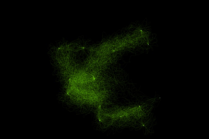
Foraging phase of slime growth simulation in standard mode.
-
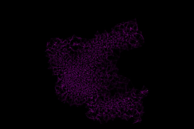
Refining phase of slime growth simulation in standard mode.
-
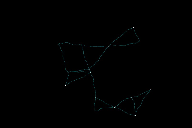
Network creation phase of slime growth simulation in standard mode. This is the final output.
-
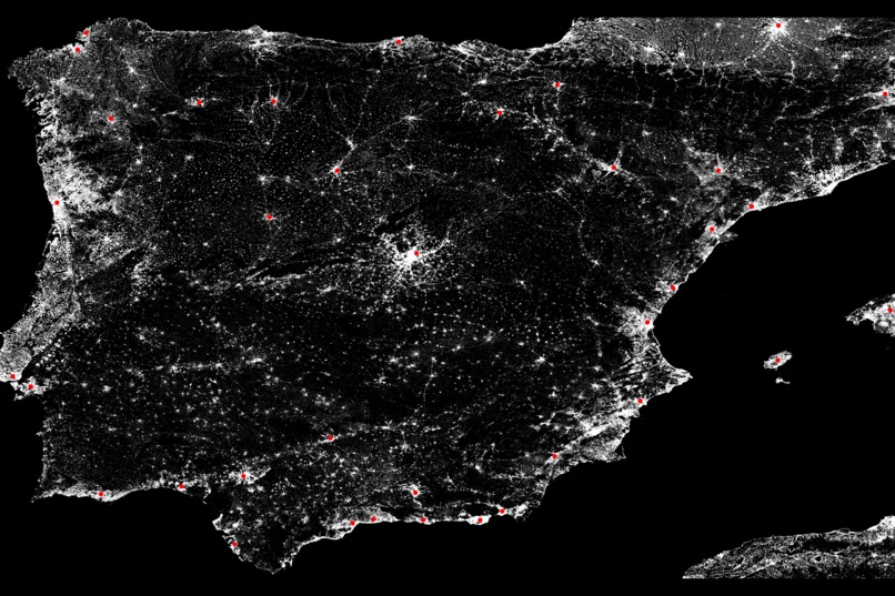
Map creation phase of slime growth simulation in Map Mode. The red nodes are generated automatically from the population data in the image.
-
Foraging phase of slime growth simulation in Map Mode.
-

Refining phase of slime growth simulation in Map Mode.
-
Network creation phase of slime growth simulation in Map Mode. This is the final output.


Inspiration
The inefficiencies of current road and railway networks have significant economic and environmental consequences. Traffic congestion on roads leads to wasted time and fuel costs, amounting to billions annually. Inefficient railways with limited connectivity and low speeds hinder economic growth and compromise safety. Additionally, both road and railway inefficiencies contribute to increased air pollution and carbon emissions, exacerbating environmental concerns. The imperative for designing maximally efficient highway and railway networks lies in fostering economic growth, ensuring environmental sustainability, and enhancing safety and reliability in transportation systems. Addressing these challenges is paramount for creating a resilient and prosperous future.
What it does
By extremely accurately simulating the growth of real life slime molds such as Physarum polycephalum, which are known to find the most efficient paths to their food sources, we are able to generate very efficient networks of edges between nodes. These networks are extremely close to those created by slime molds in real life. By generating these networks, we are creating an efficient tool for optimizing real life transportation networks. Users can enter their nodes and a few other parameters, and in this way they can generate optimized networks between these nodes. In an effort to provide larger scale solutions, we introduced "Map Mode," which allows users to create networks between urban clusters on regions of Earth's surface, simply by providing that latitudes and longitudes of the region.
How we built it
AMUNISM was developed using Python, and a variety of Python packages. The graphic user interface was built using Tkinter. The image processing was conducted using the PIL package. The data processing was conducted using Scipy and Numpy. Through the use of these packages, we were able to implement many algorithms which collectively forms our app. In particular, we have three major phases to our program: foraging, refining, and network creation. In "Map Mode," there is a fourth step which precedes all of these, map creation.
Challenges we ran into
A significant challenge in our work was creating a model which accurately simulated real slime mold growth. However, through diligent testing and the implementation of various metrics through which we could judge how well we could simulate molds, we were able to consistently model its growth. Another issue we ran into was dealing with the massive amount of population data needed to implement "Map Mode." However, by automating as much of this process as possible, and by also optimizing our code to be as efficient as possible, we were able to overcome this.
Accomplishments that we're proud of
Of course, we are proud of our entire project :). However, more importantly, we are proud of the potential applications of what we have created and the solutions it may solve in the future!
What we learned
Of course, we learned much in terms of technical skills and their implementations. However, more importantly, we learned about how difficult it is to create something with real world applications, and how much more though and consideration it takes than something like, say, a game.
What's next for AMUNISM
We will continue to develop AMUNISM, and bring it to developers and city planners across the globe!

Log in or sign up for Devpost to join the conversation.