-
-
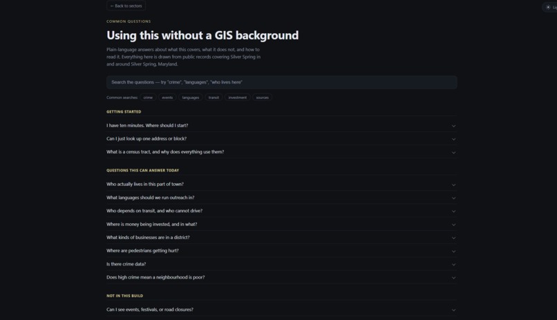
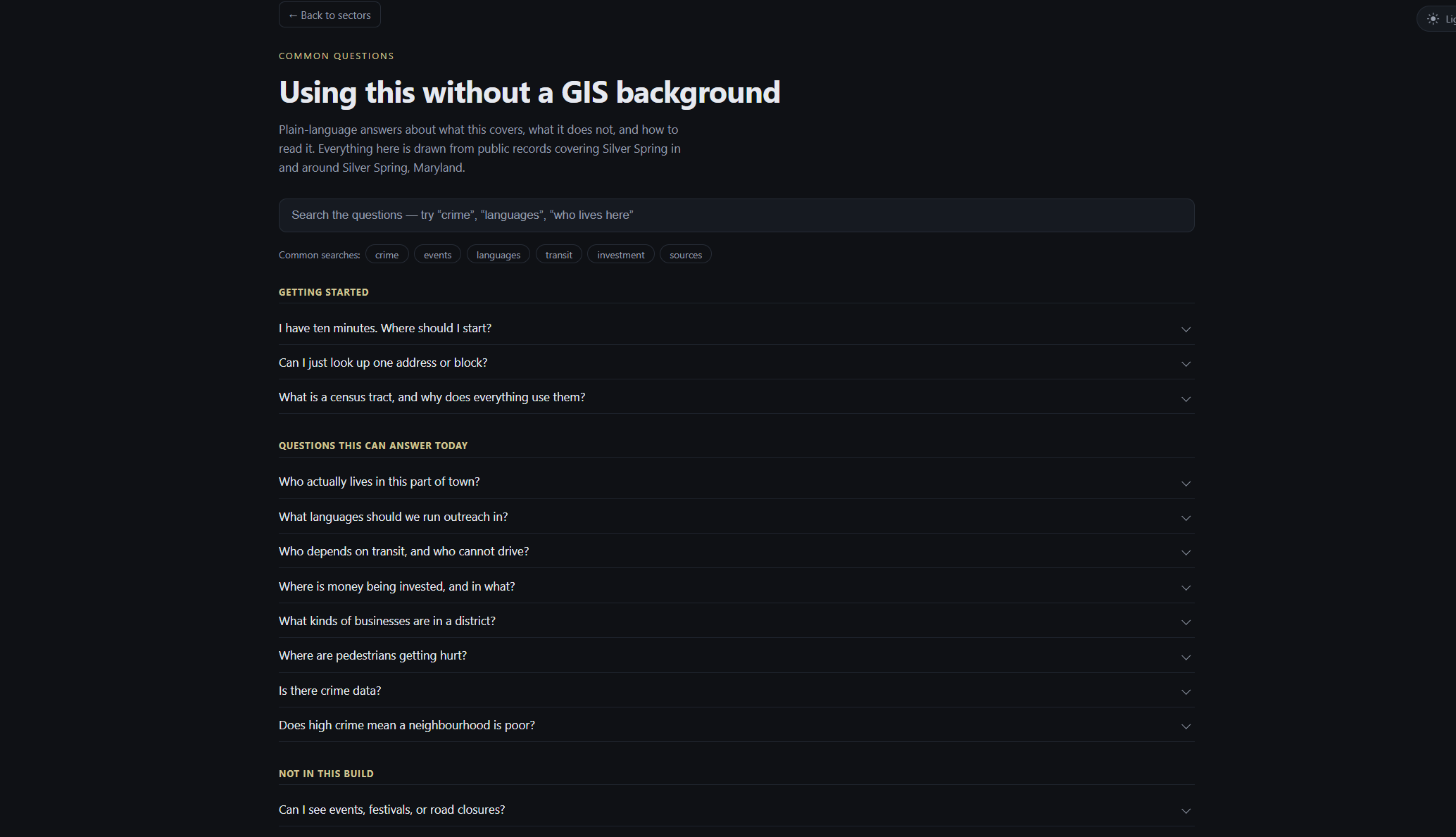
Common Questions with Simple Answers
-
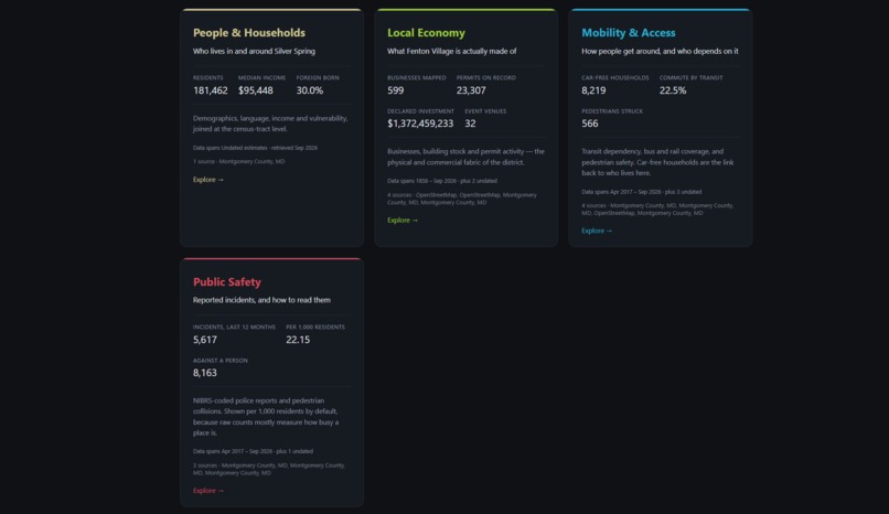
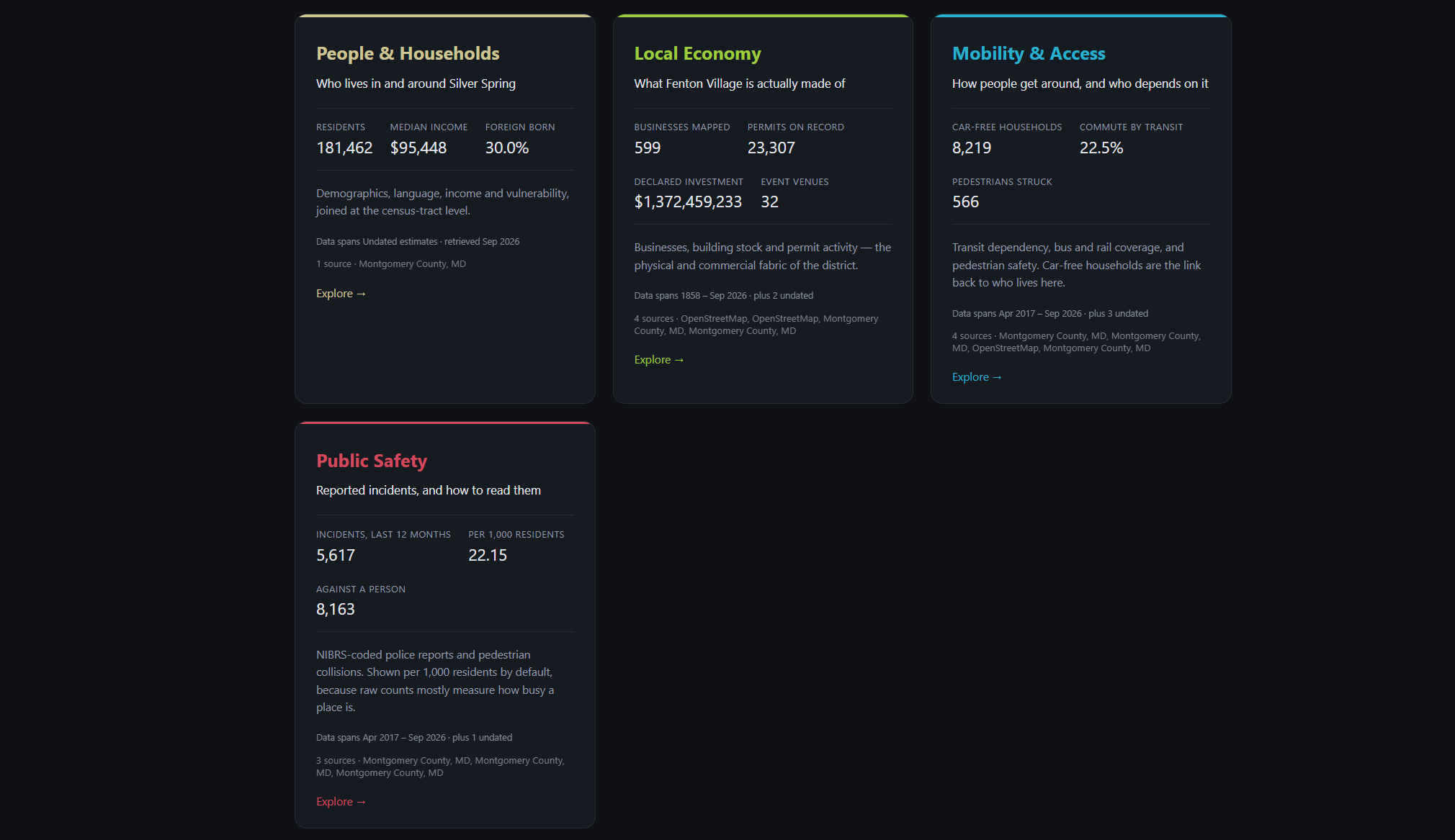
Four Sectors
-
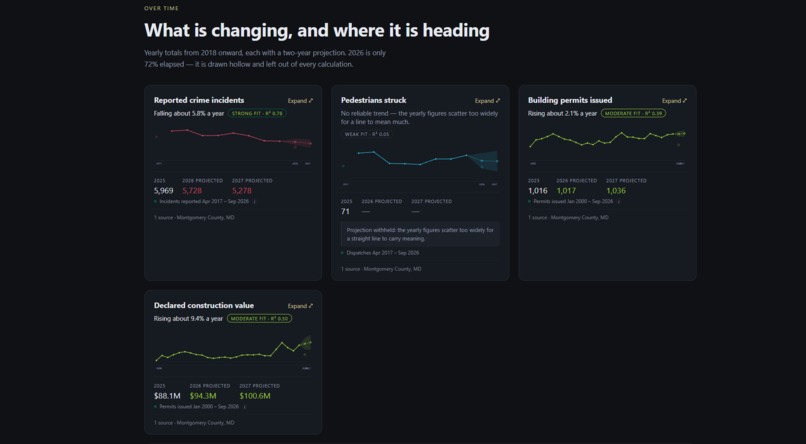
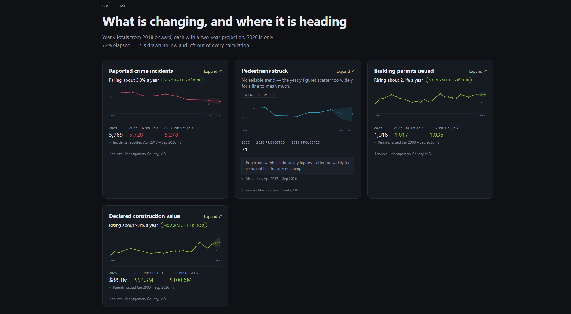
Trendlines
-
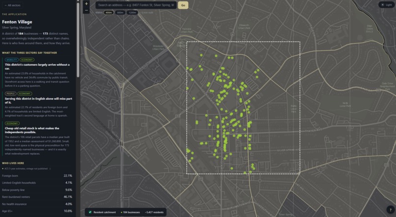
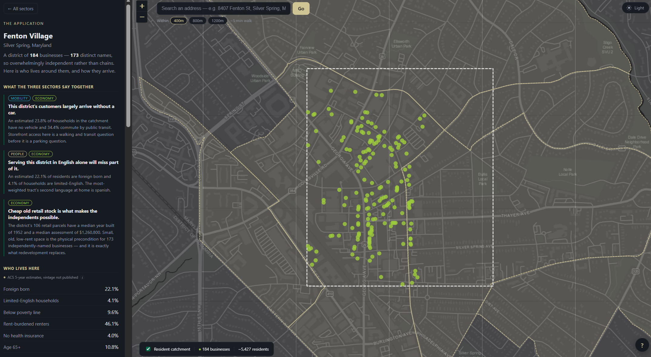
Fenton Village Zoom
Inspiration
We were inspired by a simple but meaningful idea: people should be able to plan their lives with confidence, using information that truly reflects the community they call home. Public data about Silver Spring, Maryland has long been scattered across census records, county datasets, and GIS layers, making it difficult for residents and officials to find what they need.
We wanted to change that. By bringing these sources together, we hoped to make everyday decisions, such as, organizing a community event, exploring safer routes, supporting local businesses, or simply understanding a neighborhood a little better, feel easier, more informed, and more connected to the place people live.
What it does
Silver Spring Community Intelligence unifies multiple public datasets into a single, accessible data warehouse. Instead of navigating dozens of separate portals, users can explore demographic, spatial, and community- level information in one place. Everything is joined on census tract, giving a consistent geographic foundation for combining otherwise unrelated datasets. No API keys are required, every source is open and publicly accessible.
How we built it
We began by surveying publicly available datasets covering Silver Spring, including:
- U.S. Census Bureau demographic and housing data
- Montgomery County government datasets
- GIS layers for spatial boundaries and features
Each dataset was extracted, cleaned, and standardized before being loaded into a single warehouse. The key step was aligning every source on census tract, which gave us a stable, shared geographic key for merging heterogeneous data.
In the demo video, we used Eleven Labs to generate a voice over audio to overlay onto the recorded tutorial.
Challenges we ran into
- Video production — creating our demo video took a lot of time and effort, especially aligning the audio narration with the video clips properly.
Accomplishments that we're proud of
We're proud that we built a fully open, key-free pipeline, no API keys, no paywalls, just public data made usable. We're especially proud of settling on census tract as our unifying key, since it let us merge datasets that were never designed to work together. Most of all, we're proud of turning something as dry as "public records" into a tool that can genuinely help someone find a safer street or plan a neighborhood event.
What we learned
- How inconsistent public datasets can be, even when describing the same region
- Techniques for cleaning, validating, and aligning spatial data
- That when data is unified and easy to explore, people find creative, unexpected uses for it
What's next for Silver Spring Community Intelligence
Looking ahead, we'd like to expand coverage to neighboring Montgomery County communities and add more real-time layers (such as event calendars and business listings). Our long- term hope is for this to grow into a lightweight, trusted resource that any local community could adapt for their own area.
Built With
- leaflet.js
- python
- react
- vscode


Log in or sign up for Devpost to join the conversation.