-
-
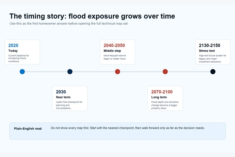
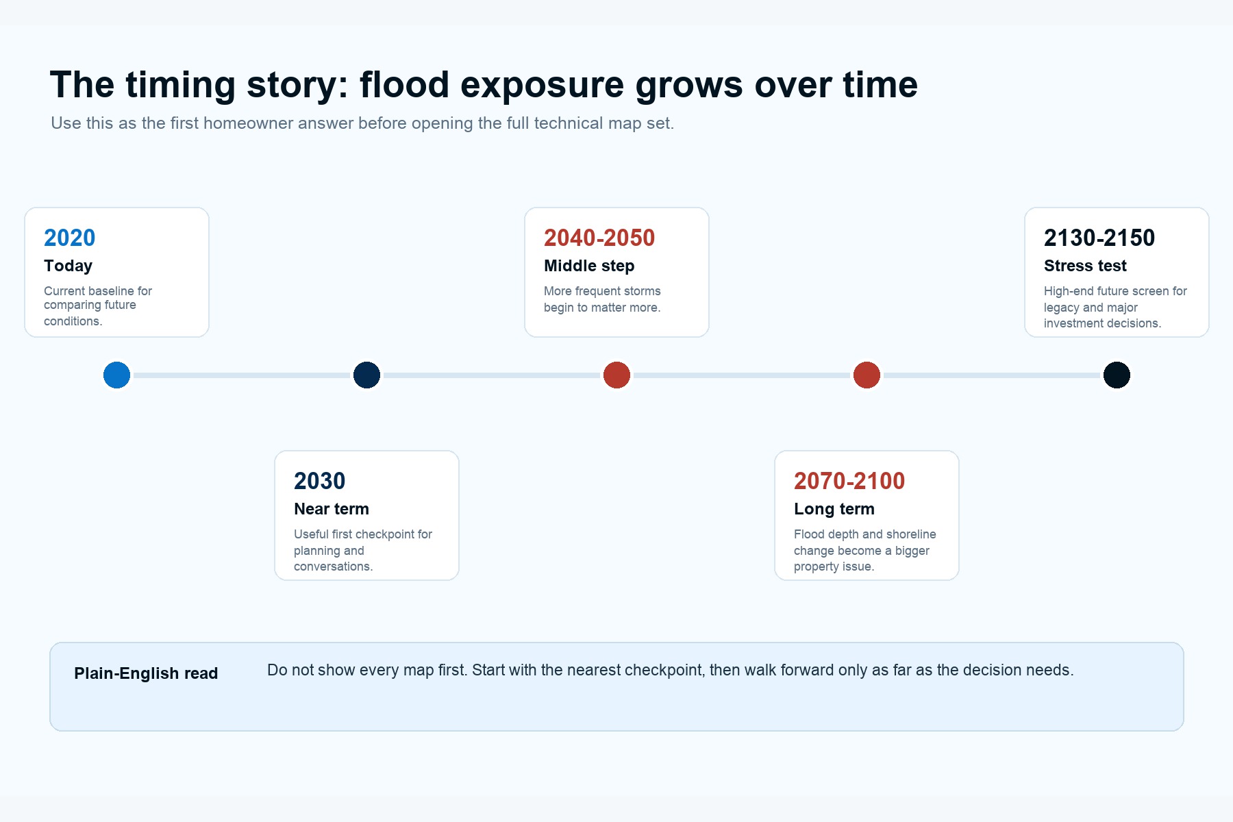
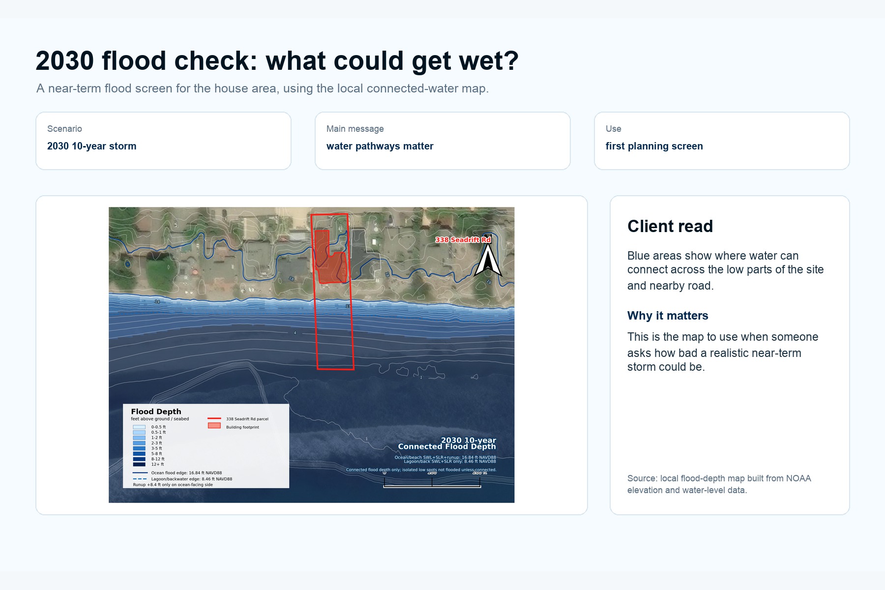
Plain-English exposure timeline: start near-term, then step through mid-century and late-century flood risk.
-
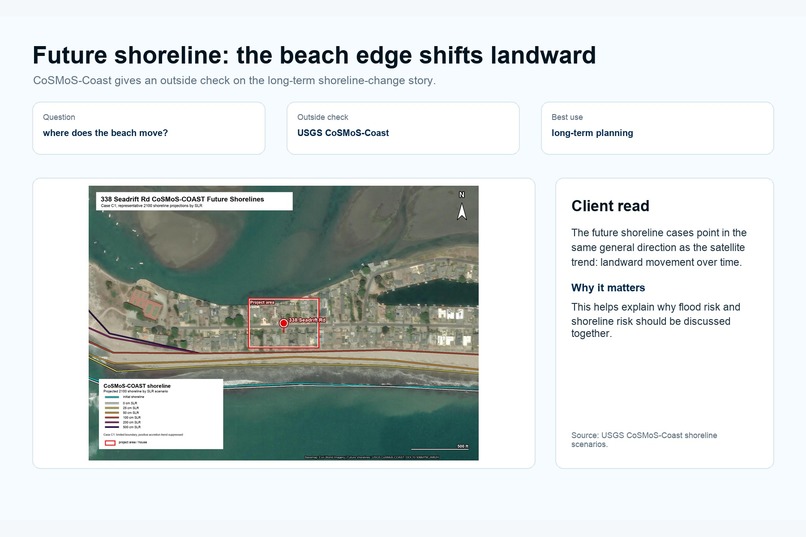
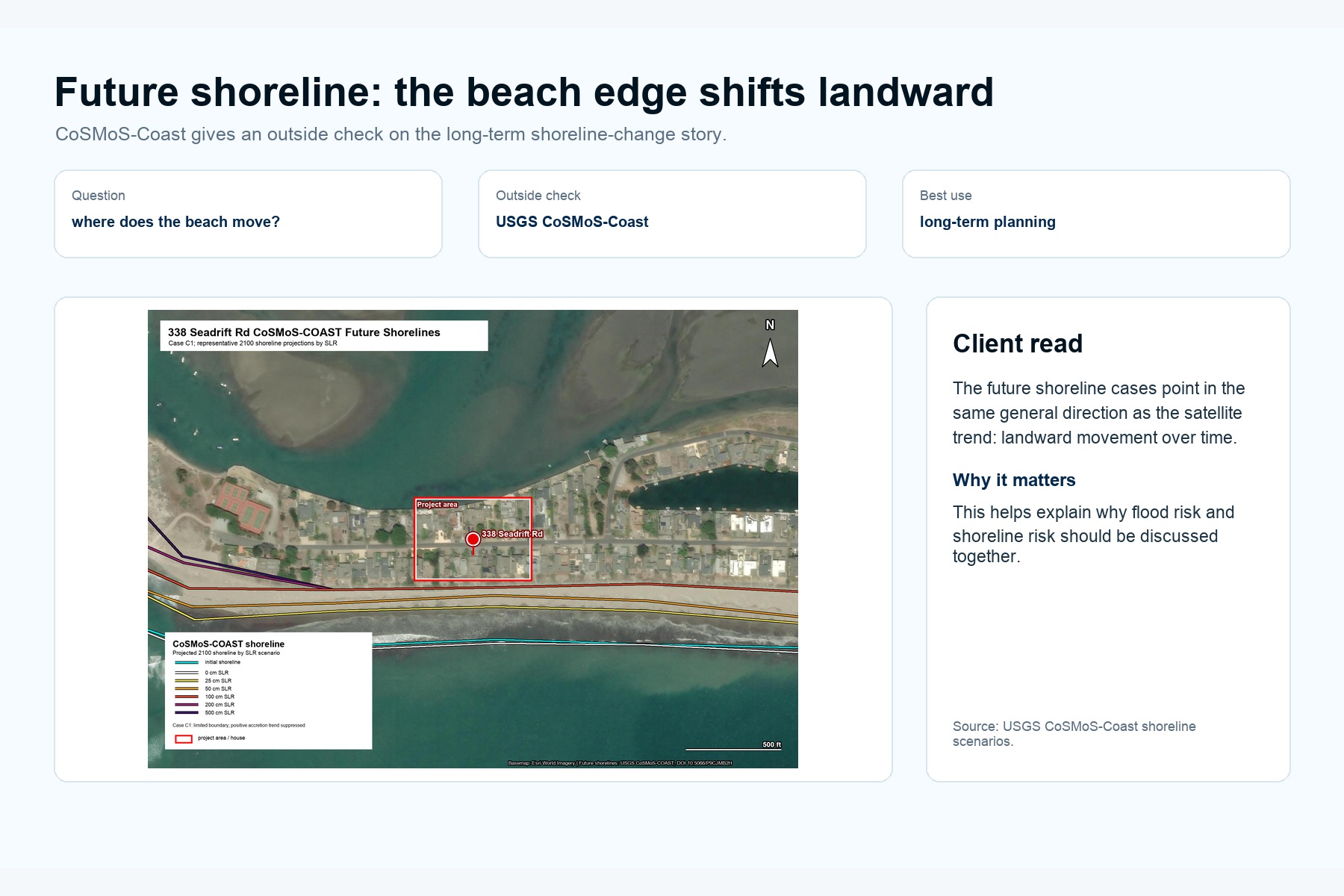
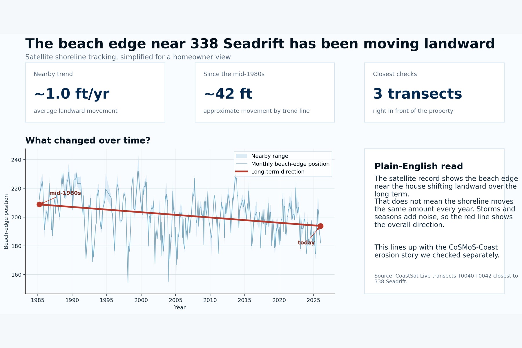
USGS CoSMoS-Coast shoreline scenario showing long-term landward beach-edge movement near 338 Seadrift.
-
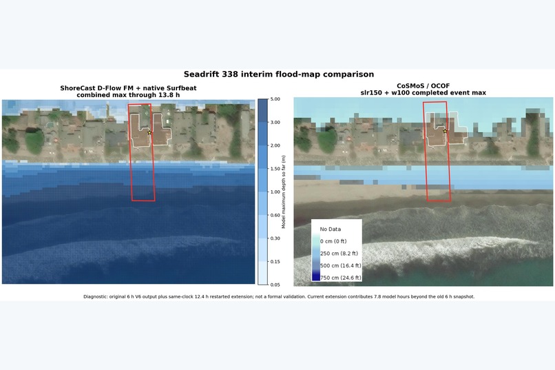
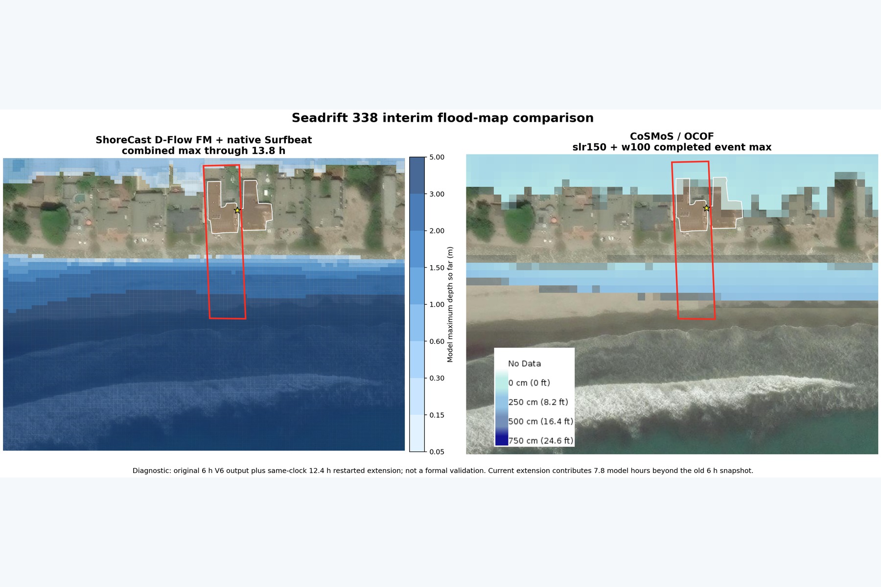
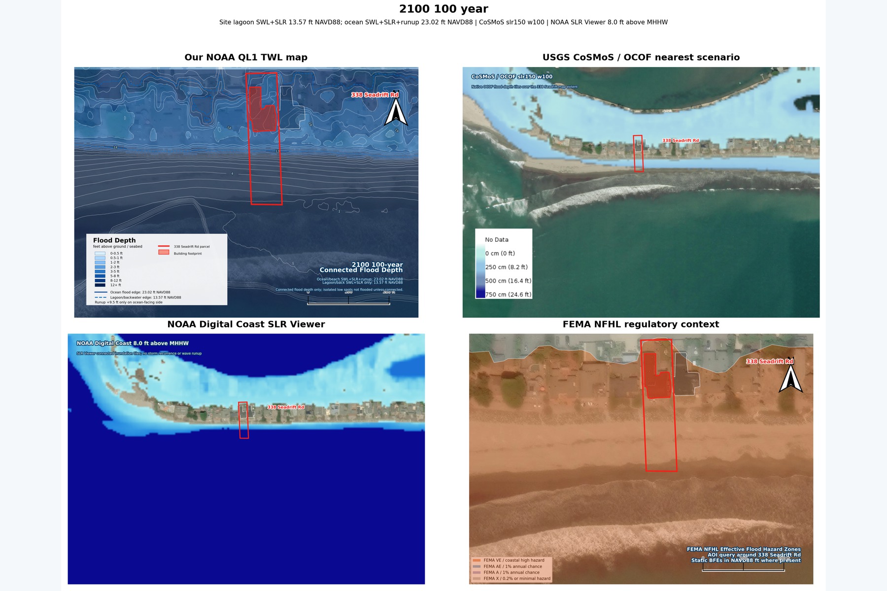
Side-by-side comparison of ShoreCast Surfbeat flooding and CoSMoS/OCOF for the 2100 1% annual-chance (100-year) scenario.
-
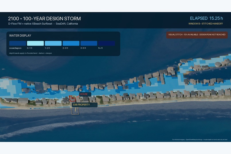
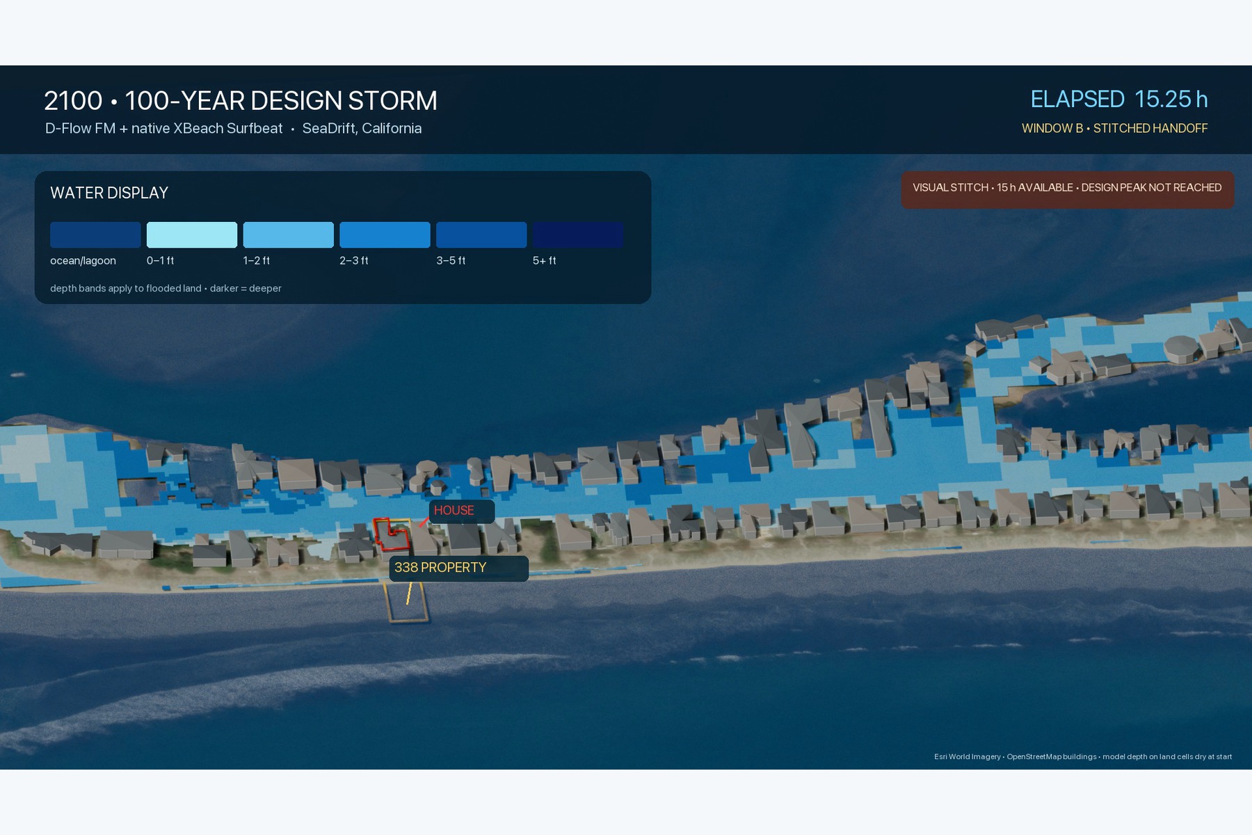
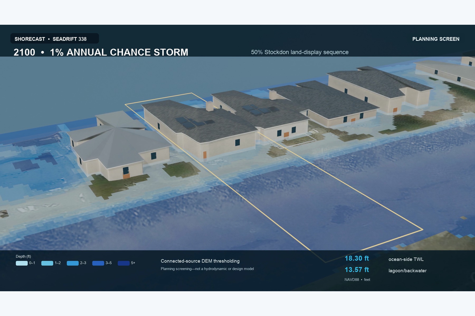
3D planning-screen view of Stockdon-based flood progression around the house and parcel scale.
-
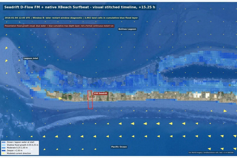
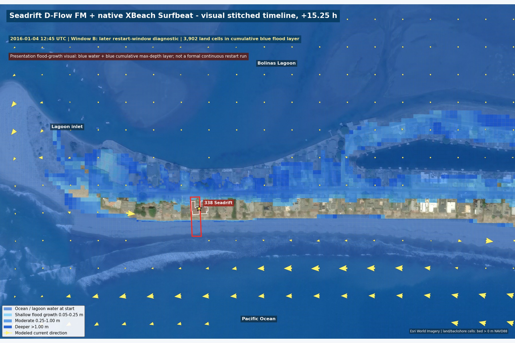
Blue-only Surfbeat flood-growth view: cumulative inundation expands across Seadrift as the storm develops.
-
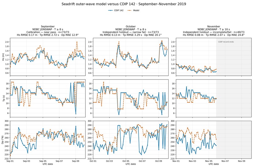
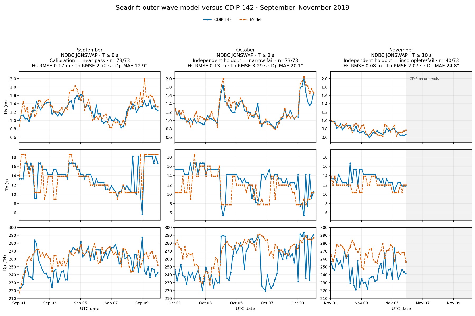
CDIP 142 comparison: significant wave height is strong; peak period is mixed and direction remains diagnostic.
-
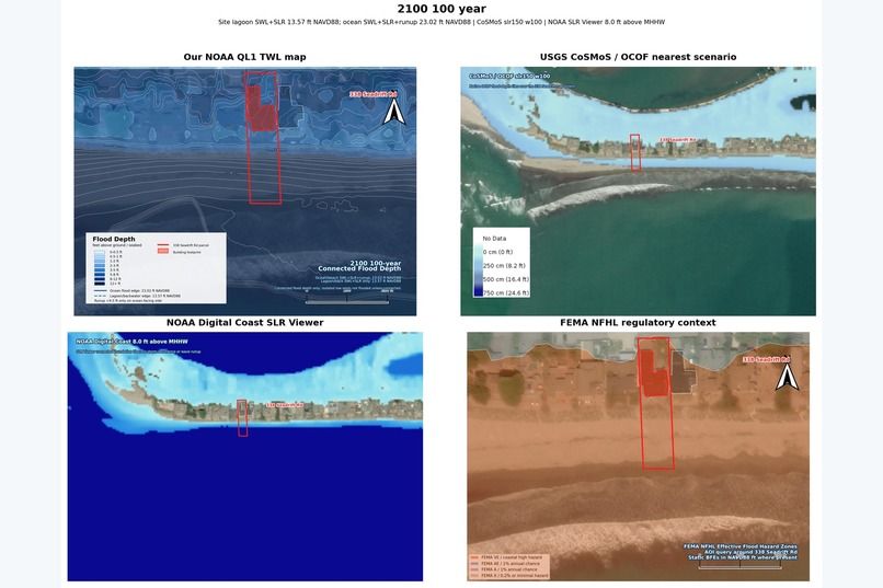
Agency comparison grid: NOAA, CoSMoS/OCOF, and FEMA layers checked against the Seadrift case study.
-
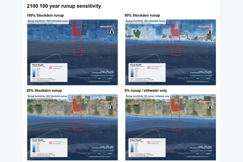
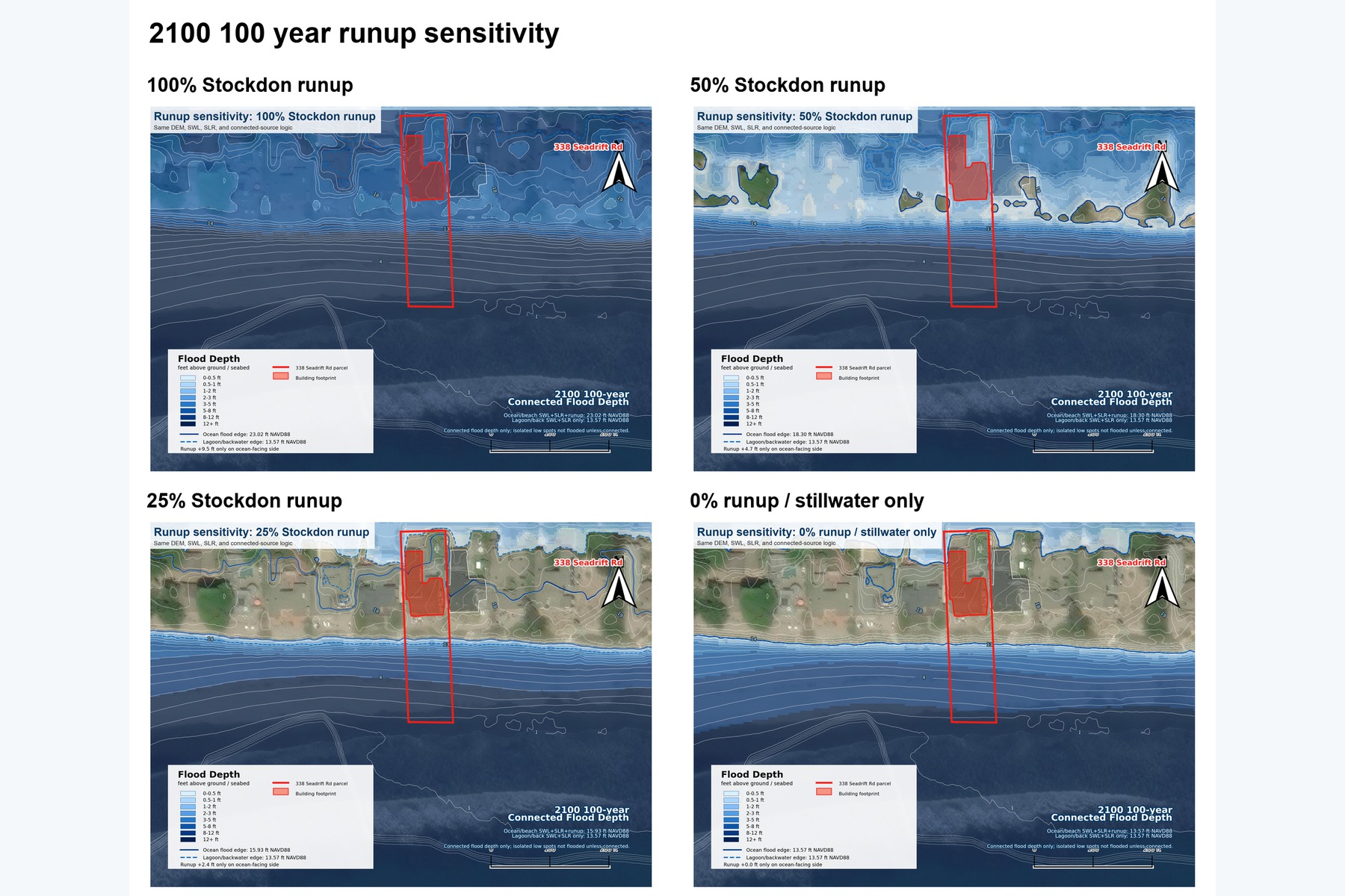
Stockdon runup sensitivity check showing how wave runup assumptions change connected flood depth.
-
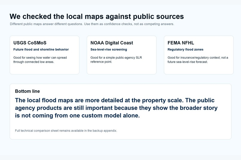
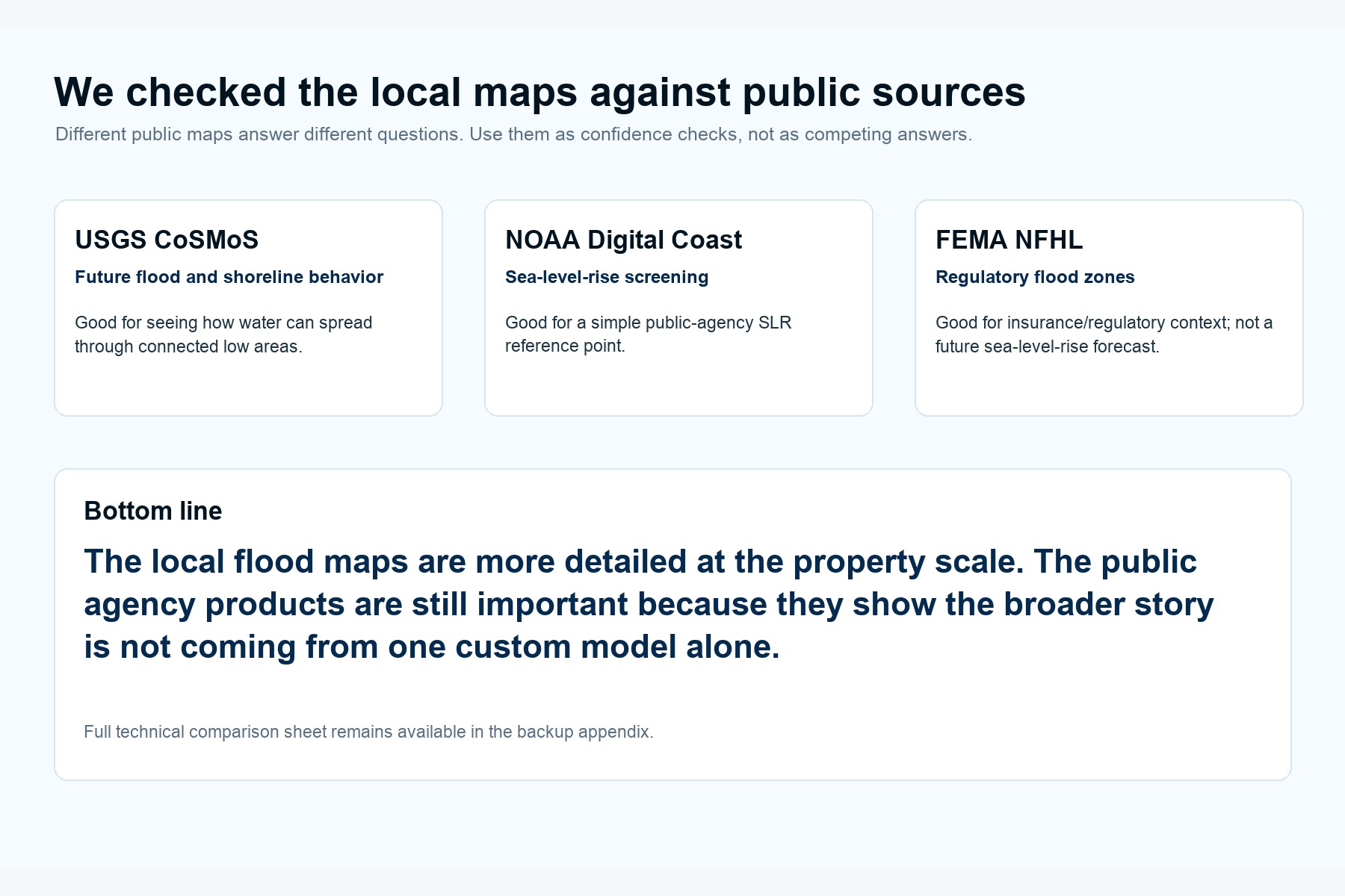
Public map check: CoSMoS, NOAA Digital Coast, and FEMA provide independent context for ShoreCast results.
-
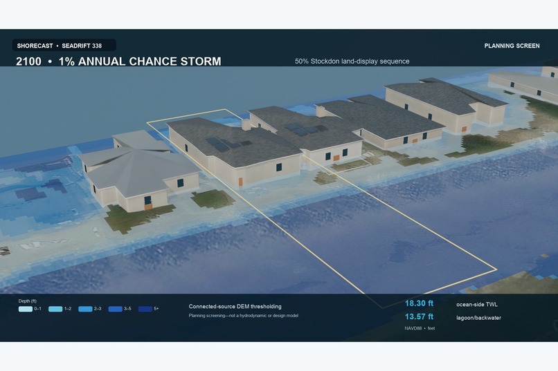
Interim 3D depth render of the 2100 1% annual-chance (100-year) event, with darker blues showing deeper water.
-
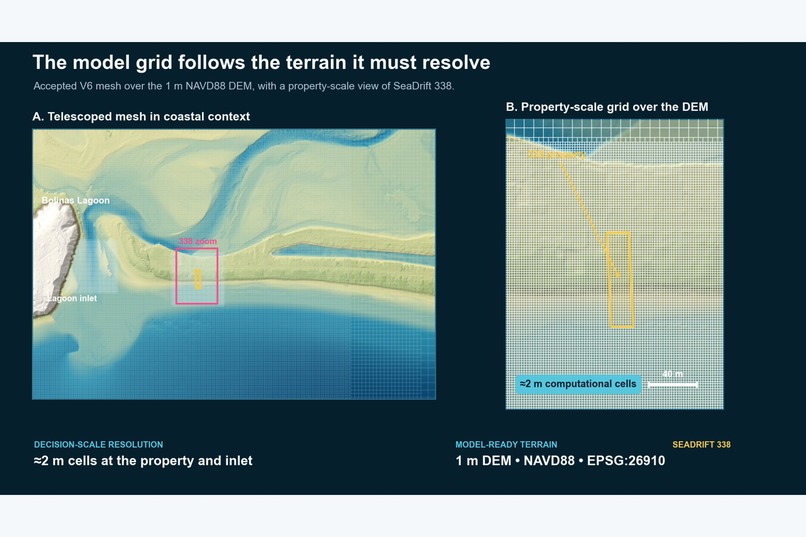
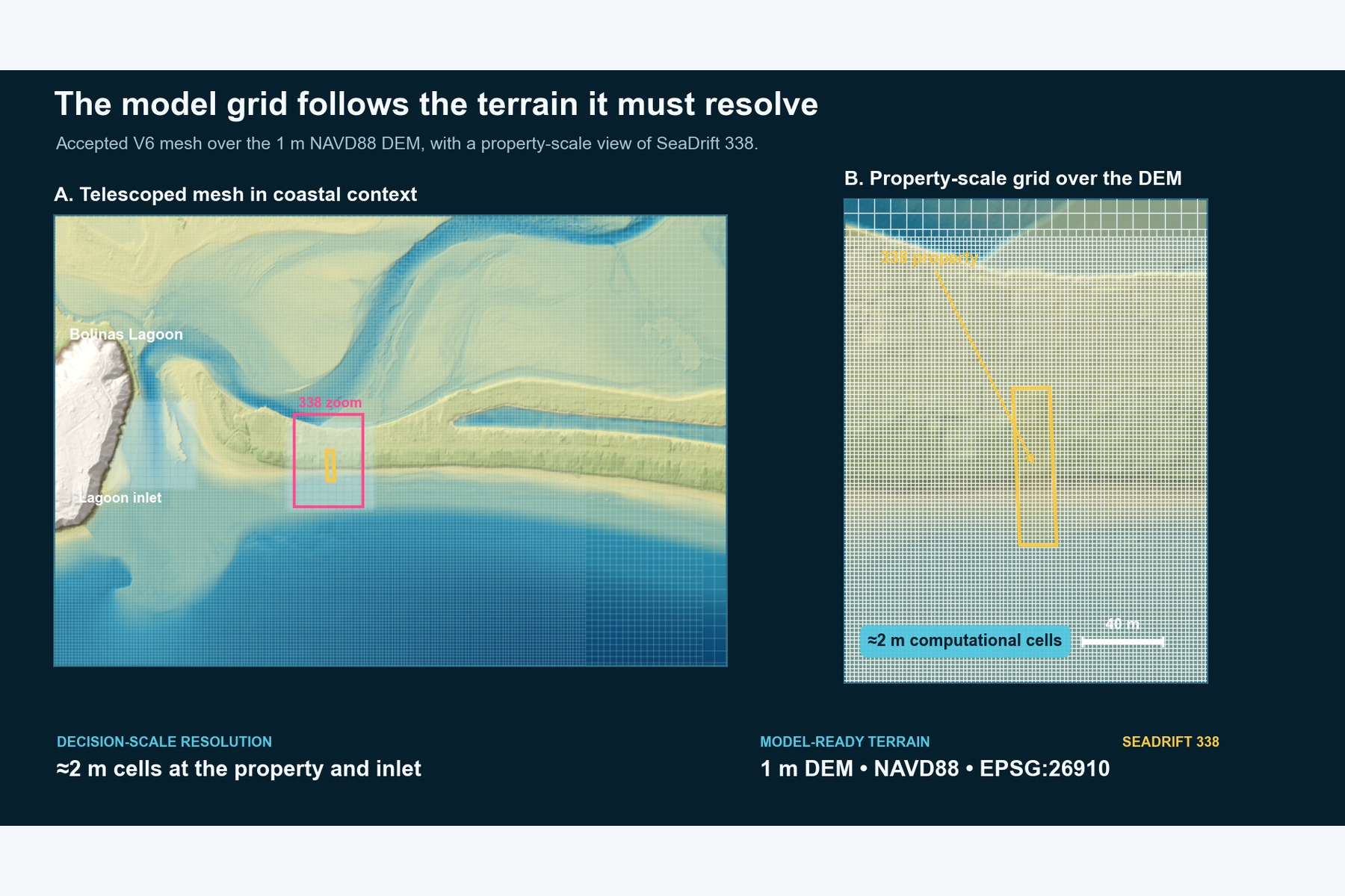
Model QA: coastal mesh and 1 m DEM resolve the inlet, beach, road, parcel, and house scale.
-
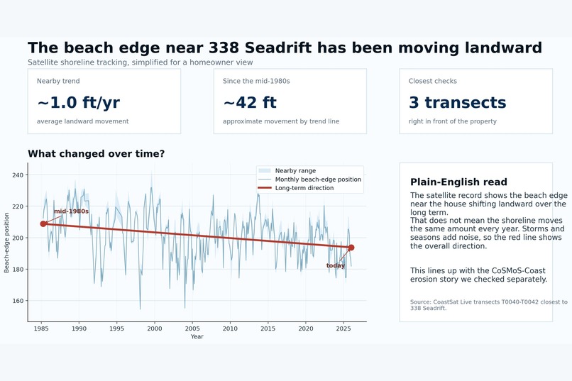
CoastSat shoreline history shows the beach edge near 338 Seadrift moving landward over recent decades.
-
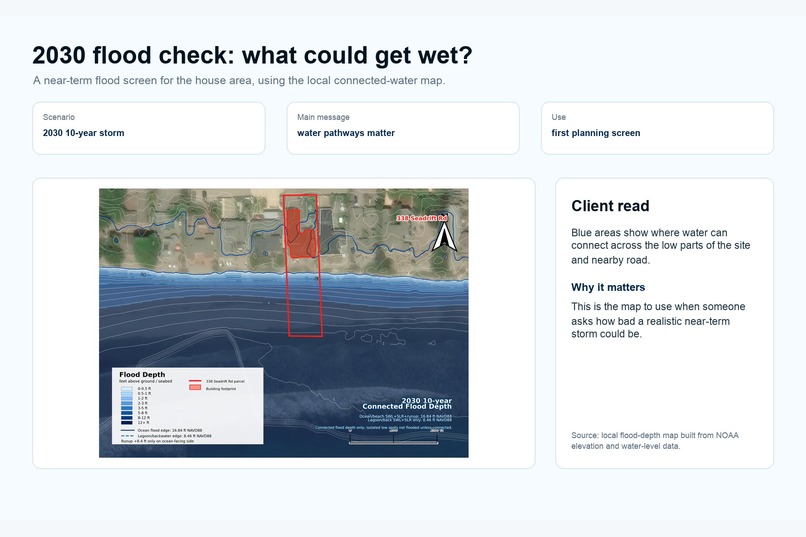
FEMA NFHL context: useful regulatory baseline, but not detailed enough for property-scale shoreline risk.
-
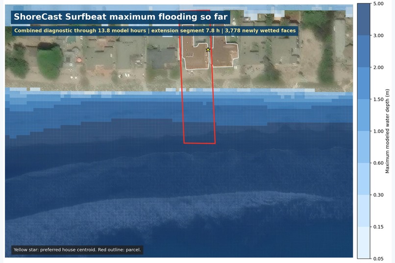
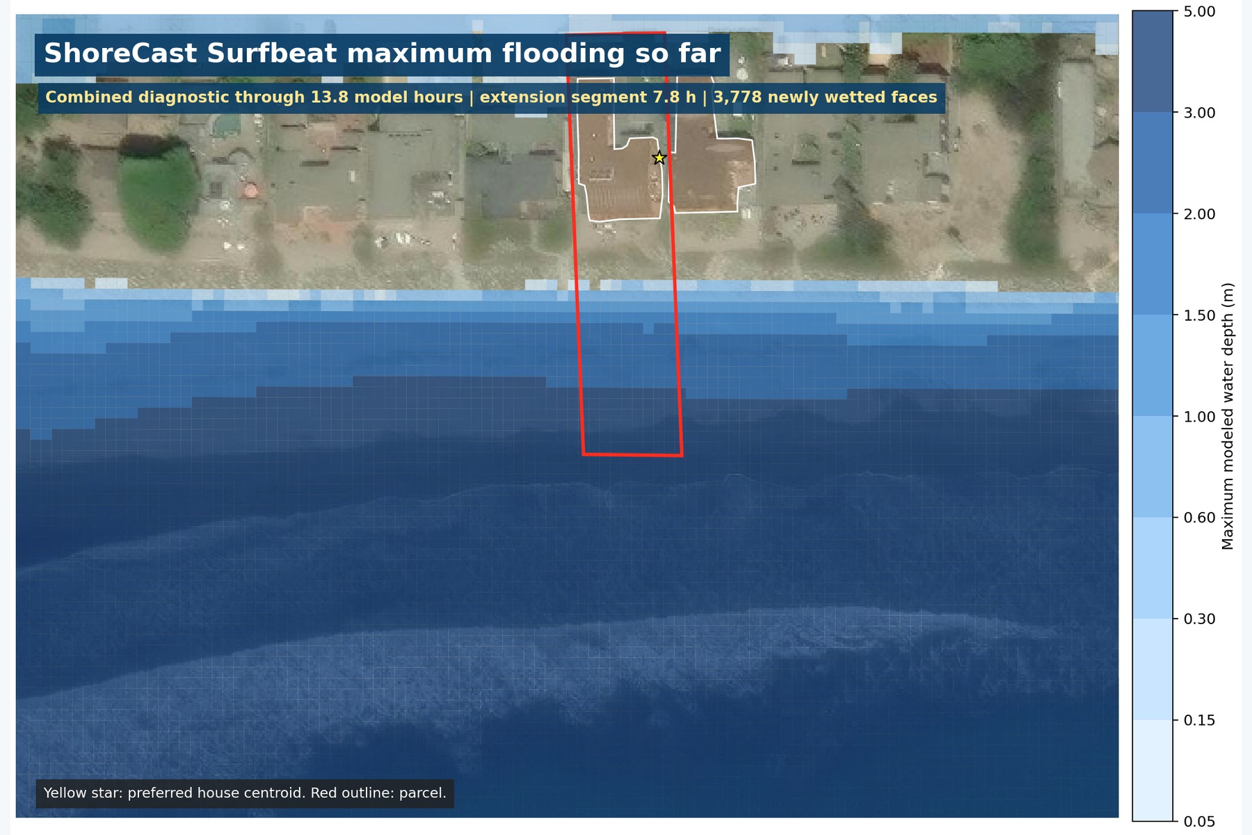
Surfbeat maximum flood depth so far over aerial imagery, focused on the 338 Seadrift property.
Inspiration
Coastal-risk modeling is powerful, but the workflow is painfully fragmented. A single property-scale answer can require terrain data, bathymetry, tide records, wave forcing, public flood products, numerical solvers, GIS cleanup, QA checks, and visual communication. ShoreCast was built to make that workflow faster, more repeatable, and easier to explain.
Our case study is 338 Seadrift Road in coastal California, where flood risk depends on the ocean beach, Bolinas Lagoon, the inlet, revetment, road elevations, waves, tides, and sea-level rise.
What it does
ShoreCast turns a coastal address into a traceable flood-risk evidence package.
For the Seadrift case study, it packages:
- D-Flow FM with native XBeach Surfbeat model evidence
- blue depth-ramped flood-growth videos
- an oblique 3D flood-depth render with buildings and property labels
- CoSMoS / Our Coast Our Future comparison figures
- Stockdon runup sensitivity checks
- model configuration snapshots, manifests, and caveats
- a static judge-facing website that explains the evidence clearly
The goal is not to replace coastal engineers or regulatory flood maps. The goal is to make the modeling workflow executable, auditable, and easier to communicate.
How we built it
We used Codex and GPT-5.6 as the connective tissue across a messy real modeling stack: Python, GIS files, NetCDF model outputs, Delft3D / D-Flow FM, XBeach Surfbeat, shell automation, static-site packaging, and documentation.
Codex helped us:
- trace a large working archive
- normalize XBeach and D-Flow FM outputs
- build QA and provenance checks
- create figures, videos, and manifests
- compare interim results with public CoSMoS/OCOF evidence
- package a clean judge-accessible submission repository with a tiny synthetic sample dataset
The physical flood results still come from the numerical models, not from the language model. AI helped make the workflow faster and more coherent.
Challenges
The hardest part was preserving scientific honesty under deadline pressure. The coupled Surfbeat model was still running, so we had to package the best available outputs without pretending they were a completed regulatory product.
We stitched two same-mesh output windows for judge-facing visualization and labeled that clearly. We also kept raw multi-gigabyte model outputs out of the public repo while still including enough evidence, sample data, and documentation for judges to understand the workflow.
What we are proud of
We turned a complex coastal modeling process into something a reviewer can inspect quickly:
- a clean submission website
- a 2D flood-growth animation
- a 3D property-scale depth render
- CoSMoS and Stockdon comparison evidence
- explicit model-status labels
- a runnable visualization pipeline with tests
The project shows how AI can support specialist work without hiding uncertainty or inventing scientific evidence.
What we learned
The biggest lesson was that AI is most useful here as an integration and review partner. It helped connect tools, files, model outputs, documentation, and presentation assets. But the scientific boundary still matters: model status, caveats, and provenance have to stay visible.
Build Week scope
ShoreCast was built during July 13–21, 2026 by applying Codex and GPT-5.6 to an existing Seadrift coastal case-study foundation. Pre-existing inputs included source data, numerical-model setup and earlier outputs, specialist modeling methods, and public-agency comparison material. New during Build Week were the unified XBeach and D-Flow FM adapters, QA and provenance pipeline, CLI and tests, synthetic sample, clean judge-accessible repository, hosted review experience, stitched and 3D evidence renders, manifests, and narrated competition demo. The submission claims that new workflow, software, verification, and communication package—not original authorship of the public datasets or every underlying simulation.
What is next
Next steps are to process the final high-water frames when the model run reaches the design peak, extend the workflow to more coastal addresses, and turn ShoreCast into a repeatable workbench for coastal planners, engineers, and property owners.
Built With
- blender
- codex
- css
- delft3d
- gis
- html
- javascript
- matplotlib
- netcdf
- openai
- python
- xbeach

Log in or sign up for Devpost to join the conversation.