Inspiration
Women face daily uncertainty while traveling, especially in unfamiliar places. Every 1 in 3 woman globally have experienced harassment in public spaces. This motivated us to build a platform that helps women choose safer and more informed routes.
What it does
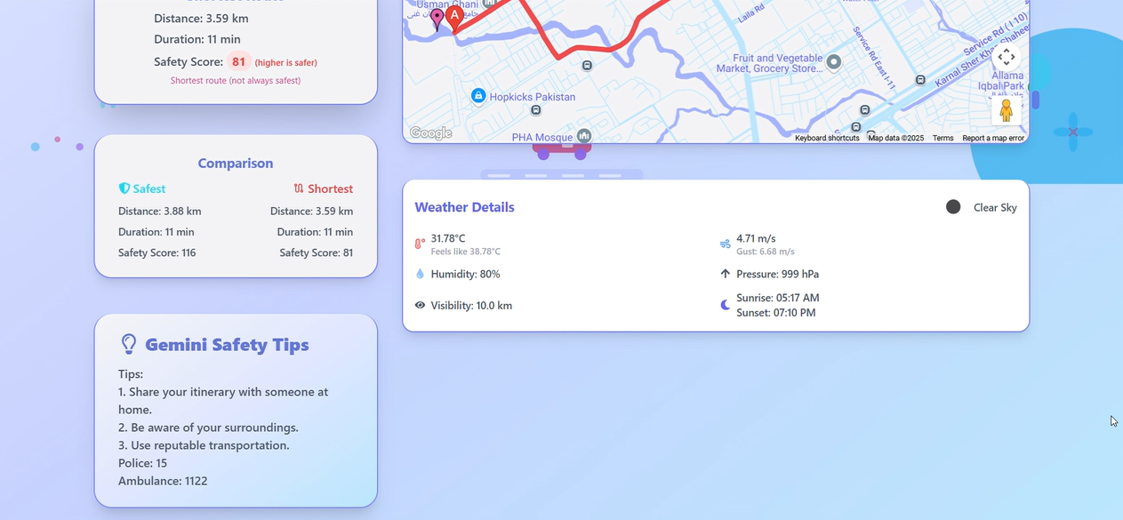
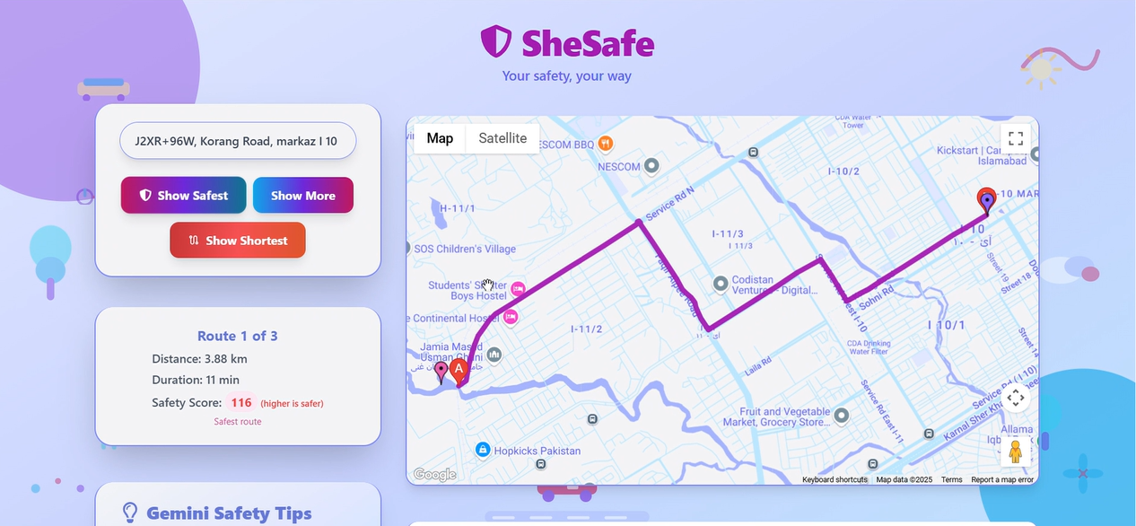
SheSafe helps women find safer routes (not just shortest) when traveling or relocating. It analyzes public space density and provides real-time travel context through:
Key Features:
- Detects nearby crowded safe zones (hospitals, markets, schools)
- Compares safest vs fastest routes via Google Maps
- Provides live weather updates
- Generates AI-powered safety tips & emergency numbers (police, ambulance) using Gemini
How we built it
- We calculate a Crowd Safety Score for each possible route using the Google Places API. This involves checking for nearby public places such as markets, hospitals, police stations, parks, schools, etc
- Each place type is assigned a weight based on its relevance to safety
- The total score is calculated by summing the weighted counts of these places along the route. The route with the highest score is suggested as the safer option, even if it’s slightly longer. To enhance situational awareness, we use:
- OpenWeather API to provide real-time weather updates
- Gemini AI to offer personalized safety tips and emergency contact numbers based on the destination This combined approach allows SheSafe to make informed, context-aware suggestions for safer travel especially useful when visiting unfamiliar places.
Challenges we ran into
- No access to real-time crime data, which limited location risk accuracy
- Google Maps sometimes shows slightly different routes on each refresh
- Unable to verify time-sensitive factors like current crowd density
Accomplishments that we're proud of
- Built a working web platform that actually helps women find safer travel routes, not just faster ones.
- Successfully integrated Google Maps and Places APIs to analyze real-time public place data for safety scoring.
- Created a custom safety score system that considers hospitals, schools, markets, and crowded areas.
- Enabled users to compare safest vs. shortest routes, making informed choices based on context.
- Integrated Gemini AI for delivering live safety tips and providing essential emergency numbers.
- Added weather updates keep travelers informed and better prepared.
What we learned
- Safety isn’t just about speed — location context matters
- Public places ≠ always safe; more real-time data is needed
- Weather and emergency context can change travel decisions
- Users want quick, low-friction tools they can trust instantly
What's next for SheSafe
- Offer safe local services along the route: Help users discover and optionally book trusted carpool, cab, or public transport options available on the safest route.
- Integrate real-time crime and verified safety data: Improve route accuracy by factoring in live reports from local law enforcement or safety databases.
- Build a mobile app with SOS and live alerts: Notify users of sudden safety risks nearby and enable background tracking and emergency button access.
- Implement ML-based dynamic safety scoring: Adapt route suggestions using real-time patterns, time of day, local activity trends, and user feedback.
- Support for global regions and languages: Expand to other countries with location-specific data sources and multilingual safety tips for travelers and locals.
Built With
- gemini
- github
- google-directions
- google-maps
- google-places
- javascript
- openweather
- react
- tailwindcss
- vercel

Log in or sign up for Devpost to join the conversation.