Inspiration
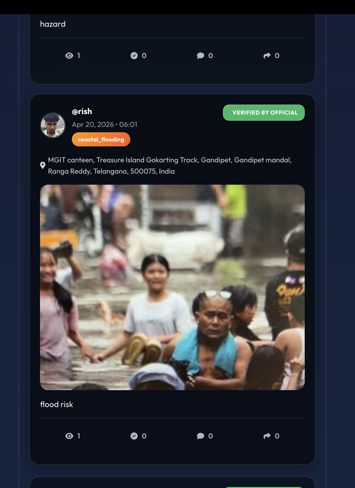
India has 7,516 km of coastline and over 170 million people living in disaster-prone urban zones. Yet when a cyclone, flood, or storm surge strikes, the response is shockingly fragmented — fire, police, municipal, health, and disaster agencies all operate on separate channels, coordinating by phone calls while lives slip away.
We saw it firsthand: a citizen reporting rising floodwater takes hours to be verified. Coordinators call volunteers one at a time. Mass-SMS alerts get ignored because they're in the wrong language. There's no city-wide intelligence layer. No digital twin. No autonomy.
We asked: what if AI agents could be the autonomous nervous system of urban crisis response?
What it does
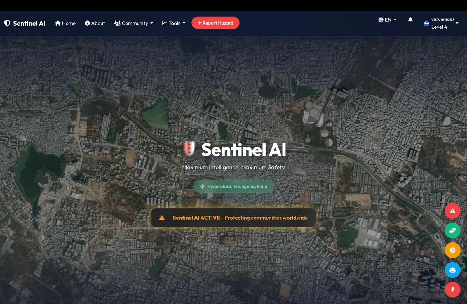
Sentinel AI is a multi-agent AI command platform that unifies disaster response across departments. Six specialized agents work in concert:
- 🔍 Detection Agent — ingests citizen reports, SOS pings, AI phone calls, satellite data, and weather feeds
- 📋 Prioritization Agent — scores every incident with a 3-parameter accuracy system (auto-approves ≥85% confidence)
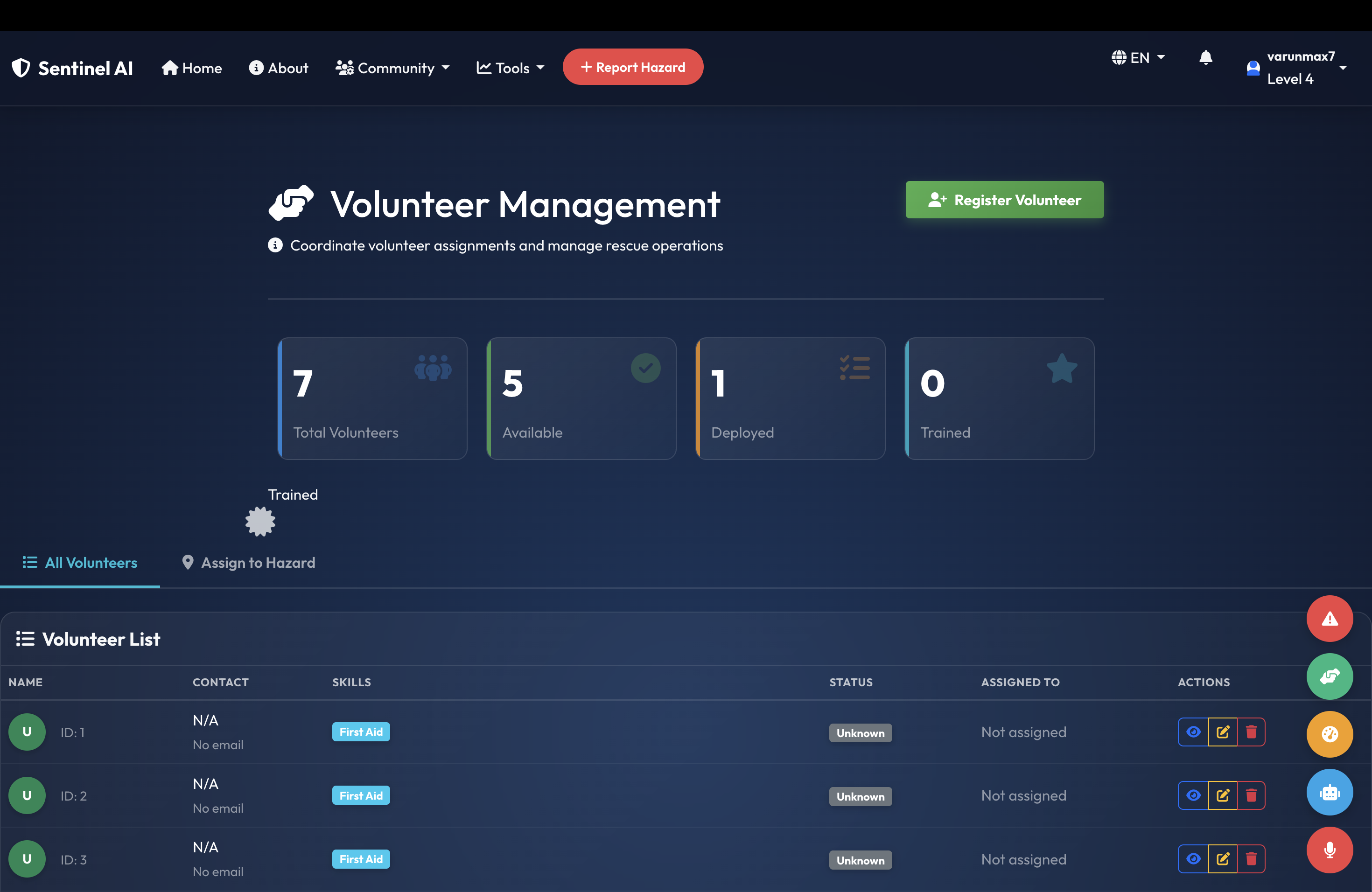
- 🚁 Dispatch Agent — Uber-style volunteer matching within 10km, fires WhatsApp assignments, tracks lifecycle
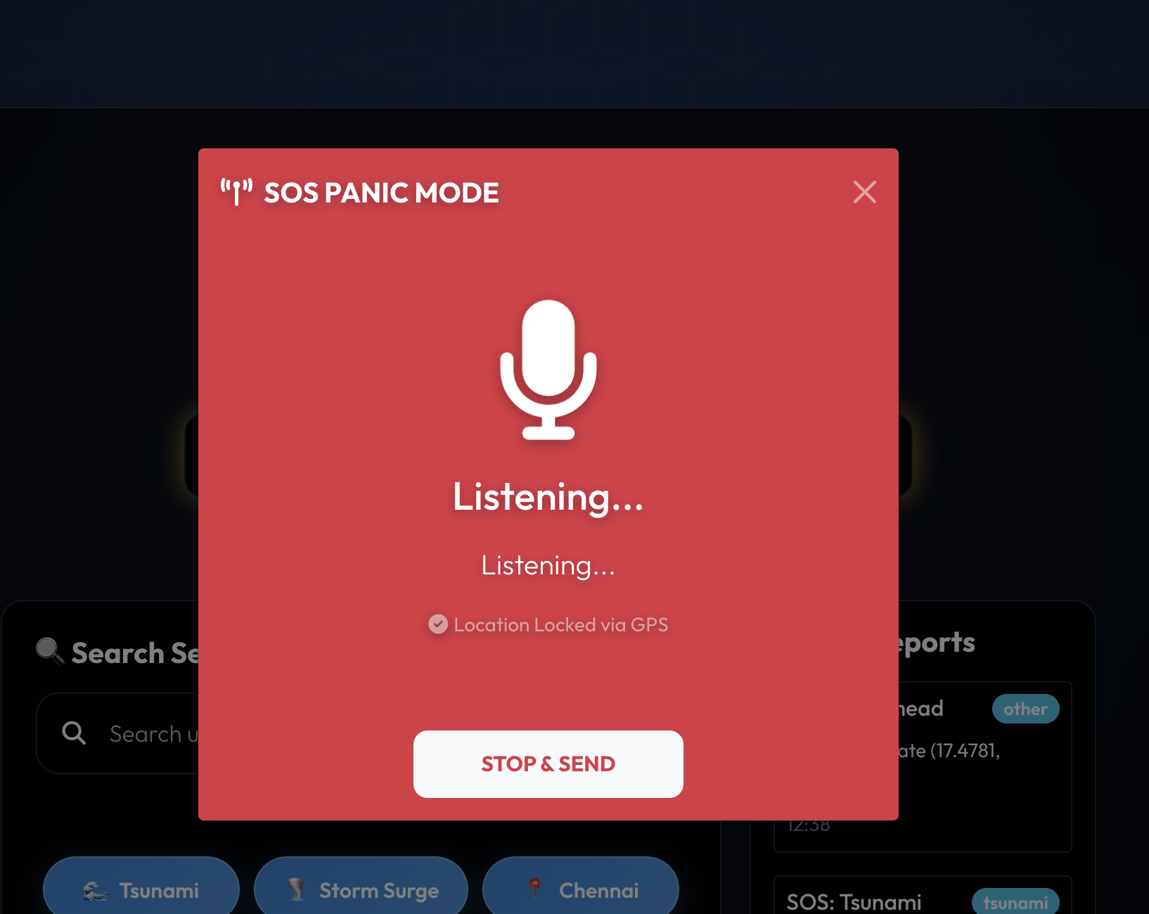
- 📡 Alert Agent — geo-fenced 20km push notifications with disaster images and safe-rescue coordinates
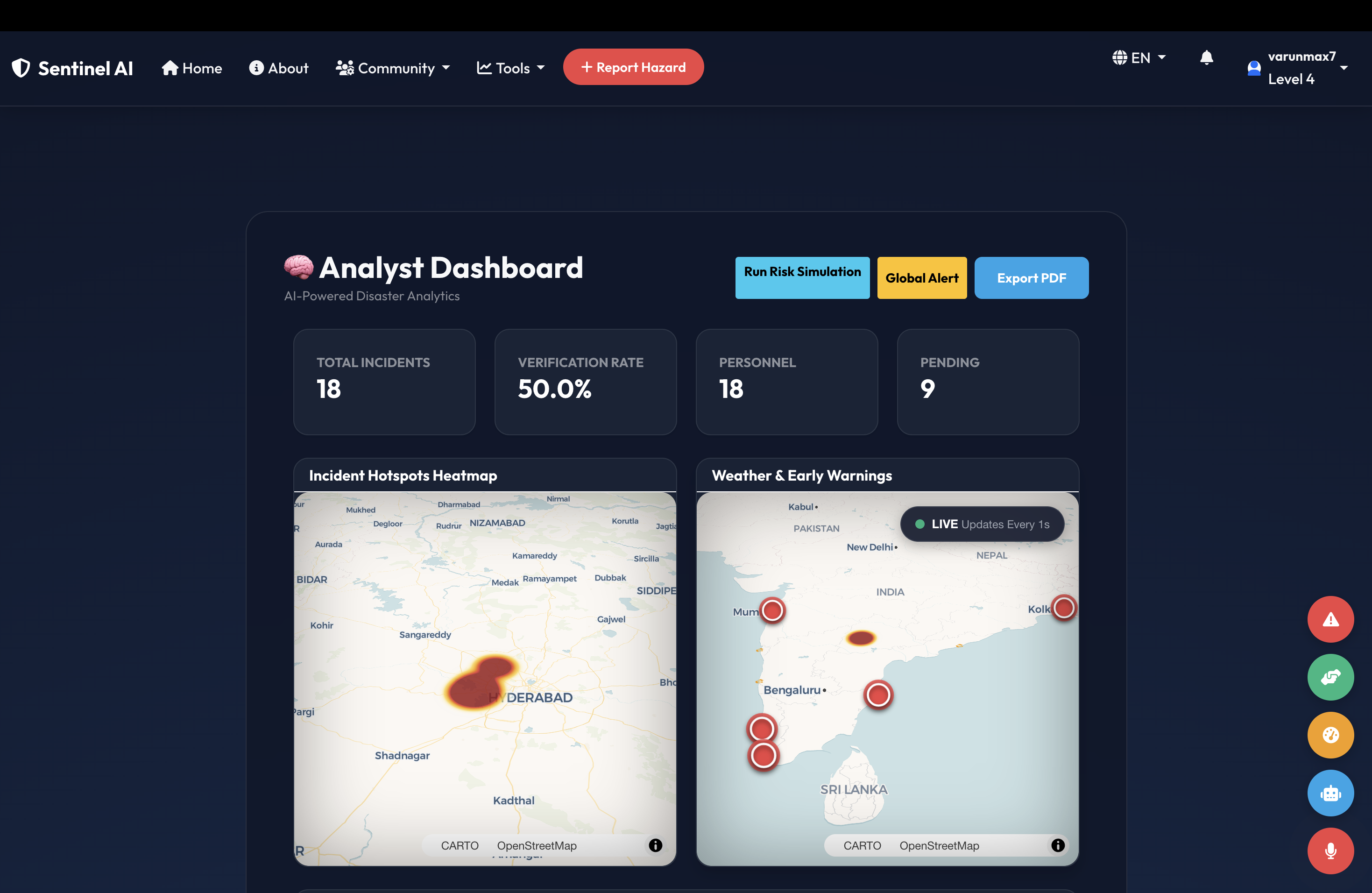
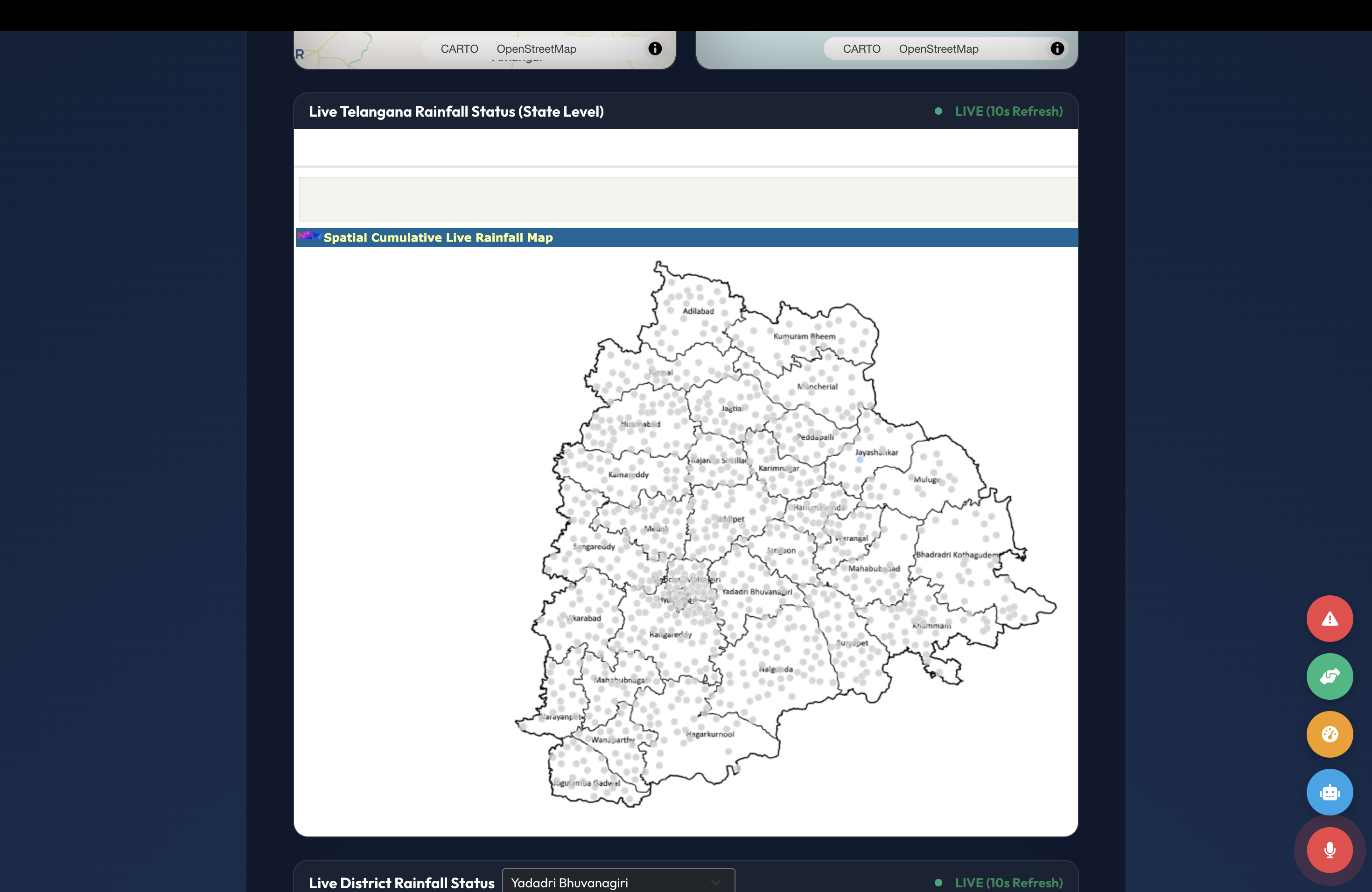
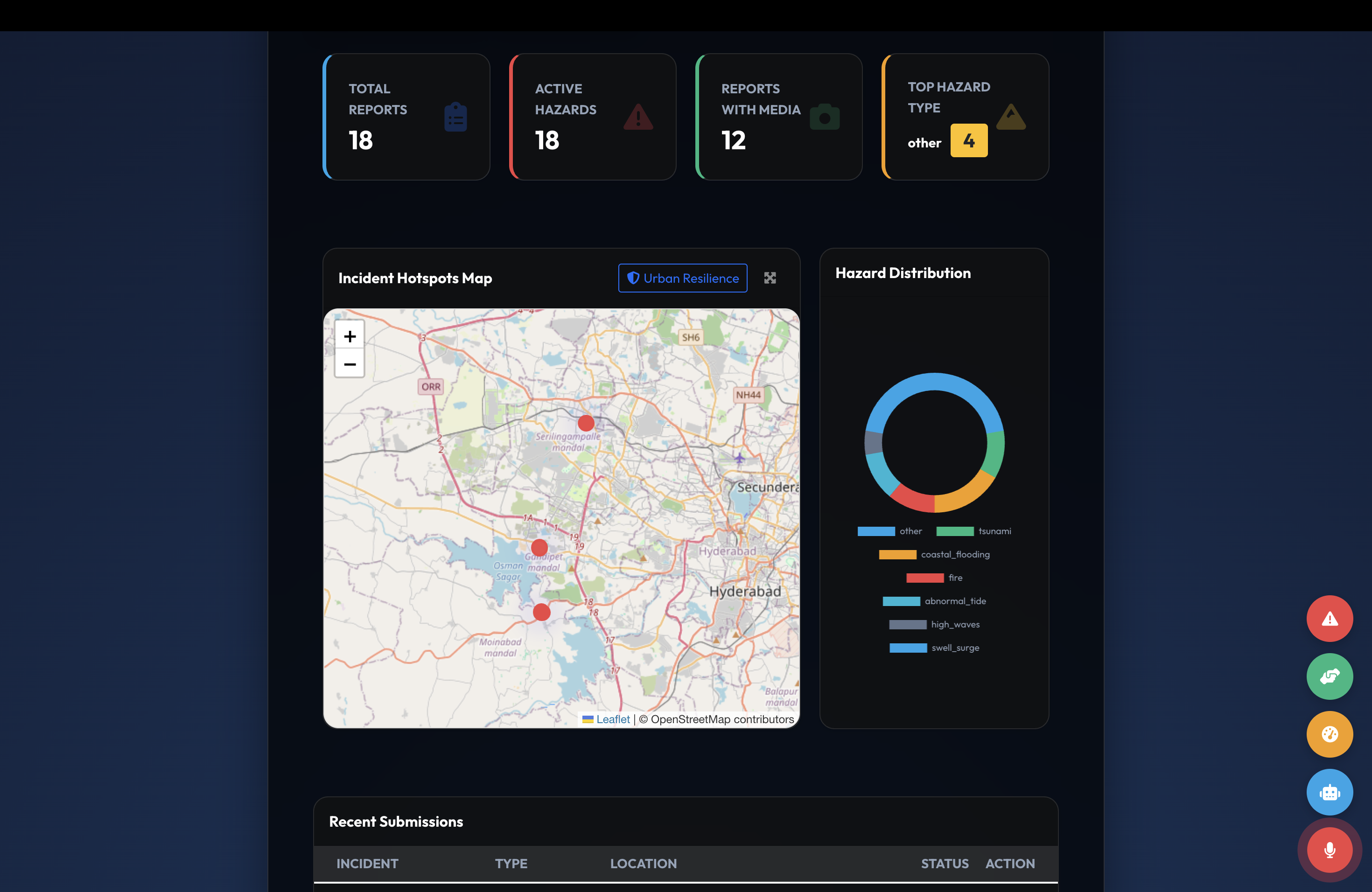
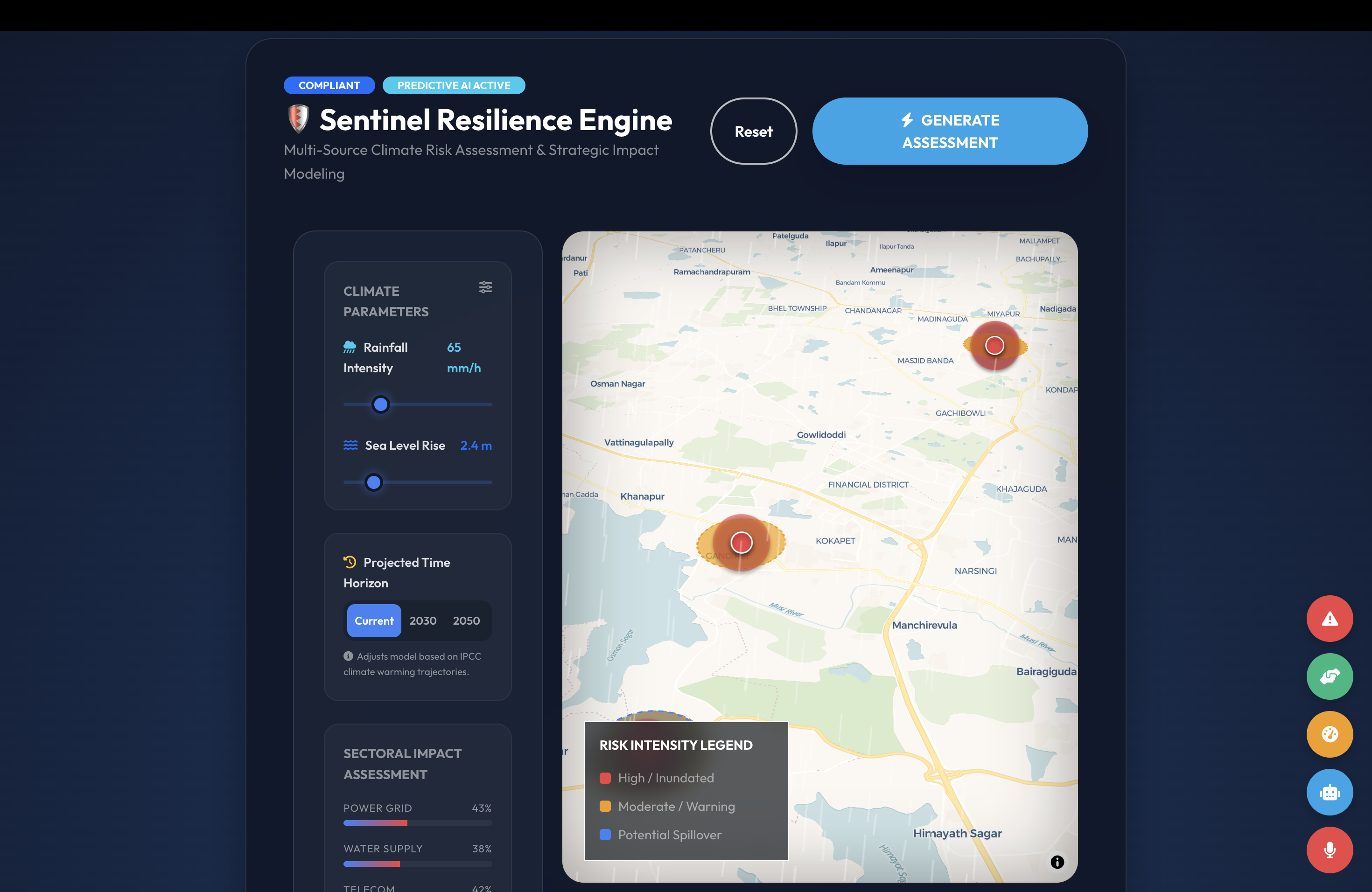
- 📊 Analytics Agent — powers the analyst dashboard with live TGDPS rainfall maps, satellite radar, and risk simulators
- 🤝 Coordination Agent — manages inter-departmental SITREPs, resource allocation, and agency registry
Highlights:
- Omni-channel reporting — PWA, WhatsApp bot, voice SOS, AI calling agent for offline users
- 3-Parameter AI Verification — heatmap match + climate alignment + user credibility
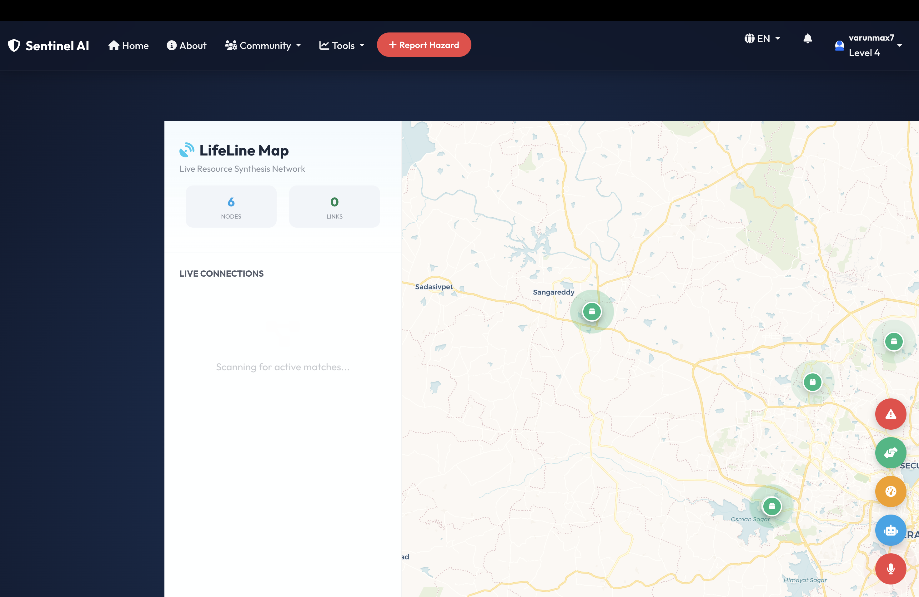
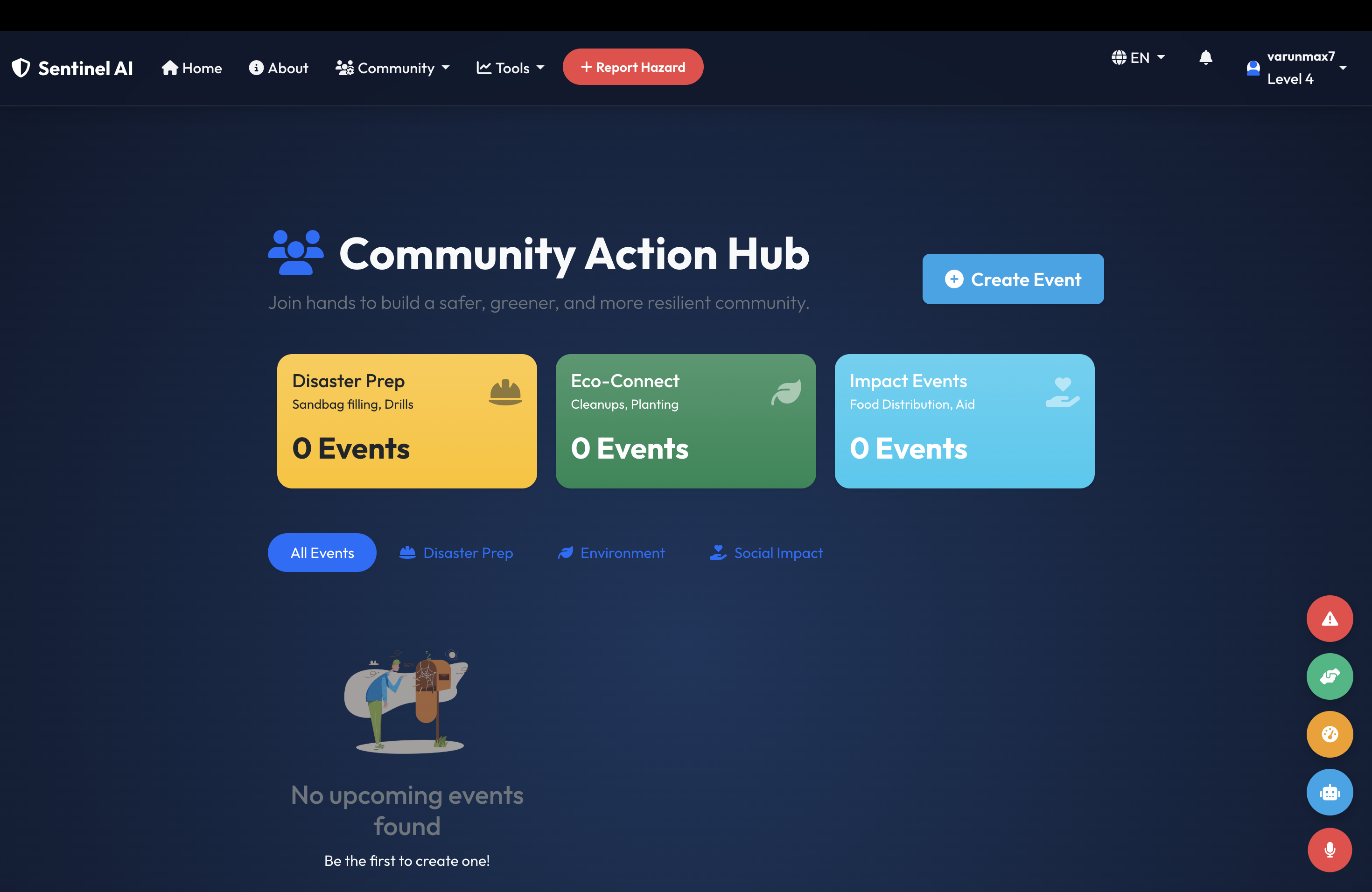
- LifeLine P2P marketplace — citizens list what they HAVE/NEED; SafeLink™ auto-pairs by proximity
- City Digital Twin — live satellite overlays, state + district-level rainfall maps, Urban Resilience Index
- 6 languages — auto-detected via GPS (English, Telugu, Tamil, Malayalam, Kannada, Hindi)
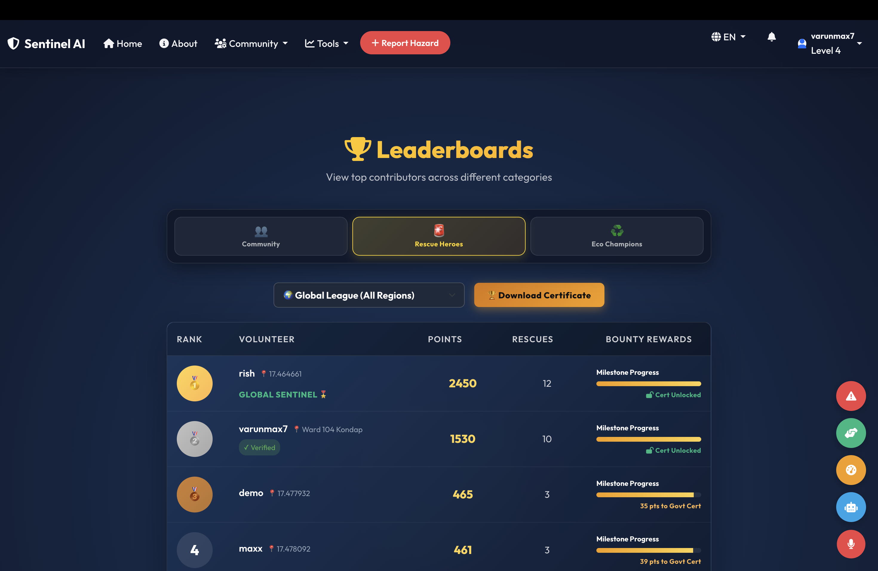
- Gamification + Govt Certification — top performers earn official recognition
How we built it
- Backend: Flask (5,600+ lines, 116 routes) with SQLAlchemy ORM and 23 database models
- Multi-Agent Architecture: Each agent is a bounded module with its own decision logic, sharing state via a SQLite/PostgreSQL layer
- AI Verification Engine: Weighted 3-parameter scoring — Haversine geo-clustering, Open-Meteo API cross-validation, historical user credibility
- WhatsApp Bot: Twilio integration handling account linking, dispatch flows, accept/decline, and media attachments
- Frontend: Bootstrap 5 + glassmorphism CSS, Leaflet.js with RainViewer satellite overlay, Chart.js analytics
- Government Data: Live proxy to TGDPS rainfall maps — state-level + 33 district feeds
- PWA: Service Worker offline caching + Web App Manifest for installability
- Background Jobs: APScheduler for alert expiry, weather pre-fetching, TGDPS refresh
Challenges we ran into
- Multi-agent coordination — getting six agents to share state without race conditions took several rewrites of the lifecycle state machine
- TGDPS proxy — government rainfall maps block direct iframe embedding, so we built a path-protected proxy with auto-refresh
- Geo-fencing precision — initial alerts went to anyone in the city; we built a Haversine-based 20km filter respecting each user's home coordinates
- WhatsApp session management — multi-step flows (linking, dispatch, completion) needed careful state tracking
- Language auto-detection from GPS — mapping coordinate ranges to regional languages without a paid geocoding API
Accomplishments we're proud of
- Built a fully working multi-agent system end-to-end
- 116 API routes powering everything from SOS to LifeLine to TGDPS
- 3-Parameter AI Verification — genuinely novel cross-validation against weather + user credibility
- WhatsApp bot works end-to-end — linking, photo dispatch, accept/decline, completion proof
- 6-language auto-detection that responds to where the user physically is
What we learned
- Multi-agent systems with clearly bounded responsibilities outperform single-LLM apps for real-world workflows
- Precision geo-fencing prevents the alert fatigue that plagues mass-SMS systems
- Real users without internet matter — that's why we built the AI calling fallback
- Government data integration is messy; proxy layers and path-protection are non-negotiable
- Gamification + government certification is a powerful combination for sustained civic engagement
What's next
- Migrate core agent logic to Jac to leverage walkers and graph-native data modeling for the agent state machine
- Pilot deployment with a Telangana district administration
- Integrate INSAT satellite imagery directly for cyclone tracking
- Expand to North Indian flood-prone regions (Bihar, UP)
- Add a predictive evacuation routing agent using real-time road conditions
Built With
- alembic
- apscheduler
- bootstrap
- chart.js
- css
- flask
- gunicorn
- html
- javascript
- jinja
- leaflet.js
- matplotlib
- ngrok
- nltk
- numpy
- open-meteo
- pillow
- postgresql
- pwa
- python
- rainviewer
- service-worker
- sqlalchemy
- sqlite
- textblob
- twilio

Log in or sign up for Devpost to join the conversation.