-
-
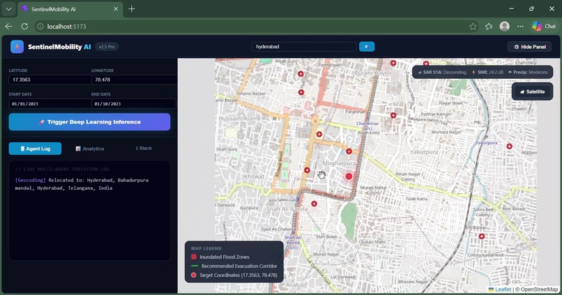
Interactive dashboard displaying mapped locations and flood-analysis results.
-
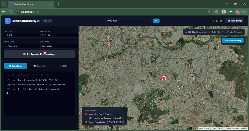
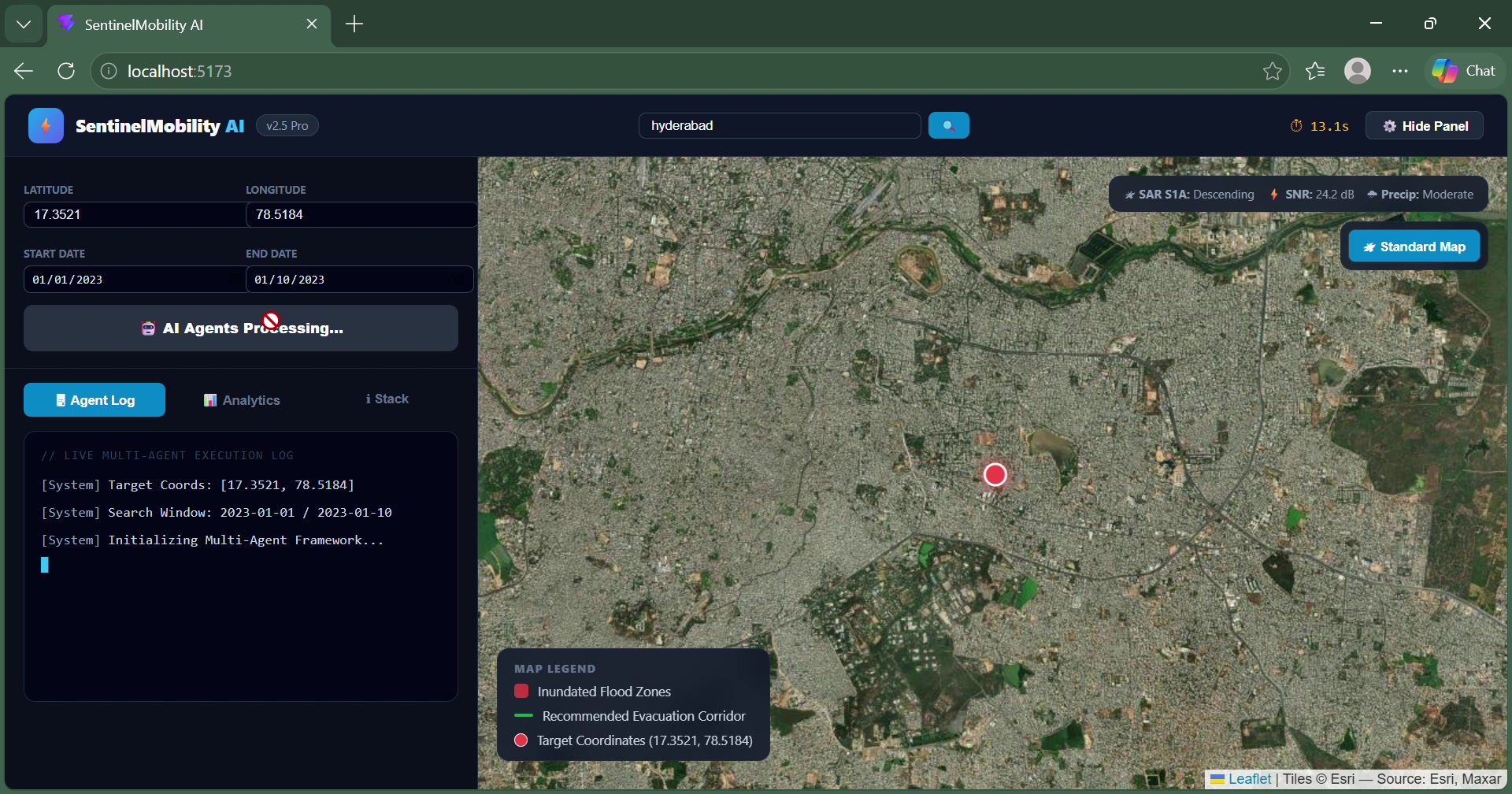
Satellite imagery view for inspecting the selected area.
-
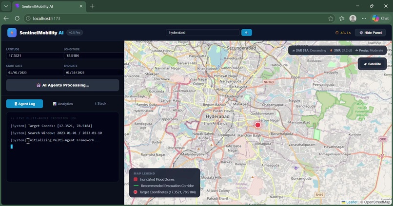
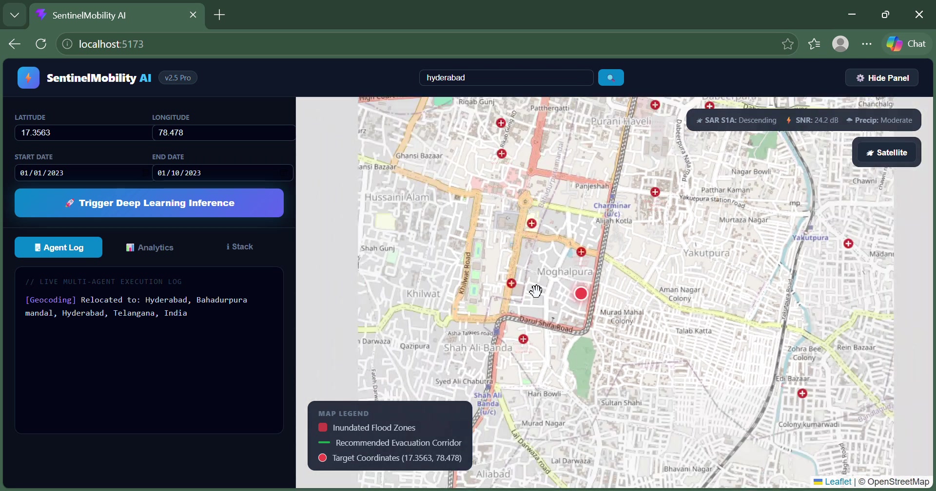
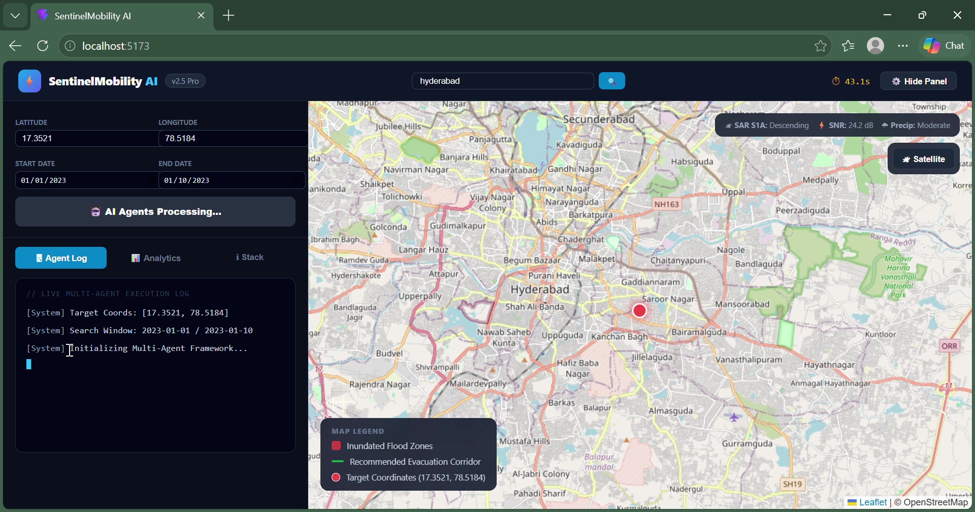
Road-network visualization supporting infrastructure impact analysis.
-
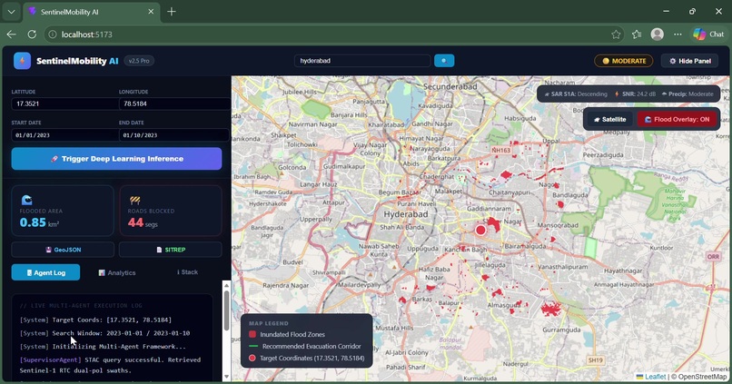
Potentially affected roads and locations highlighted on the map.
-
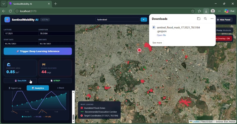
Geospatial analysis panel showing mapped results and supporting information.
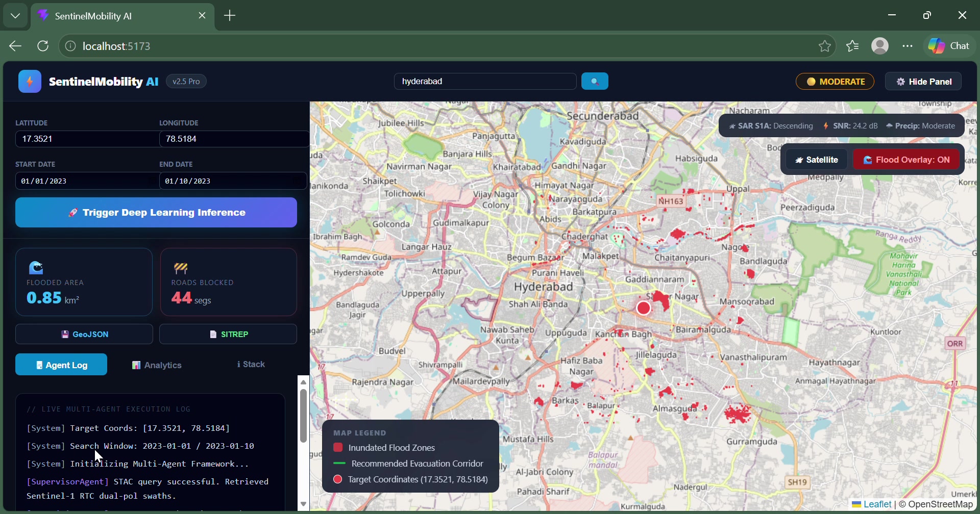
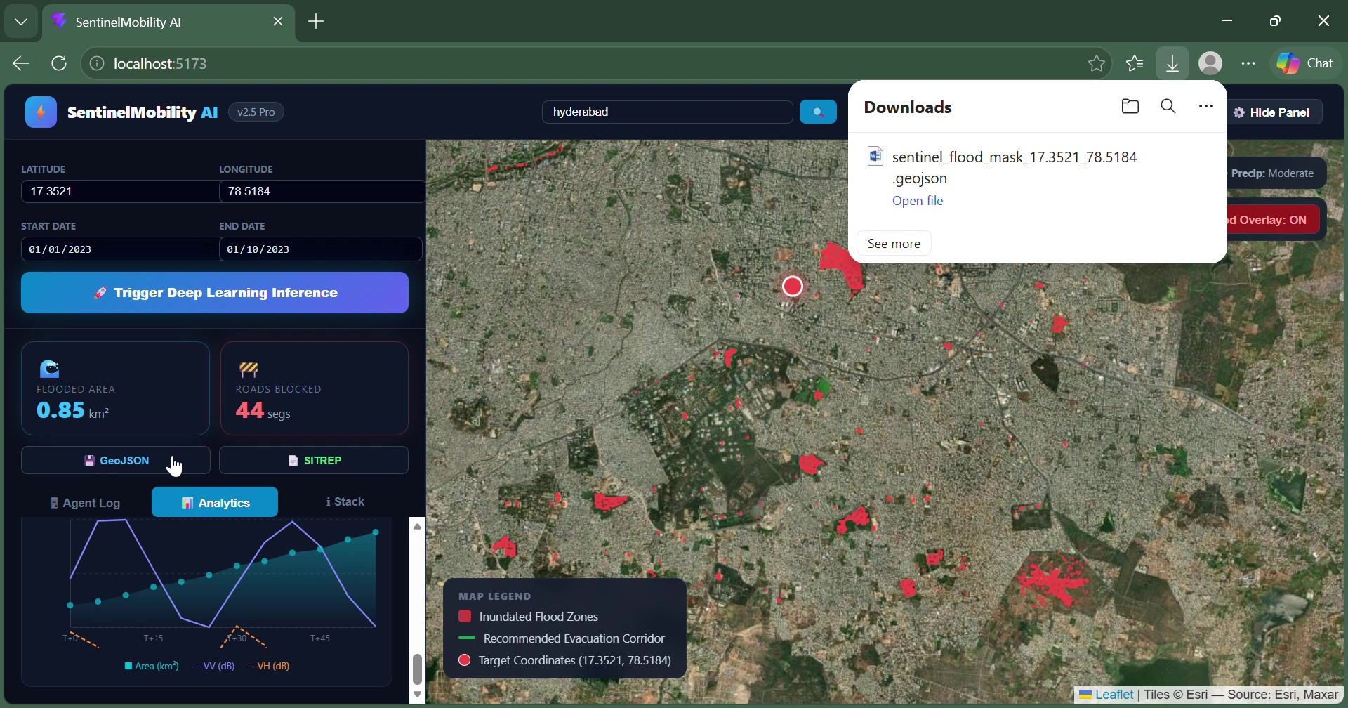
Inspiration Natural disasters like floods can devastate regional infrastructure, wash out critical bridges, and isolate vulnerable settlements when local ground data is missing or delayed. SentinelMobility AI explores how space-borne remote sensing and artificial intelligence can empower emergency response teams to rapidly assess flood impacts and navigate safe evacuation corridors.
What it does SentinelMobility AI combines Sentinel-1 SAR (Synthetic Aperture Radar) satellite imagery, PyTorch U-Net semantic segmentation, and OpenStreetMap road networks. It automatically maps flooded zones, identifies compromised and blocked roads, analyzes settlement connectivity, and provides an interactive dashboard for exploring safe alternative routes and real-time situational analytics.
How we built it We integrated a multi-agent AI pipeline that queries STAC satellite catalogs and processes raster data using GDAL and Rasterio. The core deep learning and classification rely on PyTorch U-Net models alongside LightGBM/XGBoost, while spatial routing and graph analysis are powered by OSMnx, NetworkX, and OSRM. The frontend is delivered via a responsive React.js dashboard featuring interactive Leaflet.js mapping and data export tools.
Challenges we ran into Key challenges included parsing and interpreting complex radar imagery, distinguishing permanent water bodies from flood-induced inundation, aligning pixel-level raster flood polygons with vector-based road networks, and dynamically computing how road failures impact isolated community connectivity.
Accomplishments that we're proud of
We successfully united macro-level satellite remote sensing, deep-learning image segmentation, and graph-based routing into a seamless, interactive platform designed to give first responders immediate situational awareness during climate emergencies.
What we learned
We gained deep insights into how remote sensing, deep neural networks, and graph analysis can work in tandem. We also learned critical lessons in managing model uncertainty, validating predictions against real-world geography, and clearly distinguishing between potential damage and confirmed infrastructure disruption.
What's next for Sentinel Mobility AI
We plan to expand validation on diverse terrain scenarios like Himalayan flood basins, benchmark our outputs against official disaster response maps, refine our road-disruption algorithms, and automate rapid situation-report generation for emergency teams.
For a closer look at deploying similar modular architectures, you can check out A Plug-and-Play AI Framework for Edge and Cloud Deployment. This video is relevant because it explores practical strategies for integrating AI models and real-time dashboards across diverse operational environments.
Built With
- docker
- fastapi
- gdal
- leaflet.js
- lightgbm
- networkx
- osmnx
- osrm
- python
- pytorch
- rasterio
- react.js
- sar
- sentinel-1
- stac
- u-net

Log in or sign up for Devpost to join the conversation.