-
Screenshot

Inspiration
There are a lot of opportunities to positively impact the environment. We wanted to enable decision makers to make decisions that are in touch with the views of their constituents and help streamline where their attention should be focused.
What it does
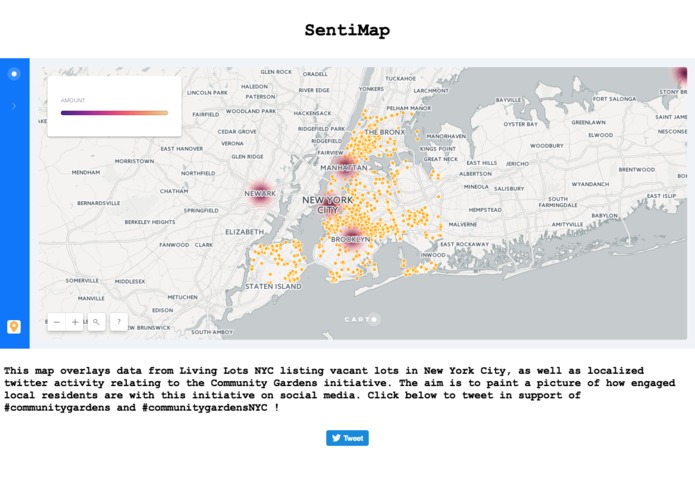
SentiMap juxtaposes public data about vacant lot use, city level governmental representation and geotagged social media posts to identify support for green initiatives.
In this way, by using social media data, we can see a live poll of sentiment around a variety of topics, for example community gardens, street trees, among others. This use case can be extended to other initiatives. Likewise, by using a hashtag, we can streamline the analysis and tailor it to specific community topics or campaigns.
How I built it
We used IBM Bluemix services to pull and analyze sentiment and map it back over opportunities for public green space initiatives. All the data is pulled together in Carto.


Log in or sign up for Devpost to join the conversation.