-
-

SCOOP: New York snow, mapped
-
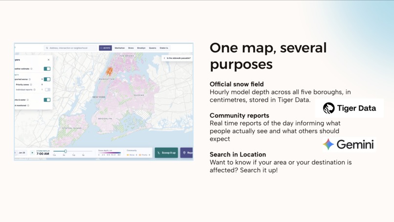
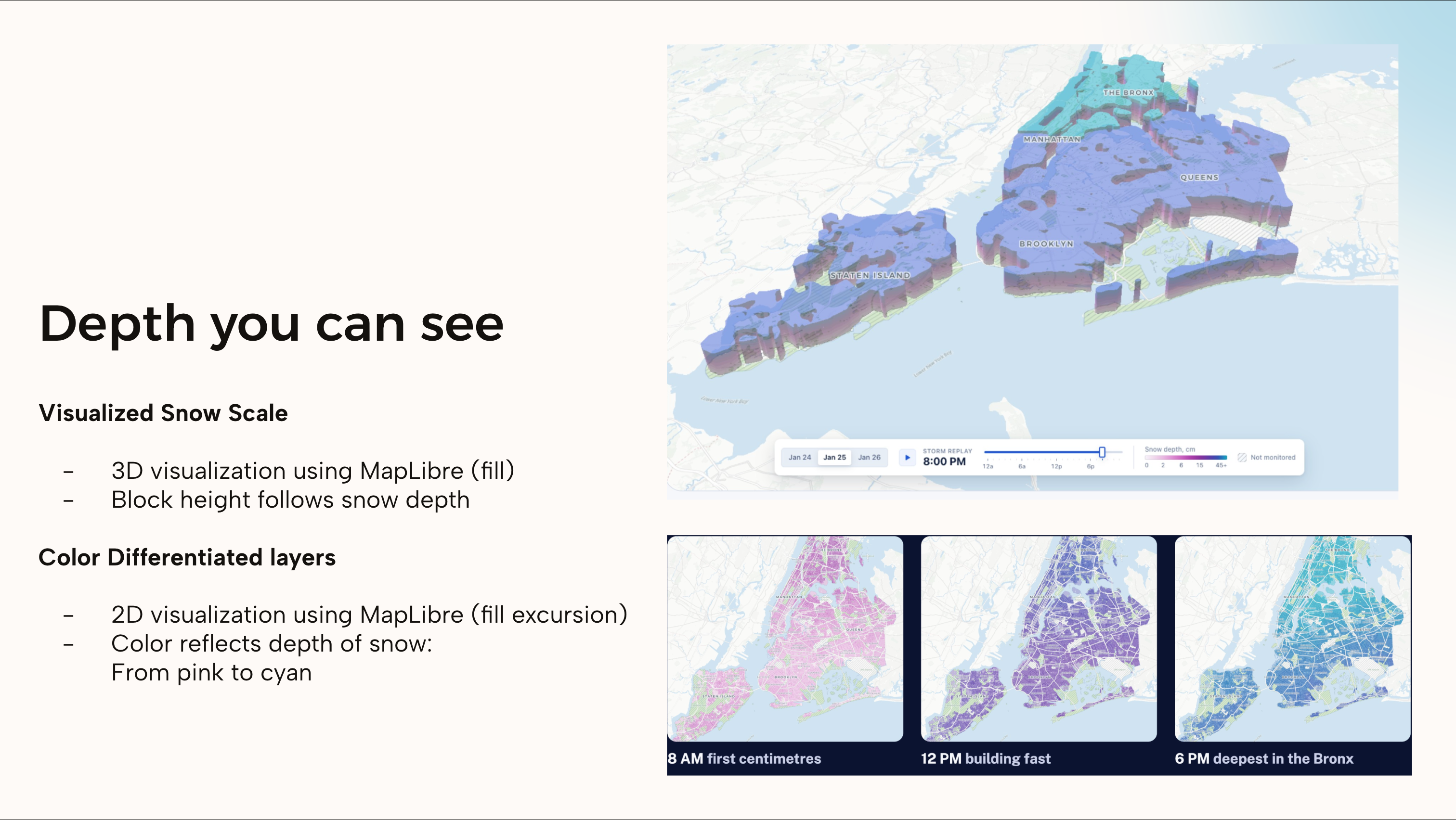
See the snow build, block by block
-
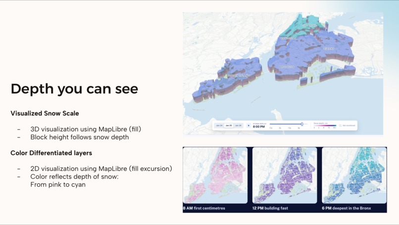
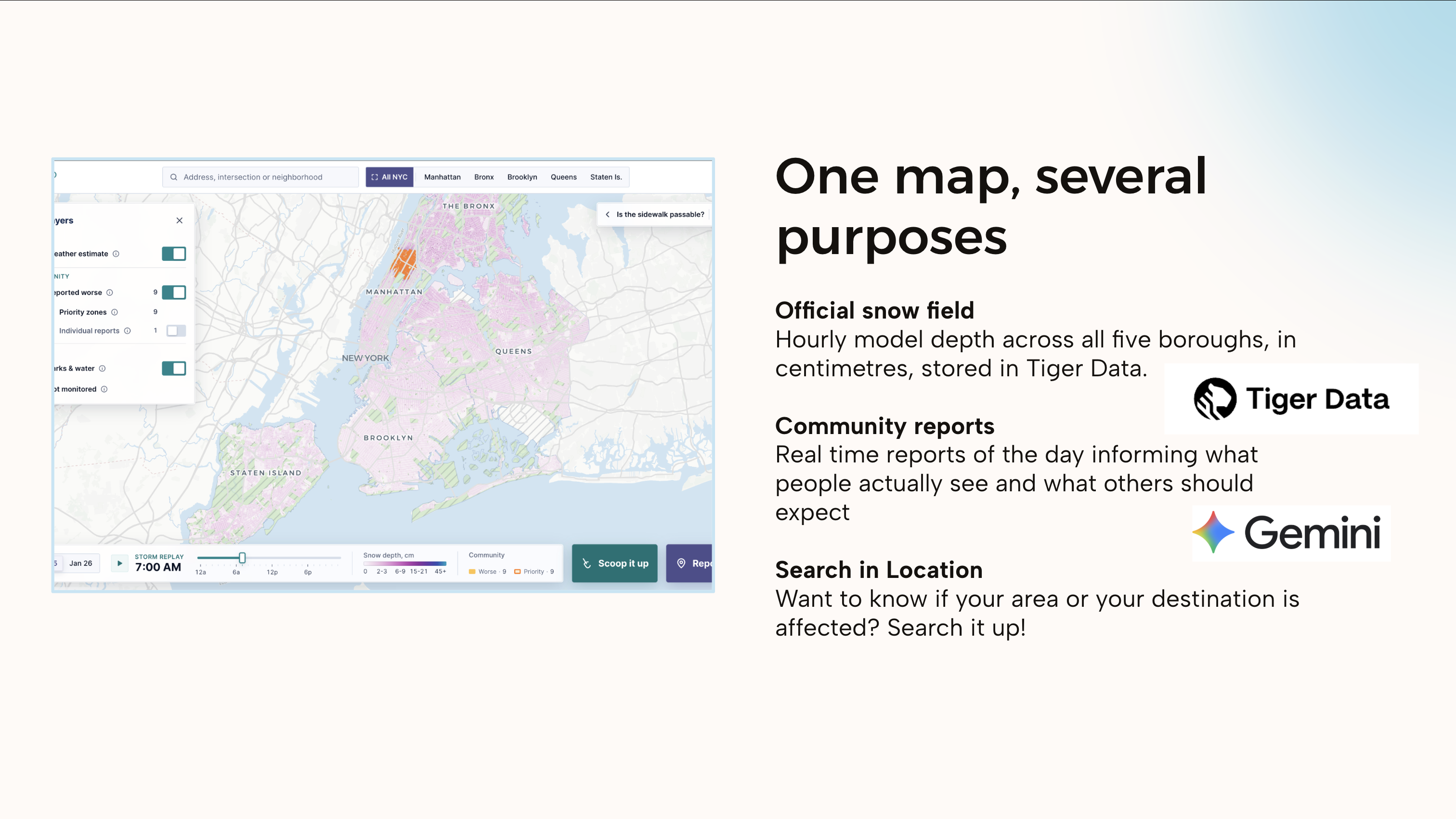
Check your route with forecasts and local reports
-
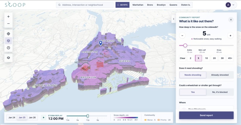
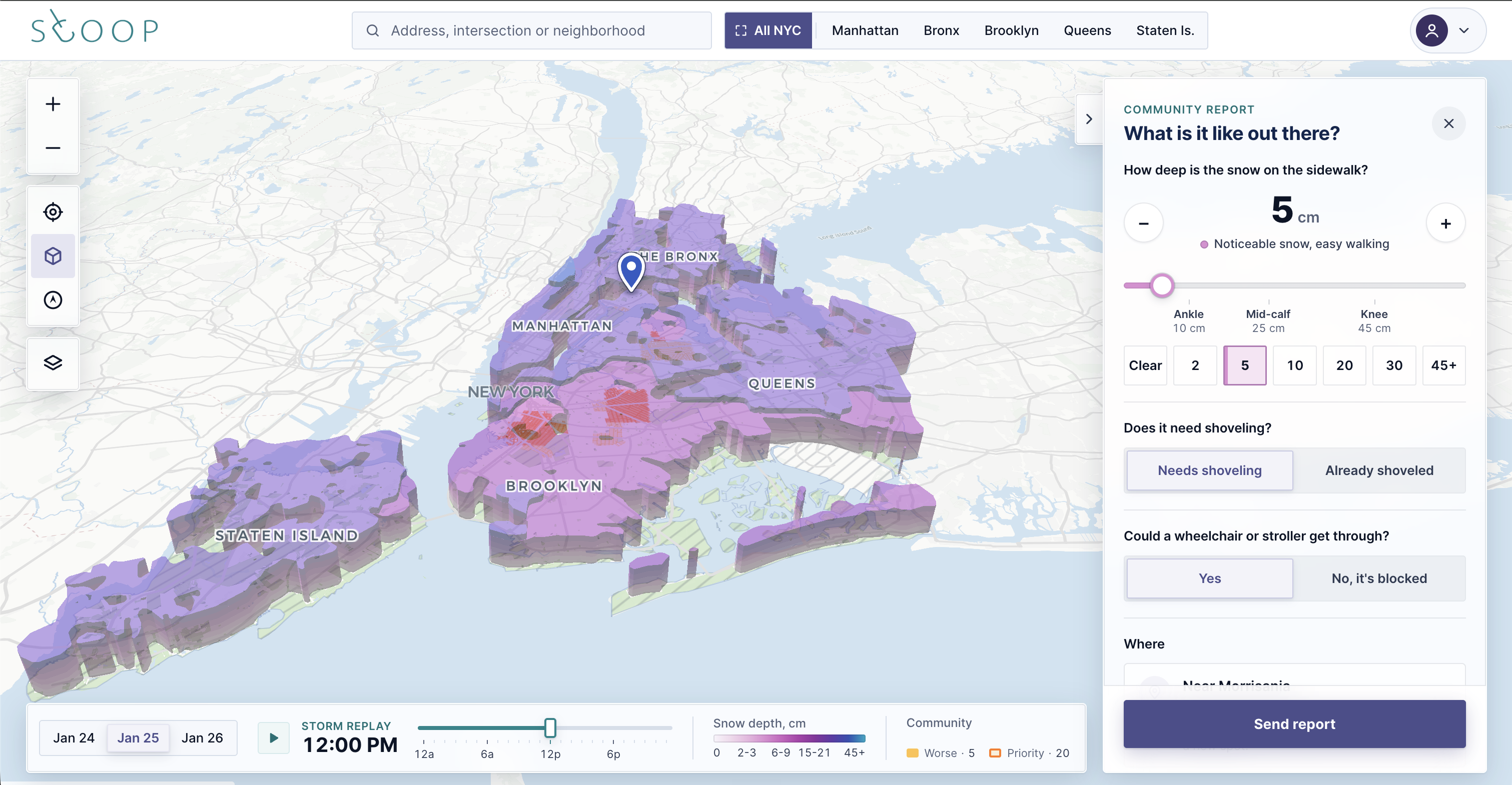
Report snow depth and sidewalk accessibility where you are
-
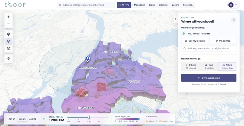
Find a nearby place to shovel and help clear the way
-
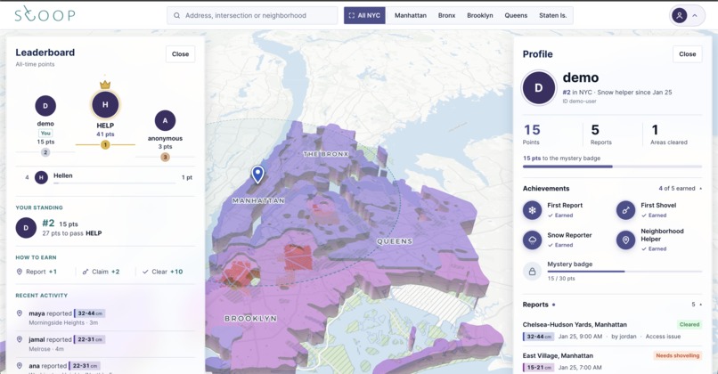
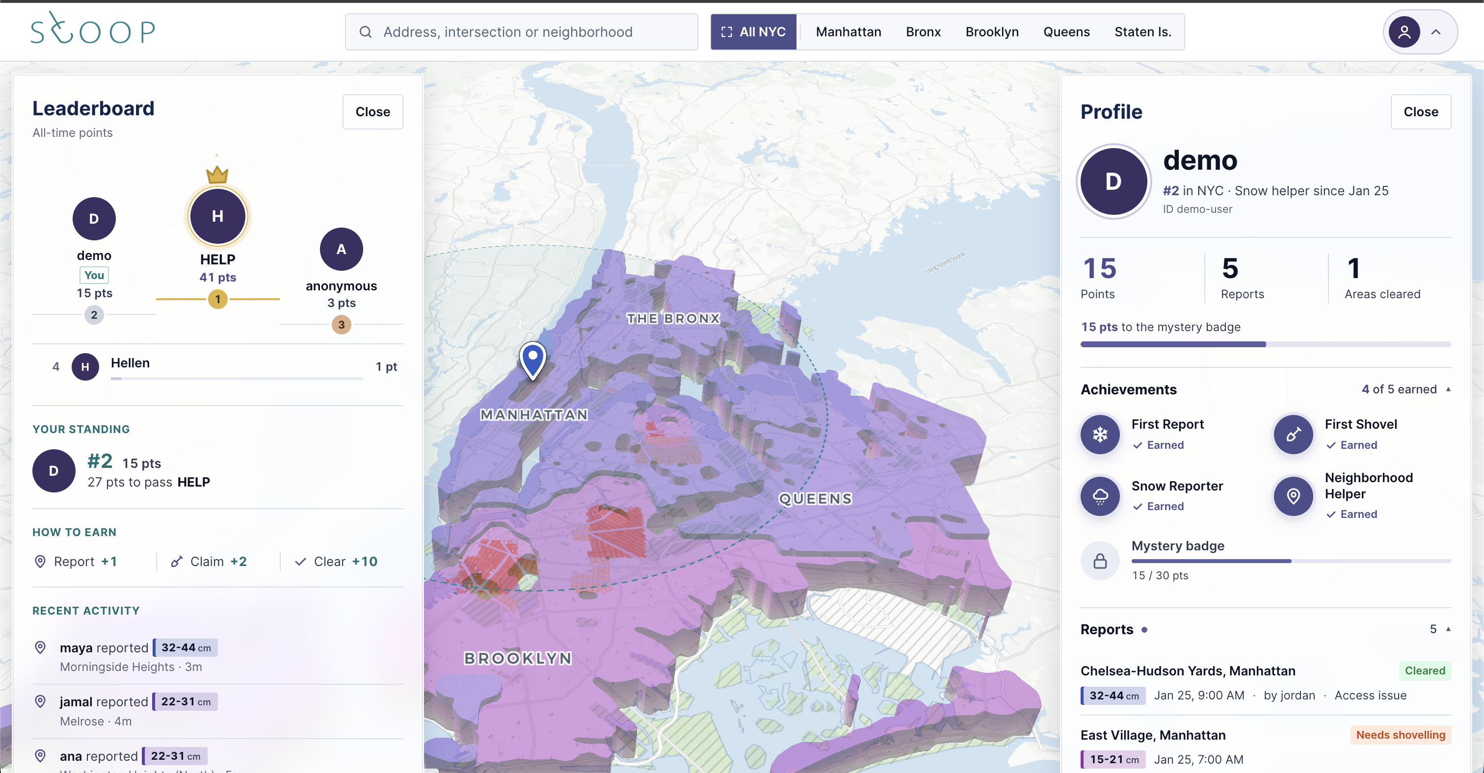
Scoop up piles of reported snow to climb the leaderboard!

Inspiration
Everyone remembers the snowstorms in January 2026: how difficult it was to get around the city, how disadvantaged communities were cut off from essential connections, and how snow-covered roads contributed to accidents. Even Mamdani turned to public funding to support volunteer snow-clearing efforts. But could we make that response more efficient?
What it does
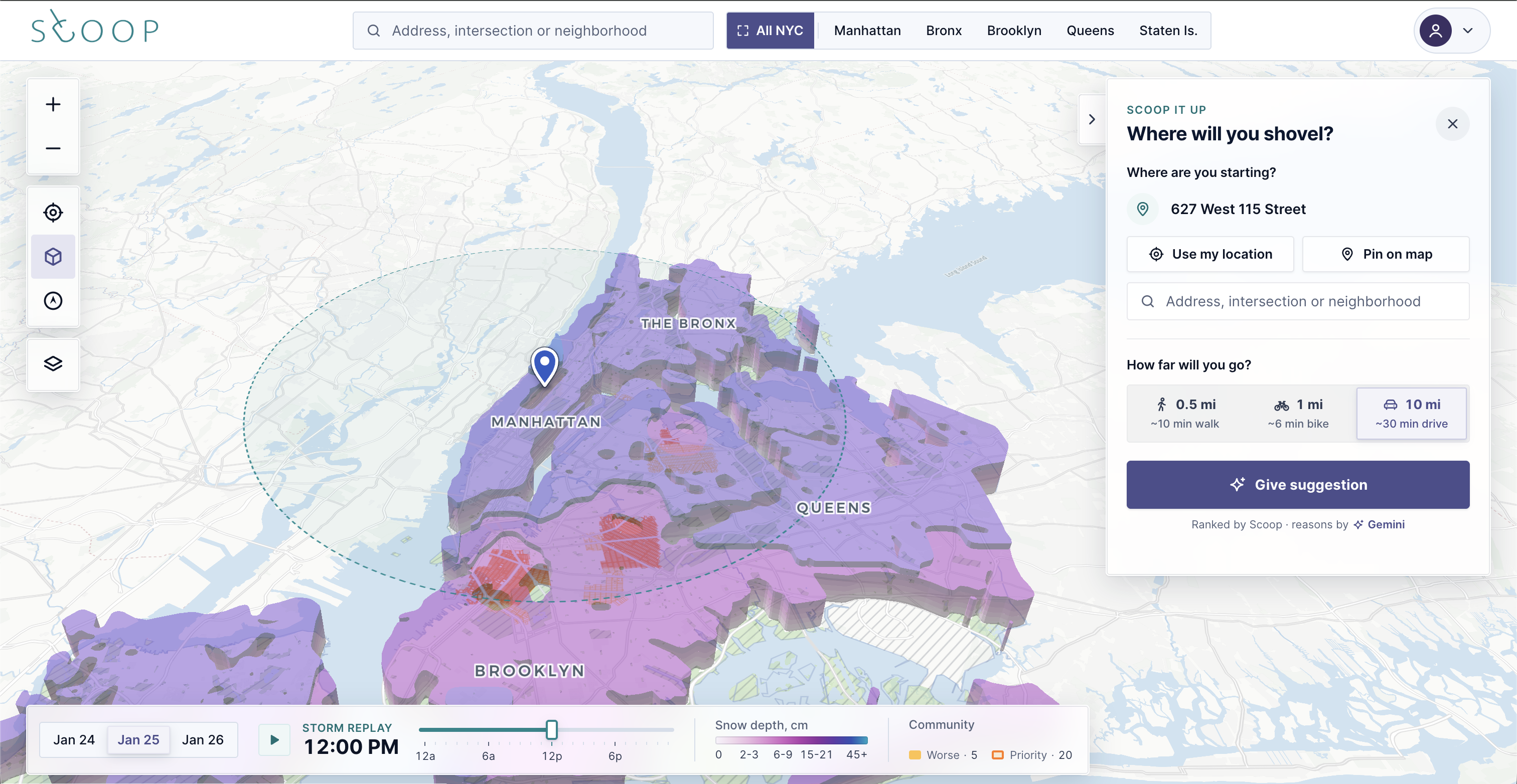
Scoop was thus created not only to visualize real-time snowfall, but also to gamify snow cleanup. Users can report blocked sidewalks, volunteer to clear them, and track which areas have been cleaned, turning community reports into real action.
How we built it
We built Scoop with Next.js, React, and TypeScript, using MapLibre and CARTO for our interactive map. Our Express backend connects TimescaleDB/PostGIS with Open-Meteo and NYC GeoSearch for weather and location data, while Gemini and Backboard power our AI summaries and area history. The frontend is deployed on Vercel, our API on Render, and our database on Tiger Data.
Challenges we ran into
We ran into several challenges during development, especially when designing the database schema and figuring out how to structure and connect variables across different data tables. We also had to spend some time optimizing the map layers and tweaking the frontend to keep the interactive map responsive and smooth. Another challenge was integrating multiple APIs and services, particularly making sure weather data, geospatial information, community reports, and Gemini AI are tied together, so that they could work together consistently.
Accomplishments that we're proud of
We’re proud of building an interactive snow map using Open-Meteo data to visualize snowfall across NYC, while also using Gemini AI to analyze snow conditions and provide recommendations on areas that need attention. We also connected real-time community reports with the map, allowing users to report, claim, and clear problematic areas, turning weather data into real-world action.
What we learned
Throughout this project, we learned that building a useful product is about more than just getting the technology to work. We learned how important it is to design a database structure that can bring together different types of data, while also making sure the frontend can efficiently visualize that information. We also gained experience integrating multiple APIs and AI tools, optimizing interactive map performance, and connecting different parts of a full-stack application.
What's next for scoop
Looking ahead, we want to make Scoop more rewarding, reliable, and useful for navigating the city. Users could exchange their points for rewards such as free food or gift cards, while partnerships with local governments and organizations could help expand the platform’s reach. We also plan to build a proof-of-cleanup system using images to verify that reported areas have actually been cleared before awarding points. Finally, Scoop could use snow and accessibility data to automatically recommend the safest and most accessible route to a destination, prioritizing streets and sidewalks with less snow. Who knows? Maybe Mamdani will need this web-app after the next snowstorm?
Built With
- express.js
- gemini
- geosearch
- maplibre
- next.js
- node.js
- open-meteo
- postgis
- postgresql
- react
- restapi
- tigerdata
- timescaledb
- turf.js
- typescript


Log in or sign up for Devpost to join the conversation.