-
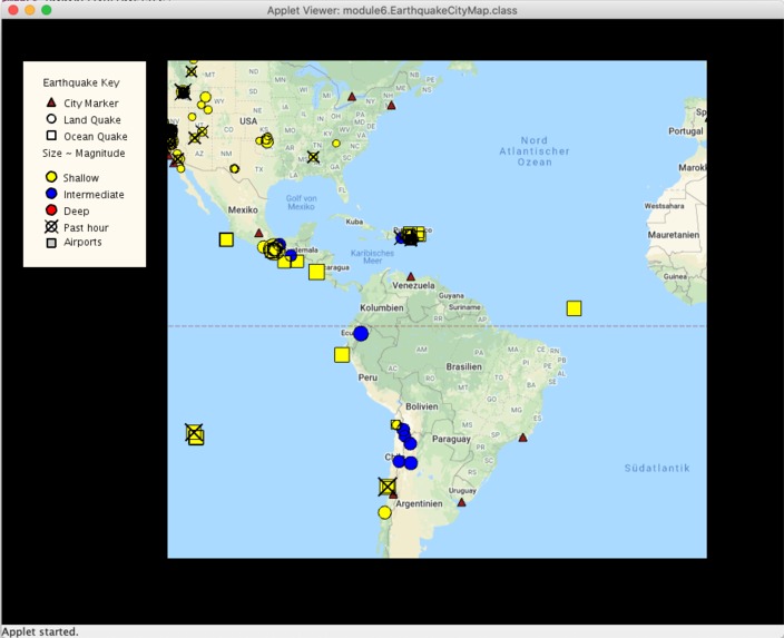
Demo 2
-
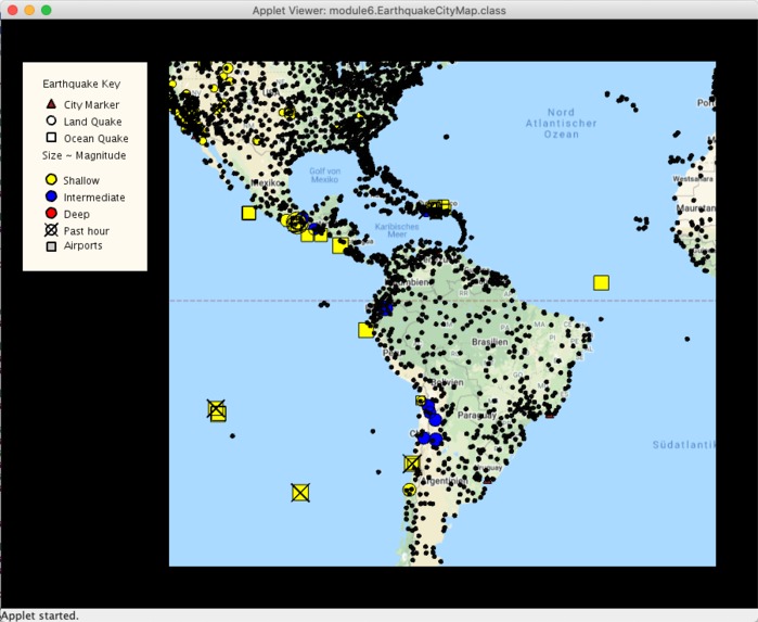
Demo 3
-
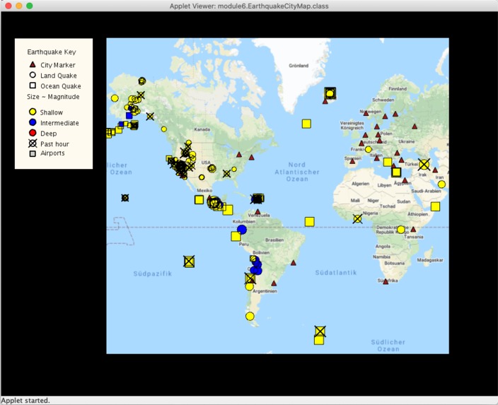
Demo 1
-
Demo 5
-
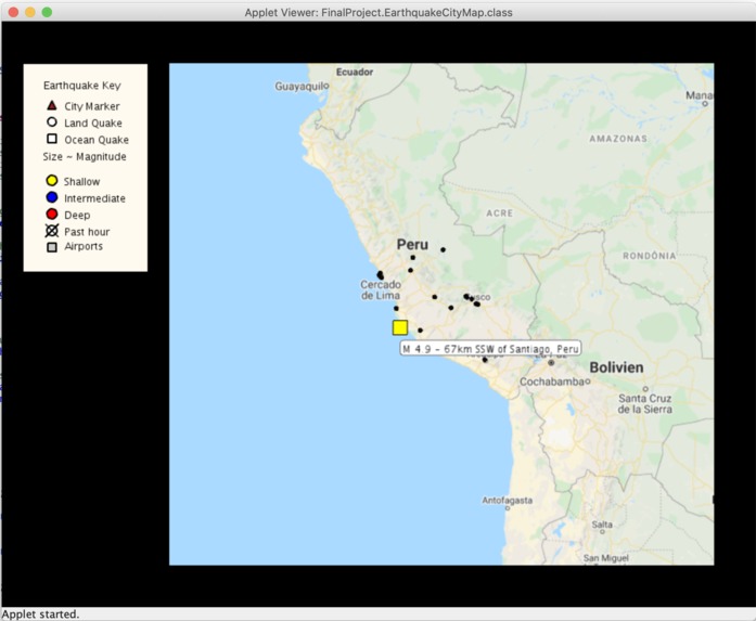
Demo 4
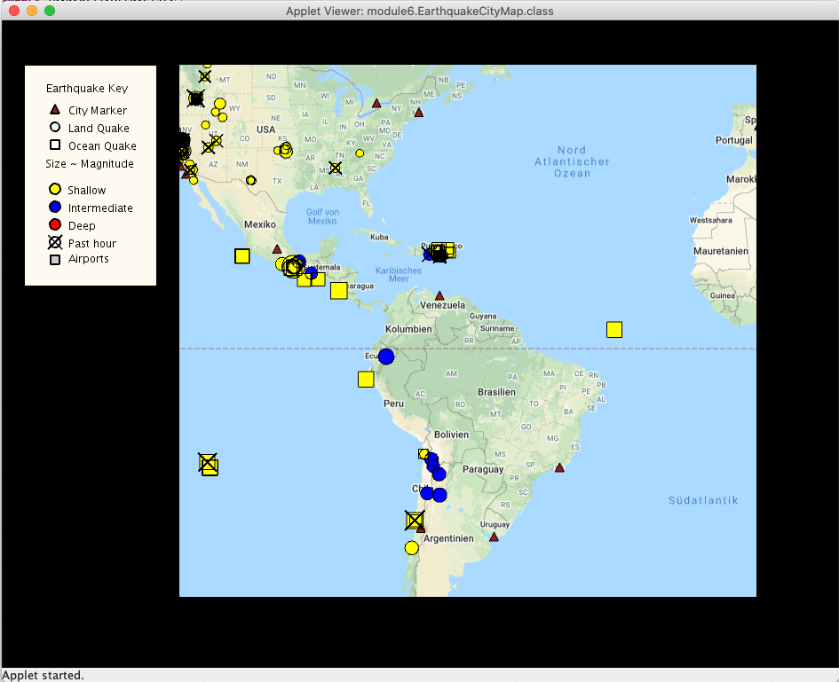

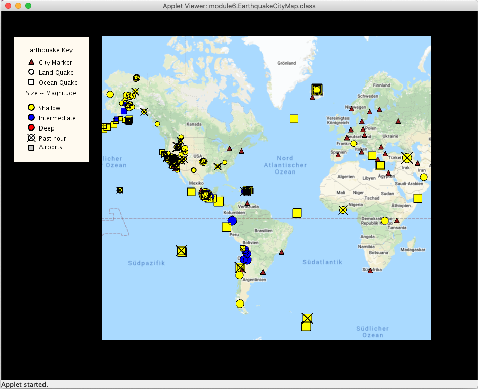
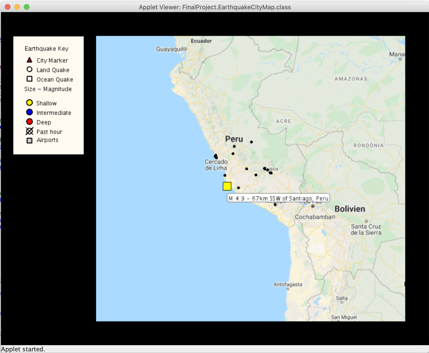

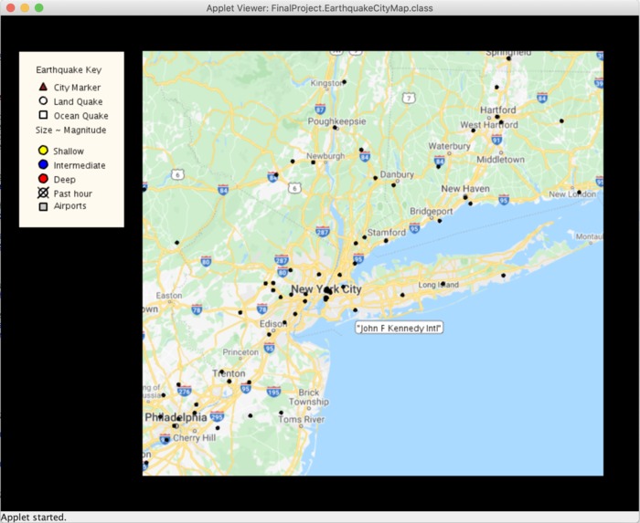
This project is an interactive visualization of a large dataset tagged by geospatial information. Both powerful and challenging, data visualization is one of the hot topics of modern computer science - as well as something that influences our world every day! It makes use of a package called Unfolding Maps, which is a library for interactive maps and geovisualizations.
Unfolding enables you to rapidly create interactive maps. Basic interactions such as Zoom & Pan are included. Other functionality such as Overview+Detail, or multitouch gestures can be easily added. Data Visualization
Simply create geo-positioned markers to display data on a map. The visual style can be adapted freely. The library supports any user-defined shapes, such as points, lines, or polygons. Styled Maps
Unfolding is a tile-based map library. Map tiles can have various geographic features, and come in all kind of styles. It comes with various map providers, such as OpenStreetMap or TileMill.
Built With
- any-ide-that-supports-jdk8
- java-se-8
- maven

Log in or sign up for Devpost to join the conversation.