-
-
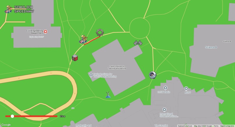
Schulich Speedway website
-
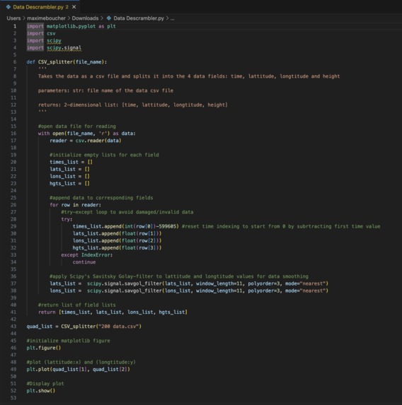
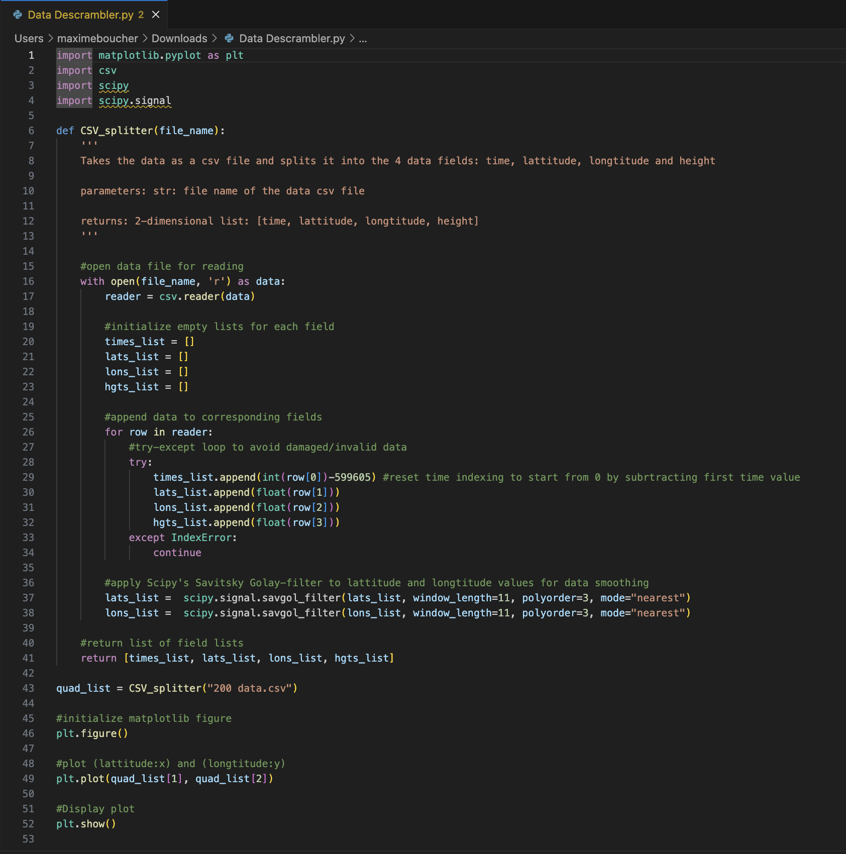
Python code
-
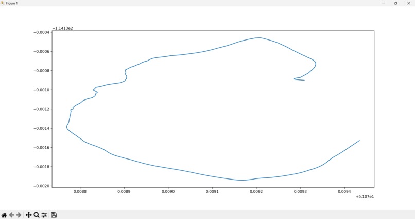
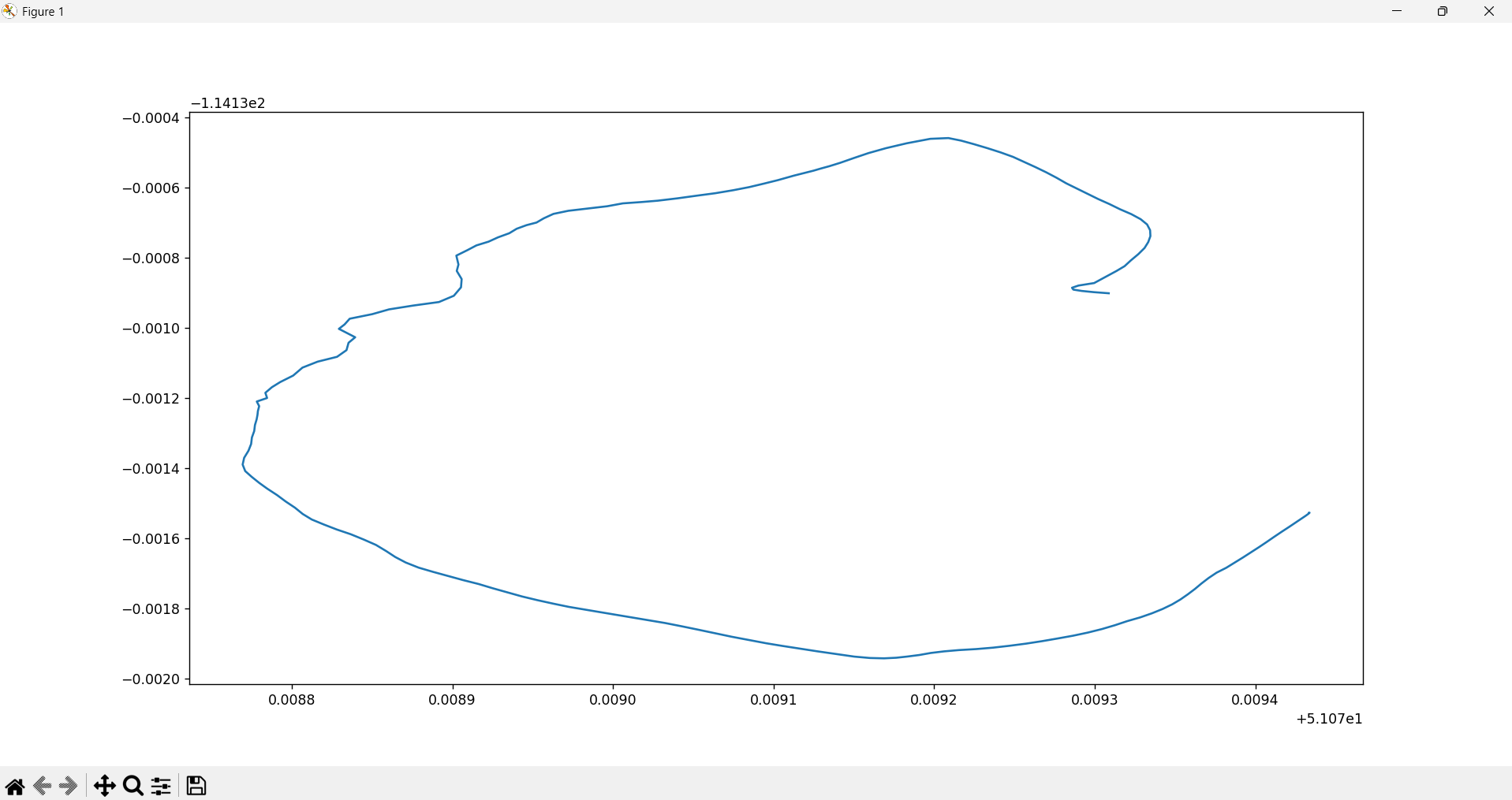
final graph

Inspiration ⚡️
Our project is inspired by the use of GPS and real-world data collected from antennae tracking our movement around the Taylor Institute building. We wanted to bring this data to life in a creative and engaging way. The website’s retro pixel-art style is inspired by classic video games, pushing us outside our comfort zones and challenging us to explore new design approaches. This project also serves as a test of our problem-solving skills and engineering knowledge.
What It Does ⚙️
At its core, our website transforms raw GPS data into an interactive experience. The main feature is a game that visualizes our tracked pathway in a racing-style format. As players navigate the course, they cross interactive checkpoints representing the journey of a first-year engineering student at U of C. This makes the data engaging by turning real-world movement into a playable experience. Each checkpoint includes fun insights, challenges, or relatable moments from student life, making it both entertaining and informative.
How We Built It 🚀
- Data Processing: We started by organizing our collected data in Excel, then wrote a Python script to clean and transform it into a usable format. We used Matplotlib and SciPy to generate plots and analyze trends.
- Web Development: The frontend was built using React, with the Google Maps API powering the visualization of our GPS-based race track.
Challenges We Faced 😭
One of our biggest challenges was handling the sheer volume of data. Our initial dataset, collected at a high frequency (every 0.05 seconds), contained over 2,000 points, resulting in excessive noise. To address this, we adjusted the sampling rate to collect data every second, significantly improving the clarity and usability of our final graph.
Accomplishments We're Proud Of 🏔️
- Successfully transforming raw GPS data into an interactive and visually appealing format.
- Stepping outside our comfort zones to experiment with pixel-art aesthetics and game-based visualization.
- Overcoming data-related challenges and refining our problem-solving skills.
What We Learned 🧠
- How GPS-based tracking systems collect and process location data.
- Techniques for data cleaning, transformation, and visualization.
- The importance of adaptability and teamwork in tackling unfamiliar challenges.


Log in or sign up for Devpost to join the conversation.