Inspiration
Navigating large campus buildings, such as educational institutions, can often be a daunting task for students and visitors alike. Traditional navigation methods often fall short in complex environments filled with hallways, staircases, and unique room designs. This can lead to confusion, stress, and lost opportunities for engagement.
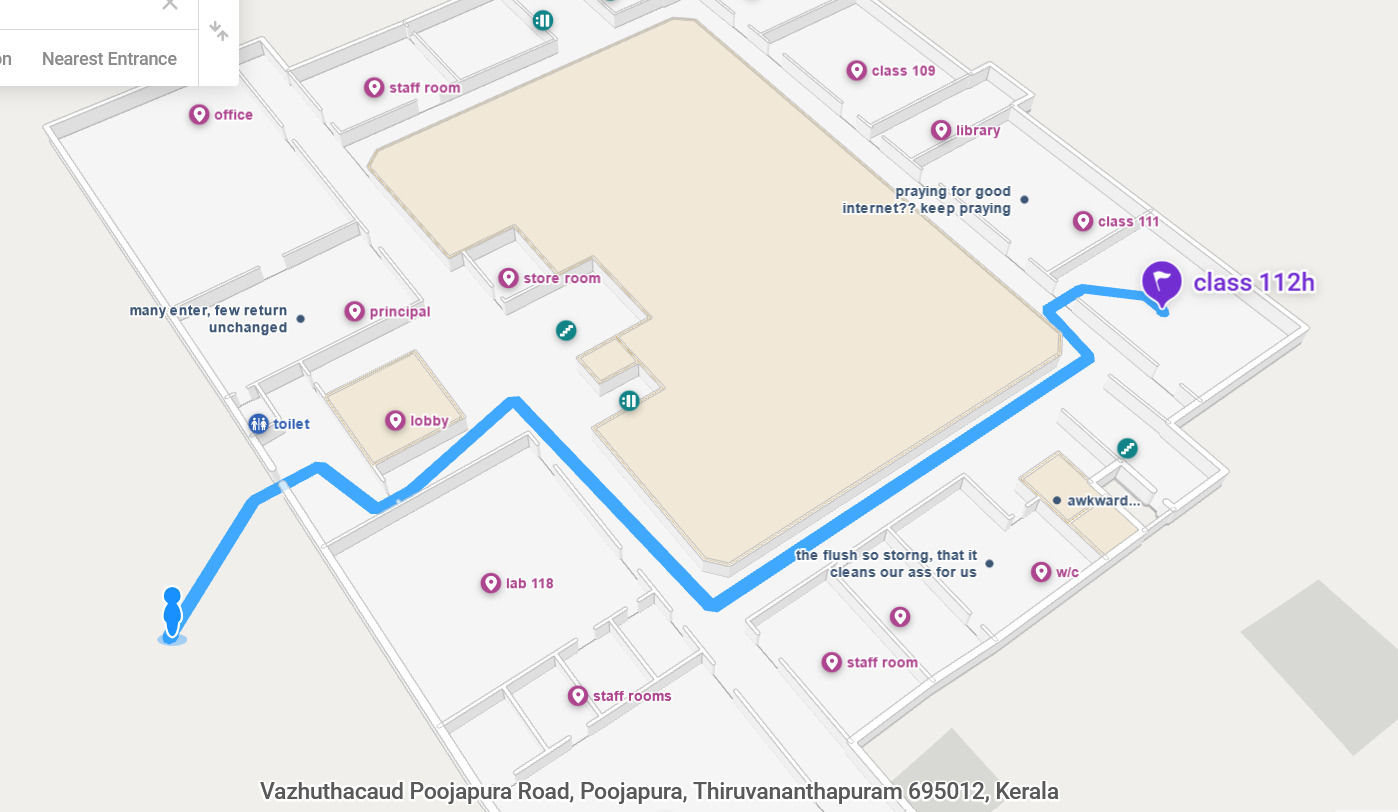
What it does
To address this issue, we are developing a web-based application that serves as an interactive map of a campus building, enabling users to find their way to classrooms with ease. The application uses the Mappedin SDK to provide navigation, displaying clear paths to destinations while accommodating the unique layout of the building.
How we built it
We utilized the Mappedin SDK to create an interactive mapping interface. The application integrates features that shows random comments and information related to those locations.
Challenges we ran into
One of the main challenges we ran into was that the Mappedin SDK was a paid service, which limited our ability to implement features that allowed users to give comments effectively. Additionally, we faced obstacles in incorporating real-time navigation, as the SDK did not provide the necessary functionalities for live tracking, which is crucial for an interactive mapping experience.
What we learned
learned working with mapping technologies and SDKs, specifically learning to work with indoor maps and navigation.
What's next for SBL-Maps
Moving forward, we plan to expand our application by adding features such as live location tracking, and the potential for integration with other campus services to further enrich the user experience.
Built With
- html
- mappedin
- react
- typescript


Log in or sign up for Devpost to join the conversation.