-
-
-
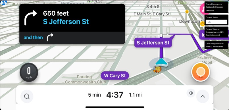
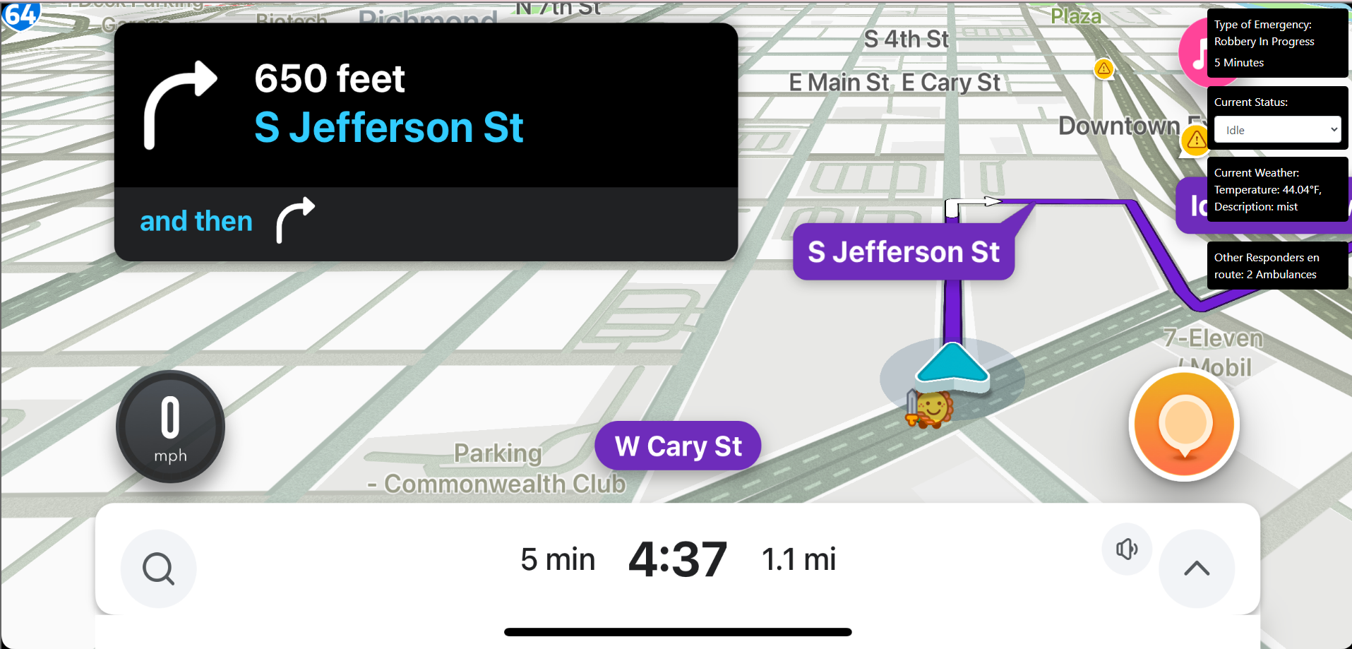
Responder View
-
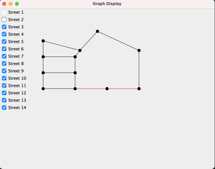
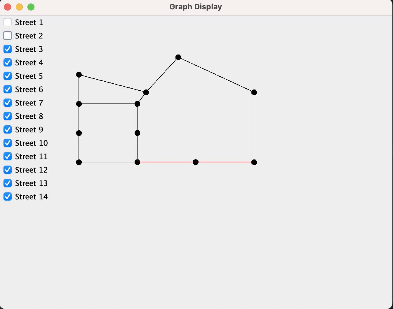
Algorithm Showing Road Closure
-
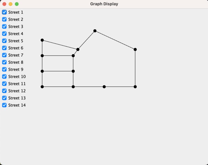
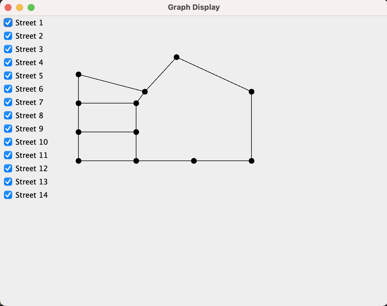
Algorithm Showing No Road Closure

Inspiration
Our inspiration stems from the critical need to enhance emergency response systems. Witnessing the challenges faced by first responders in navigating emergencies, we were driven by a collective desire to make a tangible impact. The potential to improve efficiency, reduce response times, and ultimately save lives fueled our passion and commitment to developing an adaptive emergency routing system. Our inspiration lies in the prospect of creating a solution that can make a meaningful difference in emergency situations, contributing to the safety and well-being of communities.
What it does
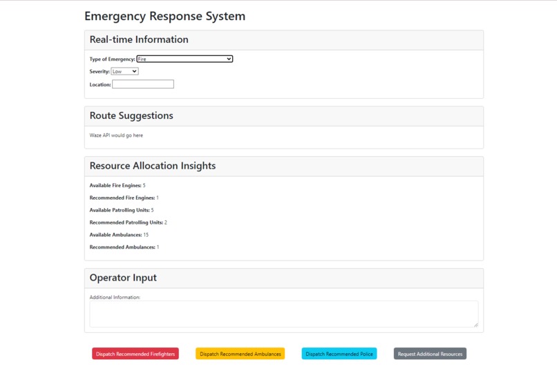
Our system allows 911 operators to assess an emergency from an incoming call and quickly dispatch the appropriate responders. On the responders’ side they are immediately able to view and respond to emergencies sent out by the dispatcher. On their screen they are able to view the type of emergency and location. The responders’ screen also displays the optimal route, which takes into consideration: proximity to the emergency, road traffic/closures, and severity of emergency.
How we built it
For the java application we used the swing library to create a demo showcasing a graph representing the streets surrounding Monroe Park. In this demo we can close/open roads, and in a future version we could use this to find optimal and adaptive routes based on various input data.
For the operator and 911 responder page we created two websites on the same local domain using javascript, css, html, and node.js. We also included weather,js to show active weather status for the current area.
Challenges we ran into
During our initial brainstorming, we veered off course, delving into a detailed UI for 911 operators. The desire to build a comprehensive system led us down a rabbit hole, contemplating an exhaustive list of injuries. Thankfully, a team member redirected us, reminding us that our goal is to enhance first responders' travel time and resource allocation efficiency. This valuable realization has refocused our efforts on the core objective, ensuring a more effective solution.
Accomplishments that we're proud of
One of the accomplishments was getting the weather.js api to work correctly, for some reason it was using kelvin as the default temperature scale but using “c” as its abbreviation. We were all pretty happy when we figured out why it wasn’t working. Since this was our whole group's first time participating in a hackathon, every single step we took, even during the brainstorming phase, felt like a mini accomplishment. It was a journey of continuous learning and collaboration, with each hurdle overcome serving as a testament to our resilience and teamwork. Our collective enthusiasm and the steep learning curve transformed each moment into a building block of confidence, turning this hackathon into a rewarding experience that fortified our passion for tackling complex problems.
What we learned
Coming into the hackathon, we were inexperienced programmers with little to no knowledge of the outside world but through this hackathon, we learned how to develop a small web application with html5, javascript, css and gained a profound appreciation for the classic language of java. We weren’t able to fully implement it but towards the end of the hackathon we were on the edge of a breakthrough with getting a database to work with our program as well as integrating a full functioning waze map with real time into our program.
What's next for Save Our Heroes (SOH)
On the back end, we need to fully develop our optimal route algorithm and implement it into our system. This entails implementing the Waze API into our application for real-time traffic data that would ensure that our first responders would be able to arrive at emergencies as fast as possible.
At the forefront of our project we will try to run tests on real life emergency scenarios and try to get real life and real time feedback from emergency responders and try to improve our program to fulfill the needs of our constituents.
We really want this program to be used across the United States by all EMS. We would love for our program to perhaps be used world wide eventually because we truly value and believe everyone should be saved.
Exploring other options
If we get enough traction, we would love to perhaps include the public on our program and incorporate a way for the public to notify road closures and other scenarios that might pop up on the field of life on planet earth! A similar function/feature that google map and waze uses to identify when there are police on the highway.
Built With
- css
- html
- java
- javascript
- node.js
- weather.js


Log in or sign up for Devpost to join the conversation.