Inspiration
Satellite images contain valuable information about agriculture, urban development, water resources, forests, and environmental changes. However, analyzing these images often requires specialized knowledge and different AI tools.
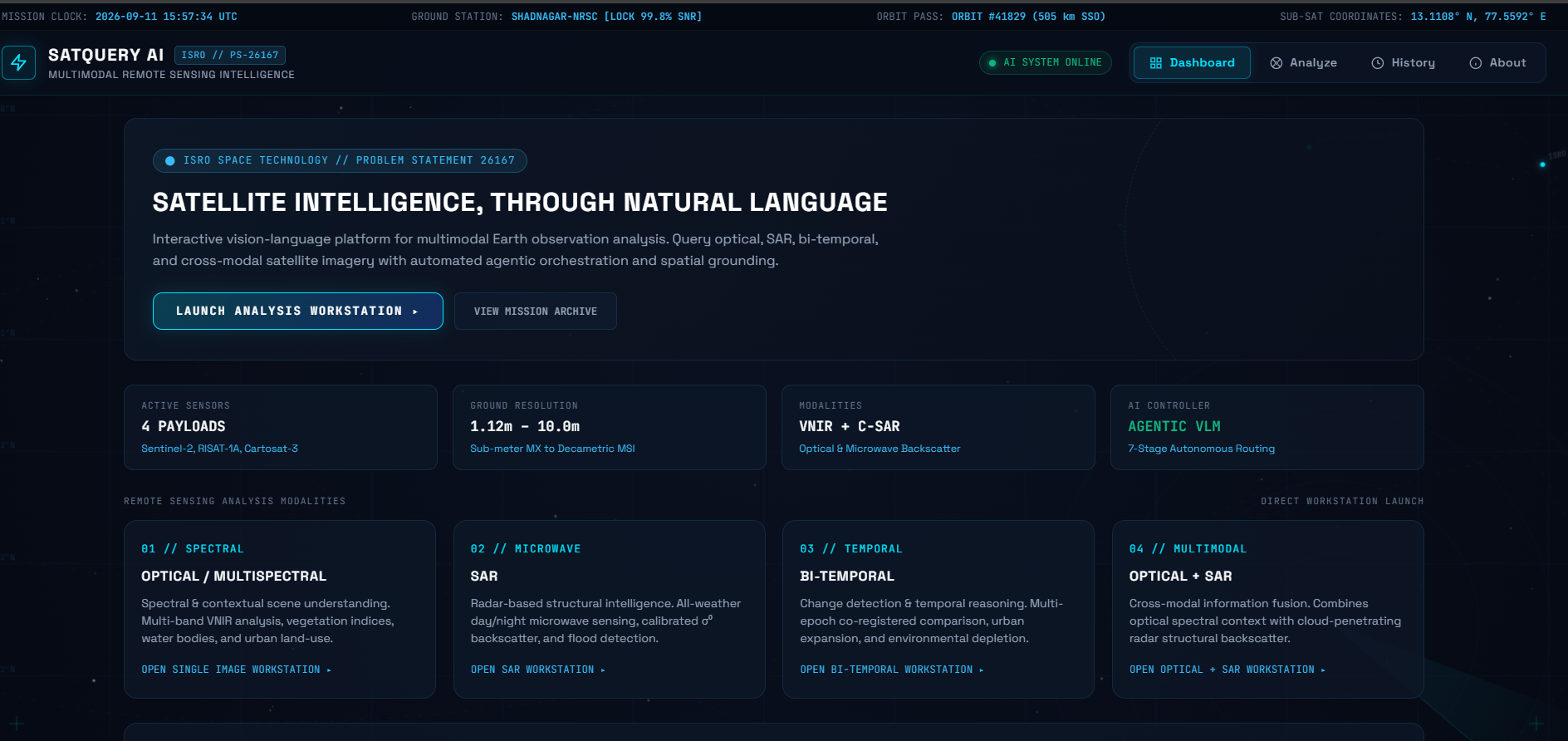
We wanted to make satellite image analysis simpler by allowing users to interact with satellite imagery using natural language. This idea inspired us to build SatQueryAI, an intelligent assistant that can understand user queries and analyze remote-sensing images.
What it does
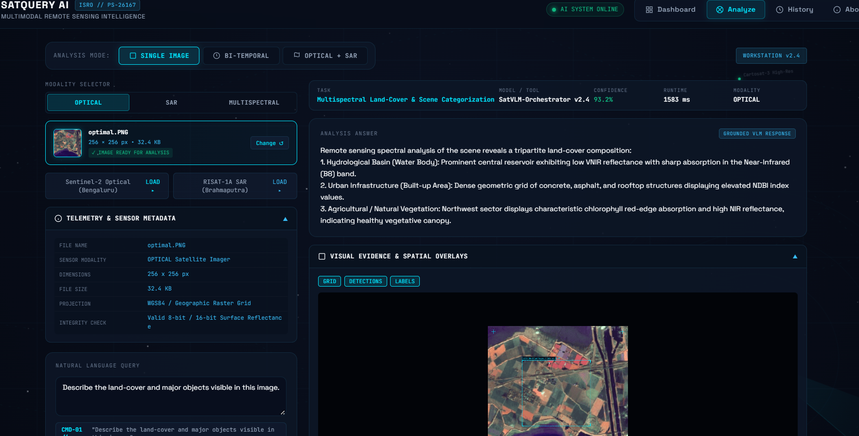
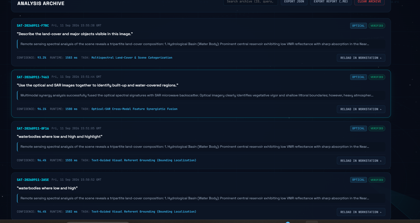
SatQueryAI allows users to upload satellite images and ask questions in natural language.
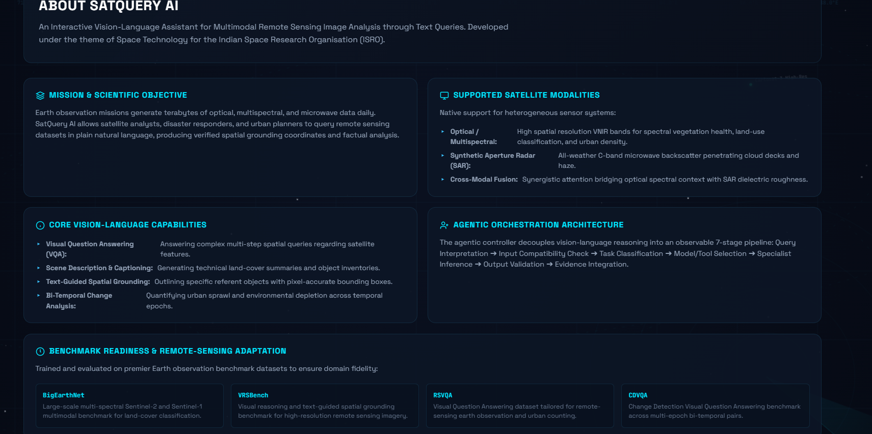
It is designed to support:
- Single-image visual question answering
- Image captioning and scene understanding
- Text-guided region identification
- Change analysis between images from different dates
- Joint analysis of optical and SAR images
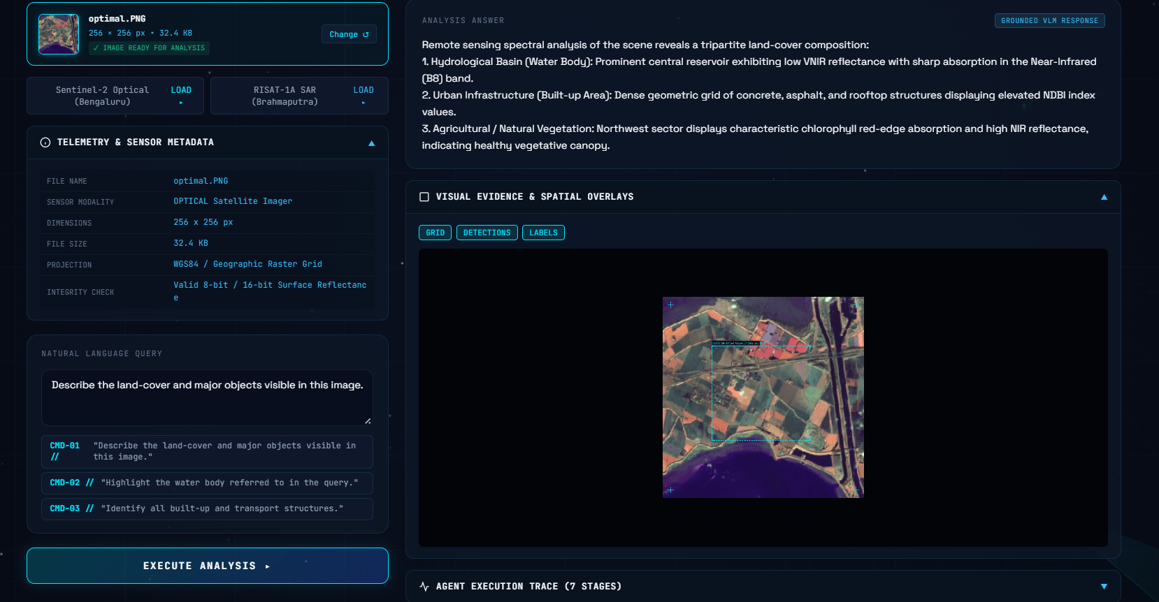
- Evidence-based visual results
The system aims to automatically identify the type of analysis required for a user's query and provide a relevant response.
How we built it
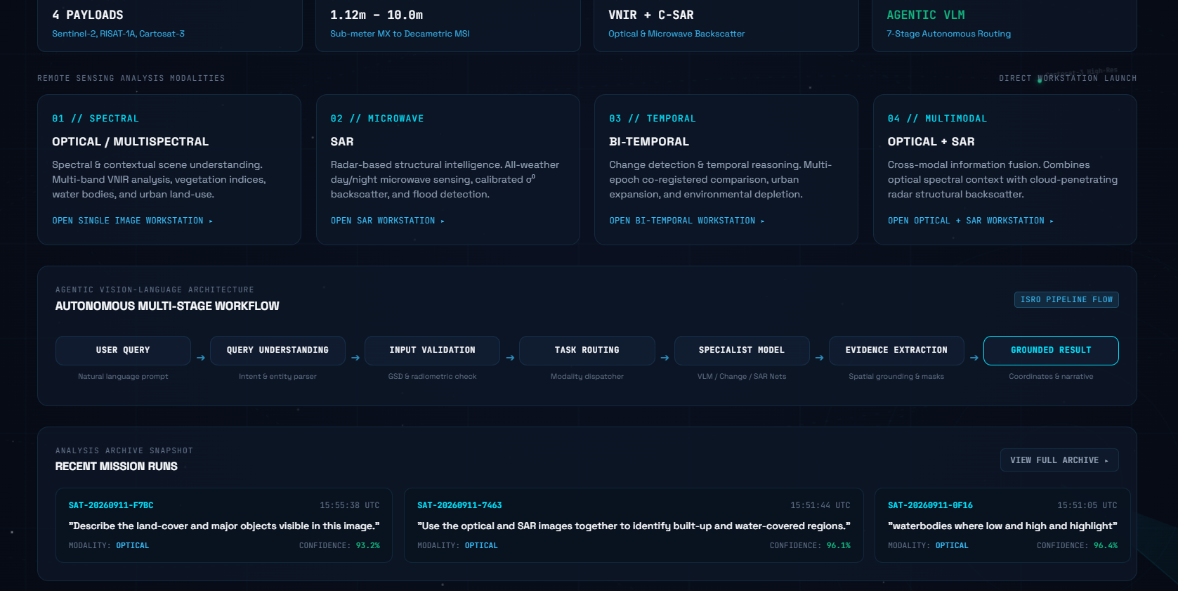
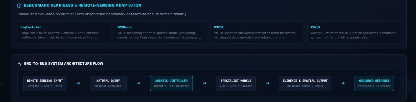
We designed SatQueryAI as an agentic AI system with a vision-language interface and specialized remote-sensing analysis components.
The system receives the user's query and uploaded satellite imagery, identifies the required task, selects the appropriate AI model or tool, performs the analysis, and combines the results into a final response.
The application is designed as an interactive web-based interface where users can upload images, enter queries, view results, and understand how the analysis was performed.
Challenges we ran into
One of our main challenges was handling different types of satellite imagery and different user queries within a single system.
Another challenge was designing an agentic workflow that can select the appropriate analysis method instead of relying on a single model for every task.
Working with multimodal inputs such as optical and SAR imagery and analyzing changes across different dates also introduced additional complexity.
Accomplishments that we're proud of
We are proud of designing a unified interface for natural-language interaction with satellite imagery.
We also focused on combining multiple specialized AI capabilities into an agentic workflow, allowing the system to support different remote-sensing analysis tasks through a single application.
What we learned
Through SatQueryAI, we learned how vision-language models, computer vision, remote-sensing imagery, multimodal AI, and agentic workflows can work together.
We also learned the importance of validating inputs, selecting the right model for each task, and presenting AI results with useful visual evidence.
What's next for SatQueryAI
We plan to improve the accuracy and reliability of remote-sensing analysis, support more satellite datasets and sensors, and expand the number of specialized AI models available to the agent.
Future versions could also provide more advanced geospatial analysis, better change detection, improved optical-SAR reasoning, and richer visual reports.
Built With
- agentic-ai
- ai
- computer-vision
- gis
- machine-learning
- multimodal
- python
- remote-sensing
- satellite-imagery
- vision-language-models

Log in or sign up for Devpost to join the conversation.