-
-

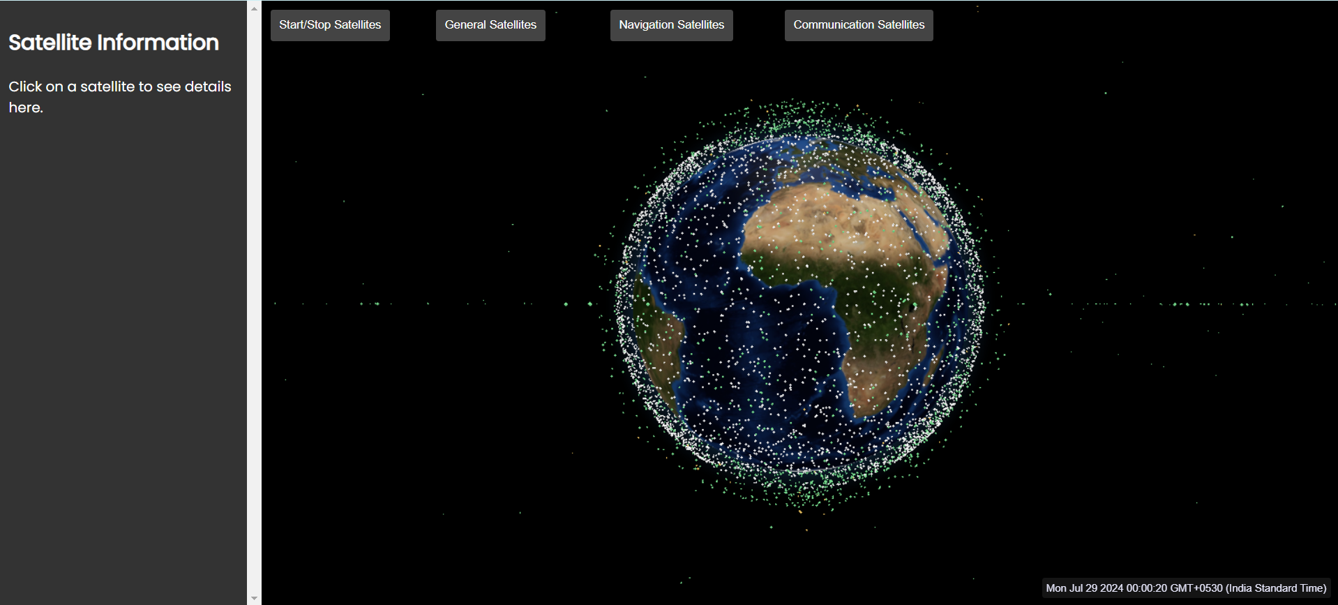
Home Page
-
Change dataset by clicking on the options given on the top
-
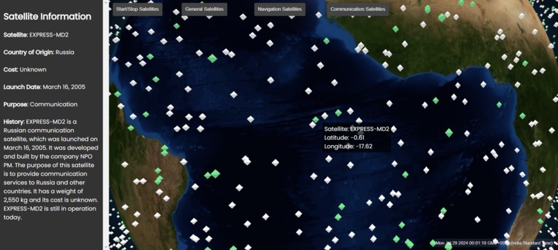
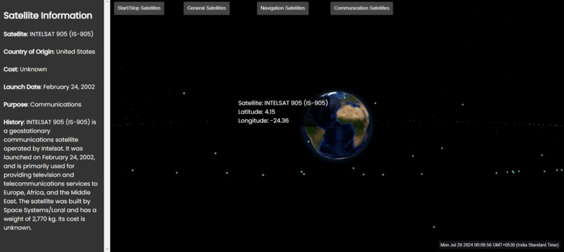
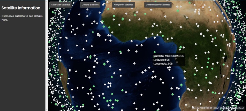
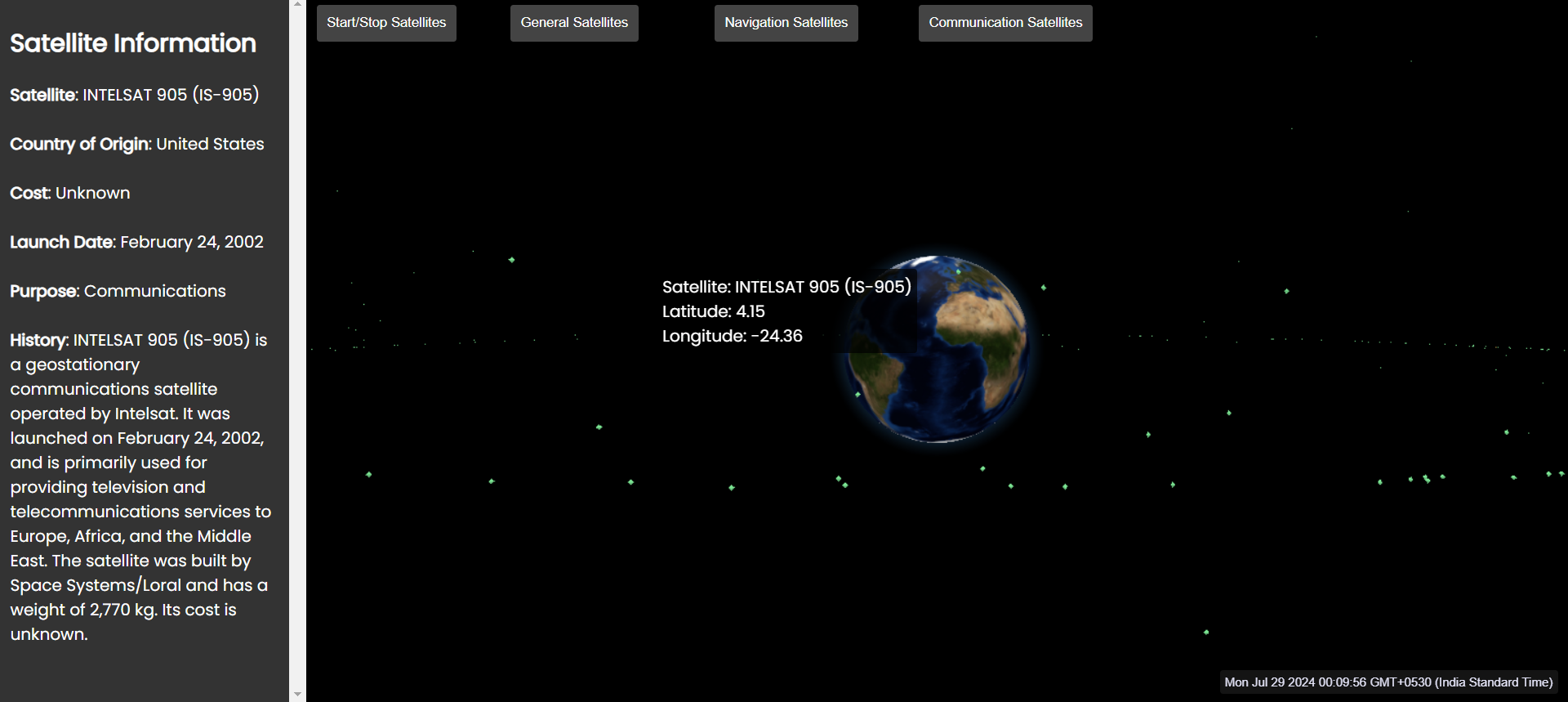
Click on a satellite to know more about it
-
Hover over a satellite to see a short description


Inspiration
Satellites have always been a fascinating topic for me. I have always wanted to see satellites in a more visually appealing way rather than what we have seen in our textbooks. While some sites offer visualizations, they often seem cluttered and hard to understand. To improve upon this, I have developed a more intuitive visualization by adding detailed information at each step.
The goal is to make satellite visualizations more interesting by not only animating the green dots representing satellites but also by providing detailed information about each of these satellites. This includes country of origin, cost, launch date, purpose, and history, which can be accessed by clicking on a satellite. In the process, I have also learned about many satellites that I had heard of but didn't know much about. This tool is purely educational, designed to help students understand satellite routes and gather detailed information about each satellite.
What it does
The main purpose of this project is to present satellite datasets in a more easy-to-understand and interesting manner. Users can choose a satellite and see more information about that satellite. I have tried to segregate them based on the country of origin. Currently it shows 2 country - USA and Russia. The satellites which are unidentified source of origin are marked green.
How we built it
I have used Three.js to render a 3D map of the globe. I have used open satellite data sets to plot satellites on the globe. The project uses html, css and JS for frontend and flask for backend. I have used OpenAI for providing the information of satellites.
Challenges we ran into
It was my first time working with 3D rendering. I learnt a lot about 3D rendering from this project. Another issue we faced was the pointer accuracy was very low. While clicking on the satellites we must point to the center and click then only it will show the details. Now, this has been fixed with a more robust system by catching the pointer within a circular area. So it gives more freedom to click within a given area rather than a point.
Accomplishments that we're proud of
The project was completed on time and it was deployed for general use.
What's next for Satellite O' Pedia
More data sets for visualization. Making the program more faster. Adding country based satellite marking. Currently it supports only - USA and Russia.
Built With
- css3
- html5
- javascript
- openai

Log in or sign up for Devpost to join the conversation.