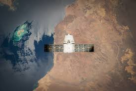
Inspiration The rapid growth of satellite data has unlocked vast opportunities to monitor and understand Earth. From disaster management to urban planning, satellite image classification empowers decision-makers with critical insights. Inspired by the potential of AI in addressing global challenges, we aimed to build a model that efficiently classifies satellite images using deep learning.
What it does Our project leverages the VGG16 deep learning model to classify satellite images into predefined categories. It enables:
Accurate detection of land cover types, such as forests, urban areas, and water bodies. Insights for environmental monitoring, urban planning, and disaster response. High-resolution, real-time analysis for actionable outcomes. How we built it Data Collection and Preprocessing:
Used publicly available satellite image datasets (e.g., EuroSAT or BigEarthNet). Preprocessed images: resizing, normalization, and augmentation for better generalization. Model Implementation:
Utilized the pre-trained VGG16 model from TensorFlow/Keras with transfer learning. Replaced the top layers with fully connected layers tailored to the dataset’s classes. Training and Fine-tuning:
Trained the model on GPU for faster processing. Applied hyperparameter tuning to optimize performance. Deployment:
Built an interactive dashboard to visualize classification results. Deployed on a cloud platform for scalability and real-time use. Challenges we ran into Data Scarcity: Access to high-quality labeled satellite images was limited. Model Complexity: Balancing accuracy with computational efficiency for large-scale datasets. Cloud Deployment: Integrating the model into a user-friendly, scalable application. Overfitting: Tackled with data augmentation and regularization techniques. Accomplishments that we're proud of Achieved high classification accuracy using transfer learning with VGG16. Developed a streamlined pipeline for preprocessing, training, and deployment. Built a scalable solution with the potential for impactful applications in real-world scenarios. What we learned The power of transfer learning in achieving robust results with limited resources. Best practices for working with satellite imagery, including preprocessing and augmentation techniques. Importance of designing models with scalability and real-world deployment in mind. What's next for Satellite Image Classification using VGG16 Expand the Dataset: Incorporate more diverse and labeled satellite images to improve model robustness. Real-Time Analysis: Optimize the model for real-time satellite data streams. Advanced Architectures: Explore newer architectures like ResNet or EfficientNet for enhanced performance. Application Areas: Extend the solution to support tasks like disaster prediction and agricultural monitoring.
Built With
- cnn
- image-analysis
- vgg16

Log in or sign up for Devpost to join the conversation.