-
-
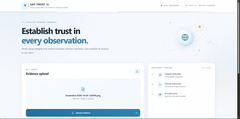
Dashboard
-
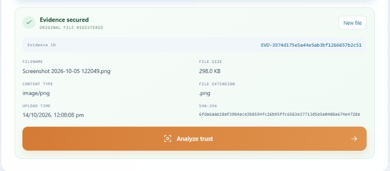
Evidence
-
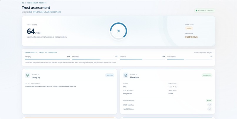
Analysis
-
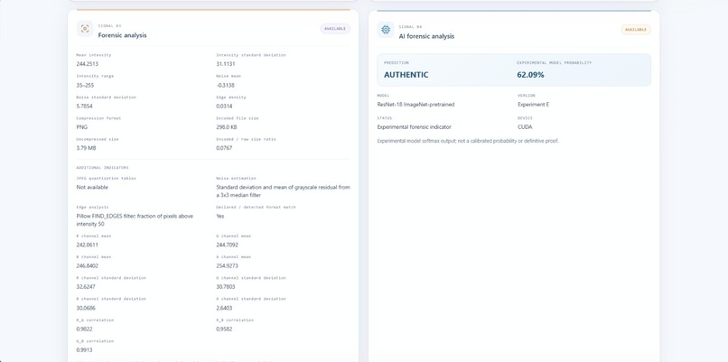
Analysis 2
-
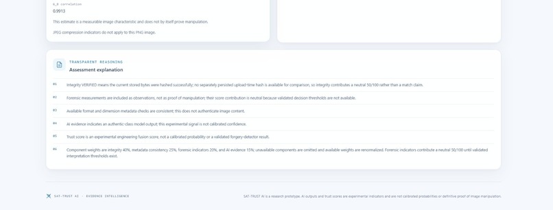
Explanation
Inspiration:
Satellite imagery plays a vital role in environmental monitoring, agriculture, and disaster management. However, verifying satellite images and determining whether their descriptions accurately represent the visible information can be challenging. This inspired us to build SAT-TRUST AI, a multimodal AI system that combines computer vision and natural language processing to analyse satellite imagery, identify potential inconsistencies, and investigate environmental changes.
What It Does:
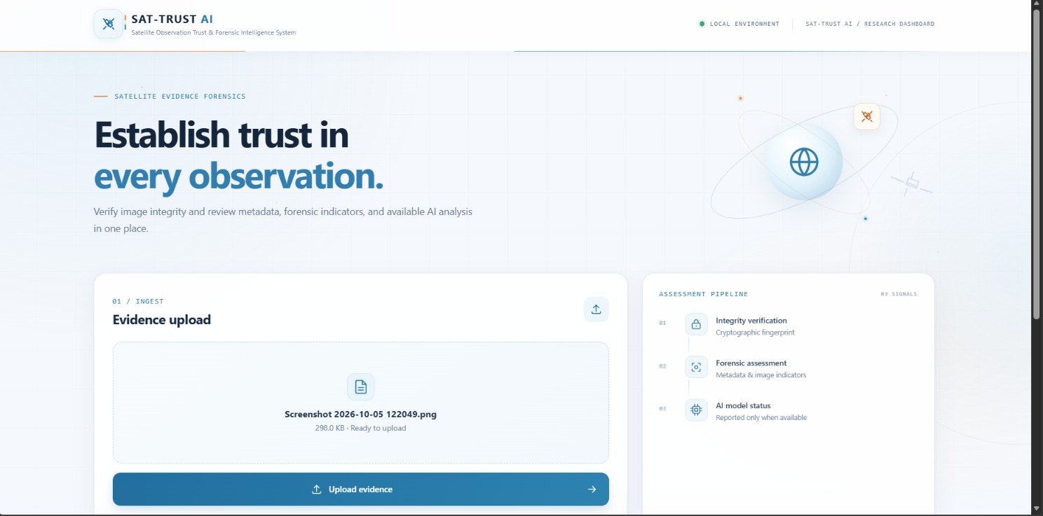
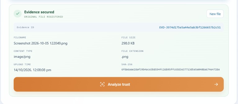
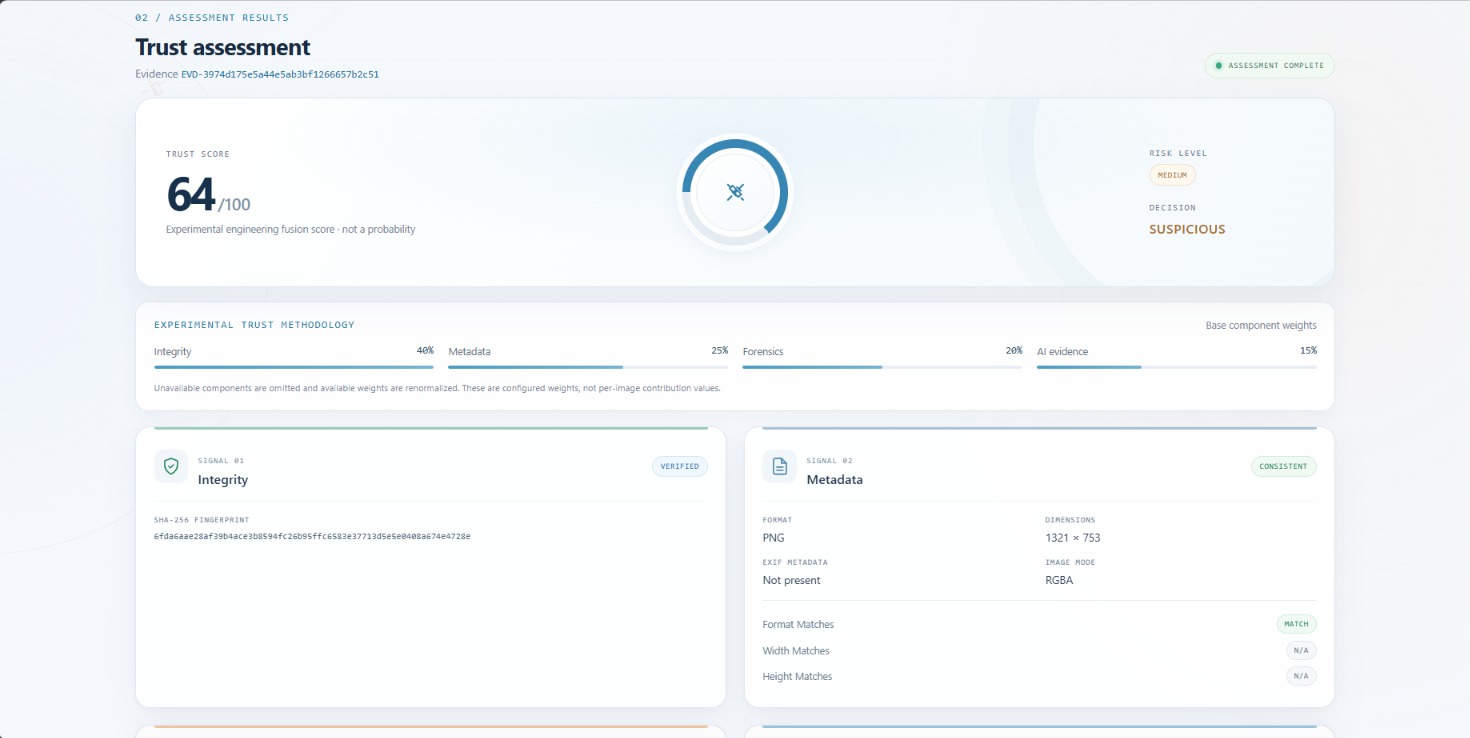
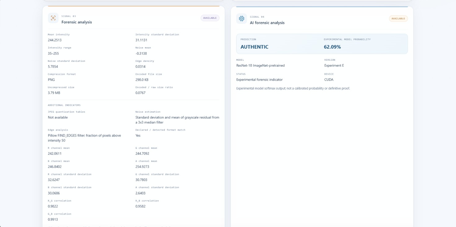
SAT-TRUST AI combines satellite image analysis with text understanding to provide meaningful insights. Users can upload satellite images, examine AI generated descriptions, compare images captured at different times, and identify potential inconsistencies between visual evidence and textual claims. The system aims to make satellite data analysis more accessible, explainable, and useful.
How We Built It:
We designed the project around three core components:
Computer Vision: Analyses satellite images to identify visible features and patterns.
Multimodal AI: Connects visual information with textual descriptions to evaluate their consistency.
Image Comparison: Examines images of the same location captured at different times to identify potential changes.
We plan to use pretrained vision-language models, Python, OpenCV, and Streamlit to develop an interactive dashboard. The system will present its findings through visual comparisons, explanations, and structured reports.
What We Learned:
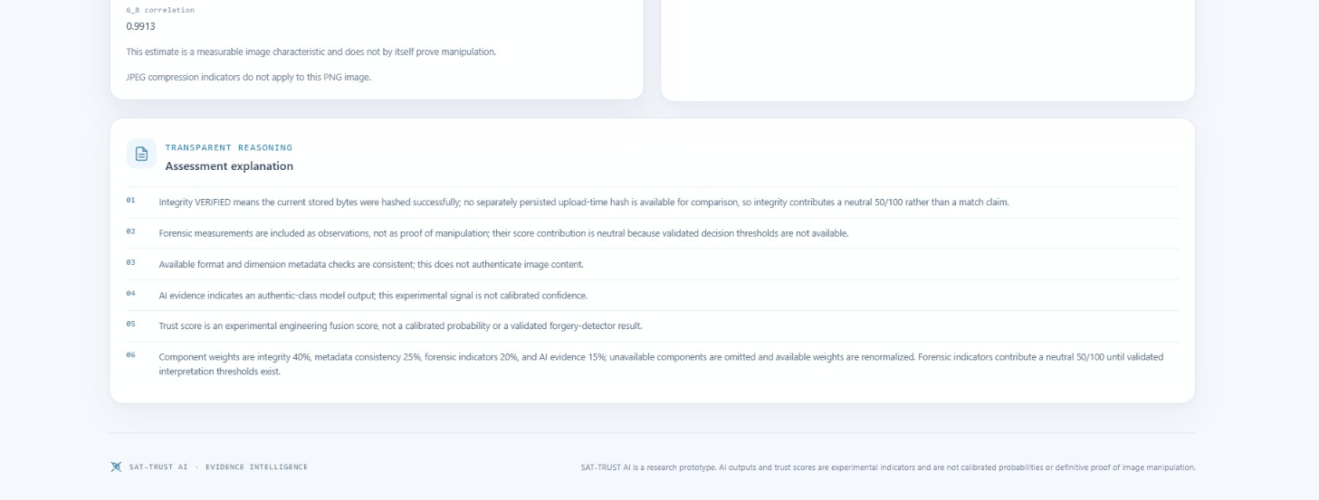
This project helped us explore how multimodal AI can combine different data types to solve real-world problems. We gained insights into computer vision, vision-language models, satellite image analysis, and explainable AI. We also learned that reliable AI systems must communicate uncertainty and distinguish observable evidence from assumptions.
Challenges We Faced:
One of the main challenges is ensuring that the system interprets satellite imagery accurately. Differences in lighting, resolution, weather conditions, and image acquisition dates can affect the results. Another challenge is comparing textual descriptions with visual evidence without producing misleading conclusions. We aim to address these challenges through suitable pretrained models, careful image comparisons, and evidence-based reporting.
Our Vision:
Our vision is to make satellite data more trustworthy and accessible through multimodal artificial intelligence. SAT-TRUST AI could eventually support environmental researchers, agricultural analysts, and disaster management teams by helping them investigate changes and assess the consistency of satellite data.
SAT-TRUST AI — Trust Every Pixel. Verify Every Signal. Understand Our Planet.
Built With
- ai
- artificial
- change
- computer
- data
- detection
- geospatial
- image
- intelligence
- language
- learning
- machine
- models
- monitoring
- multimodal
- natural
- python
- remote
- satellite
- sensing
- visualization

