Inspiration
Disaster rescue has a double blindness. Rescue teams enter dangerous rubble without sensing what is inside, while severed communications blind medical convoys to blocked roads and full hospitals. Ambulances take standard routes only to find flooded bypasses, turning 15 minute emergency trips into 2 hour dead ends. Current disaster tools only look at static physical debris. They cannot answer which bridge just collapsed or which hospital has ICU beds right now. Rescuers enter pancake collapses without knowing if the interior holds toxic methane, load bearing failures, or navigable void corridors. In catastrophic seismic events, 80 percent of fatalities occur in the first 72 hours due to unmapped void spaces, road accessibility delays, and hospital over-surge.
What it does
Sanjeevni is a unified closed loop platform bridging satellite damage and TinyFish live web intelligence with low cost edge robotics to eliminate blind rescue entries. It has three parts, all in the repo.
First, a sub-5cm rubble scout nano-rover. An ultra compact 46 mm by 48 mm by 22 mm invertible dual drive robot that penetrates pancake and cantilever collapse voids where humans, search dogs, and full sized rovers cannot enter. It carries an ESP32-S3 with dual port streaming, an OV2640 160 degree night vision camera, VL53L1X laser ranging, and an MPU6050 gyro and accelerometer.
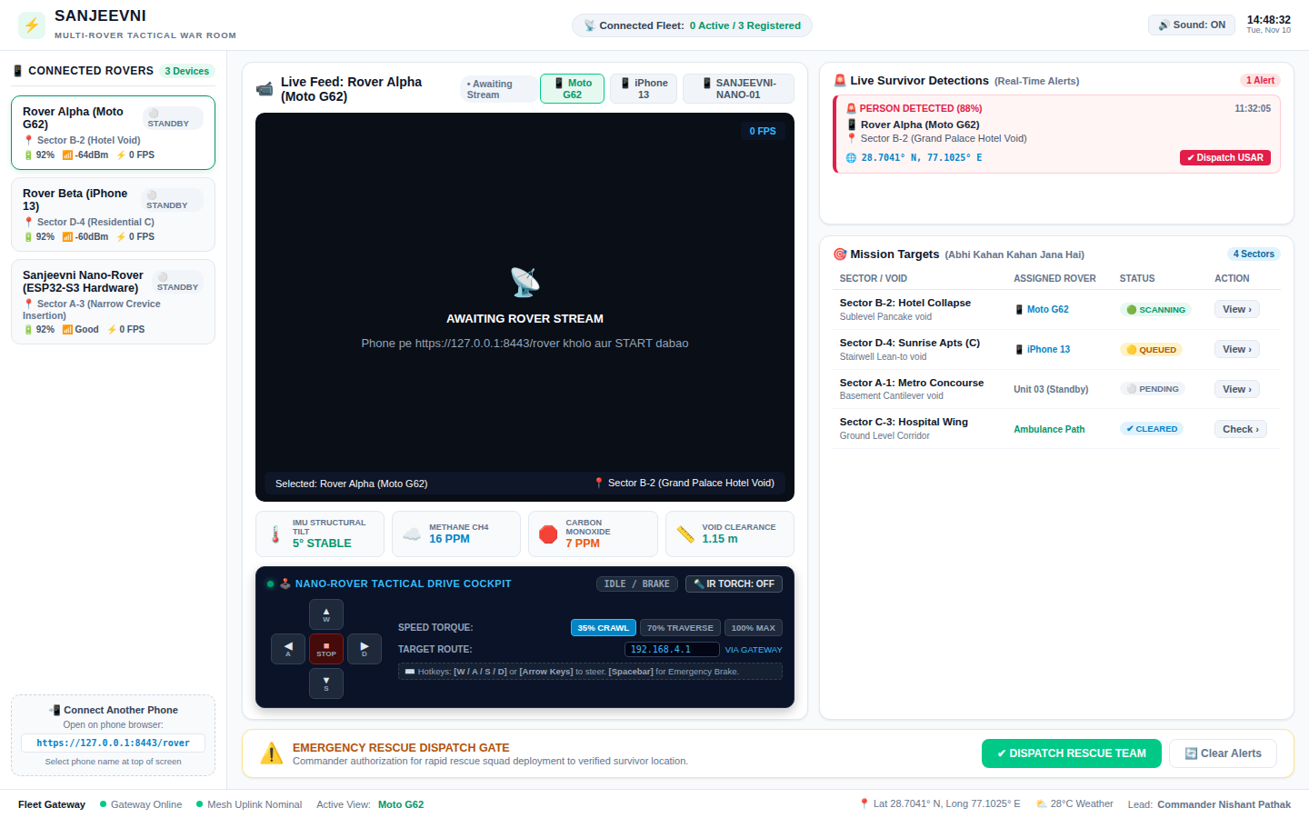
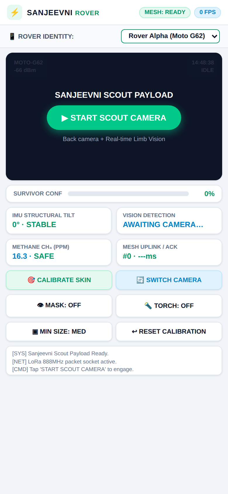
Second, a Tactical War Room command dashboard. Live multi-phone and hardware rover video feeds, a real time WASD tele-operation cockpit, environmental telemetry, and survivor alert feeds. A phone can also act as a mobile fleet scout, with MoveNet edge inference, flashlight, and a 1080p video feed.
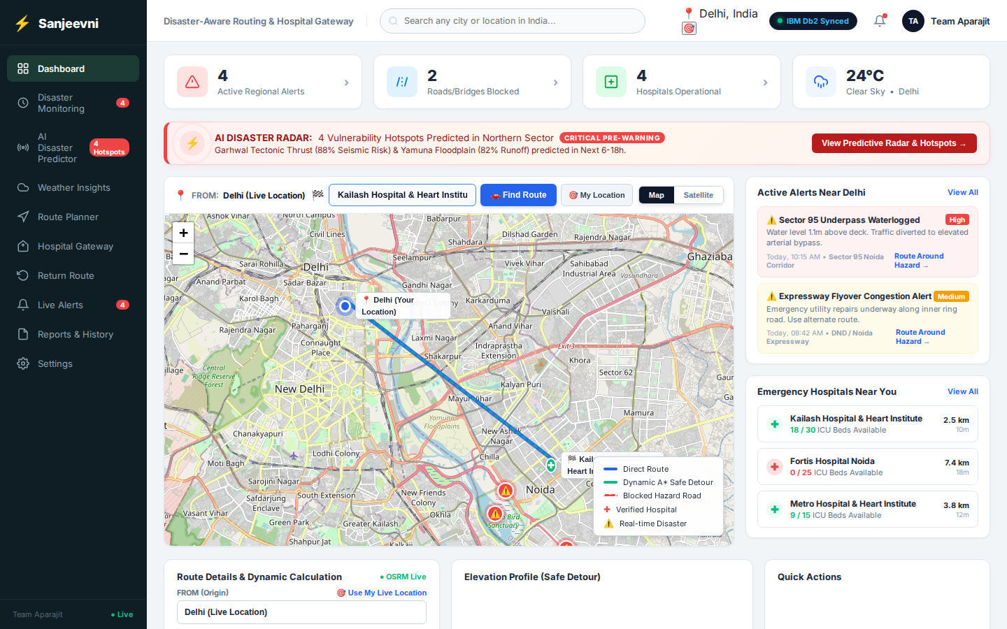
Third, disaster aware routing and an emergency hospital gateway, with IBM Db2 as the enterprise incident layer. Live GPS, OSRM routing, real road avoidance around hazard blocks, and Db2 audit logging keep every mission, sector, survivor triage record, and deployment in one reliable store. In the live field scenario, TinyFish discovers a police alert that NH-34 Bhagirathi Bridge is submerged 1.2 m, the routing engine blocks that edge in under 250 ms and detours ALS ambulances via Dharasu Ridge, and when the district hospital dashboard shows 0 ICU beds, critical victims are rerouted to AIIMS Regional Trauma with 18 ICU beds available.
The design principle: phone camera edge and 3D simulation operate 100 percent offline in zero connectivity rubble, and cloud and TinyFish enrich situational awareness whenever links exist. A mandatory human in the loop commander sign off gate means zero autonomous life critical dispatches.
How we built it
Hardware: ESP32-S3-WROOM-1-N8R8 (dual core 240 MHz, 8 MB Octal PSRAM), TI DRV8833 dual H-bridge motor driver, OV2640 2.0 MP 160 degree fisheye camera with dual 850 nm IR LEDs, VL53L1X time of flight laser (4 m range), MPU6050 6-axis gyro and accelerometer, 3.7 V 400 mAh LiPo with TP4056 charging. Firmware is dual port FreeRTOS on the ESP32-S3: port 80 control server plus port 81 dedicated MJPEG stream. The audited hardware package in hardware_pcb/v2_audited includes the BOM, netlist, schematic, audit log, and firmware.
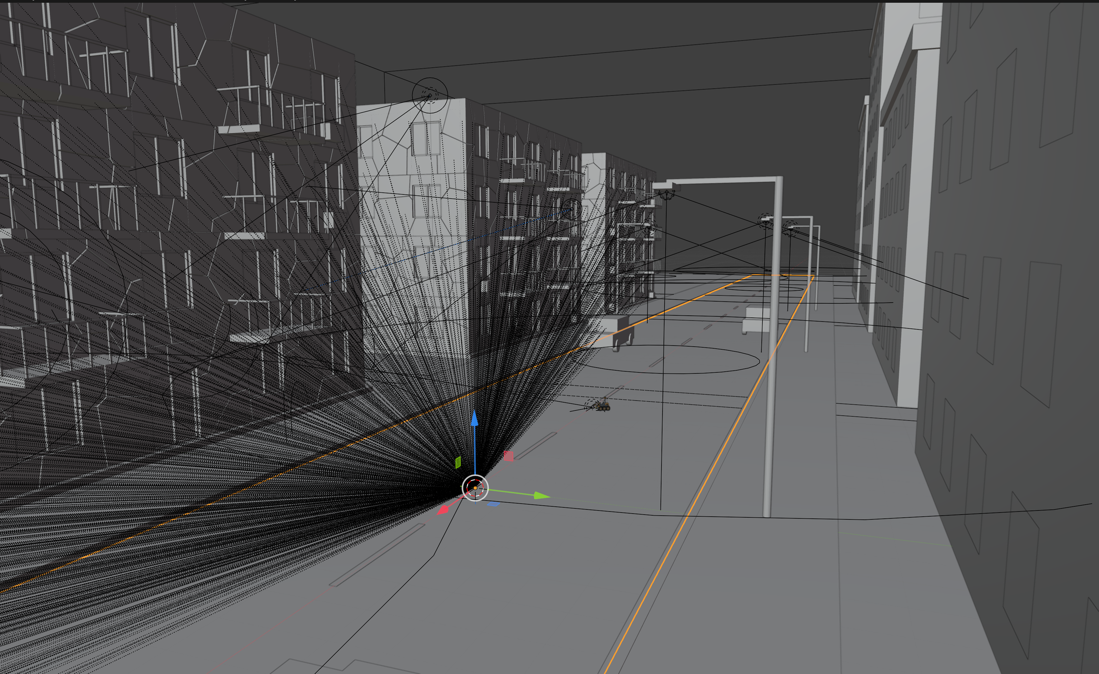
Software: server.py is the dual protocol HTTP/HTTPS tactical gateway and tele-op bridge. dashboard.html is the War Room HUD with WASD driving. rover.html is the mobile first smart rover client using phone sensors and camera. routing_dashboard is a Node.js proxy and detour engine with a Leaflet map, live GPS, OSRM routing, USGS earthquake and weather feeds. static holds the MoveNet and TensorFlow.js offline models. A Three.js 3D structural collapse simulation maps safe void corridors before any human enters.
IBM Db2: the ibm_db2 folder holds the production schema, analytics and triage queries, and demo seed data, and routing_dashboard/lib/db2.js connects the routing engine to Db2. Missions, sectors, survivor triage queues, and USAR deployment history are recorded in Db2 so every rescue decision has an auditable trail.
AI: vision based pose estimation for prone and trapped victims with automated SBAR incident reports, running offline on device at 25 FPS in our design.
Challenges we ran into
Fitting a capable scout into a strict sub-5cm envelope, 46 by 48 by 22 mm, while keeping camera, laser ranging, motion sensing, and dual port streaming on one board. Making the phone camera edge and the 3D simulation work 100 percent offline, so the system still functions in zero connectivity rubble. Keeping routing live when roads and hospitals change minute by minute, so a blocked bridge or a full ICU reroutes a convoy instead of stranding it.
Accomplishments that we're proud of
A complete loop from sensing to routing to hospital allocation, built as one repo: hardware, firmware, gateway, dashboard, routing, and the IBM Db2 audit layer. $180 hardware in our costing, delivering search capability at 1/250th the legacy cost claimed.
What we learned
Rescue is a systems problem, not a robot problem. A rover alone cannot help if the ambulance behind it is stuck on a flooded road or the hospital ahead of it is full, so sensing, routing, and hospital capacity have to close one loop with a human commander keeping final authority. And in a disaster, the record matters as much as the rescue: without a reliable incident store like Db2, triage decisions cannot be audited or reconciled afterwards.
What's next for Sanjeevni
Phase 1, 0 to 6 months: ground pilot, a 50 node mesh testbed in simulated collapse training centers with SDRF and NDRF search squads. Phase 2, 6 to 12 months: multi-hazard adaptation, flood flash monitoring, landslide early warning, and industrial chemical leaks. Phase 3, 12 to 18 months: autonomous swarm integration, tethered drone aerial mesh relays and tracked snake robots for deep void crawls. Phase 4, 18 plus months: global INSARAG integration, a standardized open API gateway connected to United Nations GDACS disaster systems.
Built With
- css
- db2
- esp32-s3
- html
- ibm
- javascript
- leaflet.js
- node.js
- osrm
- python
- tensorflow.js
- three.js


