

Inspiration
SaltVeil was inspired by the growing challenge of water salinity in Satkhira, a coastal region of Bangladesh. During the dry season, increasing salinity can affect drinking water, agriculture, and aquaculture, threatening the livelihoods of local communities.
I wanted to explore how accessible environmental data and simple digital tools could help people better understand salinity-related risks. My goal was to build a practical, locally focused platform that brings useful information together and lays the foundation for a more reliable coastal salinity early warning system.
What it does
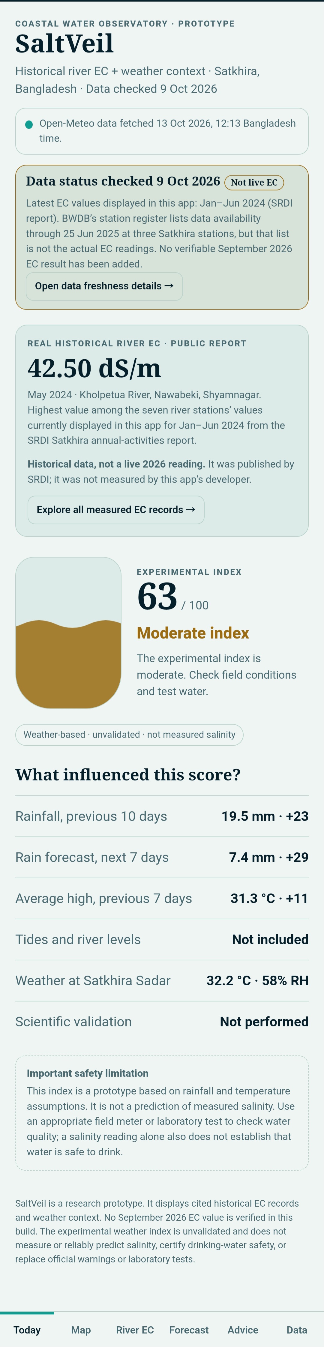
SaltVeil is a web-based coastal salinity monitoring and early warning concept focused on Satkhira, Bangladesh.
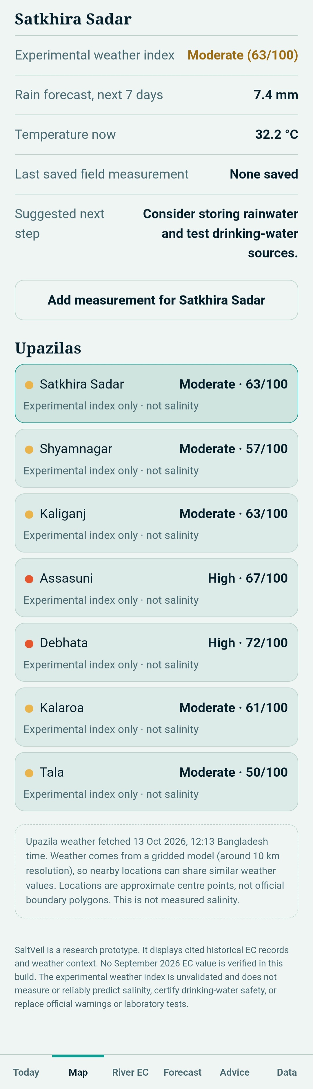
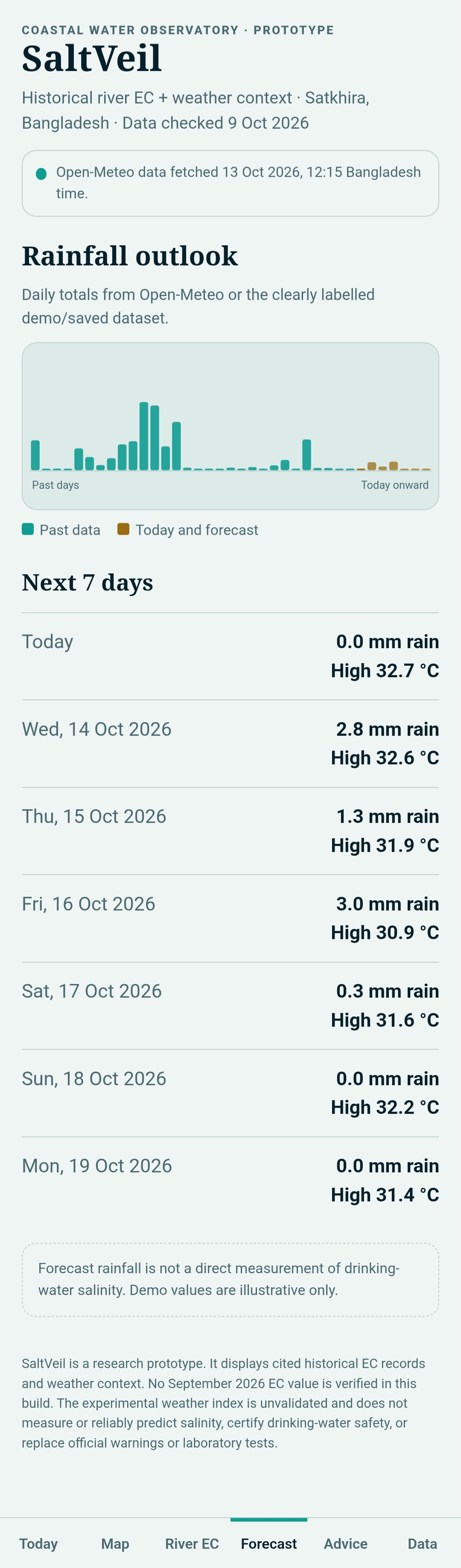
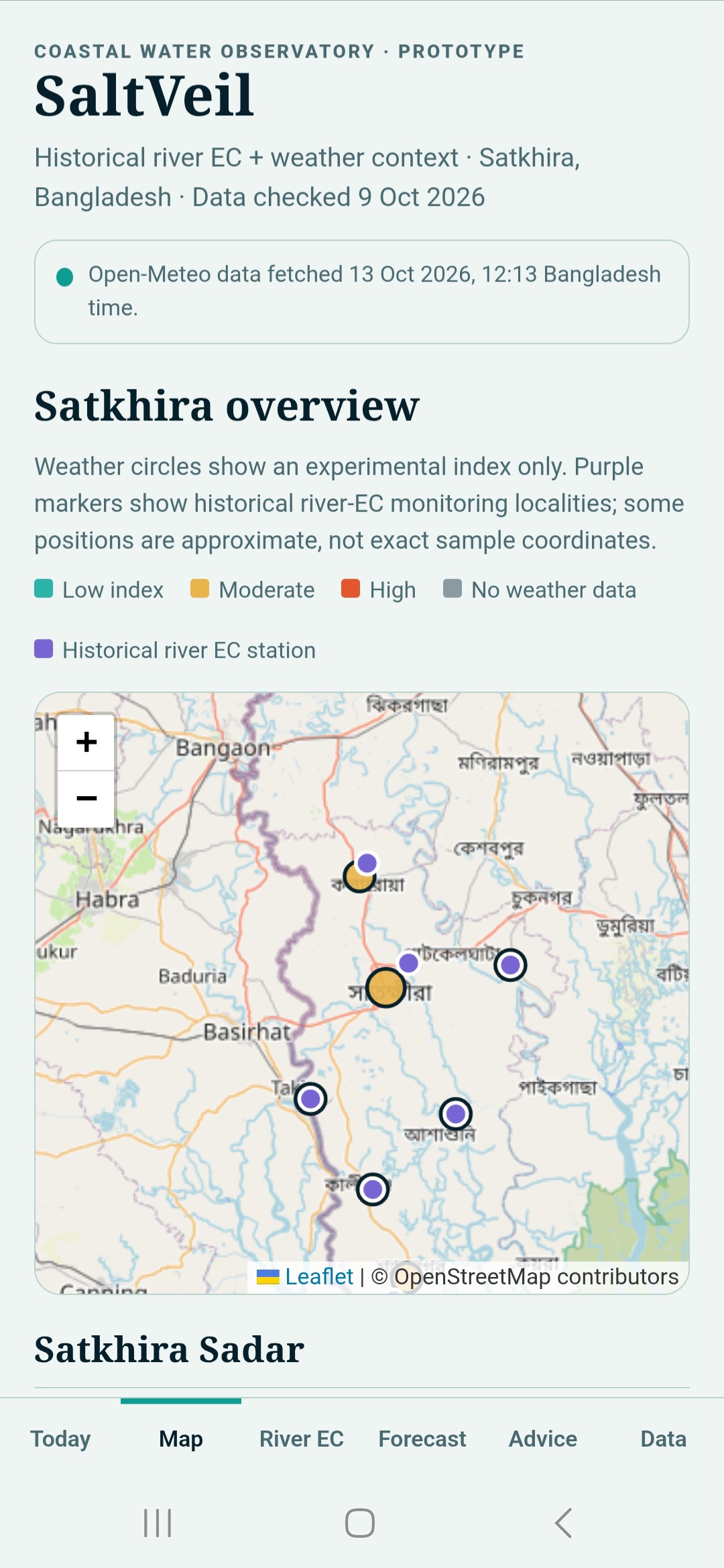
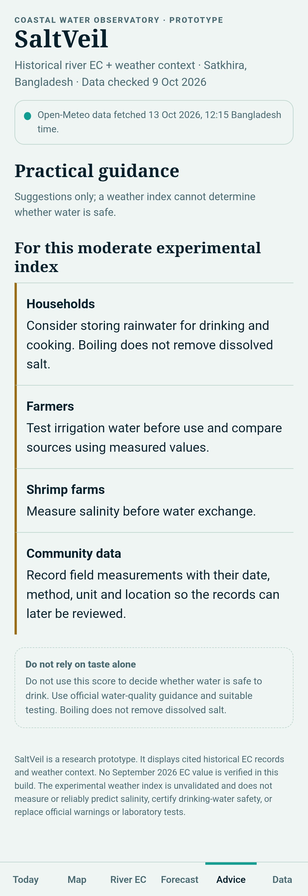
It brings together weather information, an interactive map, historical river salinity and electrical conductivity (EC) records, and an experimental weather-based Salinity Risk Index in one platform.
The system helps users explore environmental conditions and understand potential salinity risks. Its current risk index is experimental, not a validated prediction of actual water salinity. Future versions aim to incorporate verified EC measurements, river-flow conditions, and tidal data to improve risk assessment and support local water-management decisions.
How we built it
I built SaltVeil as a lightweight web application using HTML, CSS, and JavaScript, with a responsive interface designed to make environmental information easier to explore.
The application uses Open-Meteo for weather data and Leaflet for interactive mapping. I organized the interface around weather conditions, geographic information, historical river EC records, and an experimental weather-based Salinity Risk Index.
The project is hosted on GitHub Pages, making the prototype accessible through a public web link without requiring users to install an application.
I focused on creating a functional, accessible prototype while keeping the limitations of the available salinity data clear. AI assistance was used during parts of the development and refinement process.
Challenges we ran into
One of the biggest challenges was the limited availability of accessible, up-to-date, location-specific water-quality data for coastal Bangladesh.
Weather conditions alone cannot reliably determine the actual salinity of a river or drinking-water source. Another challenge was combining different types of environmental information into a simple interface that users could understand without specialized technical knowledge.
I also had to balance the ambition of an early warning system with the limitations of a prototype. Instead of claiming unverified prediction accuracy, I designed the current risk index as an experimental feature and identified real EC measurements, river-flow data, and tidal information as priorities for future validation.
Accomplishments that we're proud of
I am proud to have developed SaltVeil into a publicly accessible web prototype focused on a real environmental challenge affecting coastal communities in Bangladesh.
The project brings weather information, interactive mapping, historical EC data, and an experimental salinity risk indicator into one interface. Hosting it on GitHub Pages also makes it easy to share and demonstrate.
Most importantly, SaltVeil represents a practical starting point for a locally focused environmental monitoring tool. I have also identified the data gaps and validation steps that must be addressed before the system can be used for dependable early warnings.
What we learned
Building SaltVeil taught me that solving an environmental problem requires more than developing a working application. Reliable data, scientific validation, and an understanding of local conditions are equally important.
I learned how weather APIs, interactive maps, web technologies, and environmental indicators can be combined into a single prototype. I also learned that weather-based risk indicators must not be confused with direct salinity measurements or validated forecasts.
This project strengthened my understanding of data-driven problem-solving, prototype development, and the importance of communicating both a solution's potential and its limitations honestly.
What's next for SaltVeil: Coastal Salinity Early Warning
The next step for SaltVeil is to validate its experimental risk index against verified, location-specific EC and salinity measurements from reliable sources such as the Bangladesh Water Development Board (BWDB) and the Soil Resource Development Institute (SRDI), where suitable data are available.
I plan to investigate integrating more recent water-quality observations, tidal conditions, river-flow information, and longer historical datasets. I also aim to improve location-specific risk assessment, add clearer alerts, and test the platform with local communities and potential partners.
In the longer term, I want to explore field-based EC monitoring and develop a scientifically validated early warning system that can help communities, farmers, and water managers make better-informed decisions about coastal water salinity.
Built With
- ai
- analysis
- api
- biology
- calculation
- chemistry
- css
- data
- ec
- environment
- github
- html
- java
- javascript
- medicel
- openroute
- openrouteservice
- physics
- robotics
- safeagriculture
- safefishing
- solt
- waterquality
- web-api-for-biology


Log in or sign up for Devpost to join the conversation.