-
-
details
-
Idea Approch
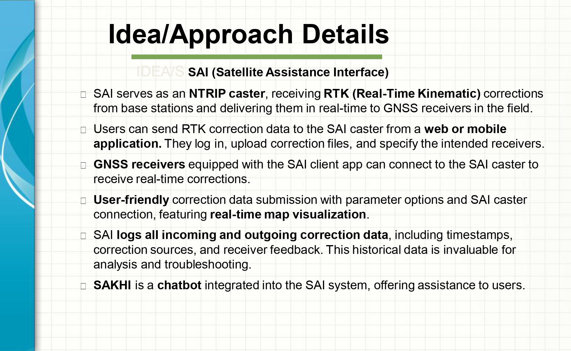
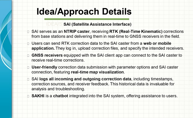
IDEA/S SAI (Satellite Assistance Interface)
SAI serves as an NTRIP caster, receiving RTK (Real-Time Kinematic) corrections from base stations and delivering them in real-time to GNSS receivers in the field. Users can send RTK correction data to the SAI caster from a web or mobile application. They log in, upload correction files, and specify the intended receivers. GNSS receivers equipped with the SAI client app can connect to the SAI caster to receive real-time corrections. User-friendly correction data submission with parameter options and SAI caster connection, featuring real-time map visualization. SAI logs all incoming and outgoing correction data, including timestamps, correction sources, and receiver feedback. This historical data is invaluable for analysis and troubleshooting. SAKHI is a chatbot integrated into the SAI system, offering assistance to users.
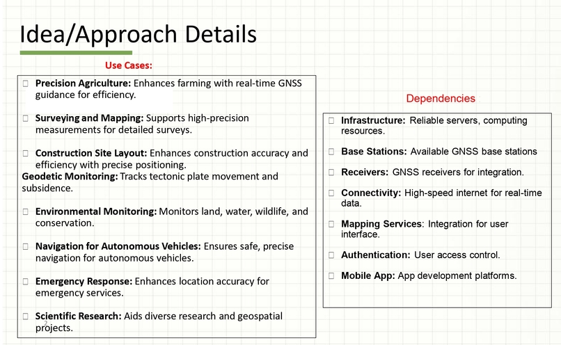
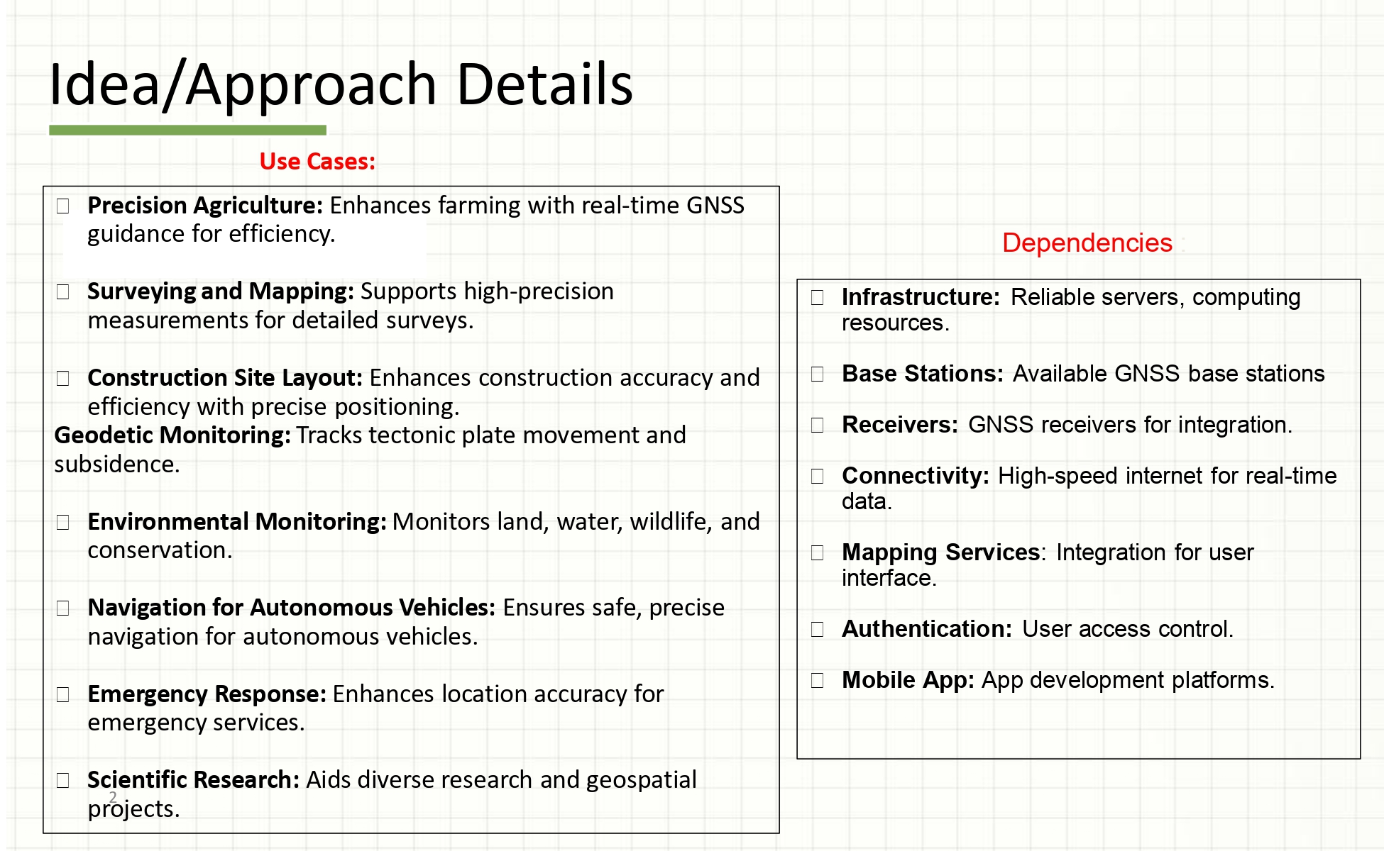
Use Cases :
Precision Agriculture: Enhances farming with real-time GNSS guidance for efficiency.
Surveying and Mapping: Supports high-precision measurements for detailed surveys.
Construction Site Layout: Enhances construction accuracy and efficiency with precise positioning. Geodetic Monitoring: Tracks tectonic plate movement and subsidence.
Environmental Monitoring: Monitors land, water, wildlife, and conservation.
Navigation for Autonomous Vehicles: Ensures safe, precise navigation for autonomous vehicles.
Emergency Response: Enhances location accuracy for emergency services.
Scientific Research: Aids diverse research and geospatial projects.

Log in or sign up for Devpost to join the conversation.