-
-
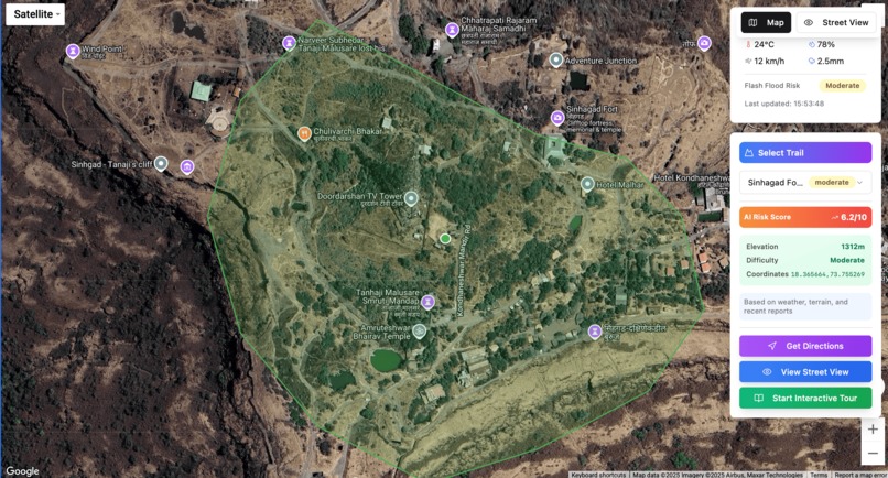
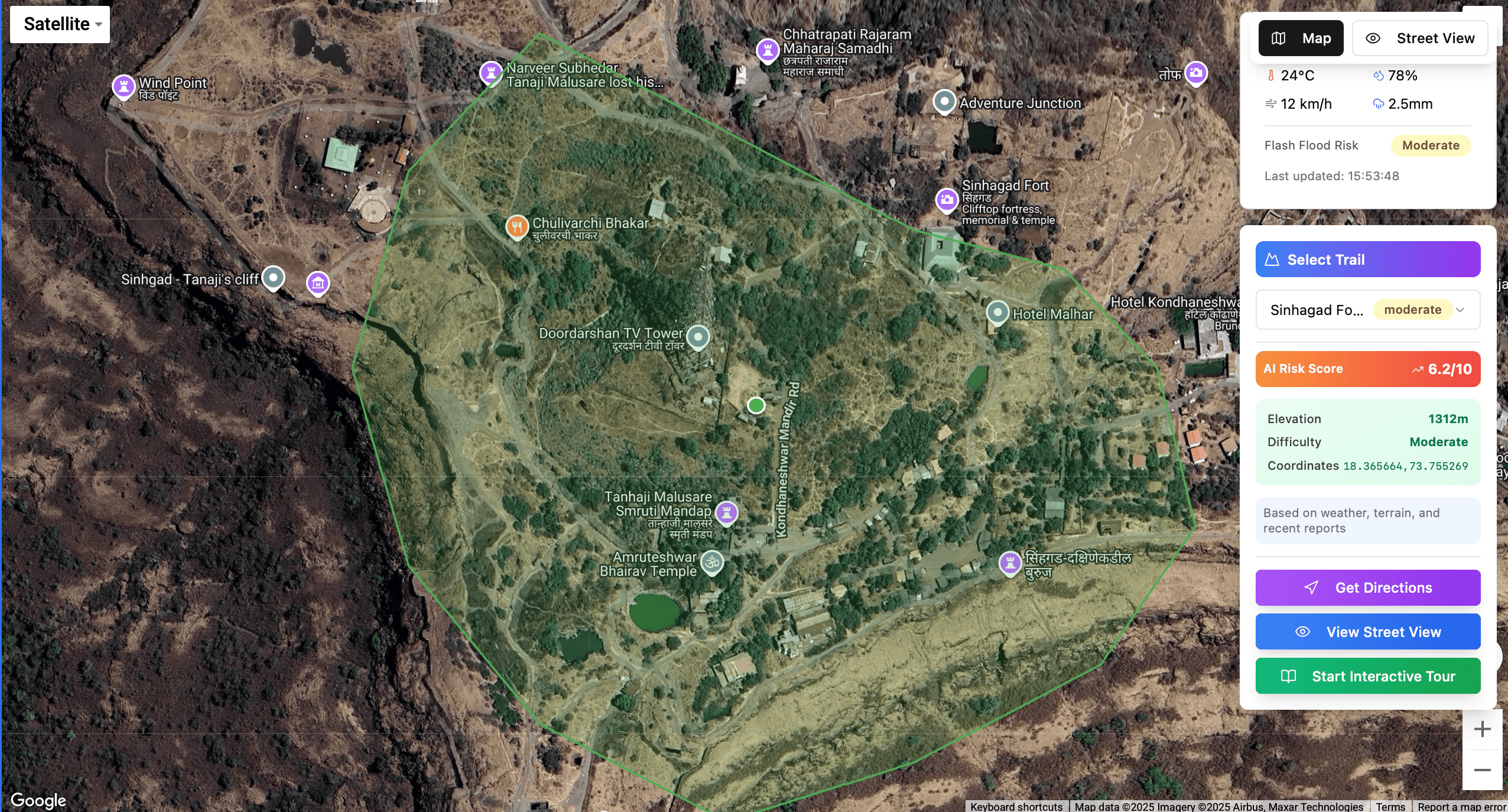
Choosing desired trail
-
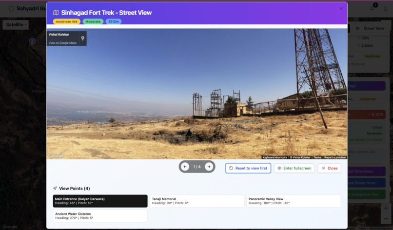
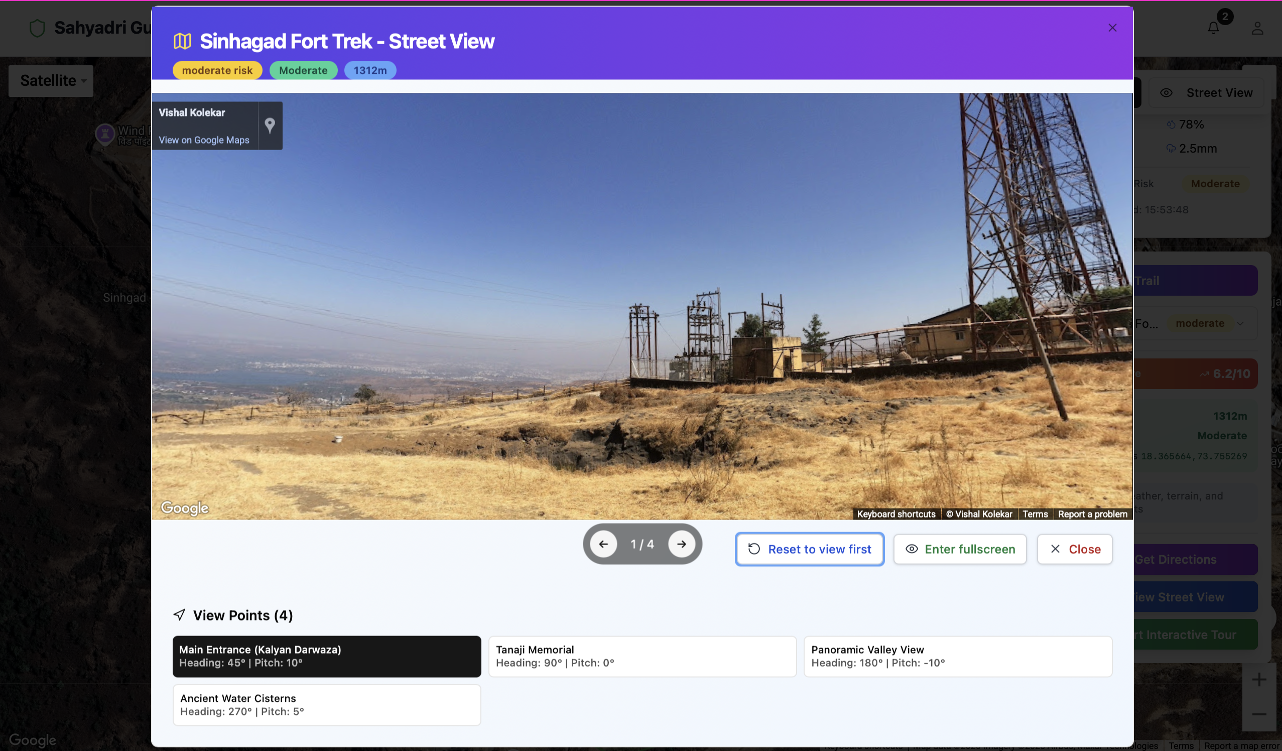
Street View
-
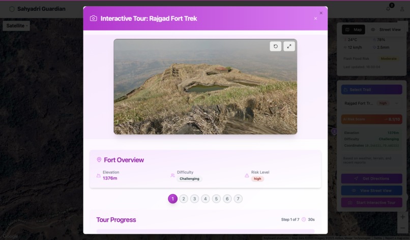
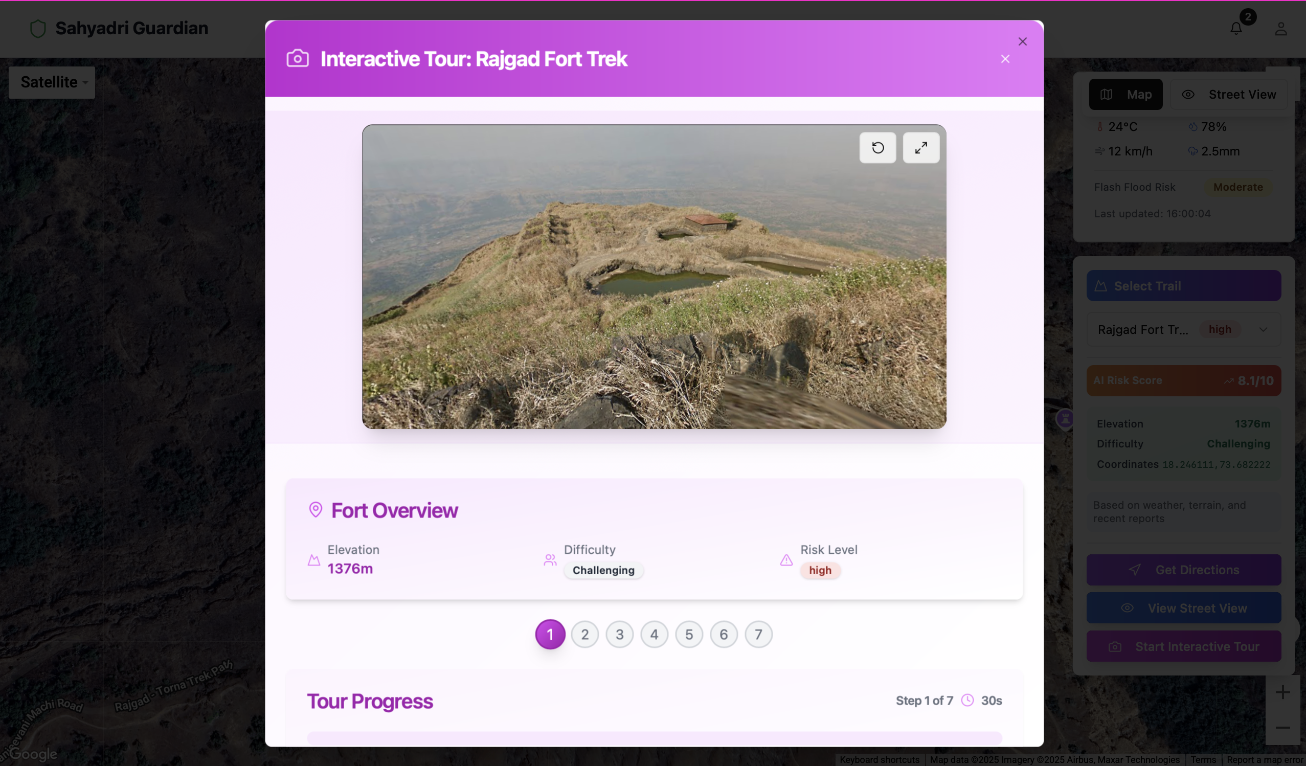
Interactive tour
-
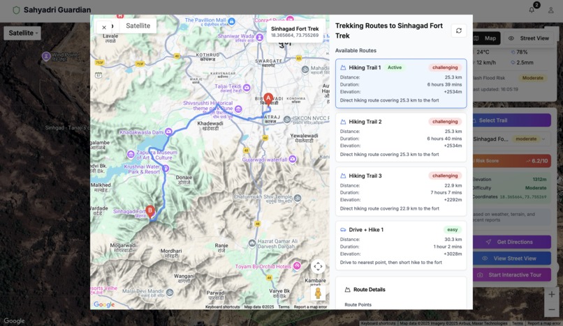
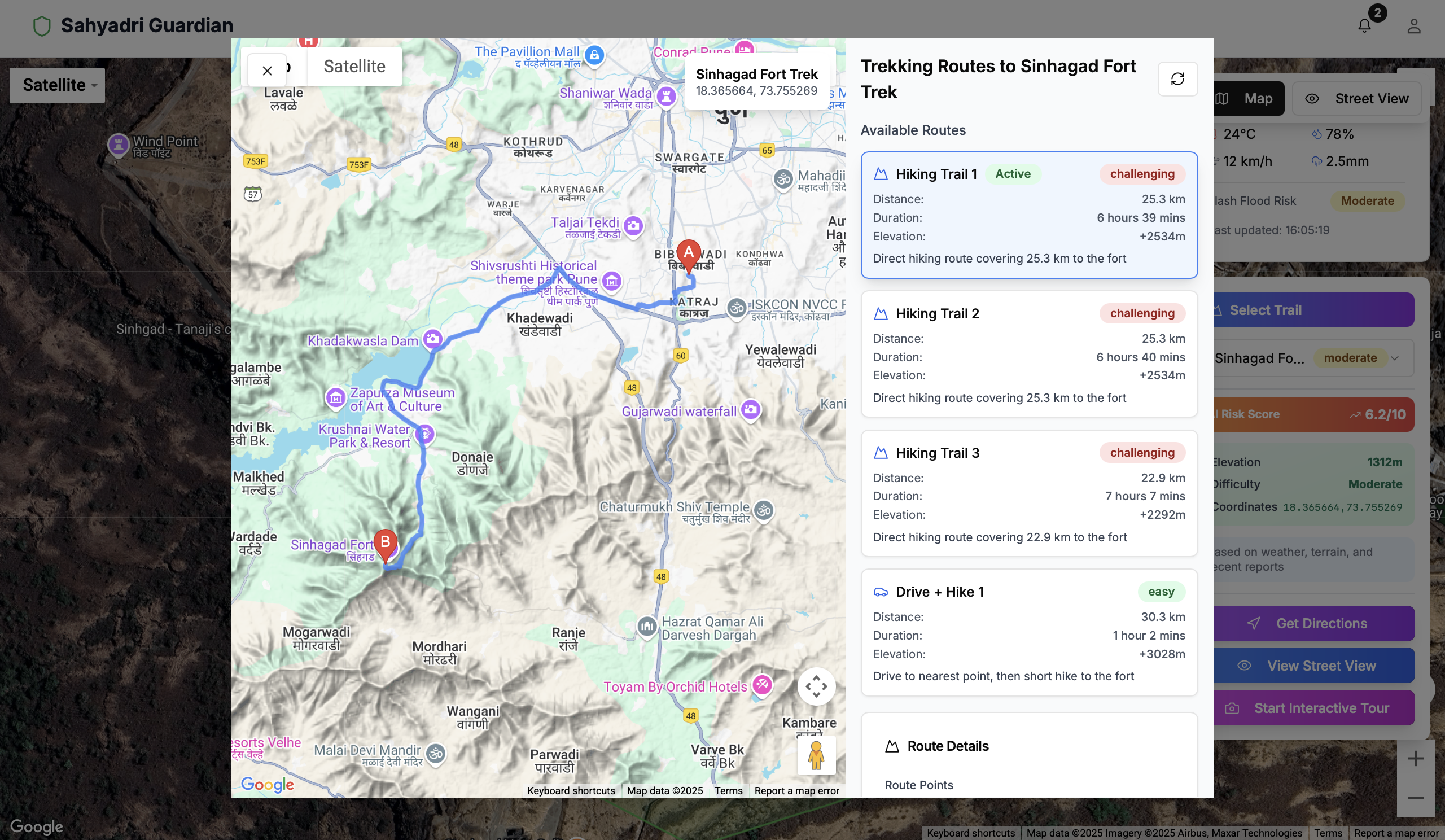
direction towards mountain
Inspiration
Being avid trekkers and nature lovers, we are often confronted with the implications of navigating the terrain and decorum of the rugged Sahyadri mountain range. Disparate maps, connectivity concerns, and safety risks such as landslides, clouds of thunder, and mere unpredictability of weather once inspired us to bring forth Sahyadri-Guardians — an advanced platform through which trekkers can receive dependable, immersive, and intelligent trail insights.
What it does
Sahyadri-Guardians is an online platform that allows users to: 1.View interactive trekking trails of historic forts like Sinhagad, Rajgad, and Torna. 2.Choose 3D terrain views using satellite and elevation data. 3.Use Google Street View for virtual walking. 4.Show AI-generated risk levels and real-time weather panels. 5.Report hazards and find locations with the help of geolocation. 6.Included are interactive fort-tour experiences and Street View hotspot interactions.
How we built it
We have employed: -Next.js + TypeScript as our frontend framework. -Tailwind CSS for UI styling. -Terrain and View from the Google Maps & Street View APIs. -Custom hooks for user authentication (useAuth) and geolocation. -The architecture is modular, with components like Advanced3DMap, TrailSelector, HazardReportModal, and so forth.
Challenges we ran into
-Rendering high-resolution, high-detail 3D terrain without any drops in performance.
-Integrating Google Street View API to accommodate dynamic coordinates.
-Designing a mobile-first responsive layout for inherently complicated map elements.
The challenge lies in balancing the display of real-time data such as weather, user location, and risk scores.
Accomplishments that we're proud of
- Live rendering of 3D trekking routes has been made successful.
- A custom Street View modal was implemented with multiple viewpoints for each fort.
- Combining maps, modals, and data layers created an intuitive user experience.
- Given our modular design, it will be easy to expand on this project to other regions in the future. ## What we learned Multiple integrations: Multiple integrations with mapping technologies (Google Maps, elevation data, POV controls). Global state management for real-time geolocation and user data. Creating immersive and full-screen modals with dynamic content. ## What's next for Sahyadri-Gaurdians -Add team collaboration features for group treks. -Introduce trail difficulty estimation using ML. -Enable offline map caching and SOS features. -Expand coverage to all Maharashtra fort treks and beyond. -Launch a mobile version and bring it to the Play Store.

Log in or sign up for Devpost to join the conversation.