-
-
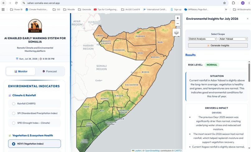
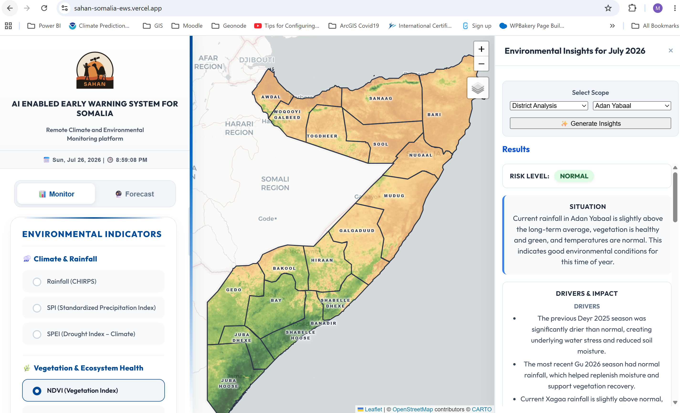
NDVI (Vegetation Index) with AI insights for the Selected District
-
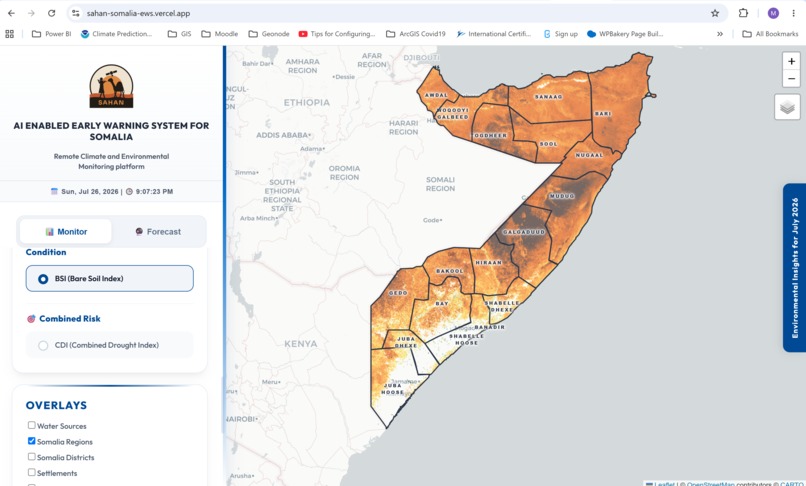
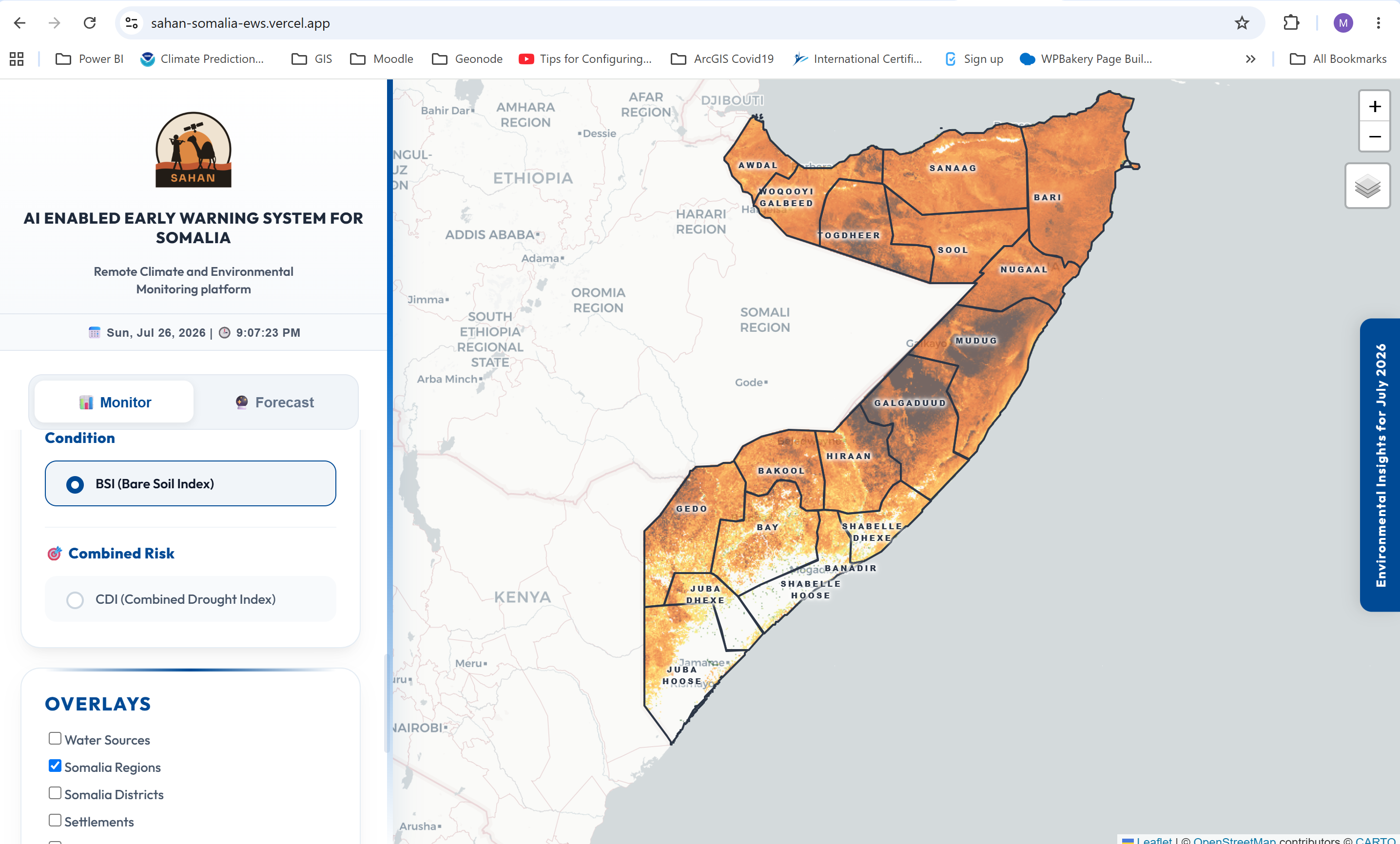
BSI (Bare Soil Index) for Land degradation Monitoring
-
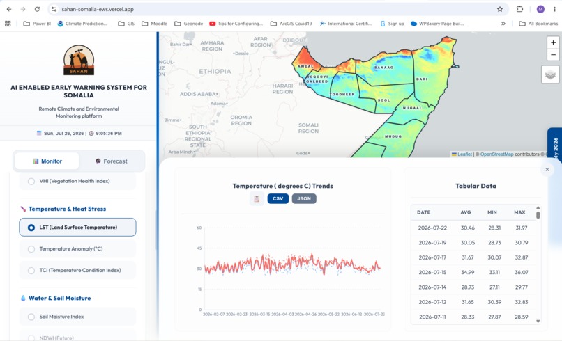
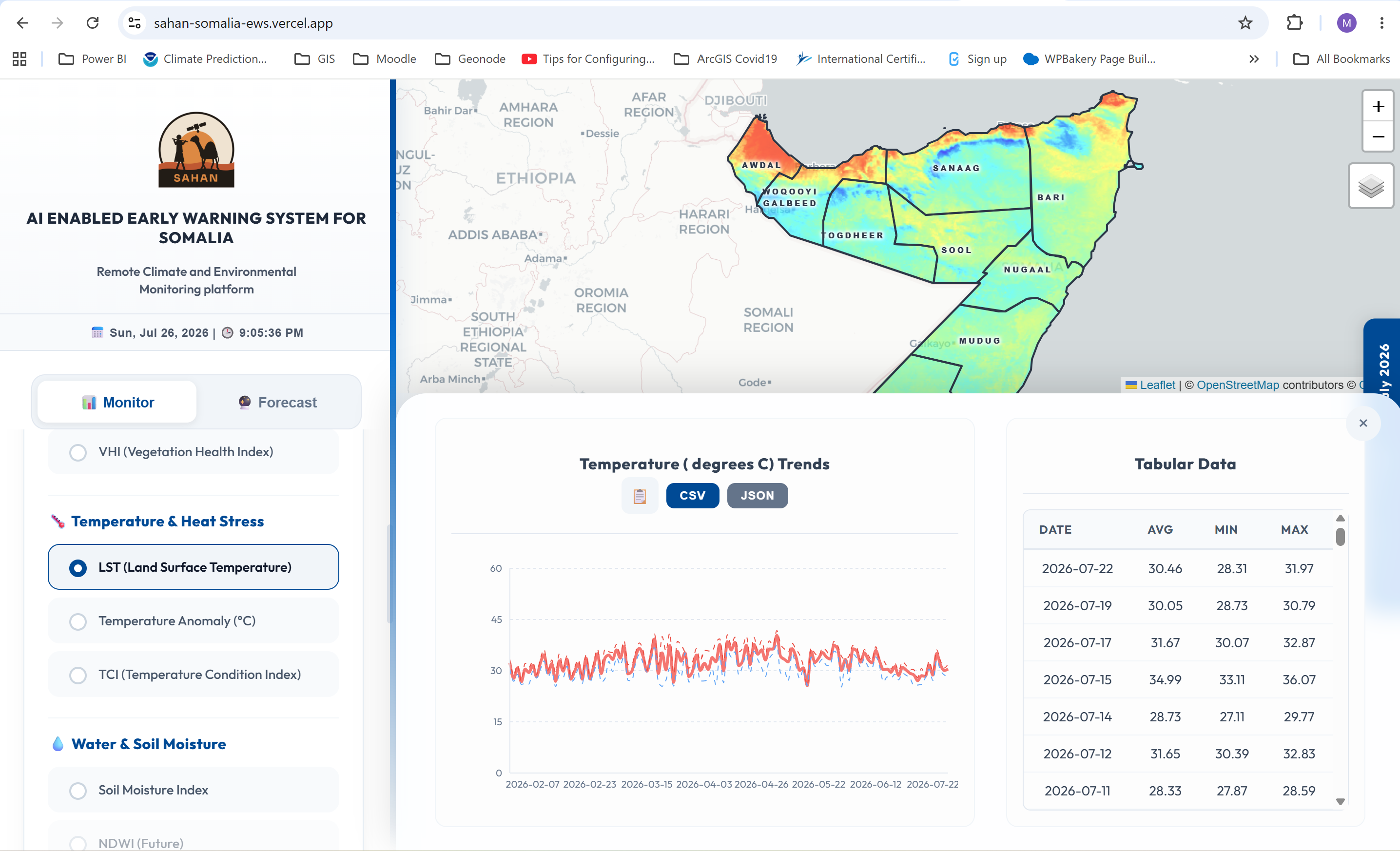
LST (Land Surface Temperature)
-
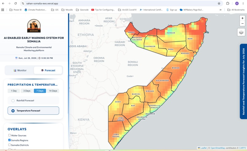
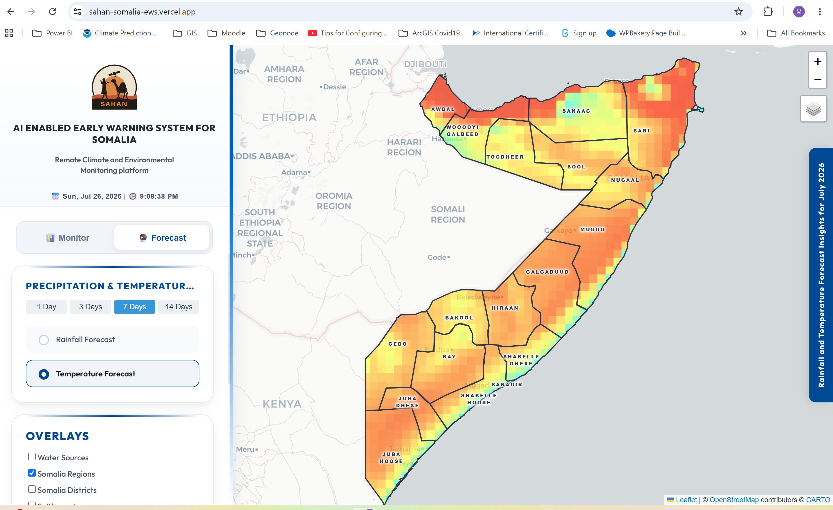
7 days Tempreture focast
-
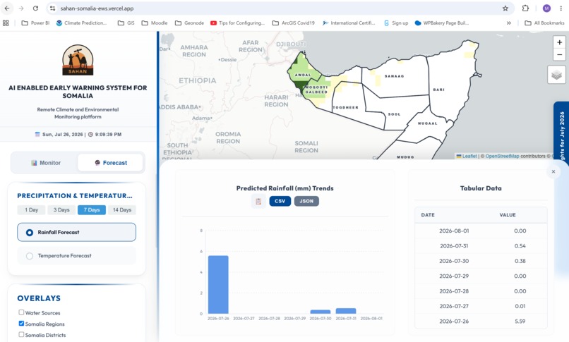
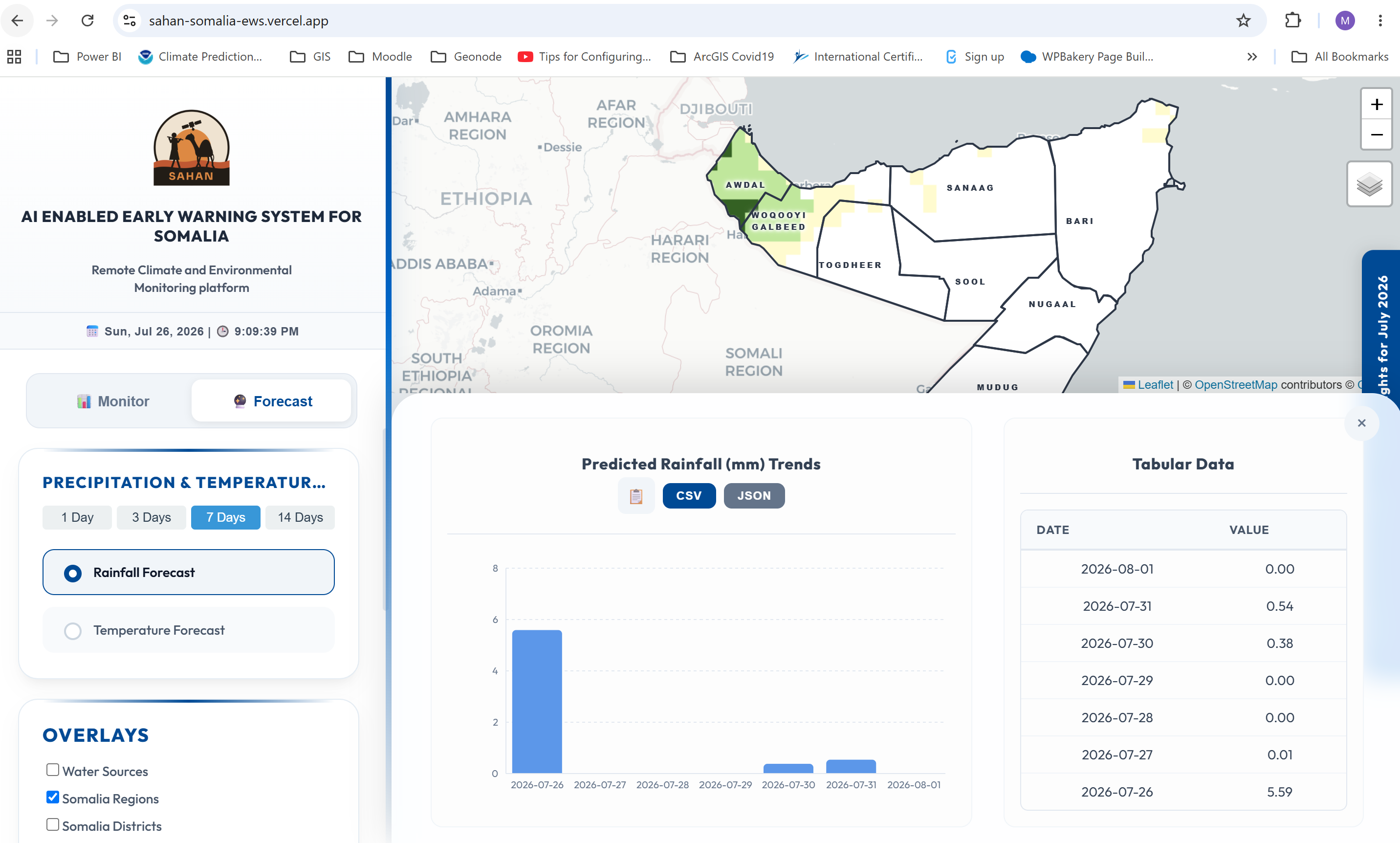
7 Days Pricipitation Forecast - with the tabular data of awdal region
Inspiration
What it does
How we built it
Challenges we ran into
Accomplishments that we're proud of
What we learned
Inspiration
A year ago we asked what it would take to give Somalia a near real-time, satellite-powered, AI-enabled environmental monitoring and early warning system. Somalia is one of the most climate-vulnerable countries in the IGAD region — recurring Gu and Deyr rainfall failures repeatedly push millions toward food insecurity. The satellite data needed to anticipate these shocks already existed (CHIRPS, MODIS, FLDAS, GFS), but it sat locked inside technical indices — SPI, NDVI, LST — that only specialists could interpret. The people who actually need to act, humanitarian responders and district-level officials, were left waiting on delayed, jargon-heavy reports. That gap pulled together our team, spanning climate science, GIS, water resources, agriculture, and information management, to build Sahan.
What it does
Sahan turns raw satellite observations into near real-time, district-level monitoring and plain-language situation reports for every region of Somalia. It fuses CHIRPS rainfall, MODIS vegetation and land-surface temperature, NASA FLDAS soil moisture and SPEI, Sentinel-2 bare soil index, and NOAA GFS 1–14 day forecasts into an ICPAC-standard, seasonally weighted Combined Drought Index that automatically adjusts for Somalia's Gu/Deyr wet seasons versus Jilaal/Xagaa dry seasons. A separate Flash Flood Susceptibility layer combines terrain, soil, and land-cover data with live rainfall forecasts to flag rapid-onset flood risk by river basin. An AI reasoning layer converts that index data into a structured report covering drivers, humanitarian impact, risk level, confidence notes, and recommended actions, instead of a wall of charts only a specialist could parse. Decades of historical climate records let users benchmark current conditions against long-term baselines, and every AI output is reviewed by subject matter experts before it informs an operational decision.
How we built it
- Backend: Python/FastAPI, querying Google Earth Engine directly for live satellite collections and computing 10+ standardized indices on the fly, scoped to any of Somalia's 18 regions/districts via FAO GAUL administrative boundaries.
- AI layer: structured index context passed to DeepSeek's OpenAI-compatible API under strict seasonal-comparison and plain-language rules; outputs are cached per scope/layer to control inference cost and latency.
- Frontend: React + Vite + Leaflet/react-leaflet dashboard with time-sliced layers, click-to-analyze charting (Recharts), CSV/JSON export, and one-click PDF situation reports (jsPDF + html2canvas).
- Forecasting: a dedicated module generating 1–14 day rainfall/temperature outlooks at district level from NOAA GFS.
Challenges we ran into
- Reconciling satellite products with different resolutions, update cadences, and units into one coherent, seasonally-aware index.
- Getting an LLM to produce operationally trustworthy, non-hallucinated situation reports — this required strict prompting rules plus a human expert-review step before any output is treated as decision-ready.
- Balancing near real-time responsiveness against Earth Engine query cost and latency, solved with scope/layer-level caching.
- Handling Somalia's administrative boundary data (18 regions/districts) carefully to keep outputs accurate at the district level.
Accomplishments that we're proud of
- Going from a rough concept a year ago to a working system that computes 10+ standardized indices live and turns them into expert-reviewed, plain-language reports in seconds.
- An ICPAC-standard Combined Drought Index that automatically re-weights itself for Somalia's actual seasonal calendar.
- A flash-flood risk layer that covers rapid-onset events, not just slow-onset drought.
- Building it open-source and modular from day one, so it's a platform others can extend rather than a one-off tool.
What we learned
Multidisciplinary framing beats a purely technical one — the hardest part of climate early warning isn't gathering satellite data, it's translating it into something a field-level administrator without a GIS background can act on with confidence. We also learned how much scaffolding (expert review, seasonal weighting, historical baselining) is needed before an AI-generated report is trustworthy enough for humanitarian decision-making.
What's next for Sahan
We're in the final stages of development, building in the open. Next steps: deeper validation with Somalia's National Early Warning Unit, Relevent Ministeries in the FGS, ICPAC, relevent UN, INGO/LNGO field teams; expanding partnerships with interested institituion in the region ; and, since the architecture is modular, extending the platform beyond Somalia to other climate-vulnerable countries across the Horn of Africa facing similar data fragmentation and early-warning gaps.
What's next for Sahan – AI Enabled Early Warning System for Somalia
Built With
- chirps
- deepseek-api
- fastapi
- google-earth-engine
- html2canvas
- jspdf
- leaflet.js
- modis
- nasa-fldas
- noaa
- python
- react
- react-leaflet
- recharts
- sentinel-2
- vite


Log in or sign up for Devpost to join the conversation.