-
-

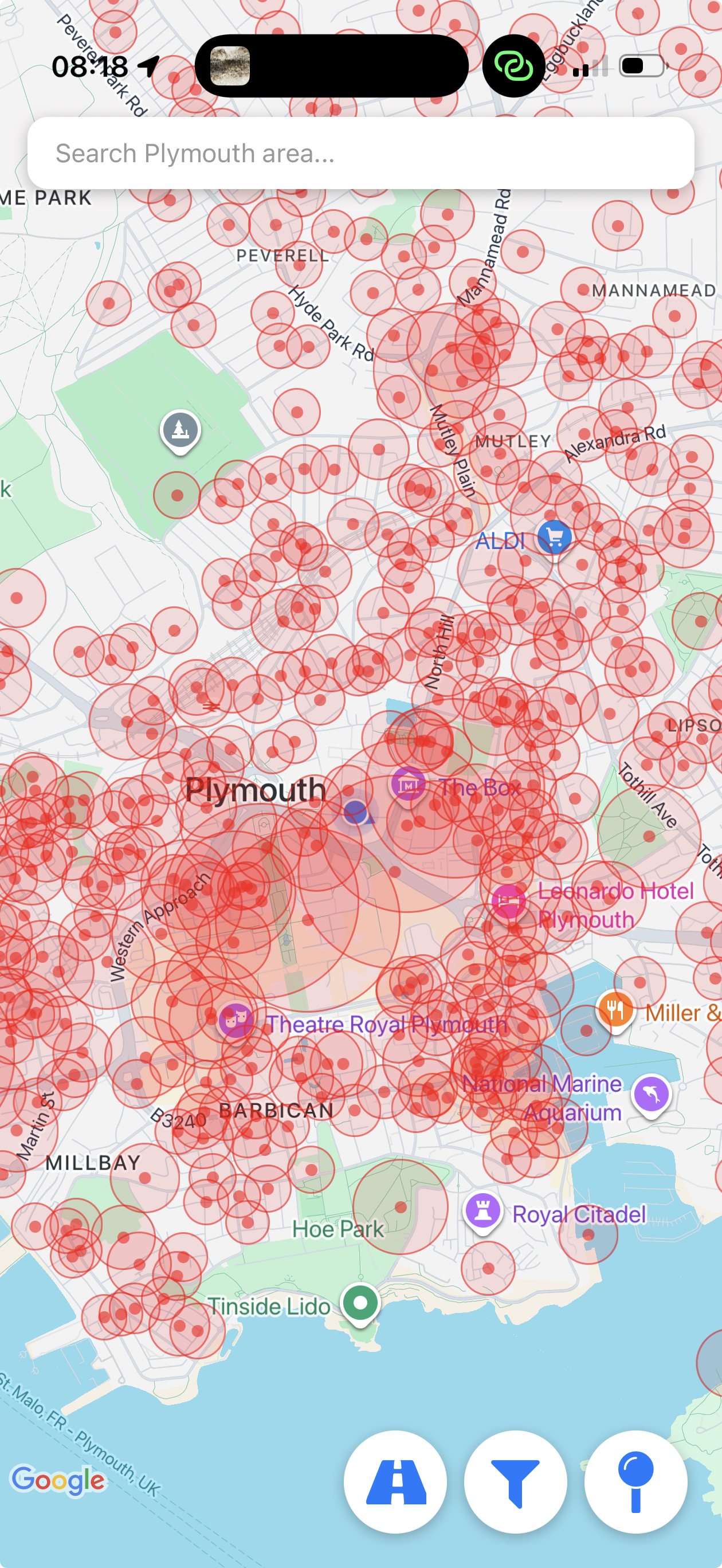
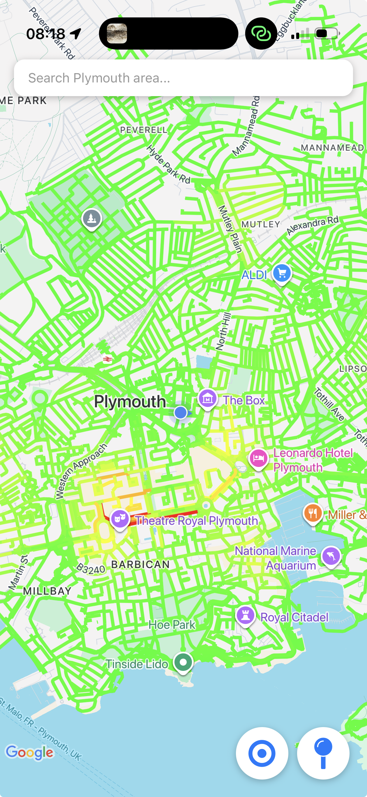
Visualisation of street level crime data in Plymouth
-
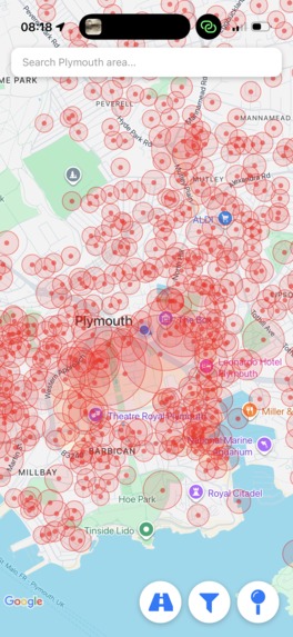
Location of crimes in map
-
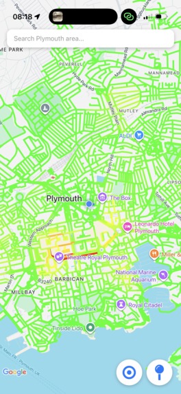
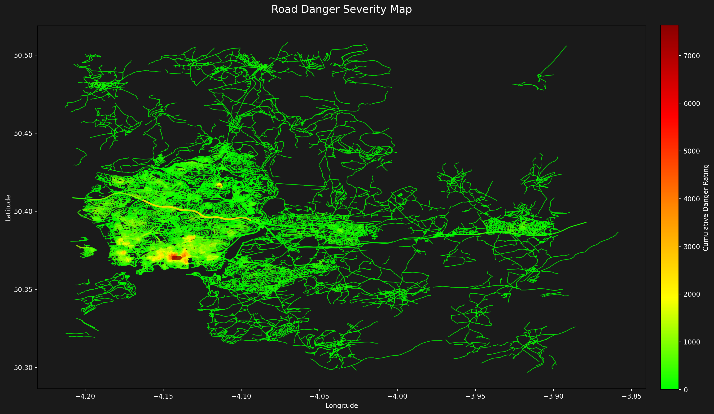
Interpolated road markings of crimes in app
Inspiration
After being in a city for a few months, you might think back and realise you probably shouldn't of walked down a certain street at that time of night. This inspired us to create an application to help route new and vulnerable people safely around cities using real street level crime data.
What it does
The application is served as a mobile application, the application allows users to view which streets are dangerous and should potentially be avoided, whilst also providing the ability to safely route users around such high crime areas
How we built it
Expo was used to interface with both IOS and Android devices, making the application accessible to both Operating Systems. The backend is run on PostgreSQL using sqlalchemy as an ORM and Alembic for migrations. As well as this API was built with FastAPI to allow the frontend and backend to interface. Python is used extensively for preprocessing and analysing the data, crime data is pulled from https://data.police.uk/.
The severity of a crime at a location was calculated by multiplying the frequency and average prison sentence of a crimes at that location. This severity number was then used to map how dangerous a street is, where more dangerous streets 'pollute' the streets around.
Challenges we ran into
Setting up Expo, Dealing with anomanyised police data, mapping crimes to OSM streets at the native mobile APIs don't expose road vectors.
Accomplishments that we're proud of
Cross-platform application working well, collaboration, making friends, compiling multiple datasets.
What we learned
How to use Expo, importance of good shell scripts and README's on how to setup projects, SQL migrations in Python

Log in or sign up for Devpost to join the conversation.