-
-
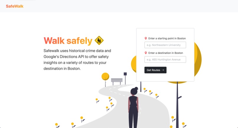
Homepage
-

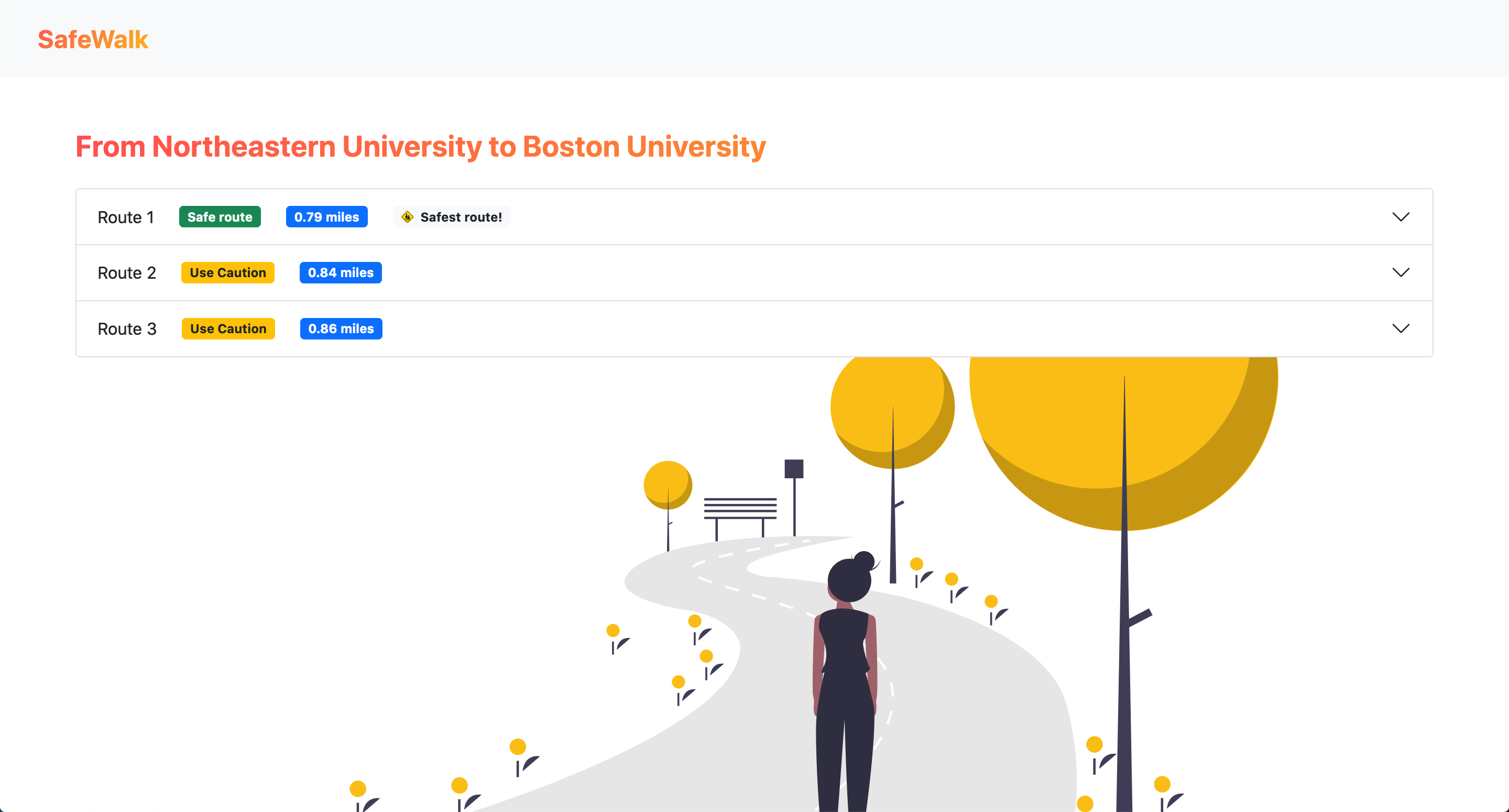
Sample Routes
-
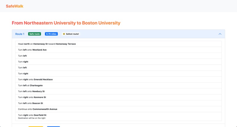
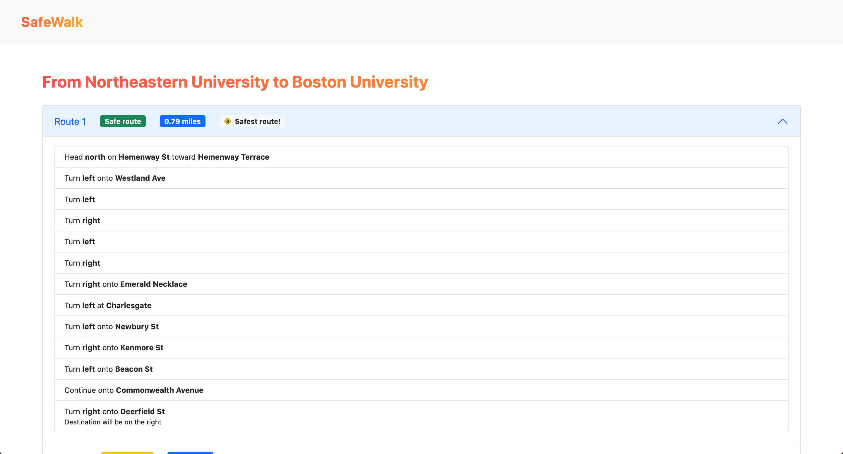
Route Directions

Inspiration
The city can be a dangerous place, especially when you're unfamiliar with many of the streets and neighborhoods. We wanted to build a product which the community could use on a daily basis to alleviate this problem. We were mostly inspired by the "Blue Light" system that is incorporated on many college campuses.
What it does
SafeWalk takes in a starting point and a destination and generates a list of routes along with their levels of danger and other insights, including whether a shooting took place on a route and which route is safest.
How we built it
We used the Google Directions API to generate possible routes, and then analyzed each route using a dataset of all crimes in Boston in 2018. The safety of a route depends on how many crimes occur on its path, weighting serious crimes more heavily.
Challenges we ran into
Processing a CSV with over 300,000 rows can get pretty tedious, this was the main issue we ran into when building our danger detection system. We also struggled to find an optimal algorithm for determining the proximity of crimes along our routes.
Accomplishments that we're proud of
We're extremely proud of our finished product and its design. It's amazing to see all of the different pieces come together to form a working app.
What we learned
This was our first hackathon, and for many of us our first introduction to Git/Github and frameworks like Flask. We gained valuable experience creating a project from scratch, from creating the frontend with HTML/CSS and Flask to linking it with our Python-based backend using Git.
What's next for SafeWalk — Boston, MA
The app could definitely be built out to consider more datapoints, as well as load the preferred route into a map application of the user's choice.


Log in or sign up for Devpost to join the conversation.