-
-
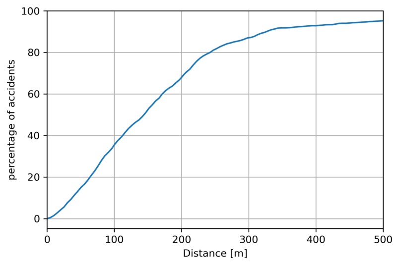
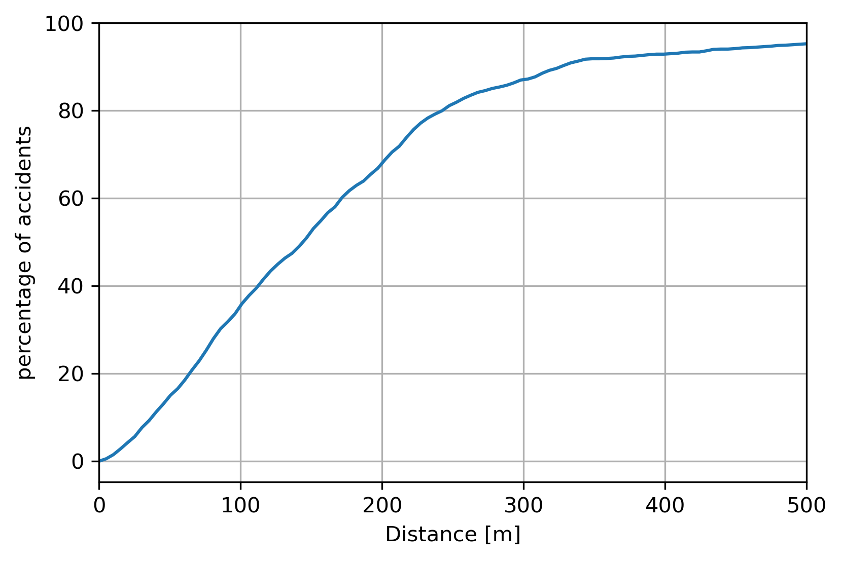
Resulting data plot
Motivation
Despite one is taught to be more careful when crossing the road after exiting the bus, the perception of accidents happening near bus stops seem to be high. This is the reason we wanted to look into this matter.
What it does
It calculates the number of accidents happening near a bus stop for a given radius. Allowing us to understand the relation between the both of them.
How we built it
Using Geopandas the bus stops were represented as circular areas. Accidents were mapped as simple points, if they are located inside a bus stop circle, we consider them accidents close to public transport stop.
Challenges we ran into
When dealing with geometric data, you have to specifiy the projection you are using, so we had to research the different projection available. The performance of the model is still not optimal, which is why we are improving it.
Accomplishments that we're proud of
The resulting analysis makes it possible for further data exploration.
What we learned
Working with geopandas
What's next for Safety First
Further improvement of the project's performance

Log in or sign up for Devpost to join the conversation.