-
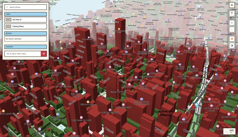
Monopoly Inspired UI
-

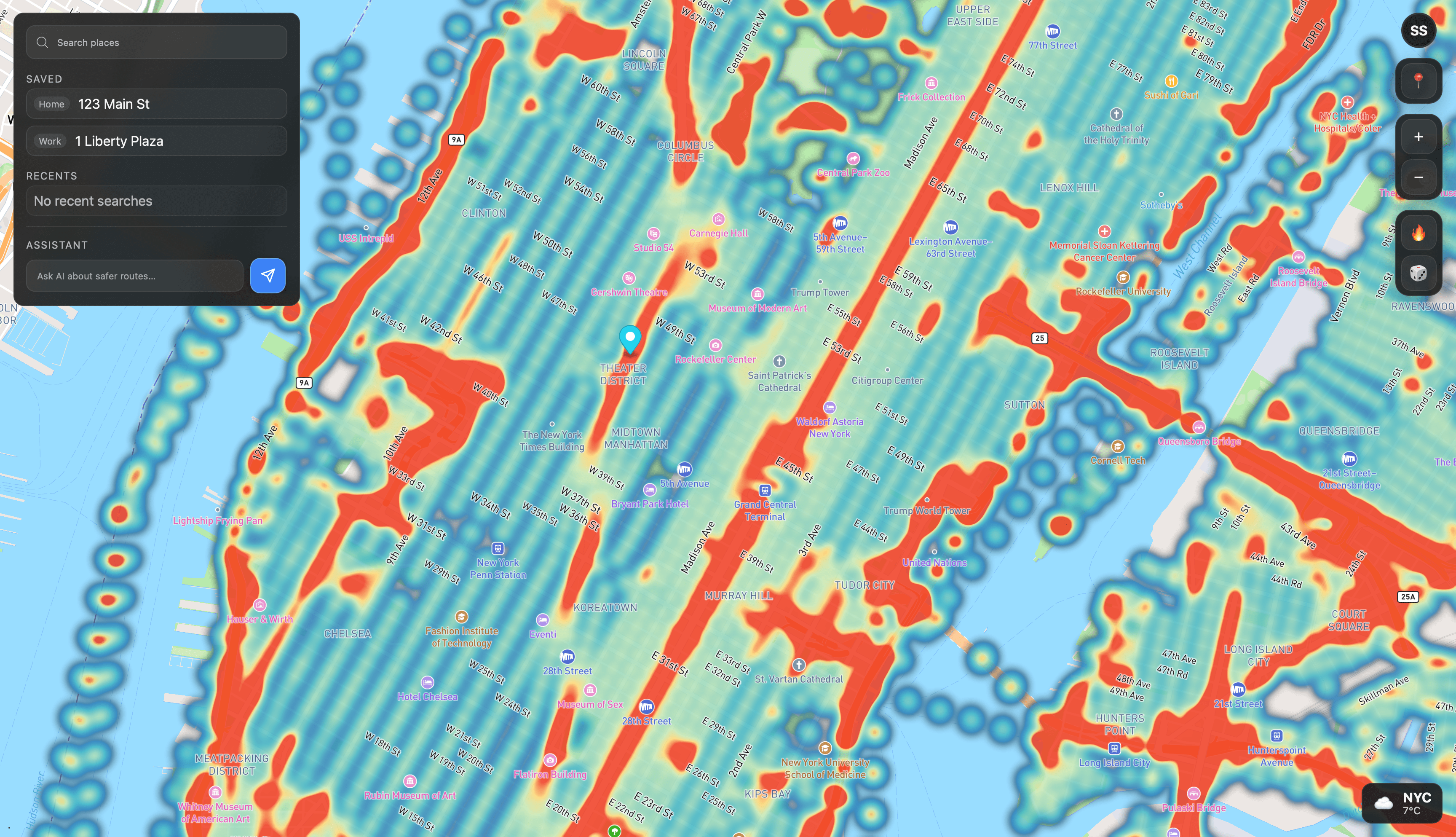
Risk Score Heat Map

Inspiration
Every day, millions of drivers and pedestrians rely on navigation apps that optimize only for speed, not safety. We wanted to change that - to help people reach their destination safely, not just quickly
What it does
SafeStreets AI adds a “Safer Route” option to maps. It analyzes real-world crash data, traffic patterns, and street features to identify high-risk areas, then generates routes that avoid them. Everything is visualized through an interactive risk heatmap
How we built it
We collected car crash, weather, and road network data, processed it, and trained a LightGBM to predict risk levels for every road segment. On the frontend, we used React and Mapbox to display routes and live heatmaps through a smooth, monopoly-inspired UI
Challenges we ran into
- Cleaning and merging messy geospatial datasets
- Computing intersections and edges efficiently on large maps
- Integrating AI predictions into Mapbox without losing performance
Accomplishments that we're proud of
- Built a fully working AI-powered risk heatmap
- Designed a clean, intuitive interface that makes complex data understandable
- Created a scalable data pipeline ready for other cities in the US and around the globe
What we learned
Working with real-world geospatial data was challenging but interesting. We learned how to balance accuracy, performance, and user experience. And also, we tried to turn raw data into something useful for society.
Built With
- fastapi
- geopandas
- javascript
- lightgbm
- mapbox
- numpy
- pandas
- python


Log in or sign up for Devpost to join the conversation.