-
-
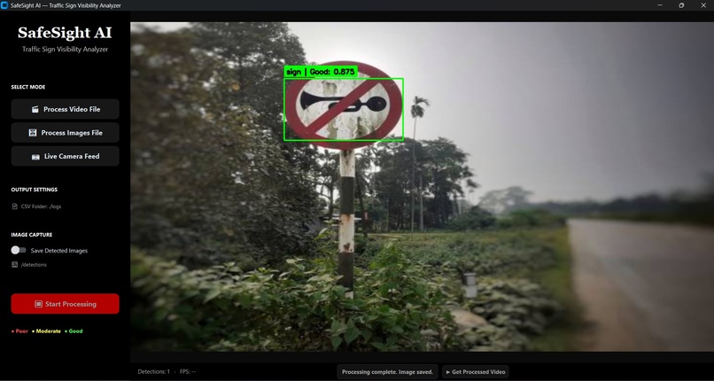
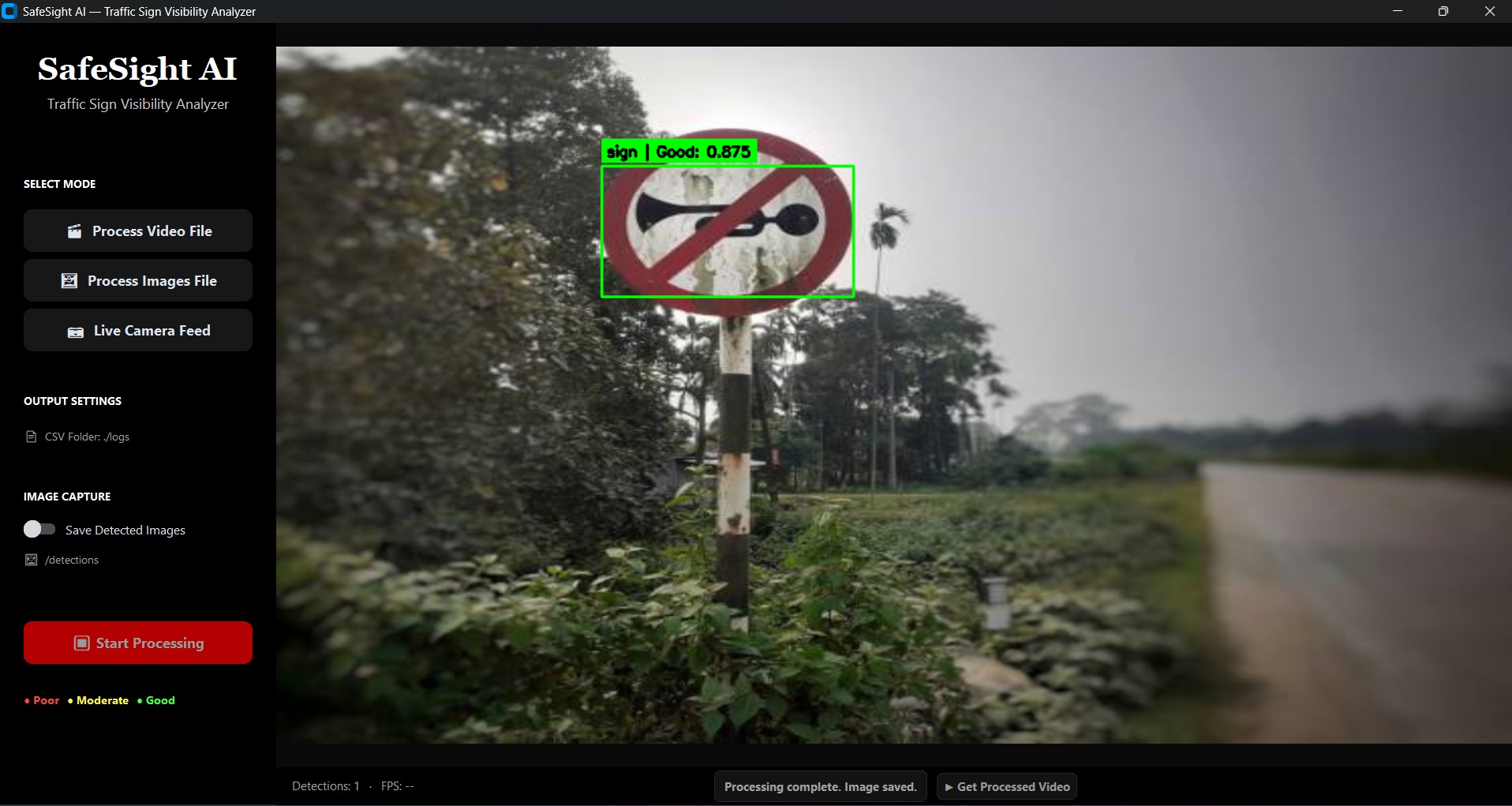
A detected roadside traffic sign is analyzed for visibility, demonstrating SafeSight AI’s ability to assess sign condition in daytime
-
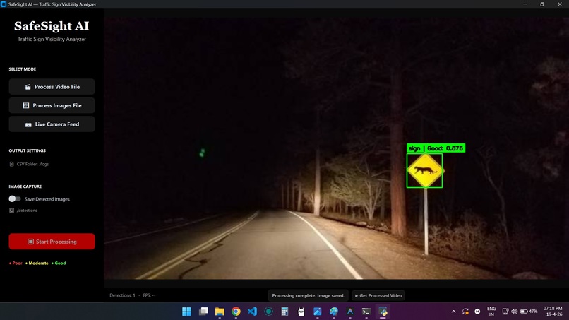
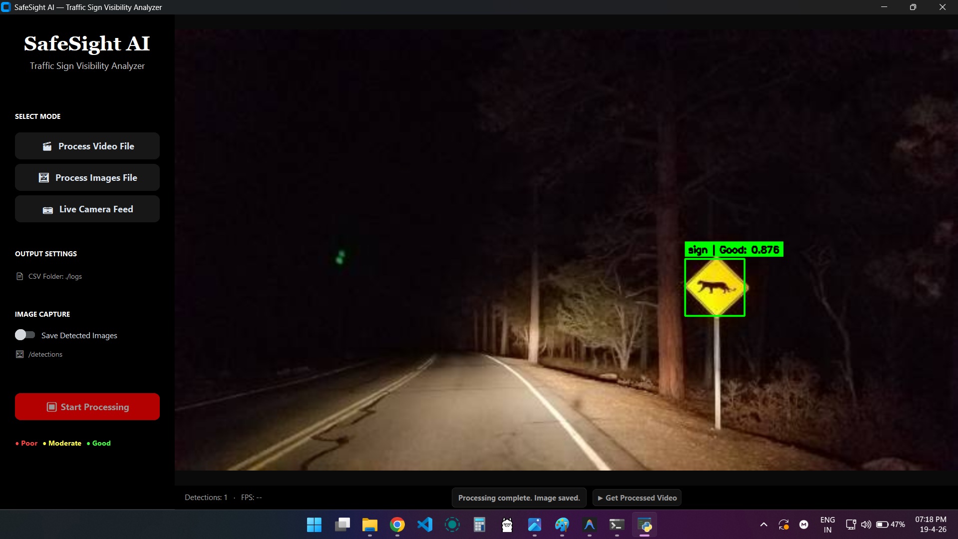
Detects and evaluates a wildlife warning sign under low-light conditions, achieving a Good visibility score of 0.876
-
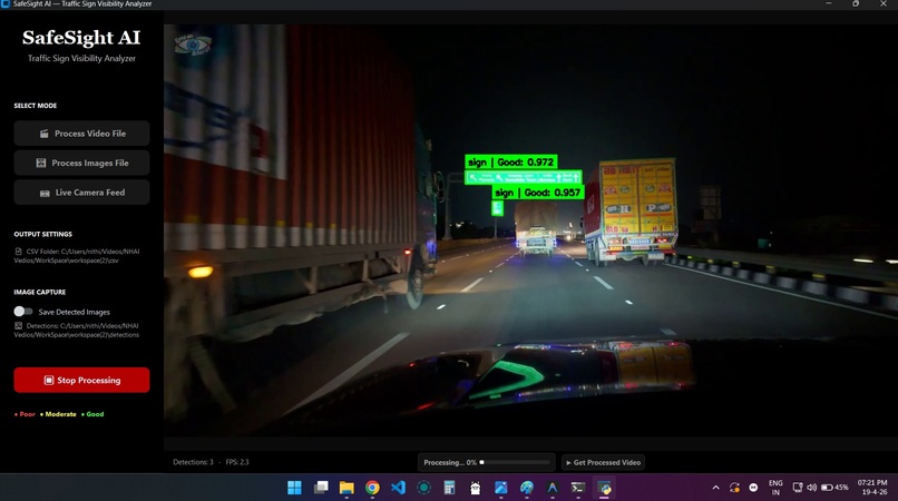
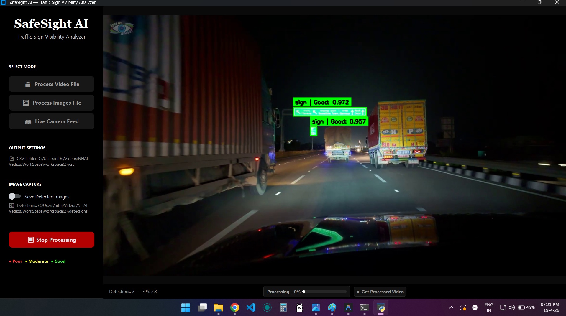
Real-Time Highway Sign Detection
-
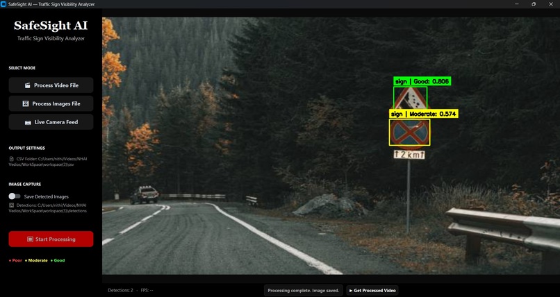
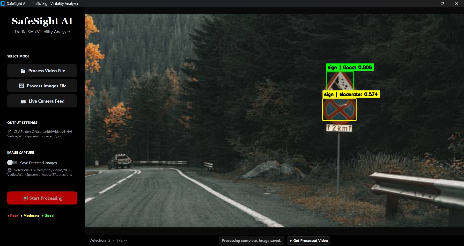
Multi-Sign Visibility Analysis
Inspiration
Traffic signs play an important role in road safety, but they can become faded, dirty, damaged, poorly illuminated, or blocked by vegetation and other objects. Finding these problems manually requires road-survey teams to inspect long stretches of highway, which can be time-consuming and expensive.
We created SafeSight AI to help identify low-visibility traffic signs automatically and assist road-maintenance teams in prioritizing repairs.
What SafeSight AI Does
SafeSight AI analyzes road images and videos to detect traffic signs and estimate their visibility. Each detected sign receives a visibility score and is classified as:
- 🟢 Good
- 🟡 Moderate
- 🔴 Poor
When GPS data is available, the system also records the location of each detected sign. The AI analysis converts the detection results into an understandable safety report and provides maintenance recommendations.
For example, when a sign receives a poor visibility score, SafeSight AI can recommend inspecting it for fading, dirt, damage, or insufficient lighting.
How It Works
- The user uploads a road image or video, or connects a camera feed.
- SafeSight AI detects traffic signs using a computer-vision model.
- The detected sign region is analyzed for brightness and visibility.
- GPS coordinates and detection details are stored in a structured log.
- The AI system evaluates the results and assigns a maintenance priority.
- The application produces annotated media and a safety report.
Visibility Score
The visibility score is calculated using the mean intensity of the brightest 15% of pixels:
$$ \text{Visibility Score} = \frac{\text{Mean intensity of the brightest 15% of pixels}}{255} $$
Visibility Classification
- GOOD — Visibility Score ≥ 0.65
- MODERATE — 0.45 ≤ Visibility Score < 0.65
- POOR — Visibility Score < 0.45
The score is then used to classify the sign as Good, Moderate, or Poor.
How We Built It
We built SafeSight AI using Python, OpenCV, a YOLO-based traffic-sign detection model, GPS logging, CSV reports, and a user interface for image and video analysis. CLAHE-based image enhancement helps improve processing in low-light conditions.
For the hackathon version, the AI workflow is deployed on Nebius infrastructure and integrated with an NVIDIA open-source model. The model receives structured detection information and generates explanations, risk priorities, and maintenance recommendations.
The application is divided into modules for sign detection, image enhancement, visibility analysis, GPS logging, report generation, and AI reasoning. This modular design makes it easier to improve the system in the future.
What We Learned
While developing SafeSight AI, we learned that a practical AI system requires more than object detection. It should also provide measurable results, explanations, location information, and actionable recommendations.
We learned how to connect a computer-vision pipeline with an AI model, structure detection results for further analysis, deploy an application on cloud infrastructure, and design an interface for a real-world safety problem.
Challenges We Faced
Detecting small and distant traffic signs was one of our biggest challenges. A sign may occupy only a small part of a video frame, making it difficult to identify accurately.
Changing lighting conditions also affected the results. Daylight, darkness, shadows, glare, rain, and overexposure can all influence visibility calculations. To address low-light conditions, we included image-enhancement techniques and separated the detection and visibility-analysis modules.
We also needed to ensure that the AI-generated report was based on actual detection results. Therefore, the AI system receives structured information such as the sign class, visibility score, image conditions, and GPS coordinates instead of relying only on a raw image.
Impact and Future Scope
SafeSight AI can help road authorities identify traffic signs that require inspection and reduce the need for completely manual road surveys. By ranking signs according to urgency, it can support more targeted and efficient maintenance.
Future improvements include:
- Improved detection of small and distant signs.
- Detection of blocked, tilted, or physically damaged signs.
- A live map-based monitoring dashboard.
- Support for regional languages.
- Deployment on NVIDIA Jetson and other edge devices.
- Historical tracking of signs whose visibility is declining over time.


Log in or sign up for Devpost to join the conversation.