-
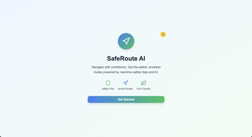
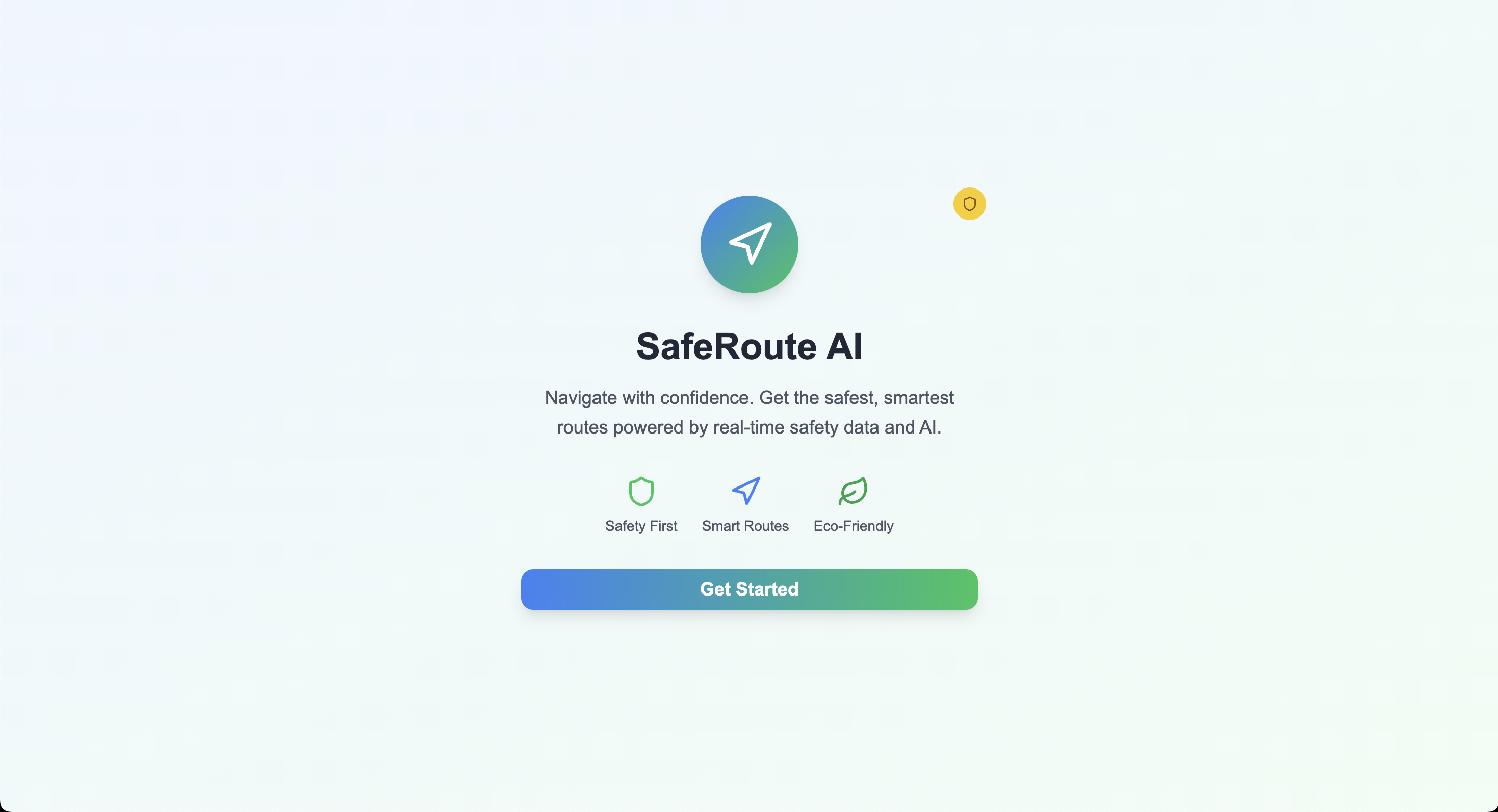
Landing_Page
-
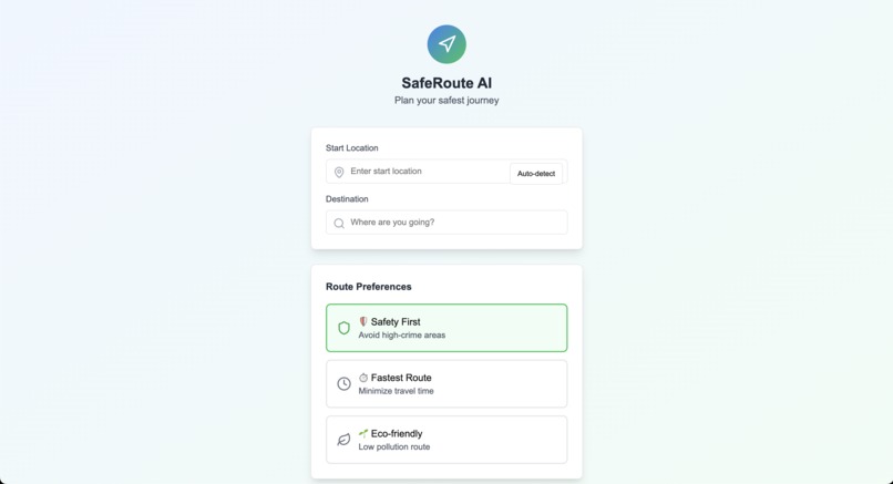
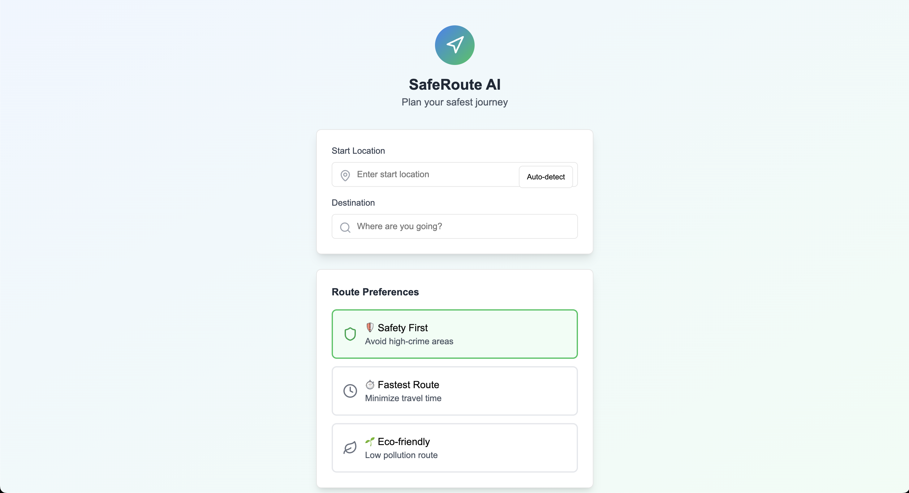
Location_Page
-
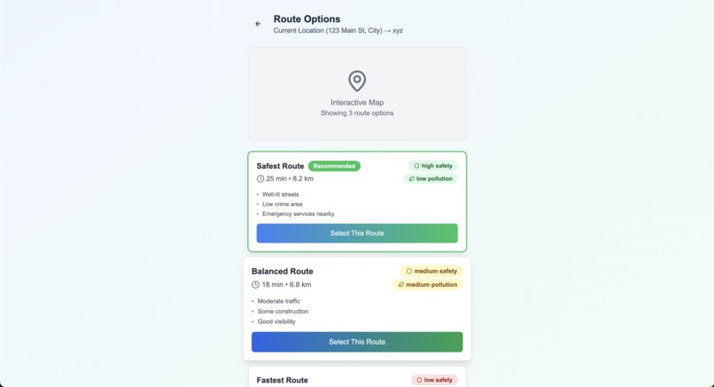
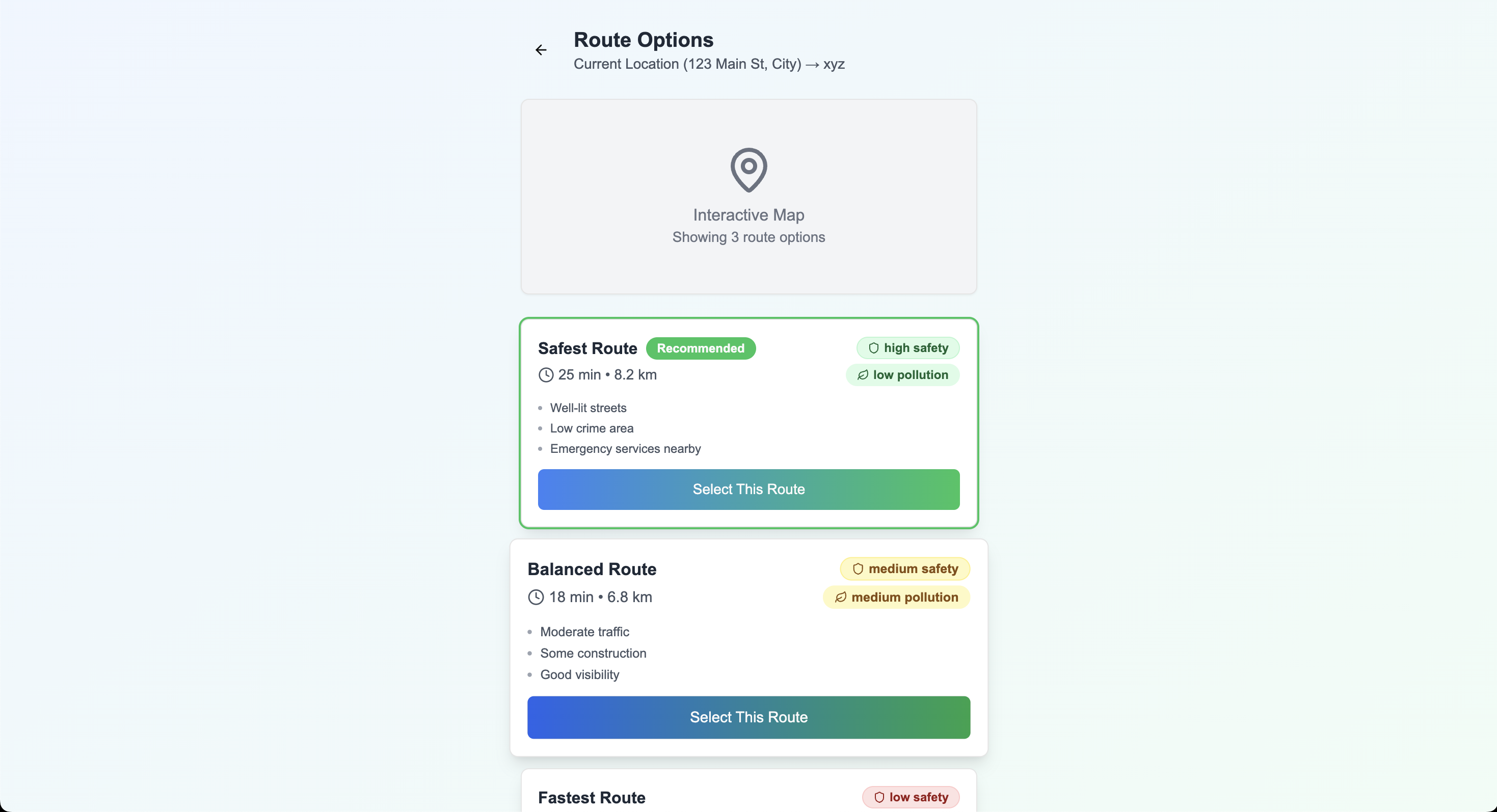
Available_Routes
-
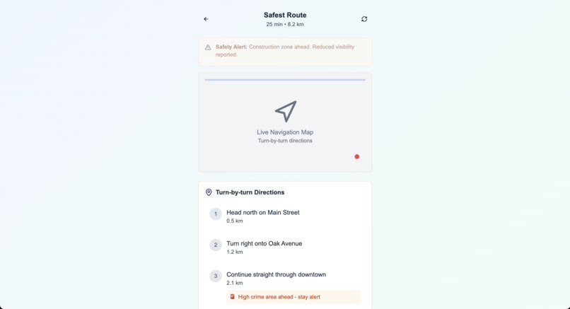
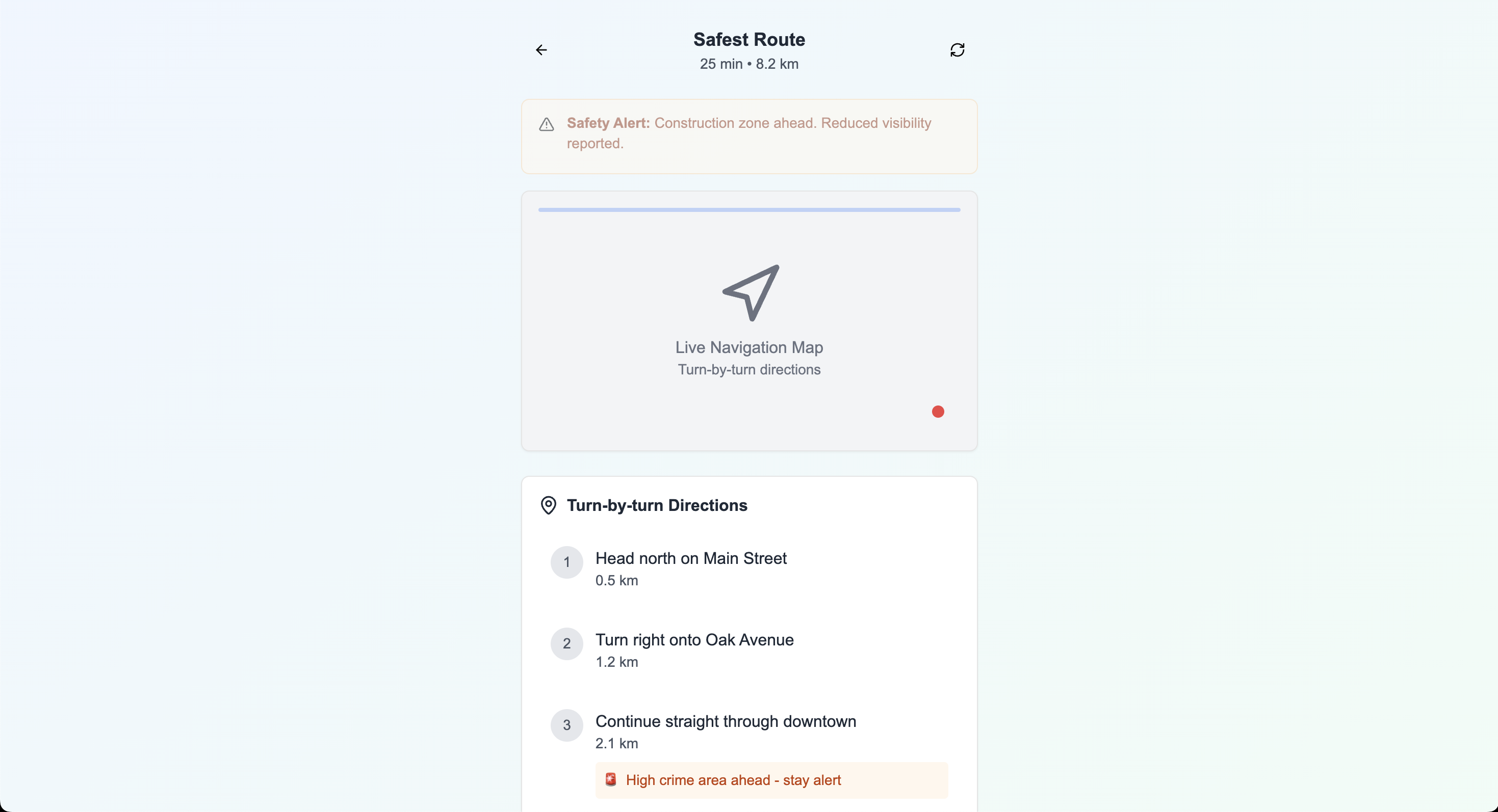
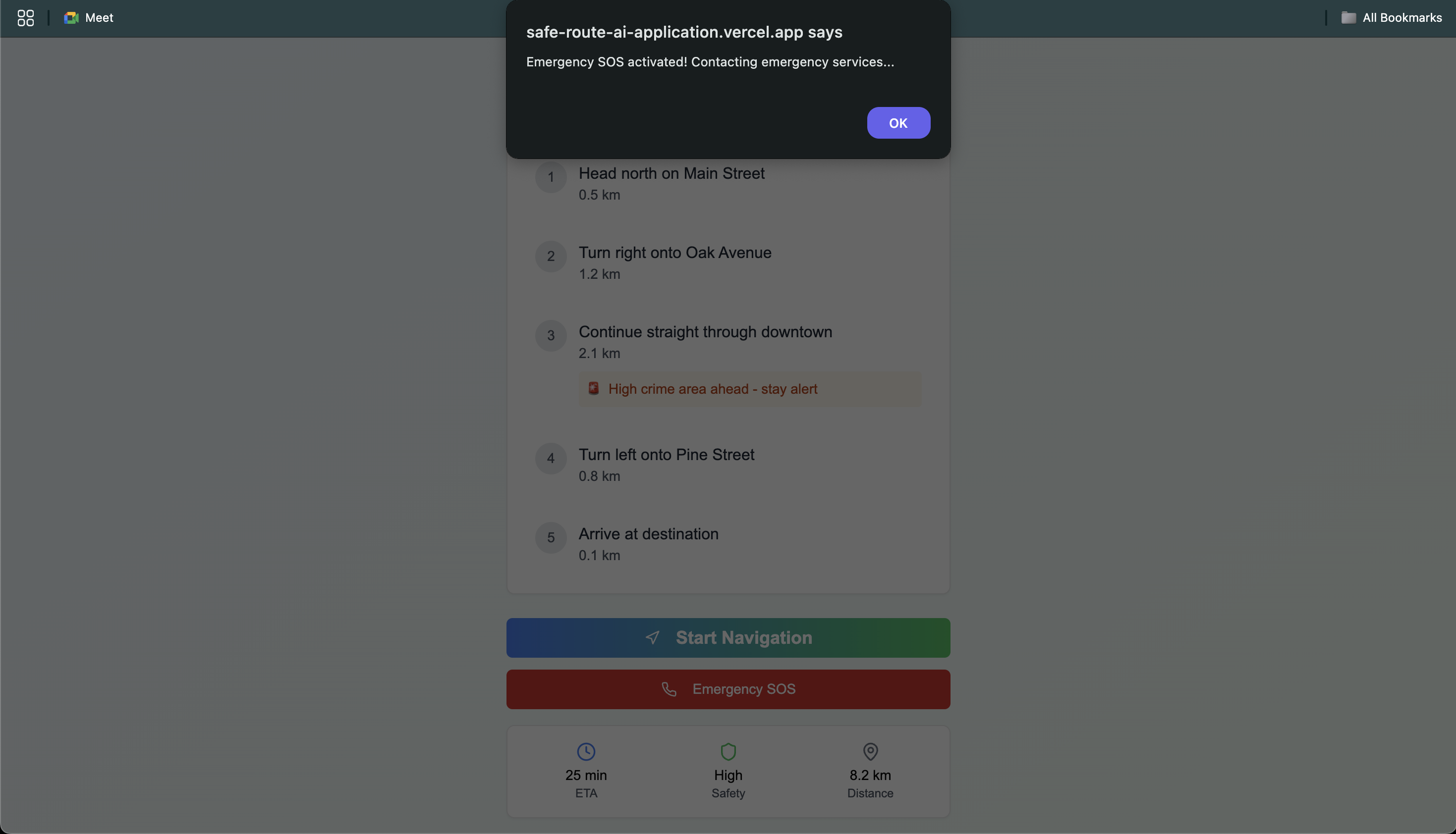
Navigation
-
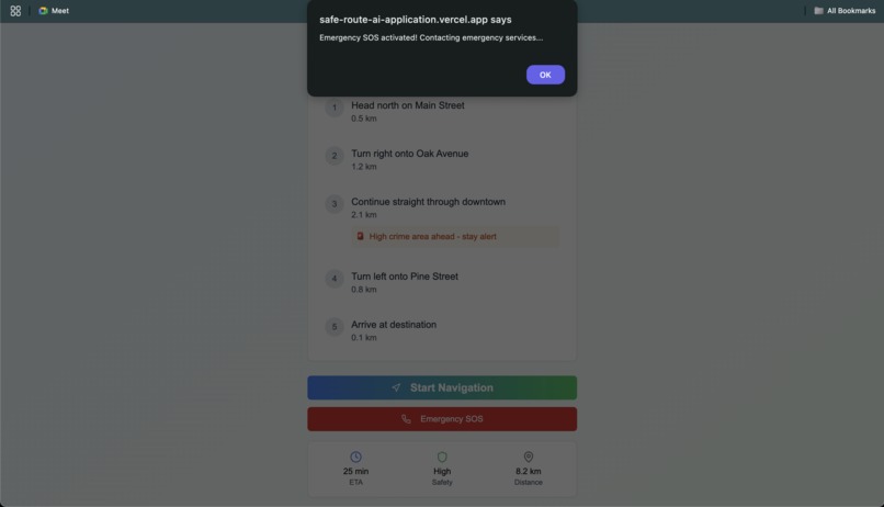
SOS
🚀 About the Project
Inspiration
As urban areas continue to grow, city navigation becomes more complex and risk-prone. Commuters often face challenges such as unsafe neighborhoods, traffic congestion, pollution zones, and road closures. We were inspired to build SafeRoute AI to help citizens—especially vulnerable groups like students, women, and the elderly—navigate cities in a smarter, safer, and more informed way.
What We Built
SafeRoute AI is an AI-powered route optimization platform that integrates data from multiple sources (crime heatmaps, pollution APIs, real-time traffic, road conditions) to recommend the best possible routes not just by time, but by safety and sustainability. It features:
- A mobile app for users to input destinations and view route safety scores
- A real-time route visualization using Mapbox
- Integration with city data APIs (crime reports, air quality index, traffic feeds)
- A machine learning model to weigh safety and efficiency based on time, location, and user preferences
What We Learned
We learned how to work with real-time geospatial data, combine multiple public datasets, and apply machine learning to derive actionable insights. We also gained experience in designing user-centric urban mobility solutions that are scalable and impactful.
How We Built It
- Frontend: React Native (cross-platform mobile app)
- Backend: Node.js with Express
- AI/ML Model: Python with Scikit-learn and Pandas
- Maps & APIs: Mapbox, Google Directions API, OpenStreetMap, AQI APIs, public safety datasets
- Database: MongoDB for storing user preferences, routes, and analytics
Challenges We Faced
- Finding reliable, real-time crime and pollution data for accurate predictions
- Balancing safety and time efficiency in route scoring
- Handling data inconsistencies across different cities and APIs
- Creating a smooth UX while displaying a lot of critical information
Built With
- ai
- ml
- next
- node.js
- tailwind

Log in or sign up for Devpost to join the conversation.