
Inspiration
Toronto’s streets can sometimes be cumbersome. It may not always be clear which areas are safest, especially for newcomers or late-night travelers. We wanted to create a tool that helps people navigate the city with confidence, using real police data to avoid high-risk areas.
What it does
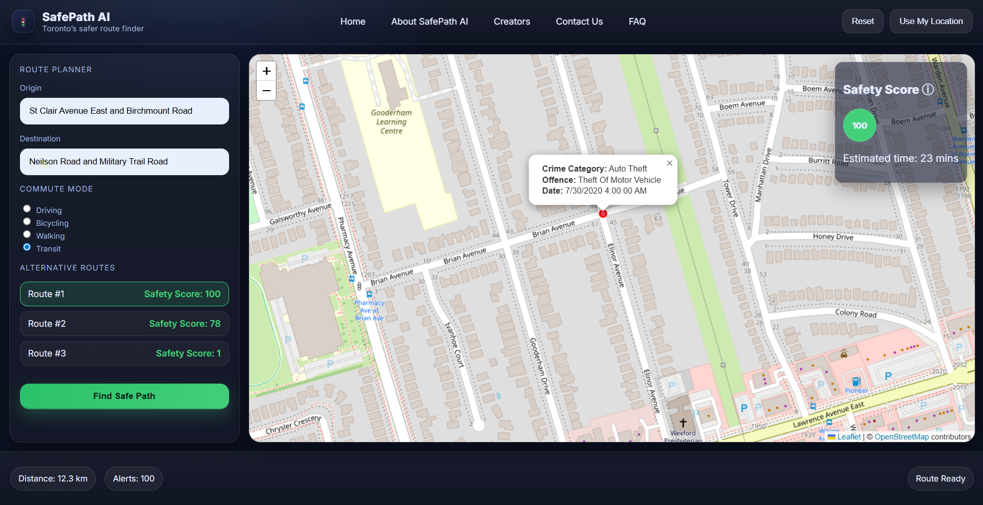
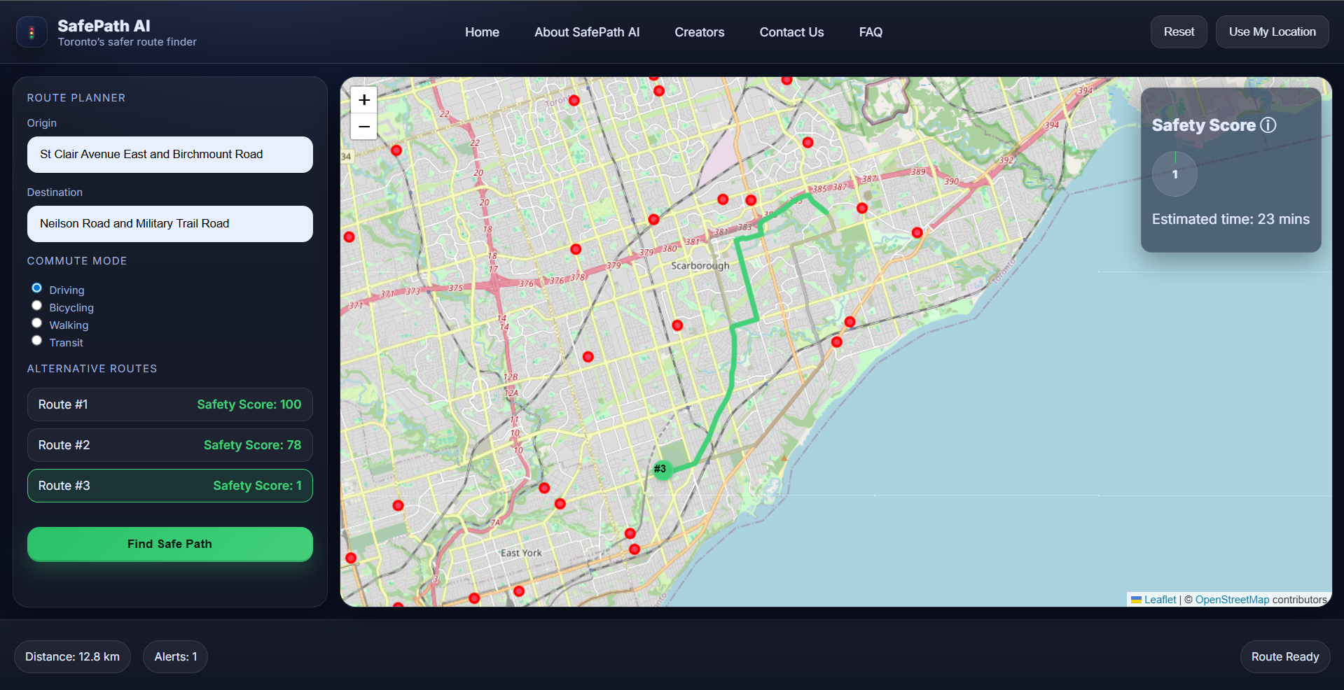
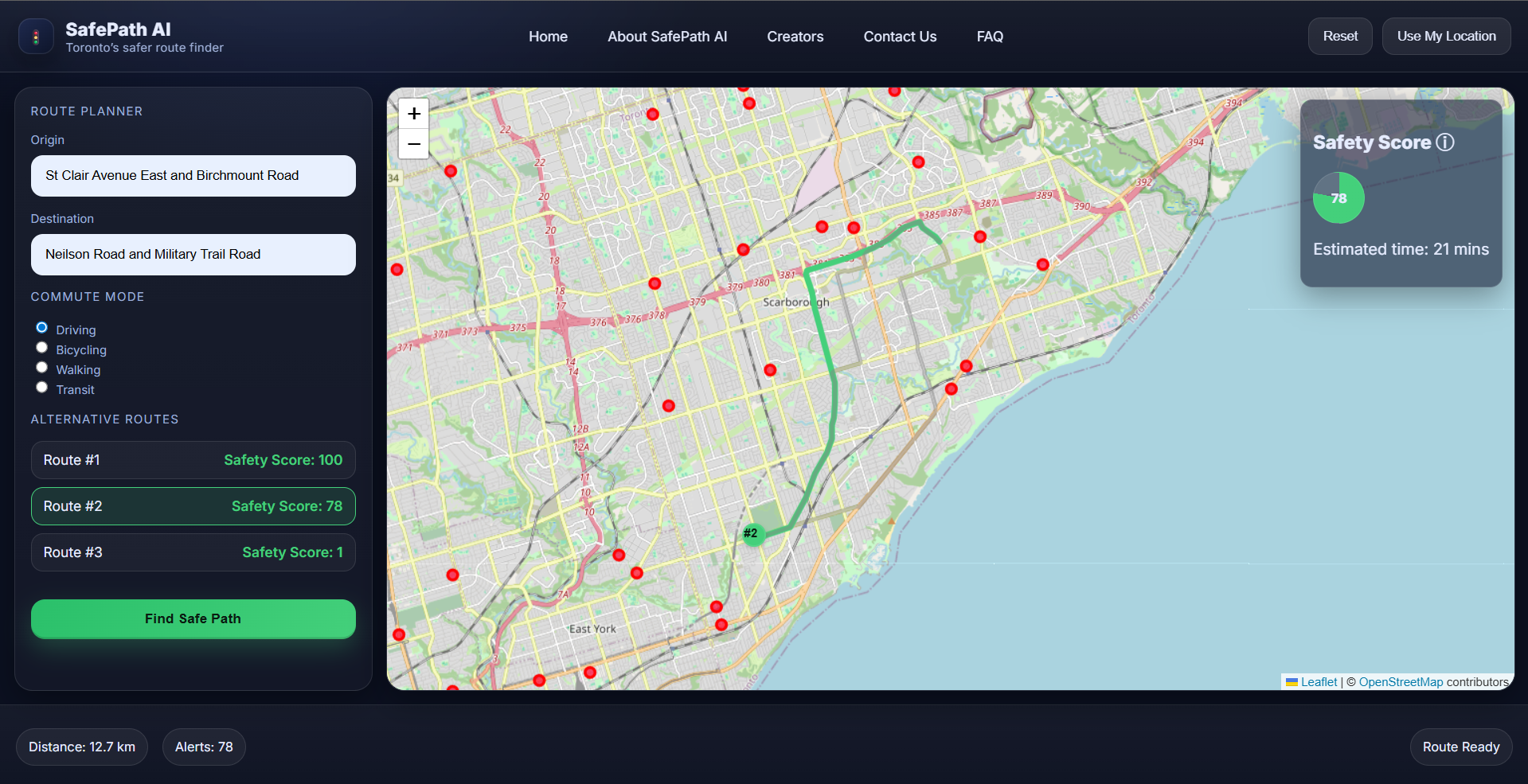
SafePath analyzes police crime data and uses Google Maps to provide users with the safest route between two locations. It highlights areas with higher crime rates and suggests alternative paths to help users travel more securely.
How we built it
We built a Python backend using Flask that processes open police data from Toronto, combines it with Google Maps Directions and Geocoding APIs, and scores routes for safety. The frontend is built with HTML, CSS, and JavaScript, allowing users to input their start and end points and view recommended safe routes.
Challenges we ran into
Integrating large and varied police datasets. Handling API limits and large file sizes on GitHub. Matching crime data locations with map coordinates. Ensuring the user interface is simple and intuitive.
Accomplishments that we're proud of
Successfully combining real-time mapping with open crime data. Building a working prototype that can analyze and recommend safe routes. Creating a tool that can help people feel safer navigating Toronto.
What we learned
How to work with public datasets and APIs. The importance of data cleaning and geocoding accuracy. How to build a full-stack application that solves a real-world problem.
What's next for SafePath
Expanding to other cities and datasets. Adding more features, like time-based safety analysis and user feedback. Improving route scoring algorithms and UI design. Deploying SafePath for public use and gathering community input.

Log in or sign up for Devpost to join the conversation.