-
-
SafeMaps!
-
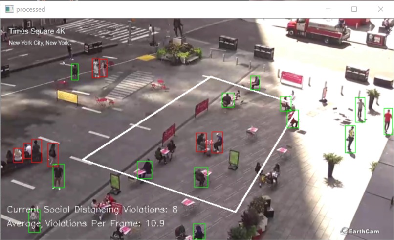
Distance Detection
-
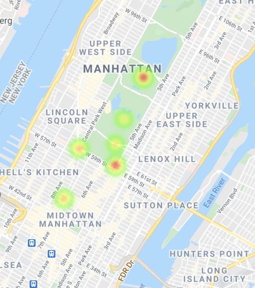
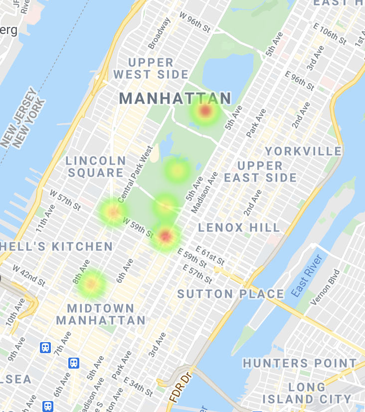
A view of the heatmap generated

Inspiration
- Covid19 pandemic
- Traffic maps used by news agencies.
What it does
SafeMaps is a platform that consists of a network of cameras installed in public spaces like parks and busy streets. Using computer visions, these cameras allow us to count the number of social distancing violations (maintaining a 6 feet distance between people) in real-time and log them in a database. This data is then displayed by a website that a user could check before making plans to determine the best places to enjoy the outdoors while also reducing the risk of exposure to COVID.
How we built it
We used OpenCV to process video inputs and send over the number of social distancing violations to a postgres db. This data is queried by the website and displayed to the user in a heatmap.
Challenges we ran into
- Accounting for camera perspective in distance calculations
- Working with the google-maps-react API to get the heatmap displayed
Accomplishments that we're proud of
- Successfully implementing human detection and perspective correction algorithm
- Putting together a simple but effective UI that displays all of the data in real-time as its collected
What we learned
- A lot about computer vision techniques
- Using google cloud API to implement the heatmap
What's next for SafeMaps
- Running the OpenCV collection scripts on Raspberry Pis or actual cameras and running through a real world scenerio
- Implementing autocomplete/search features on the heatmap


Log in or sign up for Devpost to join the conversation.