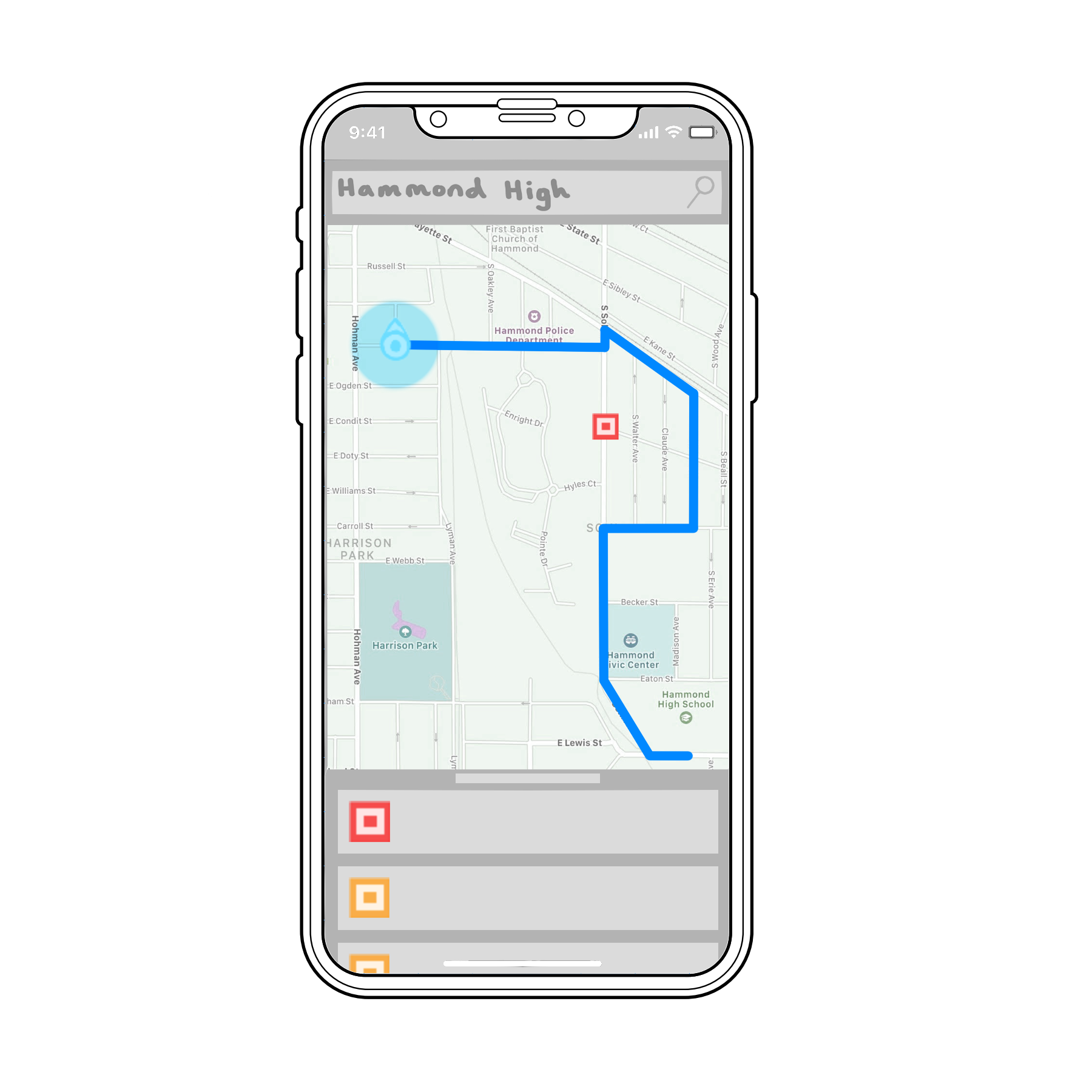
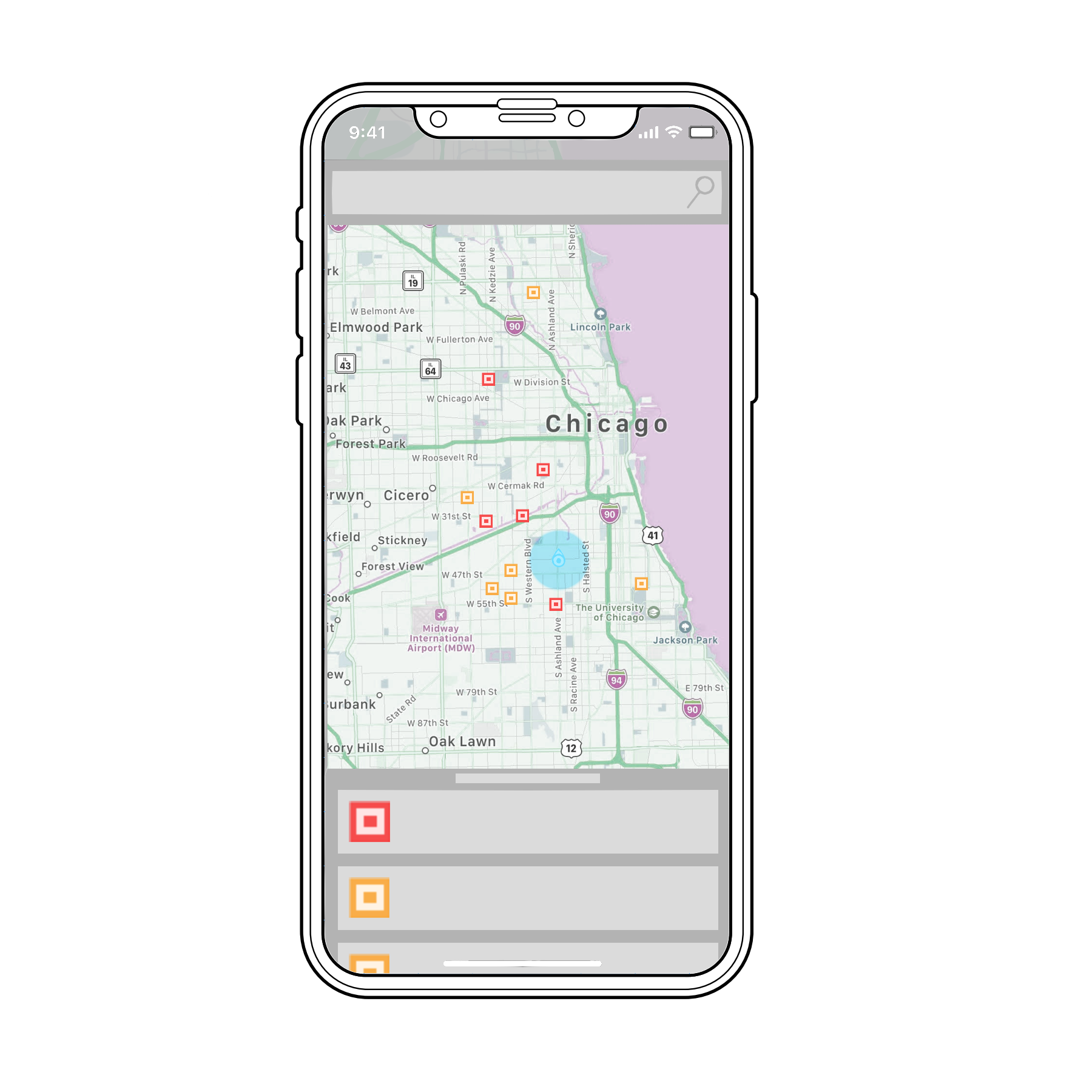
What is our project? The purpose of SafeJourney is to provide its users with a navigation system that factors police crime data into its algorithm to navigate away from dangerous streets. It maps the shortest and safest route from point A to point B. Police reports update the algorithm with current crime information to constantly adjust and improve its pathing.
Why our project? We want our project to help Baltimore residents stay safe in their day to day life. Kids can walk to school on safer paths.
USAGE Currently, this application is based entirely within your terminal. Compile every .java file. Run StreetSearch with the following arguments: mapfile, start Latitude,Longitude pair, and end Latitude,Longitude pair.
example: $ java graphFiles.StreetSearch graphFiles/baltimore.txt -76.6063,39.2907 -76.6136,39.3195
FUTURE GOALS -Planning to build app with gui -updating info and filtering it based on type of crime more thoroughly -being more precise/predictive in the severity of danger in various areas -give more detailed directions with a focus on accessibility for all users -Implement more efficient A* shortest path algorithm

Log in or sign up for Devpost to join the conversation.