-
-

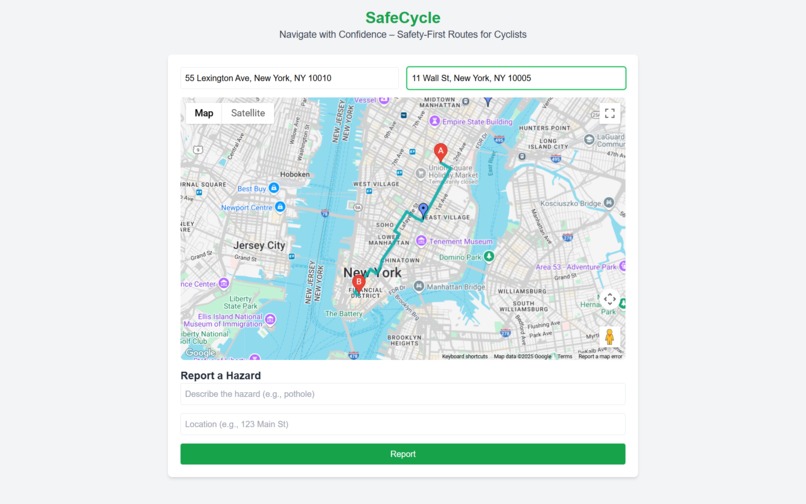
homepage
-


SafeCycle: Empowering Safe Urban Cycling
Inspiration
The rise of urban cycling as a sustainable transport option has been overshadowed by safety concerns, with cyclists facing risks from heavy traffic, poorly designed roads, and lack of real-time safety data. SafeCycle was inspired by the need to make cycling safer and more accessible, empowering users with routes optimized for safety. We envisioned a tool that leverages Google Maps Platform to combine real-time navigation with safety metrics, encouraging more people to cycle confidently while reducing accident risks.
What We Learned
Building SafeCycle taught us the power of integrating geospatial APIs with external datasets. Key learnings include:
- API Optimization: Balancing multiple Google Maps Platform API calls required caching and rate-limiting strategies to maintain performance.
- User-Centric Design: Beta testing revealed cyclists prioritize clear, intuitive visuals, leading us to simplify map overlays.
- Data Challenges: Merging open-source safety data with real-time traffic feeds was complex but critical for accurate routing.
How We Built It
SafeCycle was developed over four months in 2025 by a team of web developers and urban mobility enthusiasts. We used:
Technology Stack
- Frontend: React with Tailwind CSS for a responsive, accessible interface.
- Backend: Node.js with Express for API management and data processing.
- Database: MongoDB for storing user-reported hazards and safety data.
- Hosting: Deployed on Google Cloud Platform for scalability and global reach.
Google Maps Platform APIs
- Directions API: Generates cycling routes weighted for safety (e.g., bike lanes, low-traffic roads).
- Maps JavaScript API: Renders interactive maps with custom overlays for safety scores and amenities.
- Places API: Locates cyclist-friendly amenities like bike shops.
- Geocoding API: Converts addresses to coordinates for precise routing.
External Integrations
- External Data: Integrated open-source city safety datasets (e.g., accident statistics) and real-time traffic APIs.
Safety Algorithm
The app includes a proprietary safety algorithm that scores routes based on:
$$\text{Safety Score} = w_1 \cdot \text{BikeIndex} + w_2 \cdot \text{TrafficDensity}^{-1} + w_3 \cdot \text{AccidentHistory}^{-1}$$
Where:
- $w_1, w_2, w_3$ are weighting factors
- $\text{BikeIndex}$ represents bike lane availability
- $\text{TrafficDensity}$ measures traffic volume
- $\text{AccidentHistory}$ accounts for historical accident data
This ensures cyclists get the safest path possible.
Challenges Faced
- Data Integration: Combining real-time traffic and safety data with Google Maps APIs required robust error handling and data normalization.
- Performance: Rendering dynamic map overlays without lag demanded optimization of API calls and frontend rendering.
- Accessibility: Ensuring WCAG 2.1 compliance (e.g., screen-reader support, high-contrast UI) was time-intensive but critical for inclusivity.
- User Feedback: Early testers found the initial UI cluttered, prompting a redesign for simplicity.
Impact & Future
SafeCycle launched in July 2025 and has been adopted by over 5,000 cyclists across three cities, with plans to expand globally. The platform demonstrates how thoughtful integration of mapping technologies can create meaningful impact in urban mobility and public safety.
Built with passion for safer cycling and sustainable urban transport.

Log in or sign up for Devpost to join the conversation.