Inspiration
The inspiration came from our team members who had to navigate the bureaucracy of a natural disaster in the absence of a centralized communication system, as well as from the way their communities came together to organize.
What it does
It contains four pages:
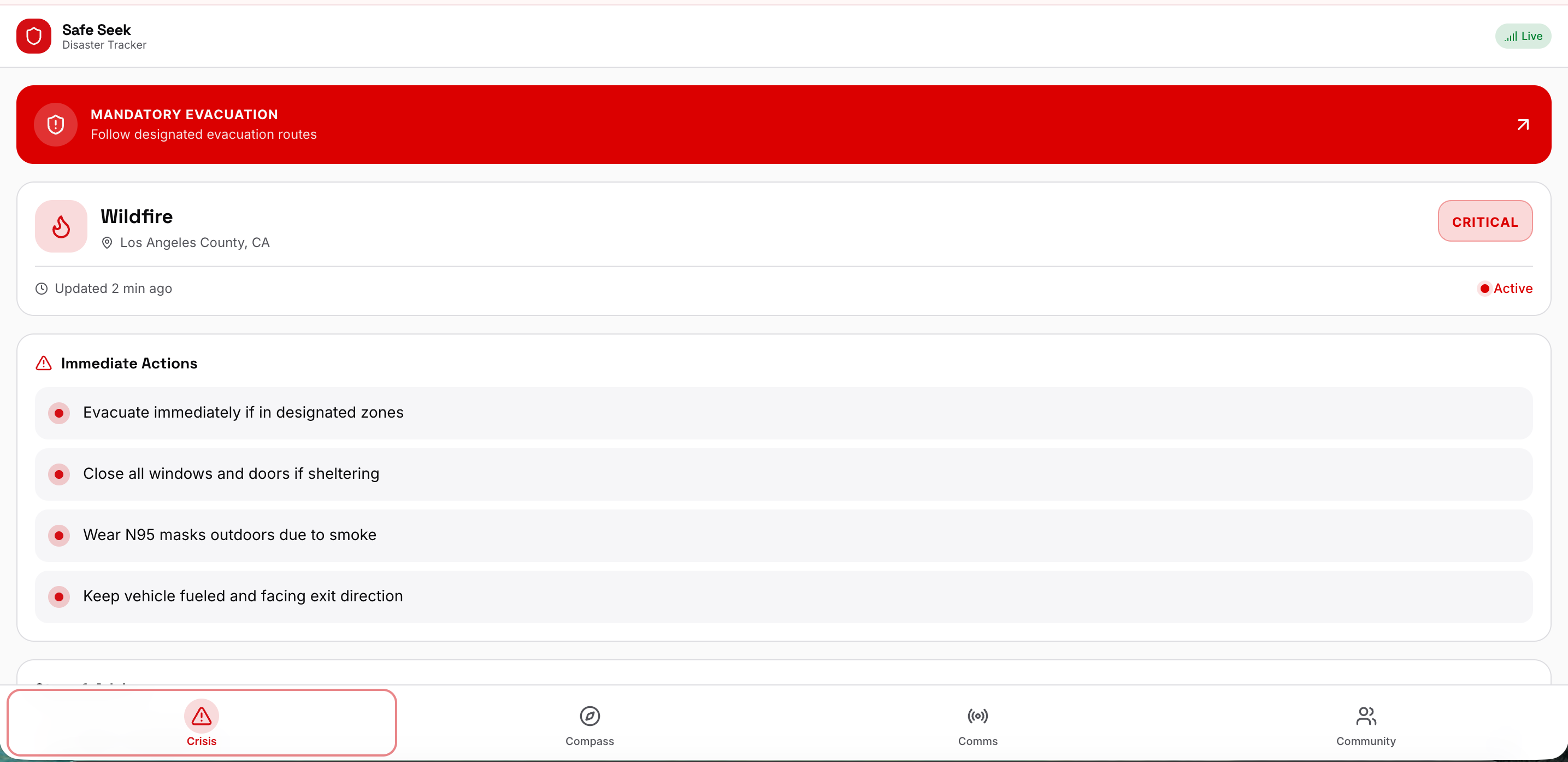
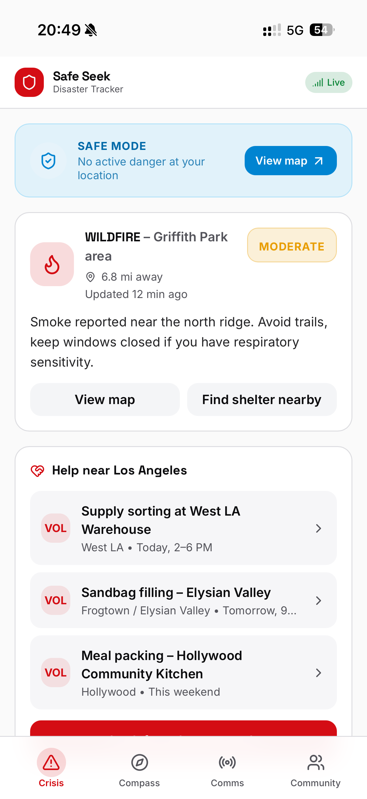
Page 1: Crisis
- Checks location;
- Disaster type
- Risk level
- Immediate actions, Steps / Advice
- Evacuation status
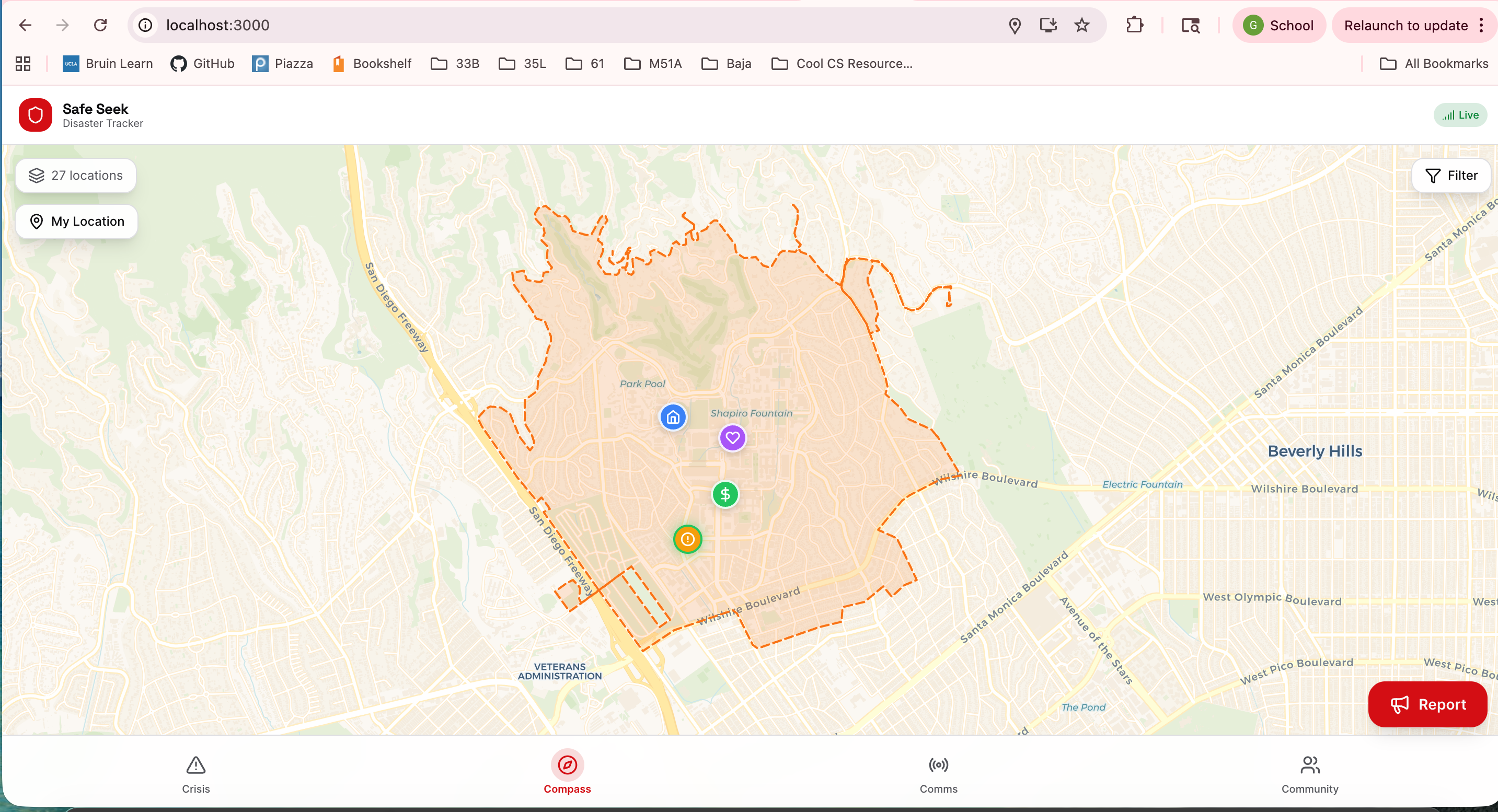
Page 2: Compass:
- Map
- Danger zones (fire spread, flood zone, storm path)
- Evacuation shelters/Routes (Closed roads), food banks, pharmacies
- Reports overcrowding, supply shortages, assault reports
- Volunteer locations
- Crowd reports / help needed (misinformation detection)
Page 3: Communication
- search bar
- Government/ official updates & News (reliable, live, up-to-date)
- Weather service
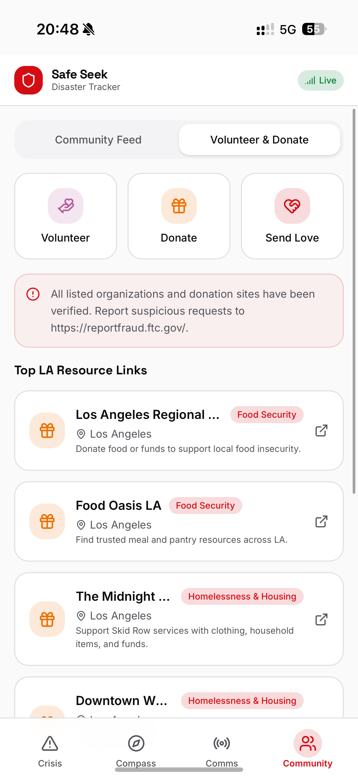
Page 4: Community
- Community (neighbor) images, videos, posts
- Volunteer locations, reliable donation sites, send love
How we built it
We built Safe Seek using: -Next.js + React -Tailwind CSS for consistent, accessible UI styling -Geolocation APIs to dynamically assess user risk -Leaflet mapping integration to render live danger zones and resource markers
Mock data layer simulating:
- Disaster metadata
- Volunteer hubs
- Community posts
- Government alerts
- Real-time map markers
Challenges we ran into
Geolocation & Zone Detection Implementing danger zone detection required careful coordinate modeling and spatial logic testing in order to snap to the roads.
UI Clarity Designing for high-stress situations meant prioritizing clarity, readability, and immediate actions over feature overload. We carefully organized the UI so that the interface was intuitive for people in need.
Accomplishments that we're proud of
- The notification system which works for both laptop and mobile.
- PWA, allowing for our app to be easily used on any device.
- The danger zones follow along road lines.
What we learned
- How to do map/road following for danger zones and road closings.
- Notifications for laptop and mobile.
- How to implement interactive maps.
What's next for Safe Seek
- Better trust/misinformation system
- Area expansion
- More types of reports
- Communication/integration with local authorities and communities
- Better algorithms for timing and area coordination

Log in or sign up for Devpost to join the conversation.