-
safe routes after implementing Geo processes
-
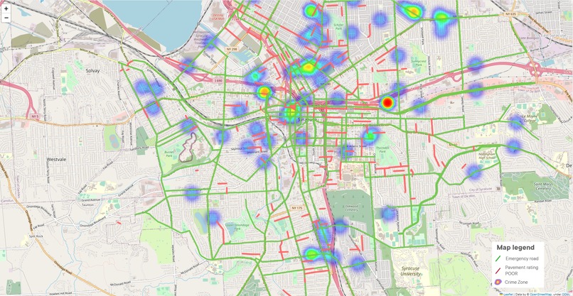
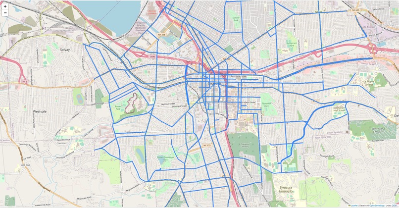
Analysis data from open data (emergency snow road, pavement rating, crime cases)


Inspiration
The concept of a "Safe Path Finder" is a powerful source of inspiration. It represents the ability to empower individuals, helping them navigate through challenging situations, and ensuring their safety. It's a reminder that technology and innovation can be harnessed to provide real-world solutions that make a meaningful difference in people's lives. This idea inspires us to create tools and systems that offer security, guidance, and peace of mind in times of uncertainty, ultimately contributing to a safer and more secure world.
What it does
A Safe Path Finder is a technology or service designed to help individuals find secure and safe routes in various situations, especially during emergencies or challenging conditions. Here's what it typically does: Real-Time Guidance: It provides real-time information and directions to guide users along the safest path to their destination. Emergency Response: During natural disasters, extreme weather, or other emergencies, it offers alternatives to avoid danger and reach safety. Open-Source Data: It utilizes open-source data and up-to-date information to ensure accuracy in route recommendations. Security: Ensures that the selected paths are secure, taking into account factors like crime rates, traffic, and infrastructure conditions. Customization: Users may have the option to tailor their preferences, such as prioritizing well-lit areas or avoiding certain zones. Accessibility: Considers the needs of individuals with disabilities, providing accessible routes for all. **Integration: **Can integrate with various platforms, such as web and mobile applications, to make it easily accessible to a wide range of users.
How we built it
Using python Geo Pandas Map and Syracuse open data
Geopandas: A Python library for working with geospatial data, which combines the capabilities of Pandas and Shapely to make it easier to analyze and manipulate geographic datasets.
Folium: A Python library for creating interactive maps and visualizations. It's often used in combination with geospatial data to display maps with various overlays and features.
Pandas: A popular data manipulation and analysis library in Python, primarily used for working with structured data, such as tables, spreadsheets, and databases.
Geopy is a Python library that provides geocoding (converting addresses to coordinates) and reverse geocoding (converting coordinates to addresses) capabilities. It offers a straightforward way to work with geographic location data and is often used in applications and scripts that require location-based services or data analysis. Geopy can connect to various geocoding services, making it versatile for different geographic data needs.
Challenges we ran into
Integration: Integrating with various mapping and navigation services.
Accomplishments that we're proud of
Data Accuracy: Ensuring that the geospatial data used for route recommendations is accurate and up to date can be a significant challenge. Outdated or incorrect data can lead users into unsafe situations.
What we learned
About data quality, User-Centric Design, Collaboration is Key, Real-Time Updates are Critical, Scalability is a Challenge, Continuous Improvement
What's next for Safe path finder
Convert this idea to a mature product and make it available online as mobile app and web application for citizens

Log in or sign up for Devpost to join the conversation.