Inspiration
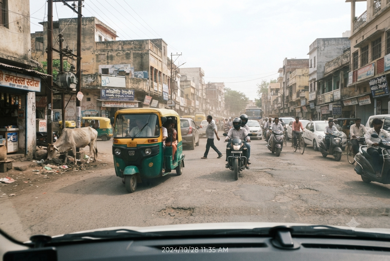
Every day, ~485 people die on Indian roads — nearly 20 every hour, and 70% of those deaths are caused by over-speeding and human reaction error (MoRTH, 2024). Most autonomous-driving research is built and tested on structured, Western roads with clear lane markings and predictable traffic. That doesn't match what an Indian road actually looks like — mixed traffic, no lane discipline, cattle, potholes, and obstacles appearing without warning. We wanted to build something that faces that reality directly instead of assuming it away.
Problem Statement
Autonomous-driving systems fail badly on Indian roads because they have no reliable lane markings, extreme mixed traffic (cars, auto-rickshaws, two-wheelers, cattle, handcarts), and unstructured obstacles like potholes and debris sitting right at the edge of the drivable area instead of behind a curb.
Our Solution
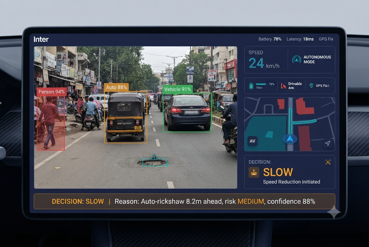
Safe Marg is a path-planning and collision-avoidance system built specifically for unstructured Indian roads. Instead of just detecting objects, it plans a safe path around them and explains every decision in plain language — turning a black-box driving decision into something a human can actually verify: "STOP — pedestrian 4.7m ahead, risk HIGH, confidence 94%."
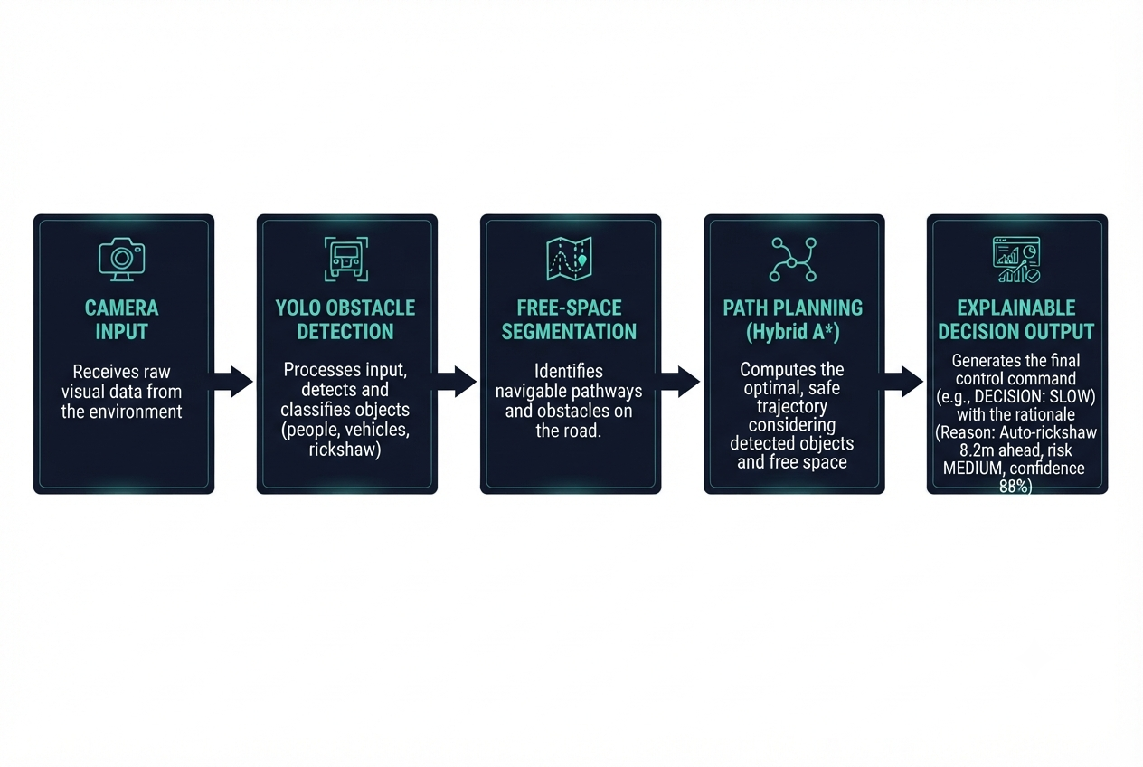
The pipeline works in a closed loop: PERCEIVE → PLAN → ACT → MONITOR
- Perceive: Detect obstacles and the drivable free-space area (not lane lines, since Indian roads don't reliably have them)
- Plan: Compute a safe path around static and moving obstacles
- Act: Validate the path against real vehicle motion constraints
- Monitor: A live dashboard shows what the vehicle sees, plans, and why
How AI Is Used
AI is not a bolt-on feature here — it is the core of the system:
- YOLOv8 performs real-time object detection on camera input to identify pedestrians, vehicles, animals, and debris
- A free-space segmentation approach identifies the drivable road area without relying on lane markings, since Indian roads often don't have them
- A path-planning algorithm (Hybrid A*) uses this AI-derived environment model to compute collision-free routes, re-planned every cycle as the environment changes
- Every driving decision carries a human-readable explanation, not just a raw command — this is the core innovation: explainable autonomous decision-making
Tech Stack
Python · OpenCV · Ultralytics YOLOv8 · NumPy · FastAPI · WebSocket · React · TypeScript · Tailwind CSS
Team
- Monika Sharma — Team Lead, planning & integration
- Anjali Yadav — Perception (object detection, free-space segmentation)
What We Learned
We learned that "autonomous driving" isn't really one problem — it's a chain of very different problems (perception, planning, control, explainability) that all have to agree on the same data contract to work together. We spent time upfront defining strict data structures (what a detected obstacle looks like, what a planned path looks like) before writing any detection or planning code — that discipline is what let us get a working, verified pipeline instead of disconnected pieces that looked right individually but didn't fit together.
Challenges We Faced
Building a full autonomous-vehicle pipeline in a short hackathon window meant prioritizing ruthlessly with just two people. We focused first on getting the perception module (detection + environment modeling) working and verified end-to-end, rather than spreading our effort thin across every module.
Impact & Future Scope
Safe Marg targets a problem with direct, measurable stakes: road safety on exactly the kind of unstructured roads most autonomous-driving research ignores. Future scope includes real-vehicle hardware integration, LiDAR fusion for more robust perception, and scaling the monitoring dashboard for fleet-level deployment.
Built With
- fastapi
- numpy
- opencv
- python
- react
- typescript
- websocket
- yolov8

