-
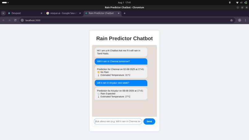
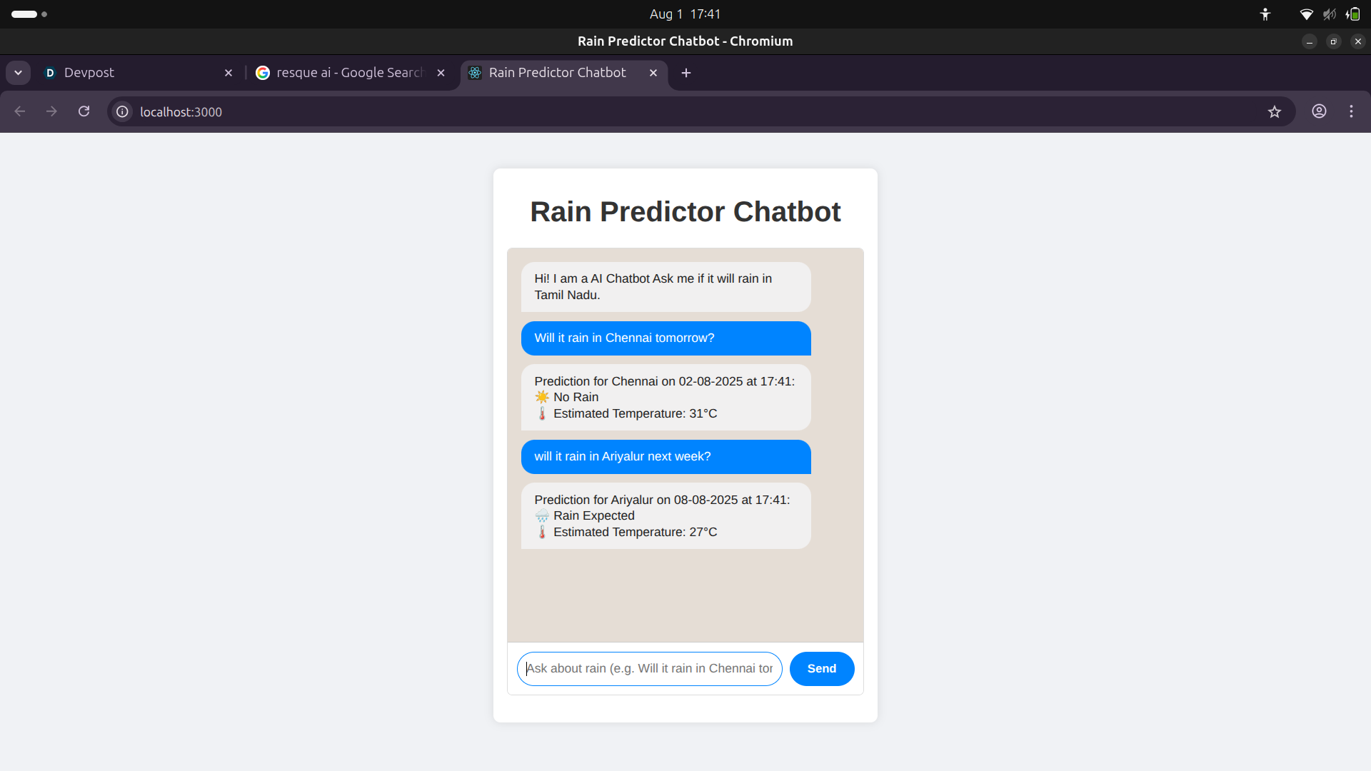
Rain detector
🌾 About the Project – RuralResQ 🔥 Inspiration Rural India is disproportionately affected by natural disasters — floods, cyclones, droughts, and landslides. Yet most disaster apps are built for cities:
They assume strong internet connectivity,
Use English or Hindi only,
Offer generic alerts instead of village-specific information,
And completely ignore community coordination needs.
We saw a huge gap: the people most vulnerable have the least access to timely, actionable disaster help.
Thus, we built RuralResQ — a robust, AI-powered disaster management platform designed for and with rural India in mind.
🚧 Problem We Tackled No hyperlocal prediction — Weather alerts are often district-wide, not village-specific.
Poor preparedness — People don’t know what to do or where to go.
No real-time coordination — Especially in low-signal or no-internet areas.
Lack of vernacular support — Critical alerts often go unread or misunderstood.
Damage goes unreported — Relief efforts are delayed due to manual damage assessments.
💡 What We Built
- Hyperlocal Risk Forecasting We trained machine learning models on rainfall, elevation, and historical disaster data.
It predicts flood-prone months and cyclone risk at village scale.
Uses Random Forests + Time-Series RNNs.
- Personalized Evacuation Planner Users input location → AI suggests best safe shelter and route.
Routes optimized via graph algorithms using elevation and road damage data.
- Community Coordination Tools Bluetooth + P2P mesh support.
Panchayat dashboard to monitor who is safe, missing, or needs help.
- Low-Bandwidth Vernacular Alerts NLP models summarize government advisories.
Auto-translated to local language (Tamil/Hindi/Bengali/etc.).
Alerts sent as SMS or voice calls.
- Damage Assessment via Vision Users take pictures of disaster-affected areas.
CV model predicts damage severity.
Auto-generates severity maps to help NGOs and govt prioritize aid.
- Offline-First Design Most data (maps, plans) is downloaded beforehand.
Everything works even during zero signal conditions.
🧪 AI/ML Stack Classification for flood month prediction (did_flood):
𝑦
𝑓 ( rainfall , humidity , soil saturation ) y=f(rainfall,humidity,soil saturation)
RNN Time Series Forecasting: Predict rainfall trends into the future.
Geospatial ML: Risk scoring using elevation, historical flooding, rainfall delta.
Graph Optimization: Shortest safe path to shelters.
NLP: Summarization and translation using transformers.
Computer Vision: Damage assessment model trained on disaster image datasets.
🛠️ Tech Stack Frontend: React Native (offline-first)
Backend: FastAPI, PostgreSQL, TensorFlow/Sklearn
ML: Pandas, Scikit-Learn, PyTorch, HuggingFace, OpenCV
Maps: Mapbox + offline caching
Offline Comms: WebRTC over Bluetooth mesh
Hosting: Render, Vercel, SQLite (for local device cache)
🧠 What We Learned Training on messy real-world data (e.g., rainfall datasets) takes patience and cleaning!
Working offline is harder than it looks — mesh networking and low-bandwidth optimizations were tricky but rewarding.
Simplicity in UI is vital when building for rural or less-literate users.
NLP summarization in vernacular languages required fine-tuning models.
🚧 Challenges Faced Finding good village-scale elevation and rainfall datasets.
Building a Bluetooth-based local network without relying on central servers.
Keeping the app lightweight yet full-featured for low-end devices.
Ensuring ML predictions make real-world sense and aren’t just numbers.
🌱 Future Scope Incorporate satellite image feeds for real-time water body analysis.
Support voice-based UI for the non-literate.
Add gamified disaster preparedness training for rural communities.
Build integrations with India Meteorological Department (IMD) APIs.

Log in or sign up for Devpost to join the conversation.