-
-
App Icon
-
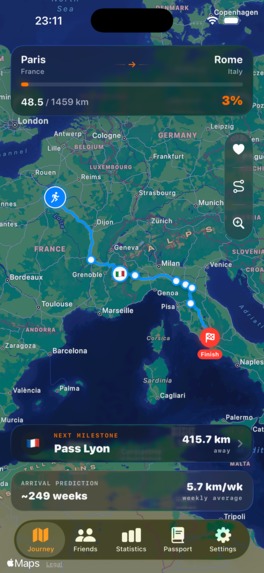
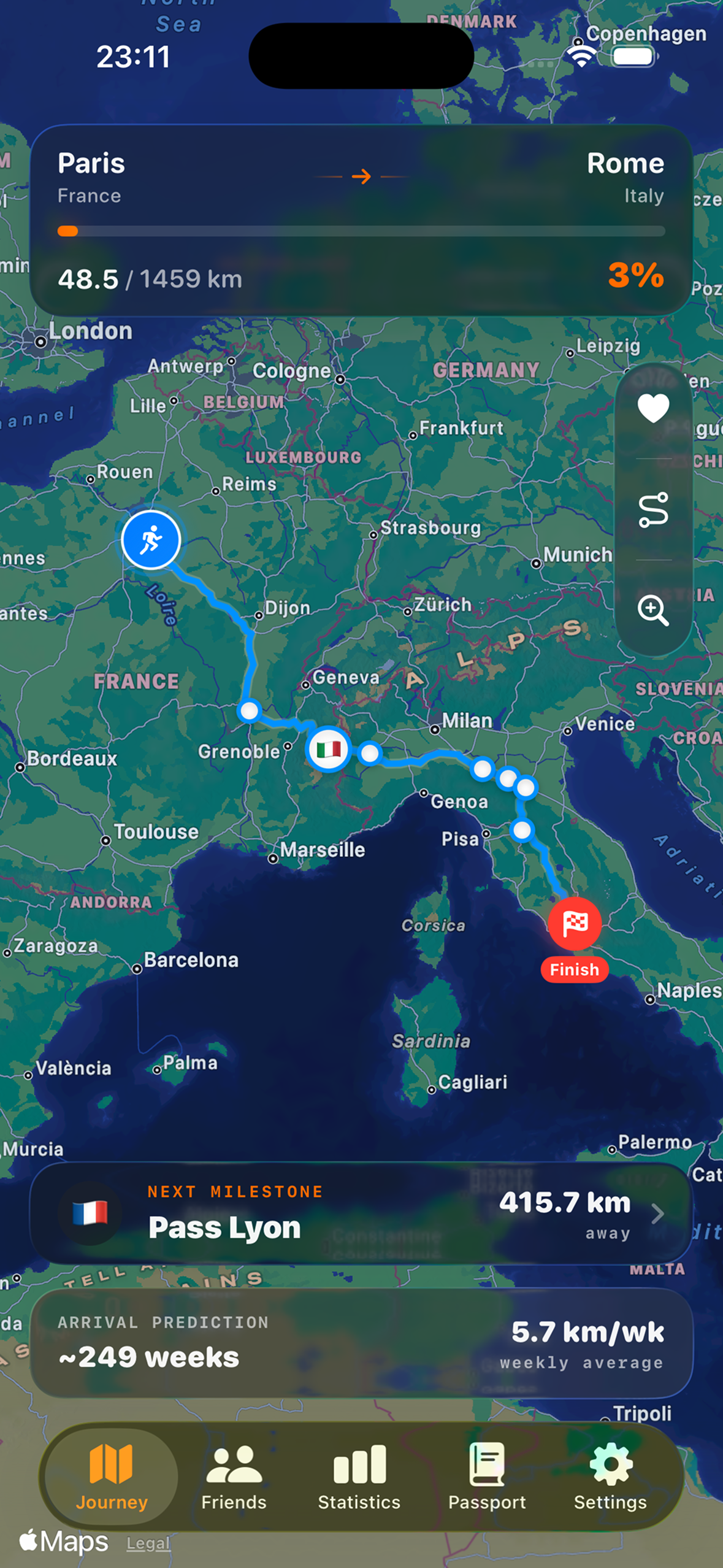
Interactive route map tracking real running distance with checkpoints
-
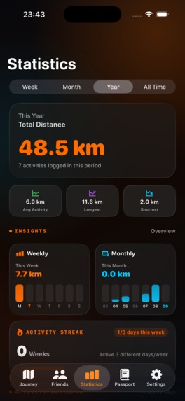
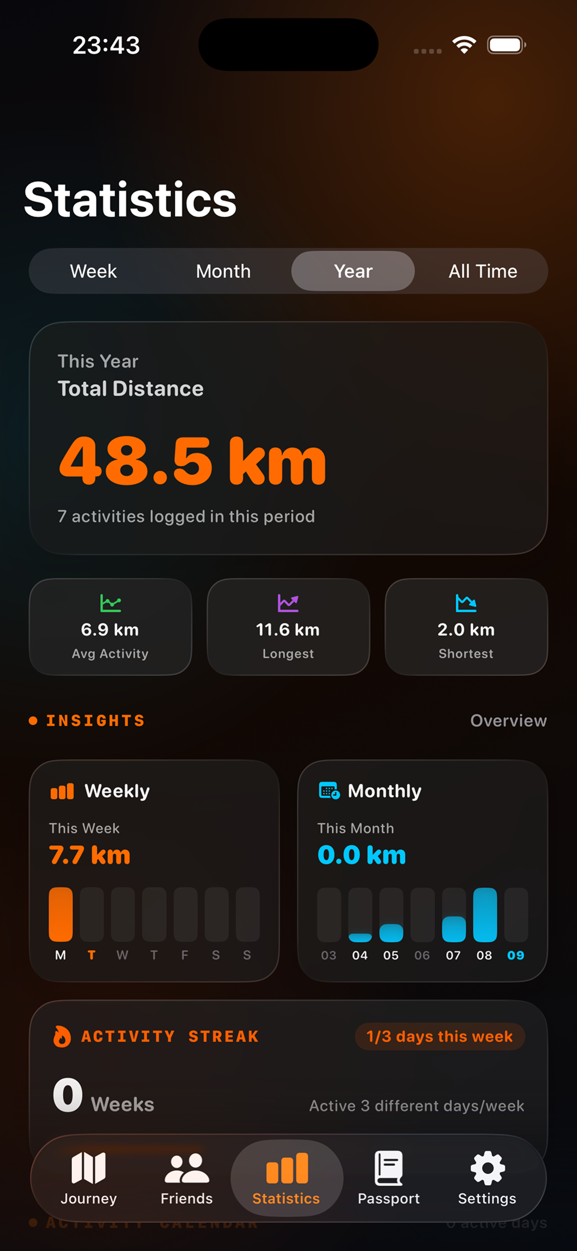
Clean running insights and activity streaks celebrating personal consistency
-
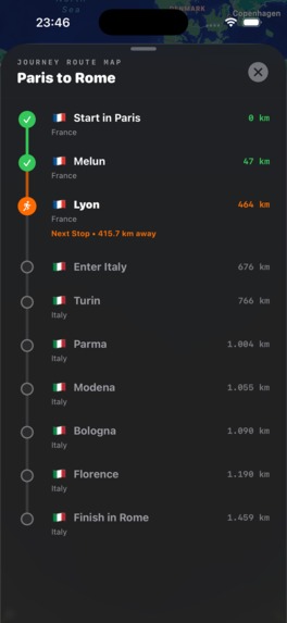
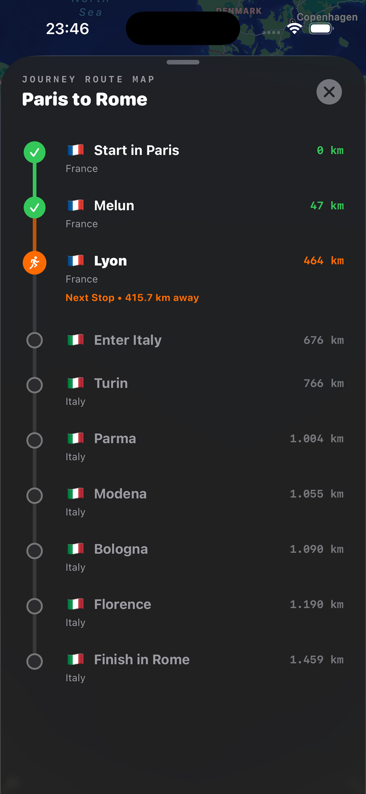
Detailed milestone overview showing unlocked cities, upcoming checkpoints, and remaining distance
-
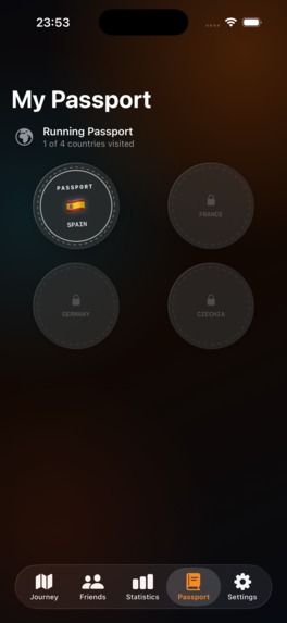
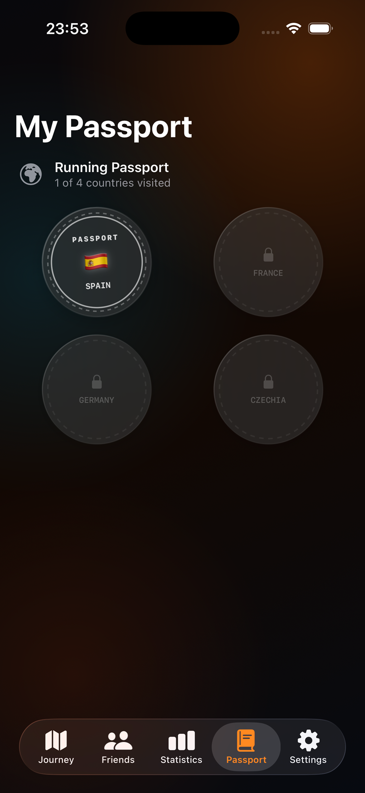
Running Passport rewarding users with unlockable country stamps as they complete virtual borders
-
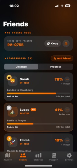
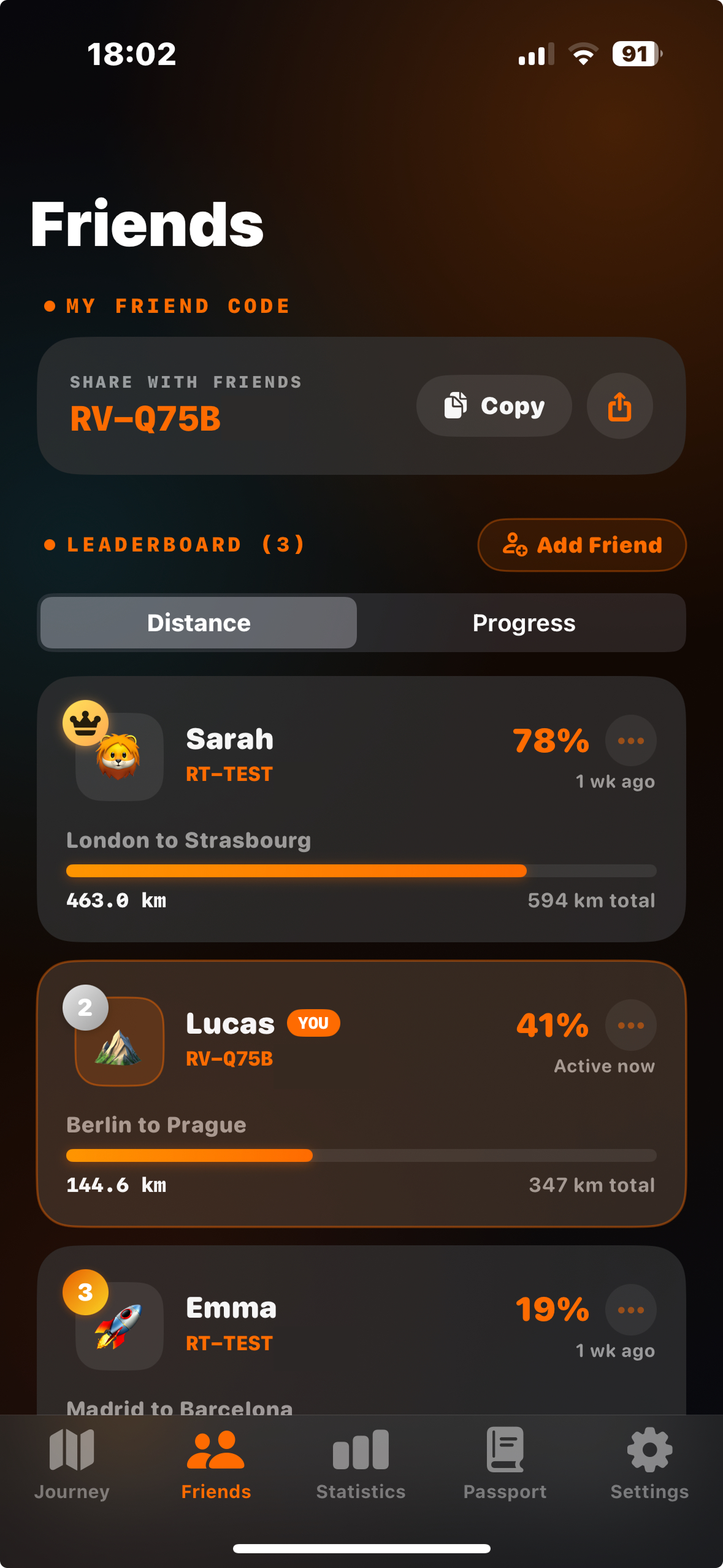
Social accountability with friend codes and live route tracking to run and progress together
-
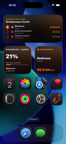
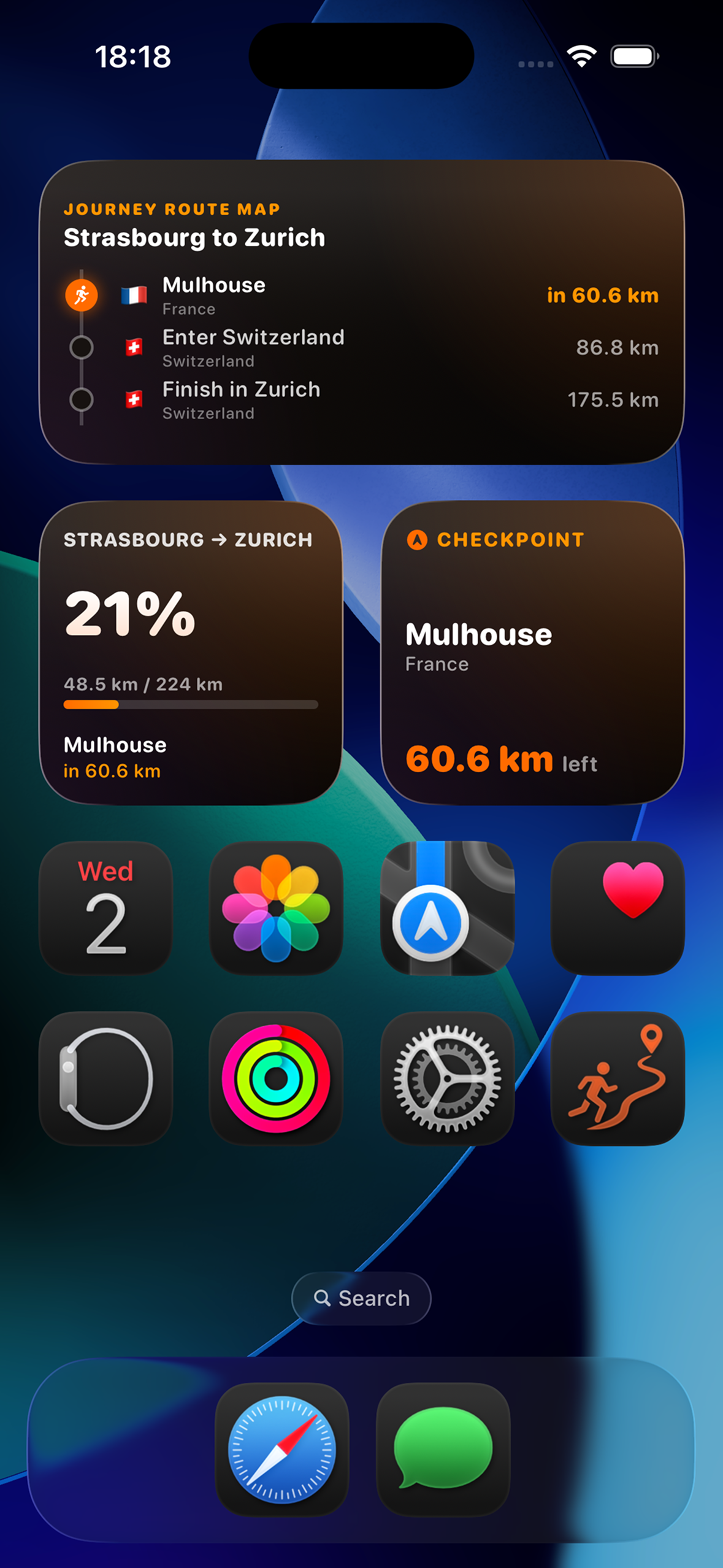
Native iOS Home Screen widgets keeping daily route progress and next checkpoint always in glance
-
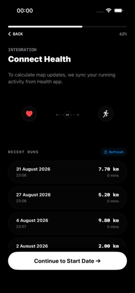
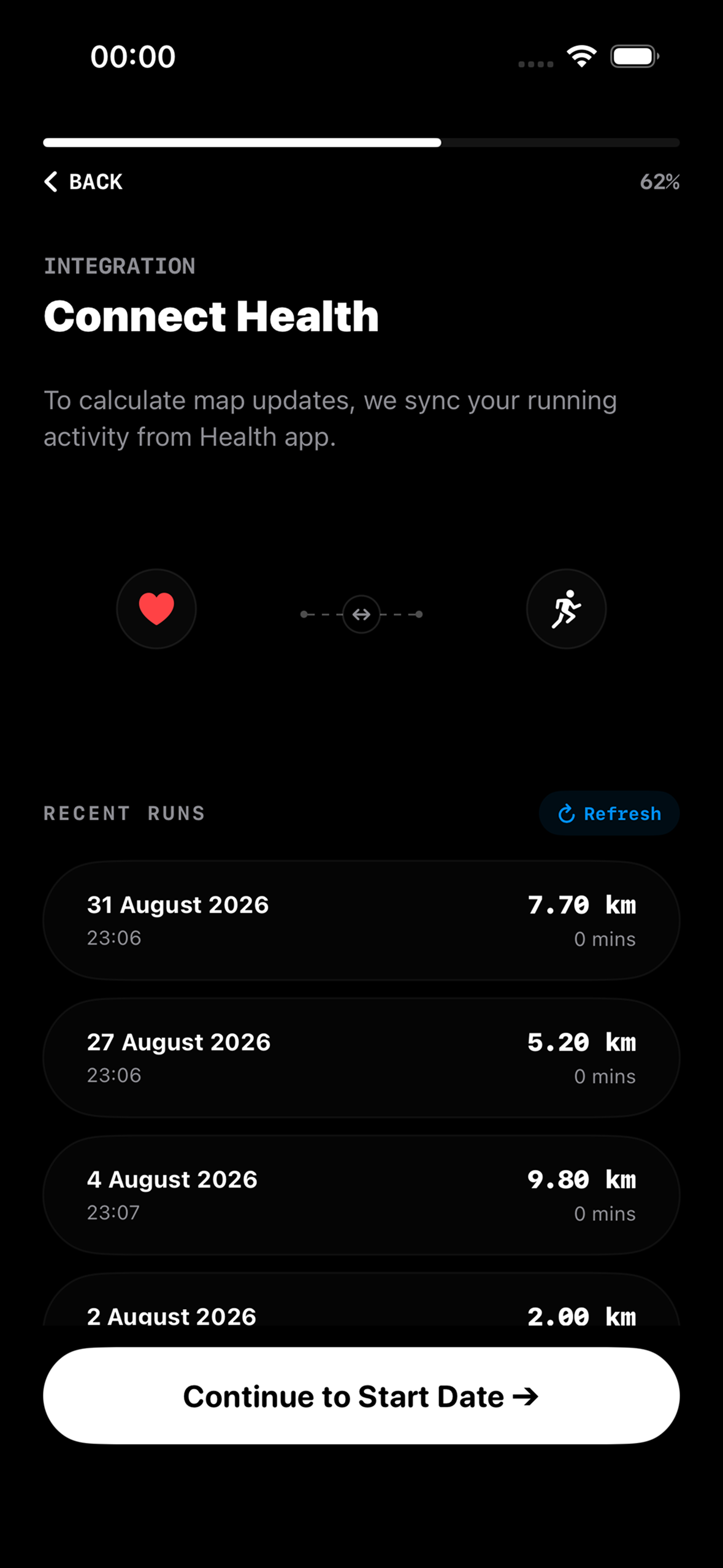
Seamless Apple HealthKit onboarding crediting past workouts toward your first virtual expedition
Inspiration
Starting a consistent running routine is intimidating. Traditional running apps focus heavily on complex charts, aggressive paces, and intimidating metrics that often trigger performance anxiety rather than genuine motivation.
We asked ourselves: What if running wasn't just about burning calories, but a peaceful mental escape?
Physical inactivity and mental burnout are two of the greatest modern health challenges. RunVoy was created to bridge fitness, mindfulness, and exploration. By transforming real-world kilometers into a mindful, gamified journey across global cities on an interactive virtual map, RunVoy gives runners an exciting, peaceful reason to lace up their shoes every single day.
What it does
- Virtual Expeditions: Pick any two cities in the world you've always wanted to travel between. RunVoy generates your custom route, and every real-world kilometer you run advances your avatar along that path, unlocking iconic checkpoints and cultural milestones along the way.
- Seamless HealthKit Sync: Automatically syncs running and walking distance in the background via Apple HealthKit, no manual logging required.
- Mindful Movement & Stress Relief: Helps users step away from screens, de-stress, build sustainable daily movement habits, and experience the mental clarity that comes with running.
- Friendly Accountability: Run alongside friends on the same virtual route, see their milestones, and cheer each other on without toxic leaderboard pressure.
- Dark Neon Aesthetic: Features a high-craft dark mode interface with neon glowing routes, smooth haptic feedback, and fluid native animations.
- Transparent Premium Access: Powered by RevenueCat, users can easily unlock unlimited global expeditions with a risk-free 7-day trial.
How we built it
- Native iOS (Swift & SwiftUI): Crafted 100% natively using modern SwiftUI declarative architecture and fluid state-driven transitions.
- Apple HealthKit: Deep integration with HealthKit queries to reliably calculate real workout distances while preserving user privacy and battery life.
- MapKit, Custom Renderers & Spatial Math: Implemented custom MapKit overlays with dynamic polyline rendering for vibrant neon routes. We integrated geospatial boundary and city datasets (from Natural Earth), developing our own lightweight geographic algorithms to accurately detect country crossings, city checkpoints, and interpolate user positions along complex multi-point coordinates.
- RevenueCat SDK: Integrated the RevenueCat iOS SDK to manage StoreKit 2 subscriptions seamlessly, handling Monthly, Annual (with 7-Day Free Trial), and Lifetime entitlements with zero backend overhead.
Challenges we ran into
- Route Generation & Natural Obstacles: Generating logical running expeditions was surprisingly complex. Should routes follow walking trails or driving paths? How do we handle water bodies and sea crossings without breaking the visual continuity of a run? We had to carefully design and curate route paths, balancing pedestrian-friendly paths on land with sensible maritime transit transitions between continents and islands.
- Handling Geospatial Boundaries & Performance: Integrating country boundaries and city checkpoint coordinates without bloating the app or lagging the UI was another big hurdle. We had to optimize spatial coordinate lookups and streamline polygon data so country transitions and checkpoint unlocks happen instantly on-device without draining the battery during the onboarding.
- Accurate Route Interpolation & Map Framing: Mapping real-world kilometers onto geographic polyline coordinates required custom distance interpolation math. We fine-tuned the map camera and viewport framing so the user's progress and upcoming checkpoints stay perfectly centered and clear on screen without sudden disorienting jumps.
Accomplishments that we're proud of
- Live on the App Store: Successfully designed, developed, polished, and shipped Build 10 to production on the Apple App Store within the Shipaton window!
- High-Craft UI/UX: Achieving a distinct dark-neon aesthetic that makes opening a running tracker feel as exciting as starting a new video game adventure.
What we learned
- The Power of "Claimed Progress": During onboarding, showing users their past distance credited toward their first milestone dramatically increases motivation and emotional investment.
- Simplicity Wins: In fitness, users don't want 50 different dials. A beautiful map, an engaging goal, and reliable sync create far more consistency.
What's next for RunVoy: Virtual Run Tracker
- Rich City & Landmark Experiences: Bringing checkpoints to life with curated photos, local cultural facts, and custom visual cards whenever a runner reaches a new city or landmark.
- Apple Watch Companion App: A dedicated watchOS companion for real-time progress glances right on the wrist during outdoor runs.
- More Global Routes & Trails: Expanding the expedition library with scenic new trails and custom distance challenges across different regions.

Log in or sign up for Devpost to join the conversation.