-
Rugged SystEMS: Navigating to the Unreachable
-
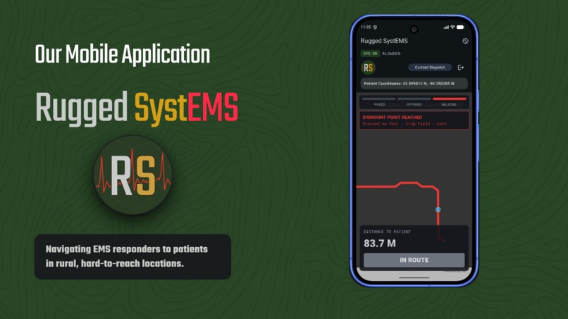
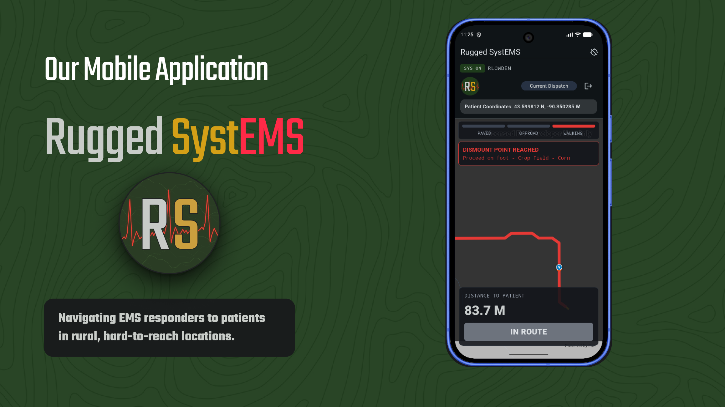
Rugged SystEMS combines GIS analysis, terrain data, and mobile routing to help responders navigate beyond the road.
-
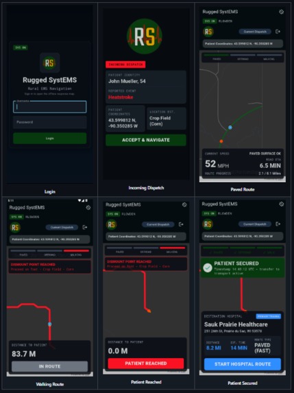
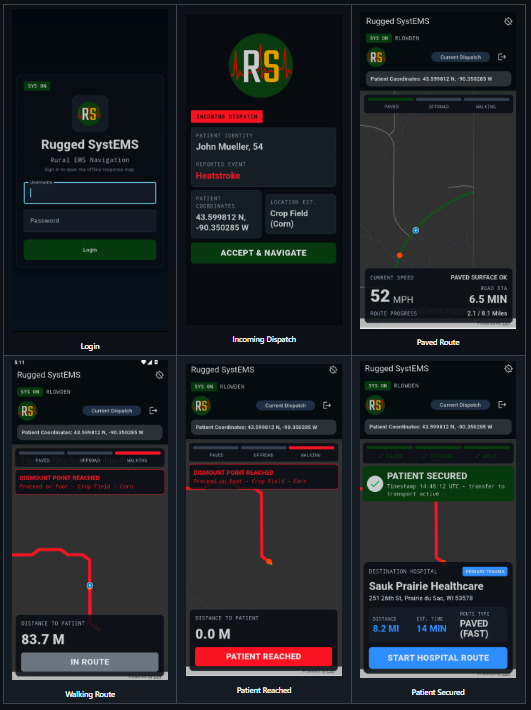
The final mobile experience: offline, terrain-aware routing directly on the device.
-
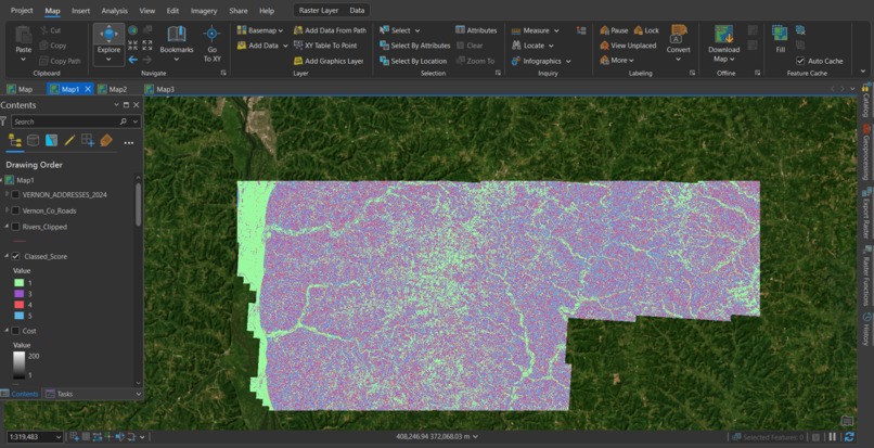
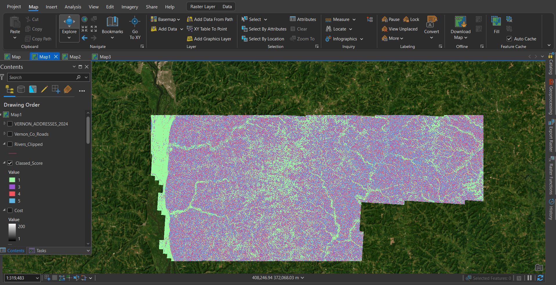
Final Terrain Cost Surface: Combined slope, road access, rivers, and ground conditions into a single travel difficulty score.
-
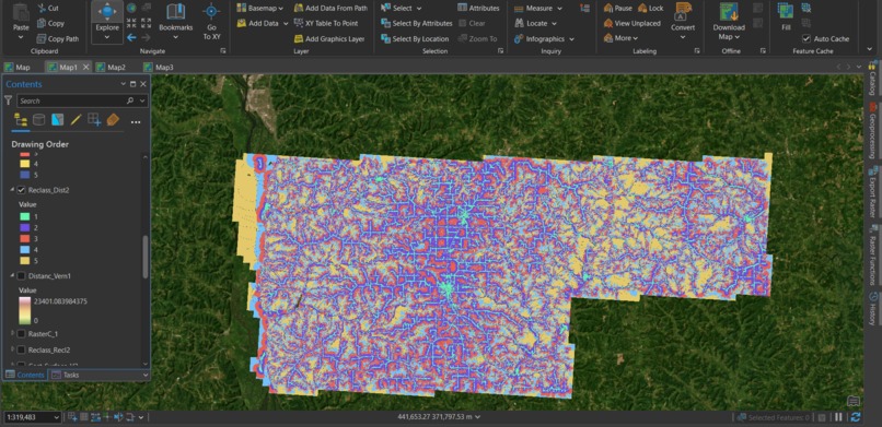
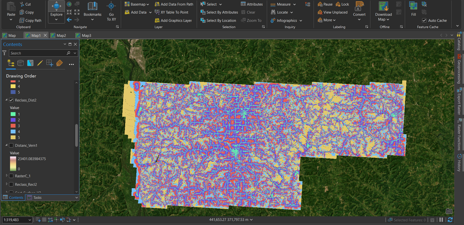
Distance From Roads Cost Layer: Areas farther from road access receive higher travel costs.
-
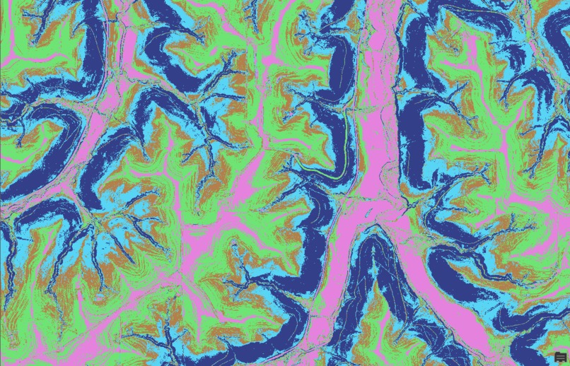
Slope Cost Layer: Steeper terrain is assigned higher movement costs for responders traveling on foot.
-
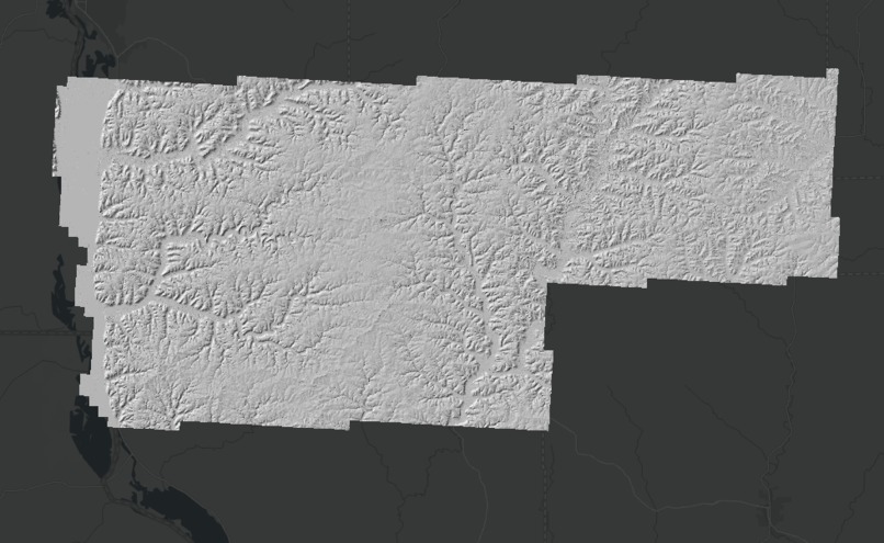
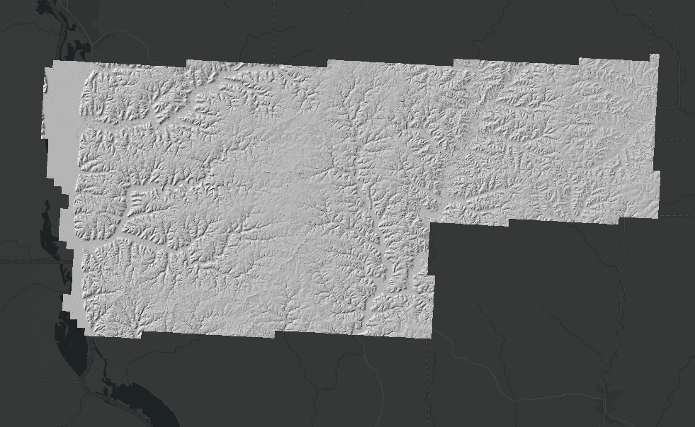
LiDAR-Derived Bare-Earth Elevation Model (60 cm Resolution) Used to Analyze Terrain in Vernon County, Wisconsin
Inspiration
The inspiration for this hackathon project came from the challenges of emergency response in rural areas. While EMS crews may be able to drive near an emergency, reaching the patient often requires leaving the road and continuing on foot through unfamiliar terrain. Steep hills, rivers, and other natural barriers can make the final stretch to a patient difficult and time-consuming. With Rugged SystEMS, we explore how terrain-aware routing can help emergency responders plan both the vehicle and on-foot portions of a rural rescue. The challenge isn't always locating the patient, it is reaching them.
What it does
We focused our project on Vernon County, Wisconsin. One of our teammate grew up around the area, while several others grew up in farming communities and were familiar with the challenges of navigating rural landscapes. This local connection helped ground the project in a real-world environment and a problem that felt personal to our team.
Rugged SystEMS helps emergency responders determine a practical route from ambulance to patient. Traditional navigation tools can guide responders close to an emergency, but the final stretch often requires traveling on foot through fields, hills, forests, or other challenging terrain. By combining road access and terrain analysis, Rugged SystEMS generates terrain-aware routes that help responders navigate both the driving and on-foot portions of a rescue. Once the required maps and data are loaded onto the device, routes can be generated entirely offline.
How we built it
Before building Rugged SystEMS, one of our teammates spoke with an EMT serving with Shawano Ambulance Service, a rural Wisconsin EMS provider, to better understand real-world emergency response challenges. He explained that responders often rely on standard consumer navigation tools to reach an incident, but those tools do not always account for the best way to access a patient. In some cases, responders may be directed to an inefficient access point or the wrong side of a property. That conversation reinforced a key idea behind our project: knowing where an emergency is does not always mean knowing the best way to reach it.
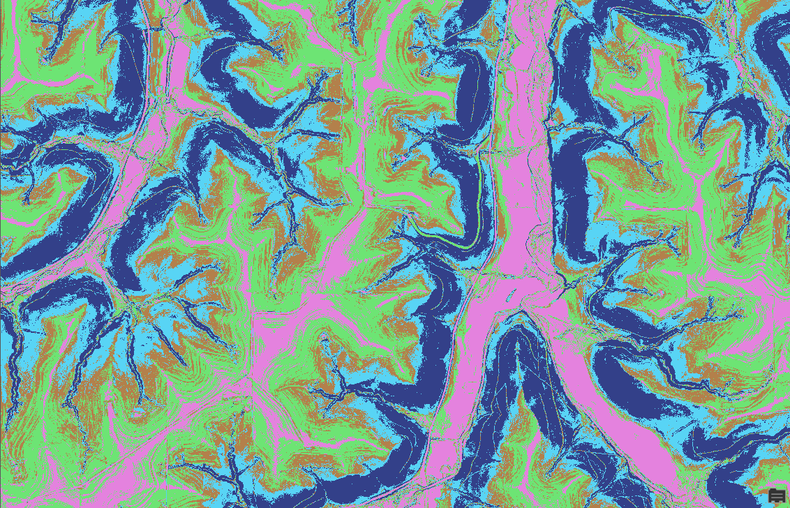
To start our build, we gathered spatial data from Wisconsin's local and state GIS portals, including roads, rivers, ground surface LiDAR Bare Earth DEM, and other terrain-related layers. Using ArcGIS Pro, we cleaned, clipped, and prepared the data for our study area. These layers were combined into a single cost surface where steeper slopes, river crossings, areas farther from roads, and rougher ground surfaces were treated as harder to travel through, while flatter and more accessible areas were treated as lower cost. On the mobile side, our team connected the GIS workflow to a Flutter and Dart app to use pathfinding logic to calculate a terrain-aware route across the cost surface. Once the app and data for an area are loaded onto the device, all routing calculations can be performed offline, allowing navigation even without an internet connection.
Challenges we ran into
One of our biggest challenges was routing performance. Terrain-based least-cost path analysis can be computationally expensive, especially when working with detailed raster datasets on a mobile device. Since Flutter SDK does not support geospatial analyst, we had to implement our own least-cost path routing algorithm. Additionally, translating real-world terrain into a meaningful cost model proved difficult. While our solution incorporates several important factors, real-world EMS navigation involves many more considerations, such as vegetation density, fences, weather conditions, private property, and other obstacles that can affect travel. Every factor had to be weighted in a way that realistically reflected how emergency responders might move through a rural landscape.
Accomplishments that we're proud of
One of our biggest accomplishments was building a mobile workflow that supports offline navigation. Once the required maps and terrain data are loaded onto the device, the app calculates the route entirely offline. Bridging GIS analysis, mobile development, and terrain-aware routing into a single workflow was something we were especially proud to achieve.
- Developed a mobile application using Flutter and Dart
- Supports offline map viewing and route generation
- Combines on-road navigation with off-road terrain-aware routing
- Generates practical routes based on terrain suitability, not just the shortest distance
What we learned
Throughout this project, we learned how to bring together design, software development, and GIS analysis into one shared workflow. Our team included members with backgrounds in business, software development, geography, and design, so one of our biggest lessons was learning how to communicate across disciplines and align everyone around a single project goal. Each team member approached the problem differently, and combining those perspectives helped us build a stronger and more thoughtful solution.
What's next for Rugged SystEMS
While our prototype focused on Vernon County, Wisconsin, rural emergency response is a challenge that exists across the United States. In the future, we want to expand Rugged SystEMS to support more rural communities where limited road access, rough terrain, and poor connectivity can slow down responders. We also want to improve the app by adding more EMS-relevant layers, such as bridges, culverts, gates, private roads, road conditions, flood-prone areas, trails, weather impacts, and local hazards. With more real-world context, Rugged SystEMS could suggest routes that are not only shorter, but also safer, more practical, and better suited for rural rescue scenarios.


Log in or sign up for Devpost to join the conversation.