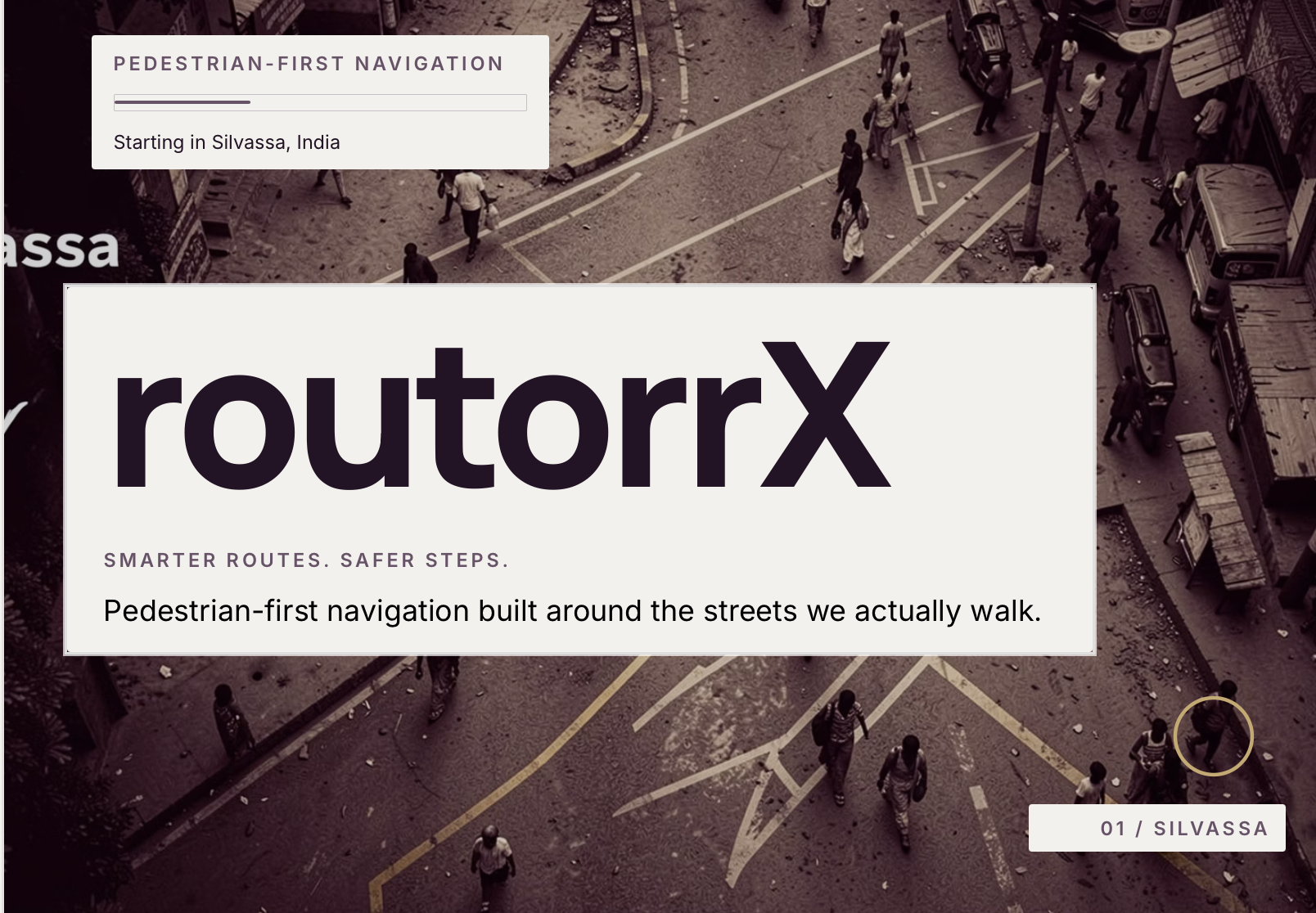
routorrX — Smarter Routes. Safer Steps.
routorrX is a pedestrian-first navigation and community safety platform built around a simple idea: the shortest route is not always the best route to walk.
Starting with Silvassa, routorrX combines pedestrian-focused routing, real road-condition information, community reporting, weather awareness, audio guidance, and privacy-conscious safety tools to make everyday walking more informed, comfortable, accessible, and safer.
Inspiration
The inspiration for routorrX came from something we experience around us every day.
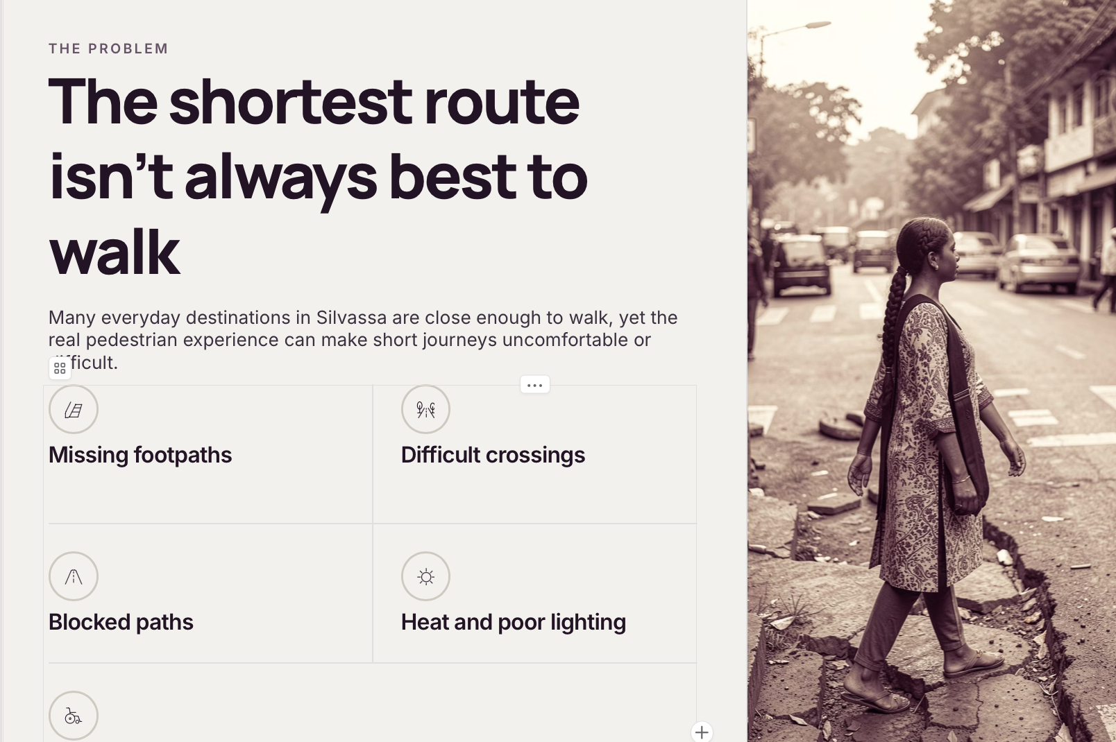
Many destinations in Silvassa are close enough to walk to, yet people often choose scooters or other vehicles even for short journeys. The reason is not always distance. Missing or discontinuous footpaths, uncomfortable crossings, obstacles, traffic exposure, heat, poor lighting, and uncertainty about the road ahead can make walking less appealing.
This made us question how navigation apps think about pedestrians.
Most navigation systems are excellent at telling us how quickly we can reach somewhere, but they don't always tell us what the journey will actually be like on foot.
That became the foundation of routorrX.
We wanted to create navigation that understands the pedestrian, not just the destination.
The Problem
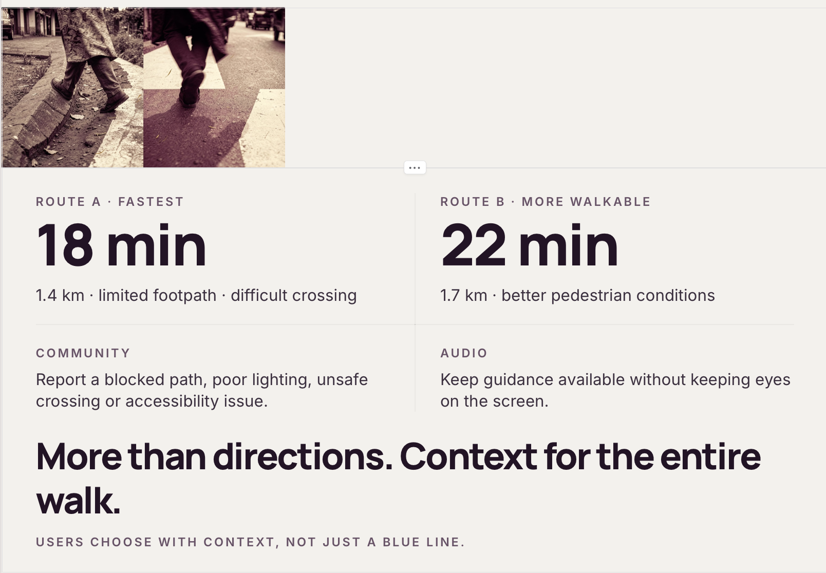
For pedestrians, two routes of almost identical distance can provide completely different experiences.
One may have better footpaths and easier crossings, while another may require walking close to traffic or navigating obstacles.
These differences matter to everyone, but they can become particularly important for women walking alone, students returning from tuition, senior citizens, people with accessibility needs, and anyone travelling through an unfamiliar area.
routorrX brings these factors into the navigation experience.
What it does
routorrX helps users understand and compare walking routes using more than distance and estimated travel time.
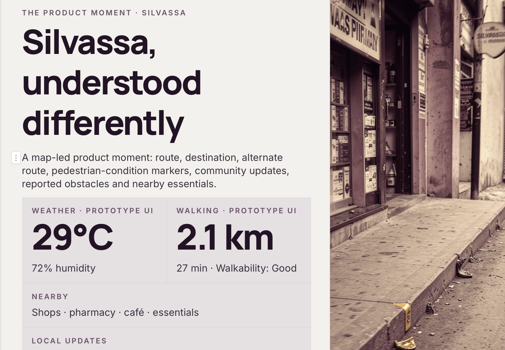
A user selects a starting point and destination. The platform can then present available routes alongside pedestrian-focused information such as footpath conditions, obstacles, crossings, reported issues, walking comfort, and other locally available information.
Instead of simply asking:
“Which route is shortest?”
routorrX helps the user ask:
“Which route works better for me?”
Core Features
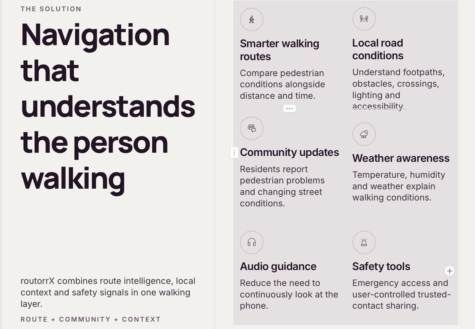
Pedestrian-Focused Route Comparison
routorrX compares walking routes using pedestrian conditions alongside conventional information such as distance and estimated time.
A slightly longer route may sometimes provide better walking infrastructure or fewer reported problems. routorrX gives users that context while leaving the final choice with them.
Local Road-Condition Information
Selected roads can contain information about:
- Footpath availability and continuity
- Broken or blocked pedestrian paths
- Difficult crossings
- Accessibility concerns
- Lighting conditions
- Obstacles
- Shade and walking comfort where documented
- Road photographs
- Location information
- Last verification date
This creates a pedestrian-focused information layer over conventional maps.
Community Reporting
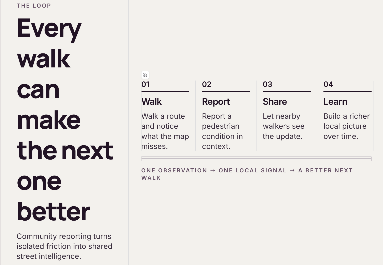
Local residents can contribute to routorrX by reporting pedestrian problems they encounter.
Reports can include a photograph, location, category, and description.
Problems such as broken footpaths, blocked pathways, poor lighting, difficult crossings, or accessibility concerns can therefore become visible to the wider community.
Information that has not yet been checked can be marked as pending verification, helping distinguish community reports from verified observations.
Audio Navigation
routorrX is designed to provide voice-guided pedestrian navigation.
Users should not need to continuously look down at their phones while walking.
Audio guidance can communicate navigation instructions and relevant information about the journey, allowing users to remain more aware of their surroundings.
Where verified information is available, audio alerts can also inform pedestrians about an upcoming difficult crossing, obstacle, or reported walking issue.
This makes navigation more convenient and can also improve accessibility for people who find visual maps difficult to follow.
Weather-Aware Walking
Weather can dramatically change the experience of walking.
routorrX can integrate current weather information to help users understand conditions before beginning their journey.
When verified information about shade or more comfortable walking sections is available, it can provide additional context when comparing routes.
Women's Safety
Women's safety is one of the most important considerations behind routorrX.
For someone walking alone to tuition, work, a market, public transport, or another everyday destination, having more information about the journey can provide greater control over route decisions.
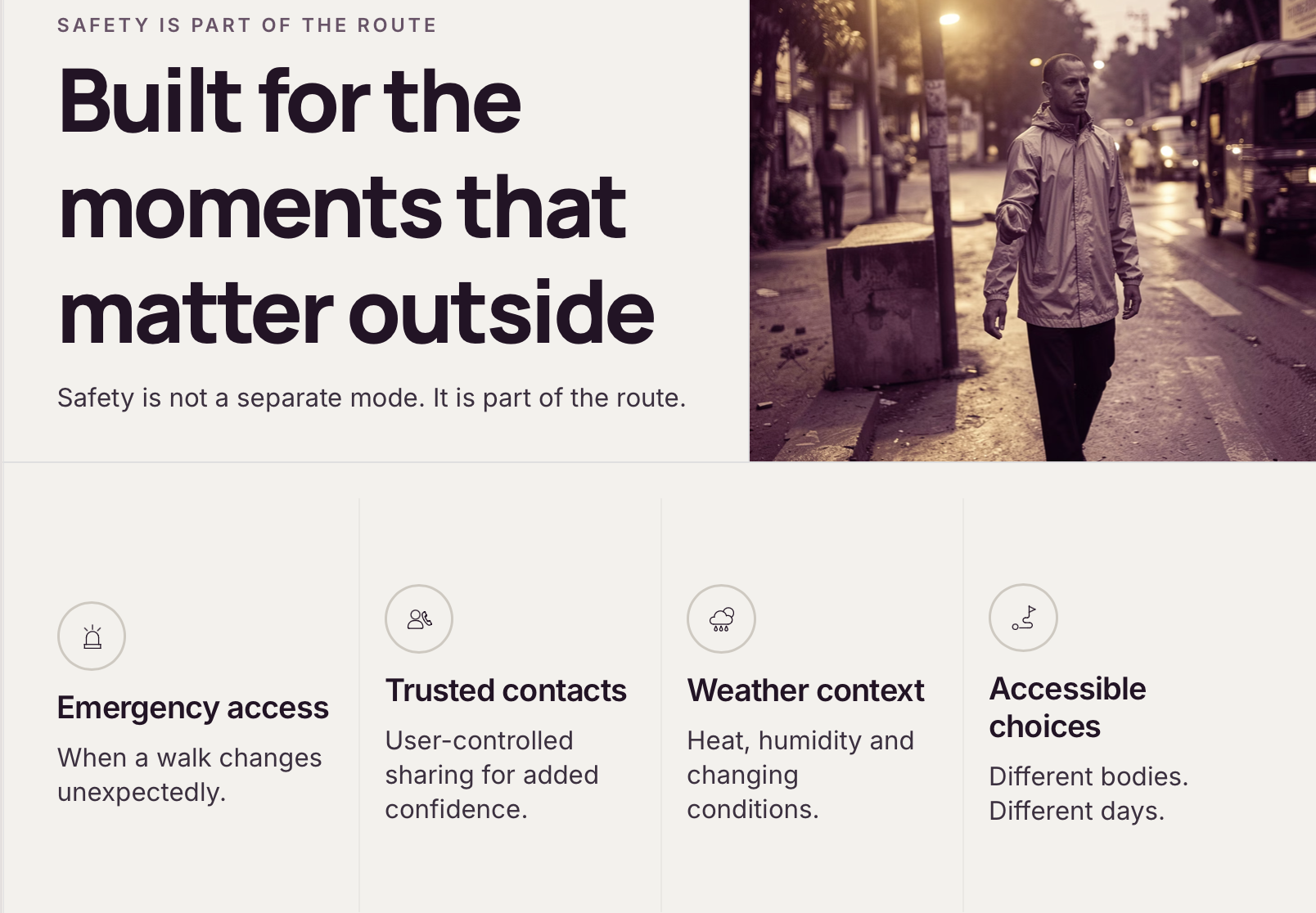
routorrX combines pedestrian-condition information with privacy-conscious personal safety tools.
Users can quickly access emergency assistance and can choose to share their journey or location with trusted contacts.
Location information remains controlled by the user rather than being publicly exposed to strangers.
Audio navigation can also reduce the need to repeatedly look at the phone while travelling.
Together, these features are designed to provide women with greater awareness and control during everyday journeys while remaining useful to the entire community.
Why routorrX is Different
routorrX isn't trying to replace conventional navigation.
It adds something conventional navigation often lacks:
local pedestrian context.
A map understands roads.
routorrX aims to understand what those roads are like to walk on.
By combining mapping with local observations, community reports, environmental information, audio assistance, and safety tools, routorrX approaches navigation from the pedestrian's perspective.
How we built it
We began with the problem rather than the technology.
We first identified the factors that influence everyday walking in Silvassa: footpaths, crossings, road conditions, weather, accessibility, personal safety, and local knowledge.
From there, we designed routorrX as a mobile-first web experience.
The project architecture uses modern web technologies and map-based interfaces to connect navigation with pedestrian-condition information.
The interface was intentionally kept minimal so important information remains understandable while someone is travelling.
Our visual identity also reflects the concept.
The X in routorrX represents an intersection — the moment where a pedestrian chooses which direction to take.
In our visual experience, the routorrX identity transitions into the map itself, connecting the brand directly to navigation.
Challenges we ran into
One of our biggest challenges was understanding how to turn subjective ideas such as “better” or “safer” into responsible pedestrian information.
We realised that we shouldn't simply label an entire road as safe or unsafe without enough evidence.
Instead, routorrX focuses on observable conditions: whether a footpath exists, whether an obstacle has been reported, what a crossing looks like, when information was verified, and what conditions users may encounter.
Another challenge was balancing functionality with simplicity.
Navigation, safety, community reporting, weather information, and audio assistance can easily create an overcrowded interface. We therefore focused on making the experience visually clean and prioritising the information pedestrians need most.
Accomplishments that we're proud of
Our biggest accomplishment is turning an everyday local observation into a broader technology concept.
Instead of building another generic navigation interface, we designed routorrX around the experience of pedestrians in our own community.
We're especially proud of combining:
navigation + local road conditions + community participation + audio guidance + accessibility + women's safety
into one connected idea.
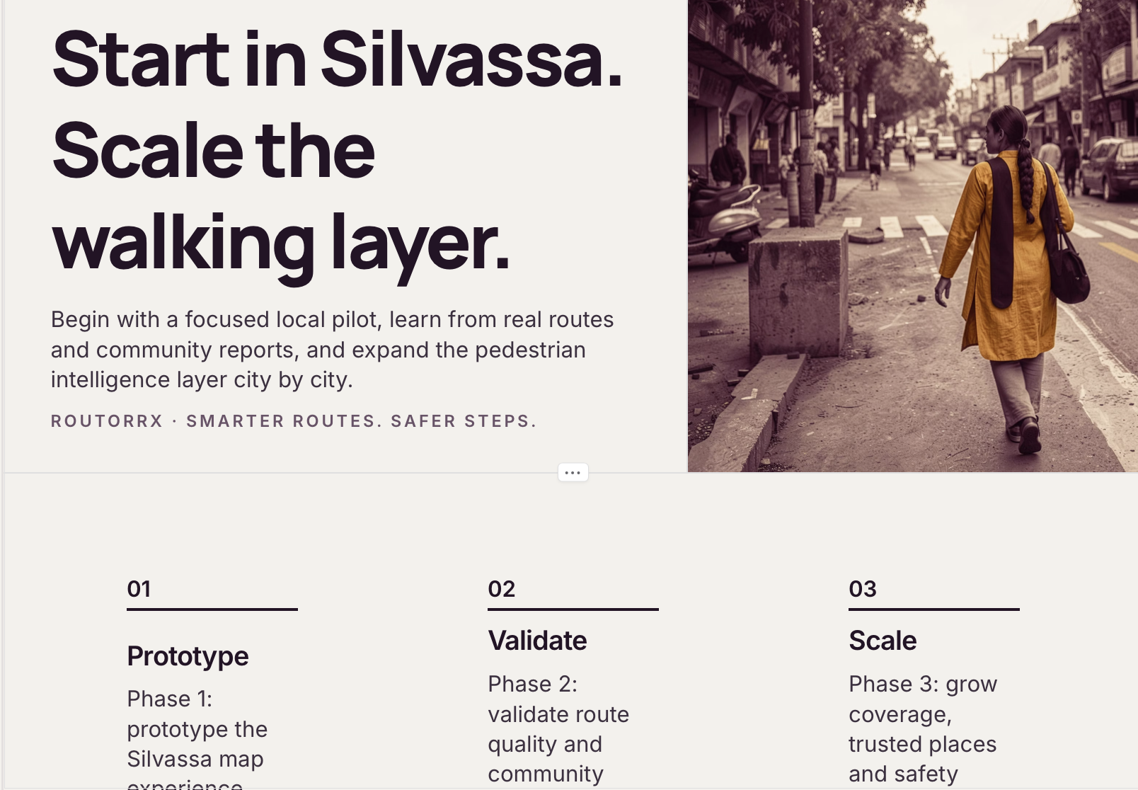
We're also proud that the concept can begin small.
routorrX doesn't require every road in an entire country to be mapped before becoming useful. We can begin with selected real routes in Silvassa, validate the approach, and expand progressively.
Community Impact
routorrX has the potential to create value beyond individual navigation.
Community reports can help identify recurring pedestrian problems.
Repeated observations about a particular crossing, damaged footpath, or accessibility issue can build a clearer picture of where improvements may be needed.
The platform can therefore become both a navigation tool and a way of understanding the pedestrian experience of a community.
Better walking experiences can also encourage people to consider walking for appropriate short journeys, supporting more active and pedestrian-friendly communities.
What we learned
Building routorrX taught us that solving a local problem requires more than adding features.
It requires understanding the people experiencing the problem.
We learned the importance of working with real local observations instead of assumptions, designing safety features around privacy, distinguishing verified information from community reports, and keeping technology understandable for ordinary users.
Most importantly, we learned that sometimes innovation doesn't require inventing an entirely new behaviour.
Sometimes it means improving something people already do every day.
Like walking.
What's next for routorrX
Silvassa is only the starting point.
The next stage of routorrX is to expand the number of surveyed pedestrian routes, improve the community verification system, strengthen route comparison, and develop richer audio navigation.
With more verified data, future versions could provide increasingly personalised walking recommendations based on preferences such as accessibility, walking comfort, route conditions, and environmental factors.
Community reporting could also help create a continuously evolving pedestrian map rather than relying entirely on static information.
After validating the model locally, the same approach could eventually expand to other towns and cities.
Our long-term vision is to create a platform where pedestrians are treated as first-class travellers and communities actively contribute to understanding their own streets.
Our Vision
Cities shouldn't only be designed around how vehicles move.
They should also understand how people walk.
routorrX begins with one community, one route, and one better-informed decision at a time.
Because navigation shouldn't only tell you where to go.
It should help you understand the journey ahead.
routorrX — Smarter Routes. Safer Steps.


Log in or sign up for Devpost to join the conversation.