-
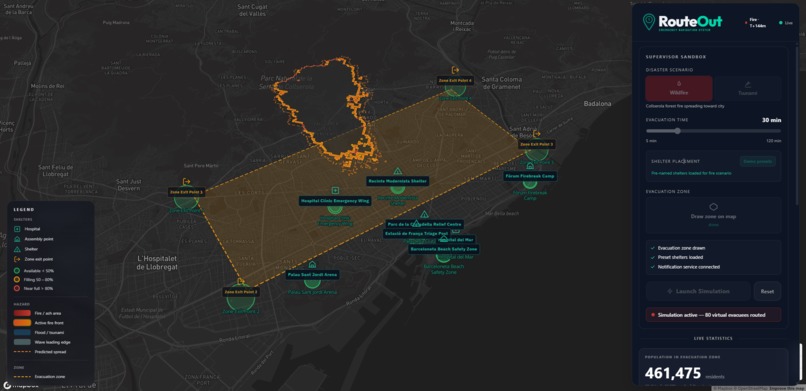
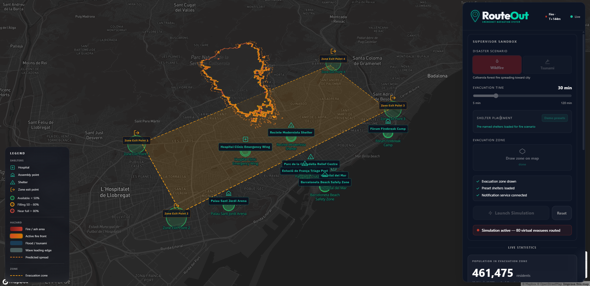
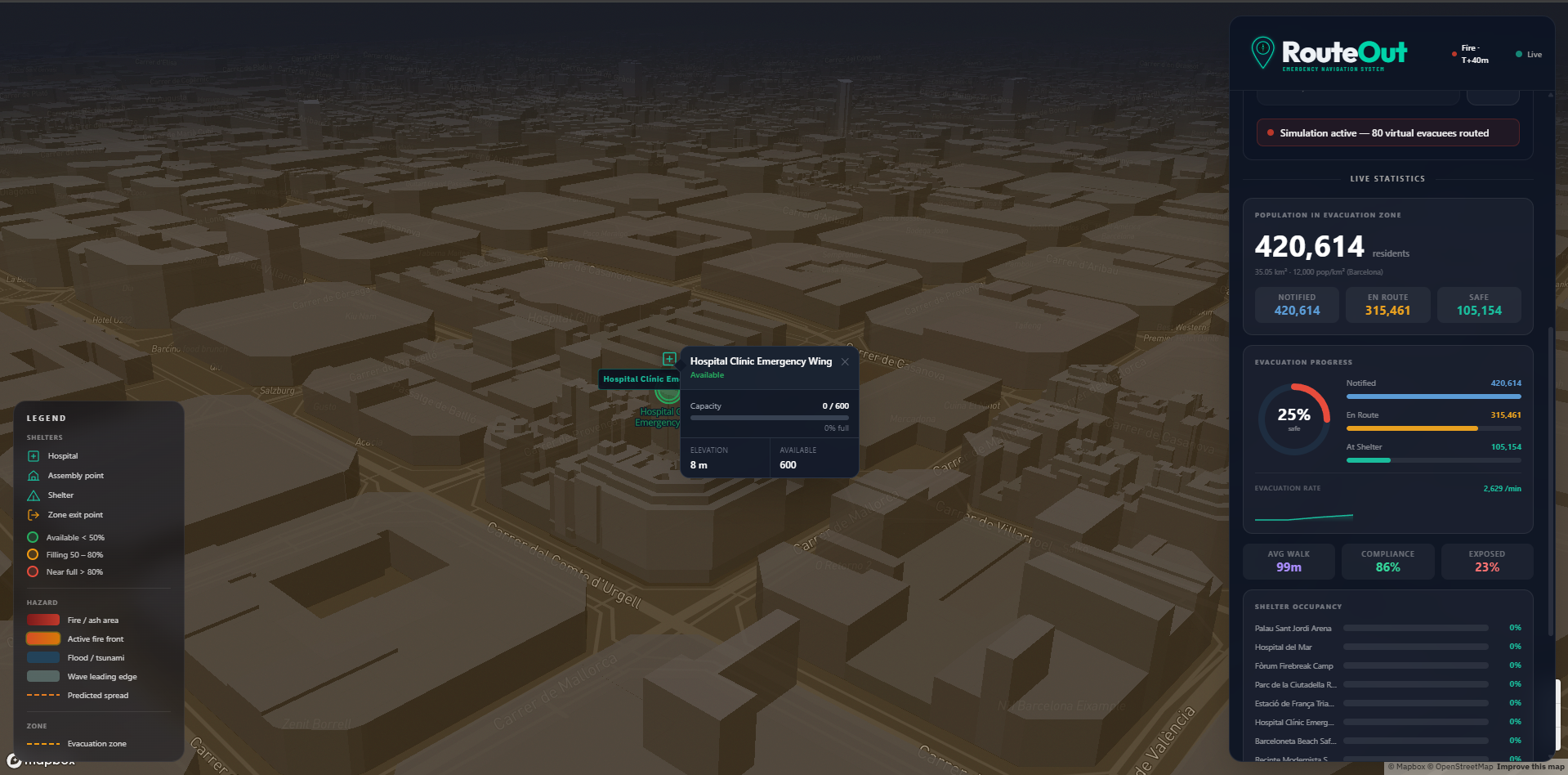
Supervisor dashboard: wildfire scenario over Barcelona, evacuation zone drawn, shelters loaded.
-
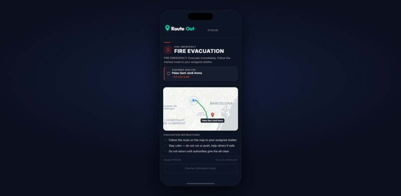
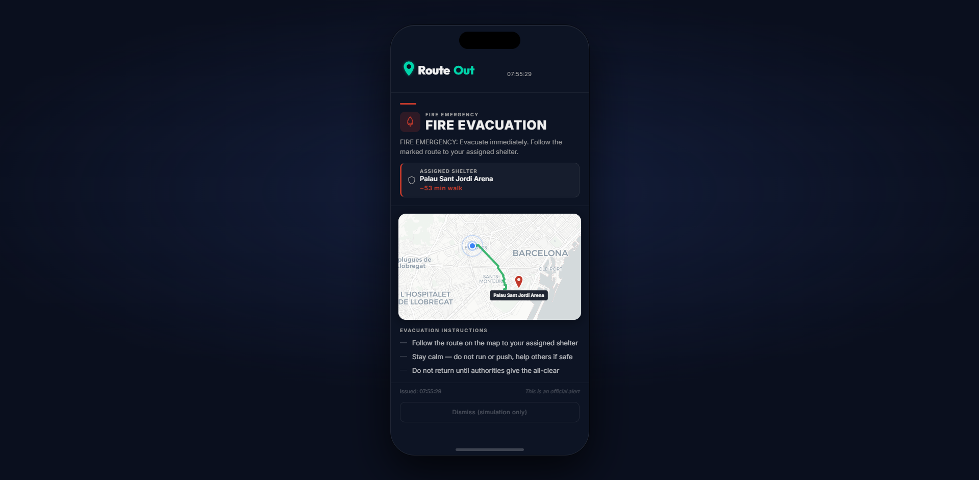
Fire evacuation alert pushed to a citizen's phone: assigned shelter, live route map, and step-by-step instructions.
-
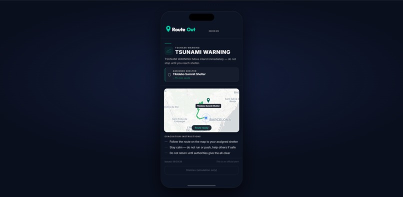
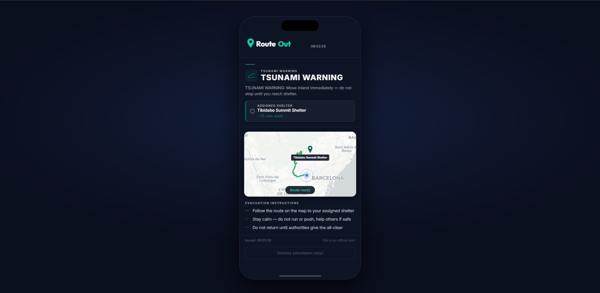
Tsunami scenario: citizen rerouted inland to Tibidabo Summit Shelter. Same system, different disaster, fully adaptive.
-
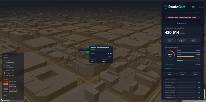
3D map view with live shelter stats updating in real time.
-
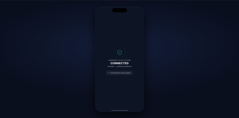
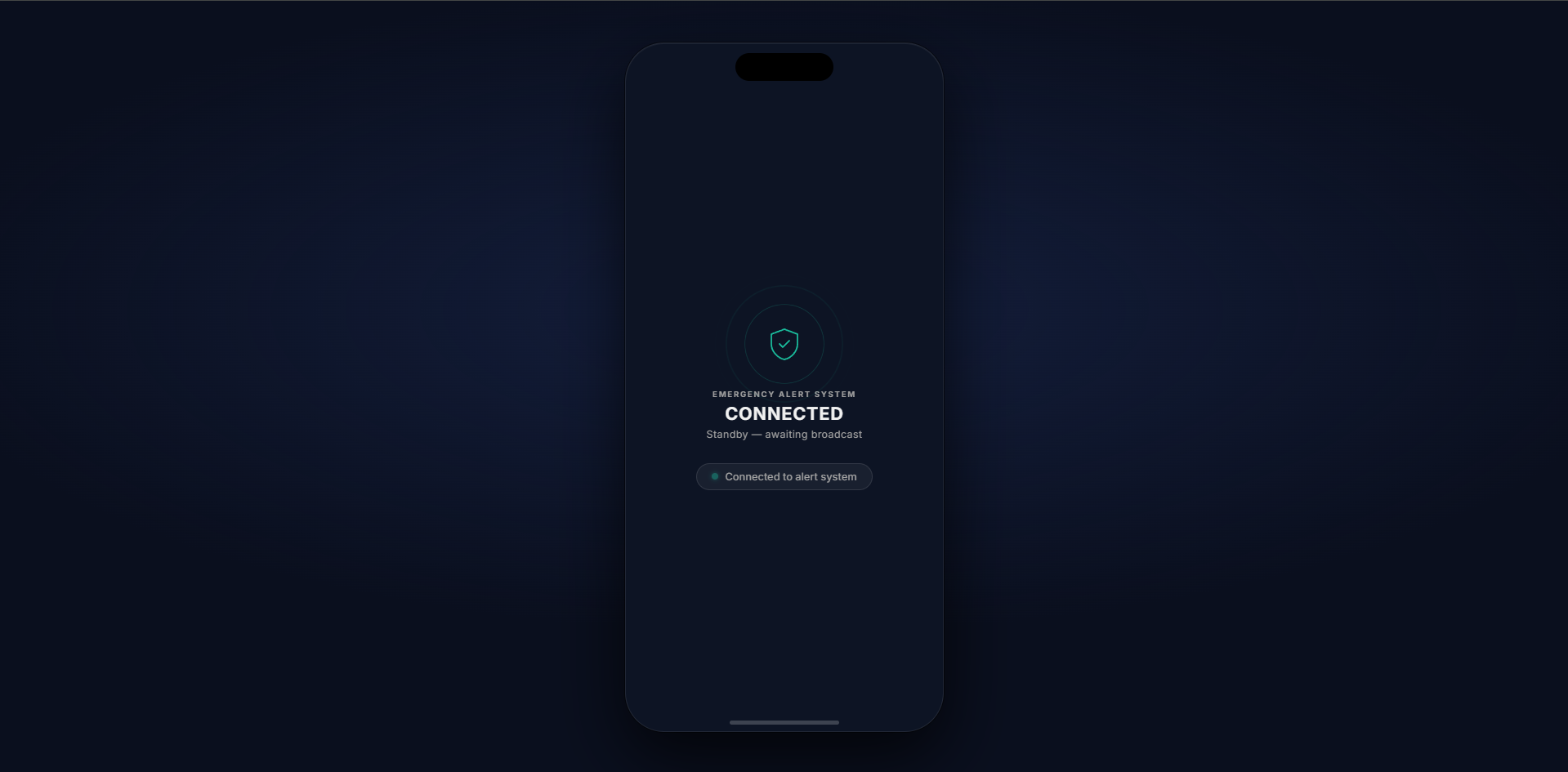
Citizen app in standby — connected to the alert system and awaiting broadcast from the supervisor dashboard.
Inspiration
In the heart of a disaster, the greatest threat isn't just the danger, it's the unknown. We were inspired by the tragic disconnect seen in recent natural disasters, where authorities have the data to save people, but citizens on the ground remain trapped in chaos and indecision. We wanted to build a bridge between high-level command and individual survival, turning panic into a guided, certain journey toward safety.
What it does
RouteOut operates on two fronts. For City Administrators, it provides a high-level command dashboard to simulate disasters and deploy evacuation strategies in real-time. For Endangered Citizens, it delivers an unmissable push notification with an algorithmically-optimized survival route, bypassing the chaos and guiding them directly to the nearest secure shelter. By connecting these two experiences, we ensure that government decisions translate directly into lives saved.
Built for the Bending Spoons Efficiency Multiplier Challenge
RouteOut was explicitly designed to answer the Efficiency Multiplier brief: taking a hard, expert-level problem (coordinating a city-scale disaster evacuation) and making it executable by a single person in under ten seconds.
The leverage is measurable. Without RouteOut, managing an evacuation for thousands of citizens requires hundreds of field officers, radio dispatches, physical signage, and manual route planning that takes hours to coordinate. With RouteOut, one administrator draws a zone on a map and presses Launch. The system simultaneously ingests live AEMET weather data, passes it through a Gemma 4 LLM synthesis layer that cross-references official bulletins and social signals into a structured hazard profile, seeds two physics simulators from those parameters, computes congestion-aware evacuation routes for every person in the zone, and pushes personalised shelter guidance to every citizen's phone, all within seconds. That is not a 10x improvement over the status quo; it is qualitatively different from it.
The platform is reusable by design. The routing engine, physics models, and push notification layer are disaster-agnostic: the same system handles wildfire and tsunami with no code changes, only a different disaster type parameter. The same architecture extends directly to industrial accidents, chemical spills, or any scenario with a spreading danger zone and a population to move. Civil defense agencies, municipal apps, or IoT sensor networks can integrate with RouteOut through its documented REST and WebSocket API without touching the core.
Most importantly, RouteOut enables non-experts to do expert-level work. Emergency management today requires specialists in GIS, routing algorithms, atmospheric physics, and mass communications working in parallel. RouteOut compresses all of that into a single browser tab. A city administrator who has never heard of A* pathfinding or cellular automata can launch a physically accurate, route-optimised evacuation simulation and reach every citizen's phone without writing a line of code.
How we built it
We engineered RouteOut as a high-performance web application built for reliability under pressure. The frontend was built with React and Tailwind CSS, using MapLibre GL JS for real-time map rendering. The backend runs on Python/FastAPI with WebSockets for zero-latency state sync to all connected clients. The evacuation routing engine uses A* pathfinding on a real Barcelona OpenStreetMap road network, with edge weights dynamically penalizing danger zones and congested paths. Disaster physics are simulated via custom cellular automata (fire spread) and BFS inundation models (tsunami). An LLM synthesis layer cross-references live AEMET weather alerts, social media signals, and emergency reports, powered by Gemma 4 via Google AI Studio, into a structured hazard profile that directly seeds the physics engine, so the AI's wind estimate changes where the fire actually spreads.
Challenges we ran into
Our biggest hurdle was the reconciliation of reality. Syncing a global admin's disaster simulation with a user's local, real-time position required complex state management to ensure zero lag, because in our use case, a 5-second delay isn't a bug; it's a life-threatening failure. We also struggled with minimalist urgency: designing a UI that is simple enough for a panicked person to understand instantly, while still providing enough data for an administrator to make city-wide decisions.
Accomplishments that we're proud of
We are incredibly proud of successfully closing the loop between government and citizen. Most apps focus on one or the other; RouteOut creates a unified ecosystem. We built two distinct, physically accurate disaster simulators from scratch: a cellular automata wildfire model with wind alignment and ember spotting, and a BFS coastal inundation model for tsunami, each producing a live, evolving danger polygon that drives every routing and rerouting decision on the map.
What we learned
We learned that building for crisis contexts forces extreme design discipline. We gained a deep appreciation for algorithmic reliability. Our A* pathfinder must never return a route through a fire or tsunami zone, so the danger-edge penalty system had to be mathematically airtight. We also discovered that minimalist design is a safety feature; when lives are on the line, every extra button is a distraction.
What's next for RouteOut
The vision for RouteOut is to become the digital pulse of civil defense. Our next steps involve integrating real-time sensor data (fire sensors, water level monitors) to automate disaster detection. We also plan to add offline-first capabilities using mesh networking, so that RouteOut continues to guide endangered citizens even when the cellular grid goes down.
Built With
- aemet-opendata-api
- fastapi
- gemma-4
- google-ai-studio
- google-genai
- maplibre-gl-js
- networkx
- node.js
- numpy
- osmnx
- python
- react
- shapely
- tailwind-css
- vite
- web-push
- websockets


Log in or sign up for Devpost to join the conversation.