-
-
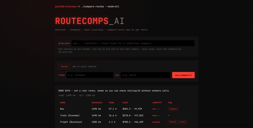
shortest · cheapest · most luxurious — compare every way to get there
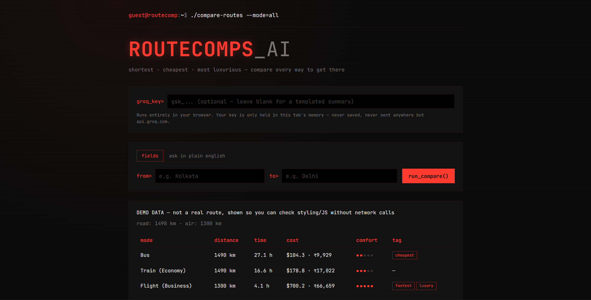
The Inspiration ROUTECOMPS_AI was born from a fatigue with modern travel aggregators—heavy, ad-laden web portals designed to upsell insurance and push sponsored hotel ads rather than give you the raw data you actually need. It is a retro, terminal-style travel intelligence tool that calculates and compares multiple modes of transport between two locations. Specifically, it: Compares Travel Options Side-by-Side: Evaluates routes across different transit types (such as buses, trains, and flights) to break down distance, travel time, estimated cost (in USD and INR), and comfort levels. Identifies Key Highlights: Automatically tags routes based on whether they are the fastest, cheapest, or most luxurious options. Generates AI Summaries: Integrates with Groq to provide natural language insights and reviews of your journey options (with options to bring your own API key or use built-in templates). Runs Client-Side: Processes geography via OpenStreetMap Nominatim and routing data through OSRM directly within your browser tab.
Frontend: Built with vanilla HTML, CSS, and JavaScript wrapped in a retro, hacker-chic terminal interface. Geocoding & Routing: Powered by OpenStreetMap Nominatim for location lookup and OSRM for distance and routing calculations. AI & Summaries: Uses Groq for natural language route insights, with built-in fallbacks for templated summaries if no API key is provided. Deployment: Hosted directly on Vercel as a lightweight, client-side application.
Browser Sandboxing & Deployment:Getting the application out of localized chat environments and into a real, live browser tab with proper styling and network calls.
- Network Integration Limits: Handling external API calls seamlessly client-side across OpenStreetMap Nominatim for geocoding and OSRM for routing without CORS or timeout issues.
- Fallback Systems: Designing robust client-side templates so the app remains fully functional and visually striking even if a user doesn't provide a Groq API key.
Successfully designing and deploying ROUTECOMPS_AI from scratch into a fully functional, production-ready web app stands as a proud achievement. Bringing this concept to life required bridging complex moving parts—coordinating open-source geocoding via OpenStreetMap Nominatim, distance calculations through OSRM, and natural language insights via Groq API—into a sleek, client-side application. Overcoming deployment hurdles and sandbox constraints to transform a retro-terminal design concept into a responsive, blazing-fast live platform highlights both technical grit and creative execution.
Client-Side Architecture:Learned how to build a fully functional, zero-backend web application that handles heavy lifting (geocoding, routing calculations, and AI integration) entirely within the user's browser tab API Integration:Gained experience handling asynchronous cross-origin requests and data flows with open-source tools like OpenStreetMap Nominatim and OSRM, alongside Groq for natural language text generation. Robust Fallbacks: Understood the importance of designing graceful fallback systems—such as default templated summaries—so applications remain fully functional even when optional third-party API keys are missing. UI/UX Craftsmanship: Mastered styling specialized themes, specifically crafting a retro developer terminal look with clean dark-mode interfaces, high-contrast layouts, and responsive multi-modal data tables.
What's Next for ROUTECOMPS_AI
Live Multi-Modal Aggregation: Integrate live ticketing and schedule APIs (such as train schedules and real-time flight fares) instead of relying solely on algorithmic distance estimates and fixed currency conversion rates. Smart Route Optimization: Add support for multi-stop journeys, layover calculations, and custom waypoint detours directly within the terminal interface. Collaborative Trip Planning:Enable users to share generated route comparison terminal states via unique session links or export them cleanly as markdown/JSON. Expanded Transit Modes: Introduce specialized modes like carpooling, electric vehicle (EV) charging routing, and ferry connections for broader global travel utility.
Built With
- and-custom-table-layouts.-external-apis-&-services:-integrates-openstreetmap-nominatim-for-geocoding
- and-javascript-without-relying-on-heavy-frontend-frameworks-(like-react
- css
- flask
- groq
- html
- javascript
- monospace-typography
- or-angular)-to-keep-it-ultra-lightweight-and-fast.-styling:-custom-retro-terminal-css-styling-featuring-high-contrast-dark-mode-aesthetics
- osrm-for-routing-calculations
- vercel
- vue

Log in or sign up for Devpost to join the conversation.