-
Main Page
Inspiration
Every second counts during an emergency. Delays in locating and dispatching the nearest responder can have life-altering consequences. Our motivation was to create a solution that minimizes response times, making communities safer and ensuring help arrives as quickly as possible.
What it does
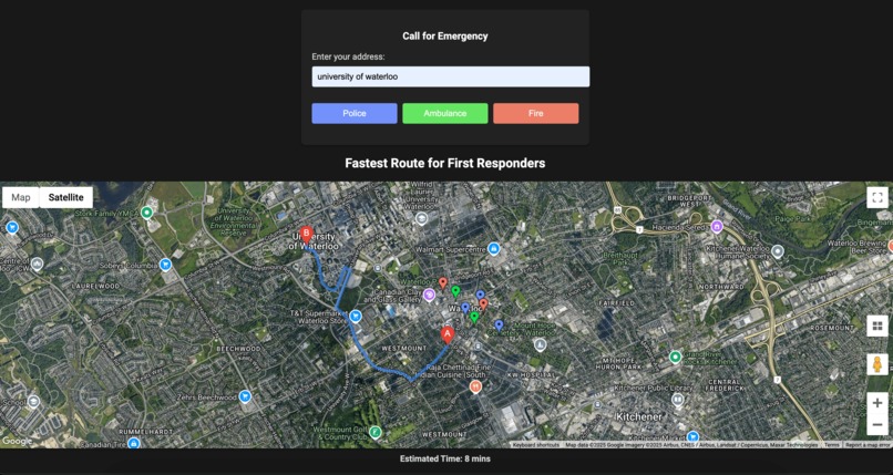
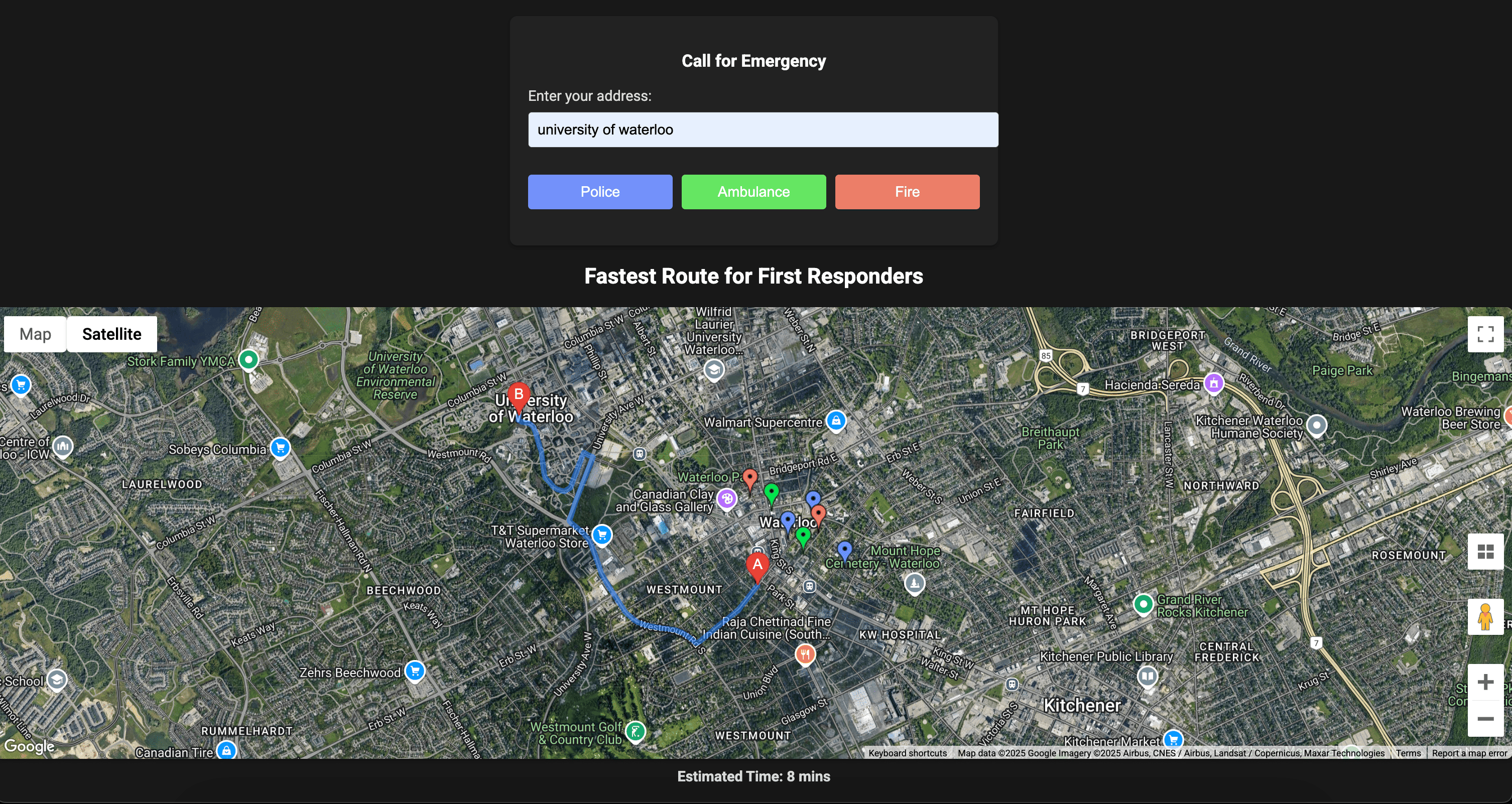
The Route Optimizer for First Responders identifies the closest emergency vehicle—whether police, ambulance, or fire truck—and maps out the fastest route to the caller's location. It streamlines coordination in emergencies, ensuring optimal resource allocation and response time.
How we built it
We combined Google Maps API for real-time mapping, JavaScript for dynamic functionalities, and HTML/CSS for user interaction. Using geolocation and custom markers, the platform calculates distances and displays optimized routes for each scenario.
Challenges we ran into
- Fine-tuning the distance calculations for accuracy.
- Ensuring seamless integration of APIs for real-time route updates.
- Balancing simplicity for the user interface with backend complexities.
Accomplishments that we're proud of
- Successfully built a responsive and intuitive map interface.
- Optimized routing logic for real-world use cases.
- Developed a scalable solution capable of incorporating future features like live traffic data.
What we learned
- The critical role of user experience in emergency tools.
- Effective ways to use mapping APIs to solve real-world problems.
- The importance of cross-functional teamwork and iterative problem-solving.
What's next for Route Optimizer for First Responders
- Incorporate live traffic data for more accurate route optimization.
- Expand to include disaster response vehicles like rescue boats or drones.
- Integrate AI for predictive dispatching based on historical data.
Built With
- apis
- bigquery
- css
- flask
- google-cloud
- google-maps
- html
- python

Log in or sign up for Devpost to join the conversation.