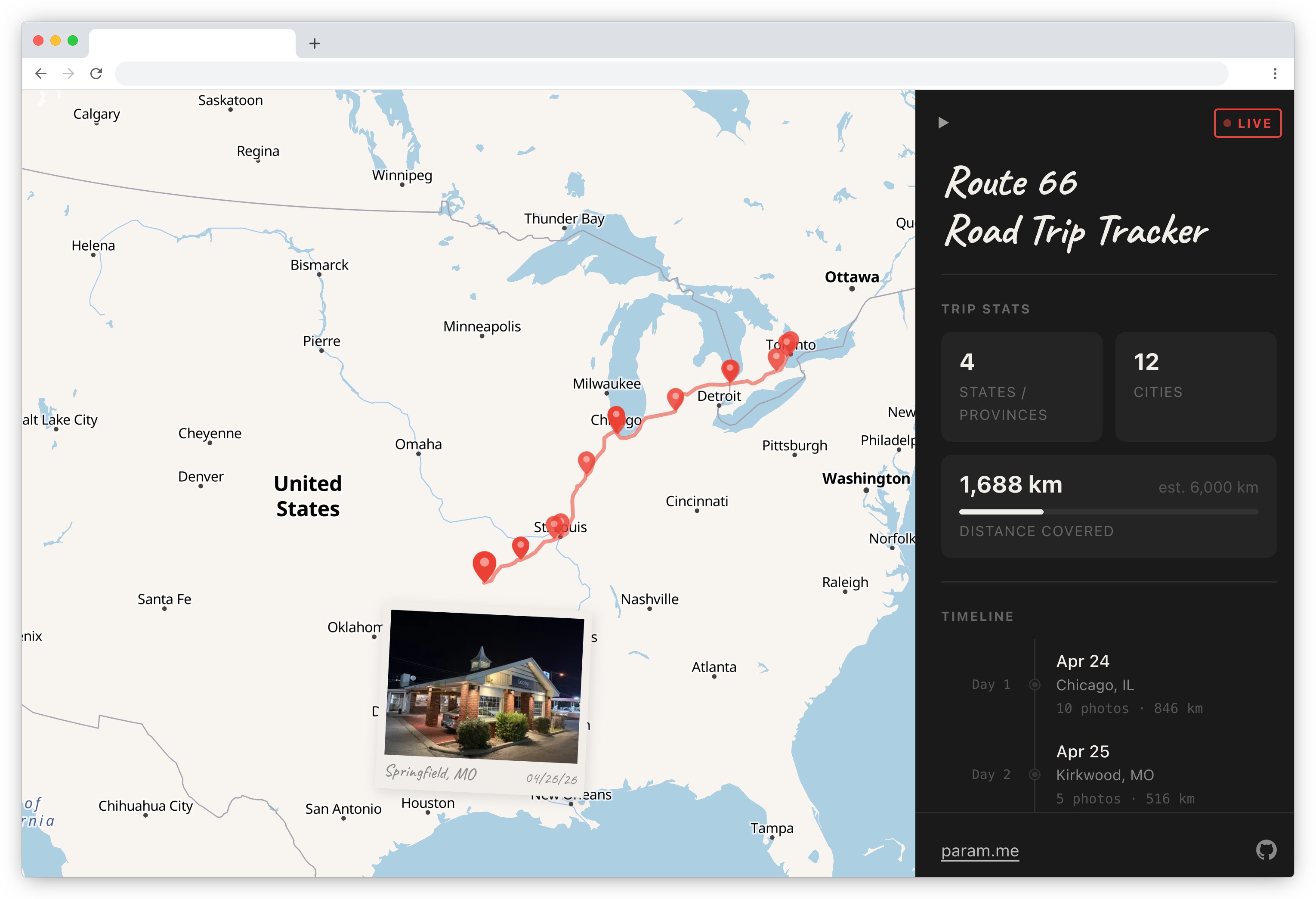
Route 66 Road Trip Map
A live tracker for my road trip from Toronto to SF via Route 66
Syncs with photos from my phone to generate an interactive map with polaroid popups, an interpolated route, a day-by-day timeline, and live trip status. Copy this for your own trips!

Built with React + MapLibre GL JS + OpenFreeMap tiles
Set up for your own trip
1. Fork the repo
Fork this repo on GitHub.
2. Enable GitHub Pages
Go to your repo's Settings → Pages and set the source to GitHub Actions.
3. Enable Actions
GitHub Actions runs the scripts to extract photo metadata and generate the route between photos.
4. Add your OpenRouteService API key
Sign up for a free key at openrouteservice.org, then add it as a repository secret named ORS_API_KEY under Settings → Secrets and variables → Actions → New repository secret.
This is used to snap your route to actual roads. Without it, the map falls back to straight lines between photos.
5. Update src/trip.config.js
Optional, modify these to edit trip metadata as well as to personalize the look and feel of the tracker
6. Add your photos and push
Drop GPS-tagged photos (JPG, HEIC, or PNG) into public/photos/ and push to main. Any photo taken on a modern iPhone or Android with location enabled will have GPS data.
GitHub Actions handles the rest automatically: it extracts EXIF metadata, generates thumbnails, fetches the road-snapped route, builds the site, and deploys it to GitHub Pages. The route also re-fetches hourly — useful if you're adding photos mid-trip.
Local development
You don't need to do any of this — CI handles everything automatically when you push. This is just for previewing changes locally.
npm install
npm run dev
To process photos locally (useful for previewing before pushing):
Create .env at the root of the repo and add ORS_API_KEY=your_key.
npm run process       # extract EXIF, generate thumbnails → src/data/photos.json
npm run update-route  # fetch road-snapped route from ORS → src/data/route.json
Tech stack
| Piece | What it does |
|---|---|
| React + Vite | UI framework and build tool |
| MapLibre GL JS | WebGL map rendering |
| OpenFreeMap | Free map tiles (no API key needed) |
| OpenRouteService | Road-snapped routing (free tier) |
| Nominatim | Reverse geocoding (free, no key needed) |
| sharp + heic-convert | Thumbnail generation and HEIC conversion |
| exifr | EXIF metadata extraction |
| GitHub Pages | Hosting |
| GitHub Actions | CI/CD: process photos, fetch route, deploy |
Project structure
public/photos/        ← drop your photos here
src/
  data/
    photos.json       ← generated automatically by CI
    route.json        ← generated automatically by CI
  components/
    WorldMap.jsx      ← MapLibre map, markers, route layers
    Polaroid.jsx      ← photo card component
    Tack.jsx          ← map marker pin
  App.jsx             ← main app, sidebar, timeline, state
scripts/
  process.js          ← photo processing script
  update-route.js     ← route fetching script
.github/workflows/
  deploy.yml          ← build + deploy on push
  update-route.yml    ← re-fetch route every hour
Notes
- Photos without GPS are included in the sidebar timeline but not plotted on the map
- HEIC files are automatically converted to JPG during processing; the originals are not deleted
- The route is cached by a hash of your waypoints — it only re-fetches from ORS when photos change
- The free ORS tier supports up to ~50 waypoints per request; the script batches automatically for longer trips
- Sidebar stats (Photos, Cities, States/Provinces) come from
photos.json; Distance Covered comes fromroute.json. If ORS has never succeeded, the stats section is hidden. If ORS fails on a re-run, the previous distance and route are shown unchanged — stale but consistent

Log in or sign up for Devpost to join the conversation.