-
-
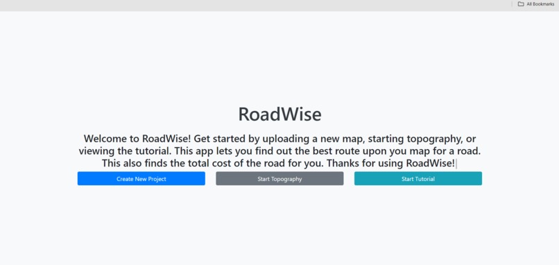
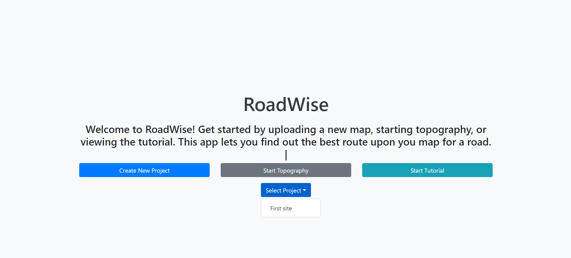
Home Page
-
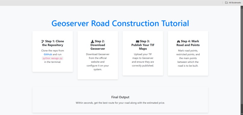
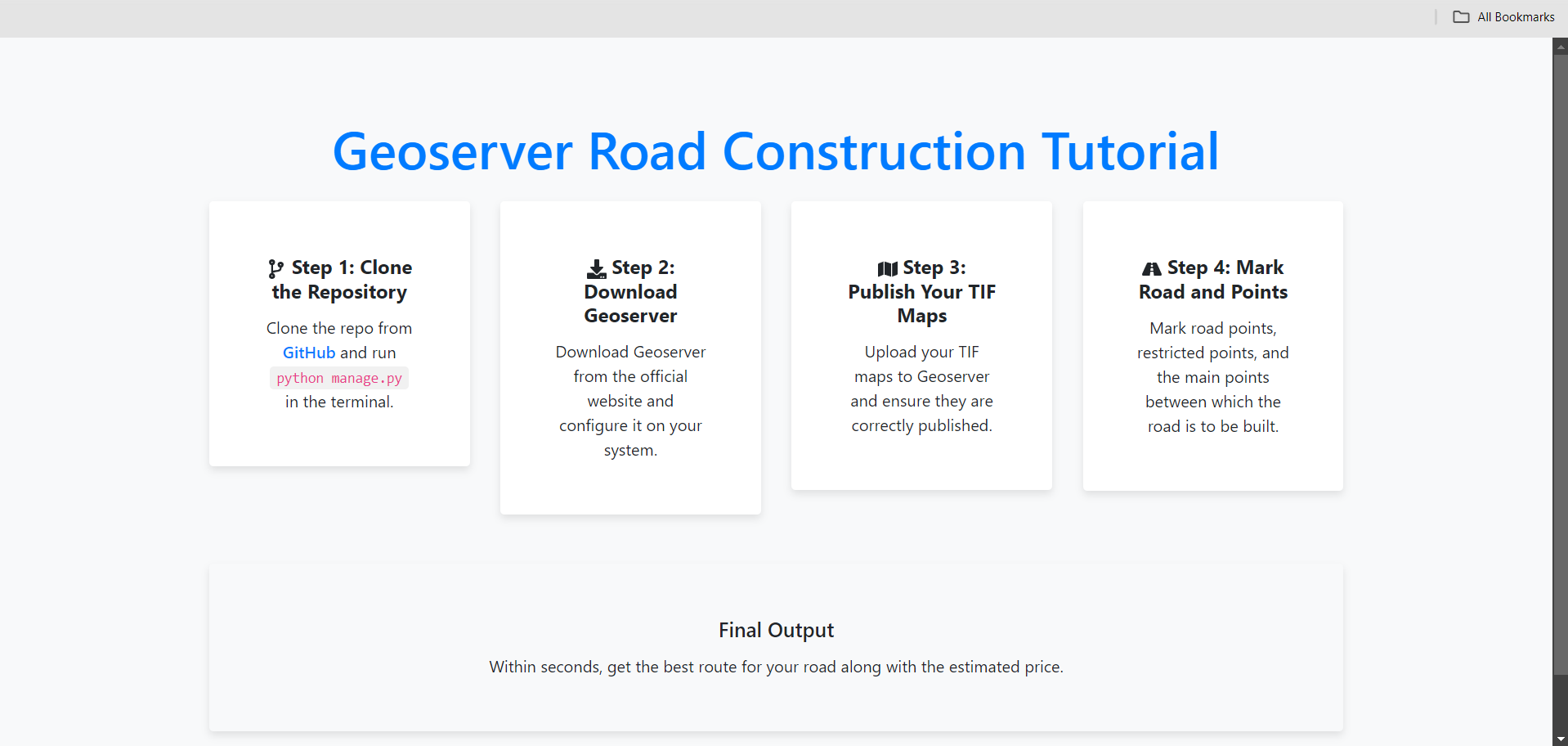
Tutorial Page
-
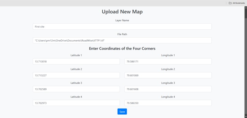
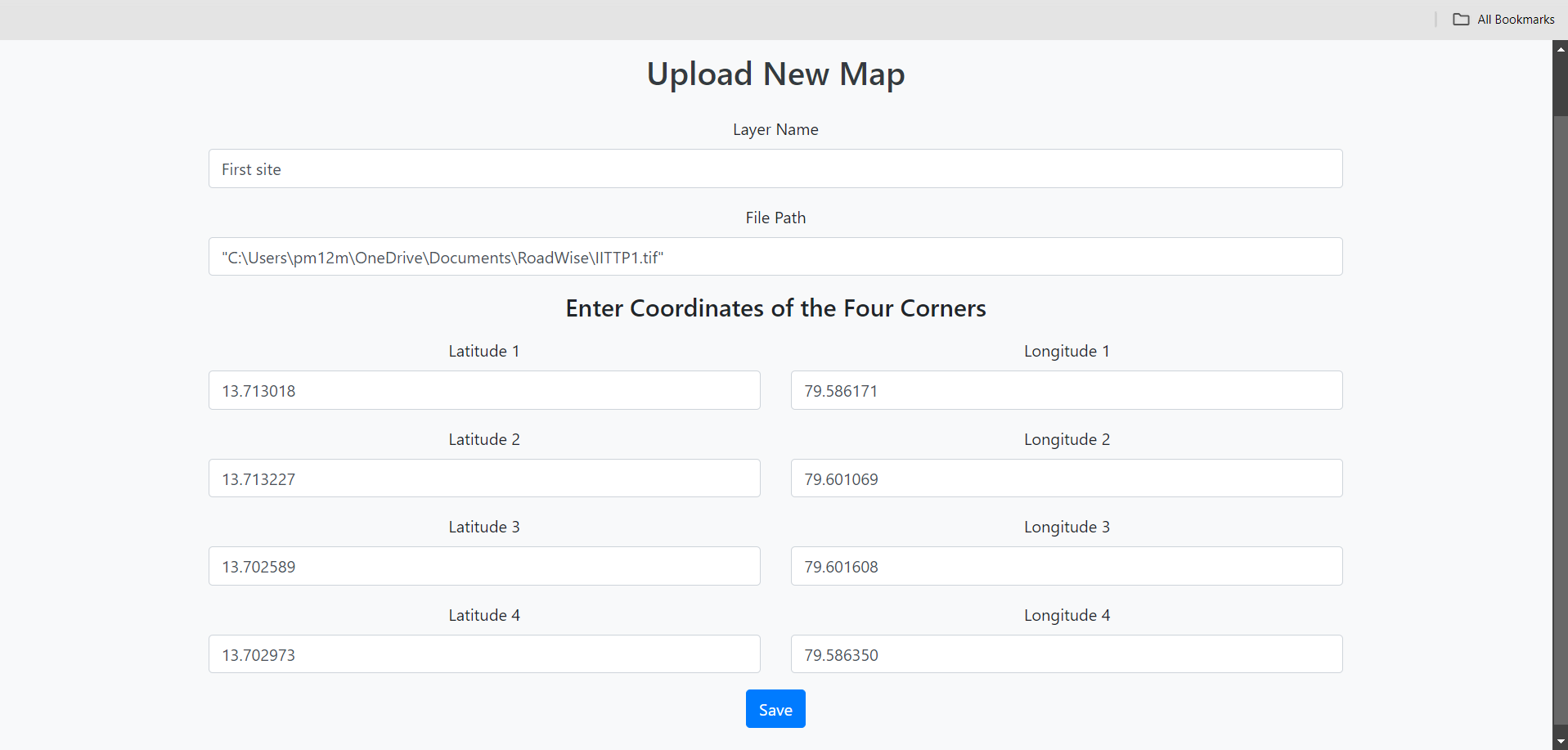
Project Adding Page
-

Selecting Project
-

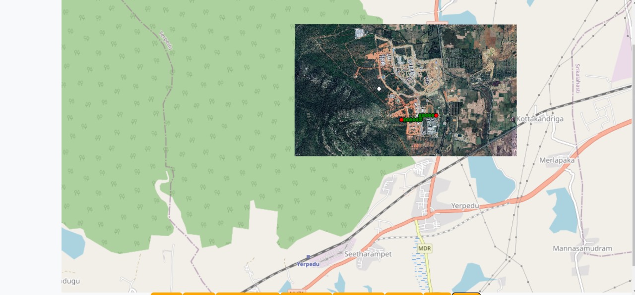
Road displayed
Inspiration
During a construction project at our college, we noticed that a significant amount of time was spent on road planning. This observation sparked the idea to apply software concepts to streamline the process. We created RoadWise, a tool that leverages a modified Dijkstra algorithm and the Haversine formula to identify the optimal route for new roads. The tool also calculates the cost of constructing the best route, which is defined as the most economical path that considers existing roads and areas where construction is not feasible.
What It Does
RoadWise efficiently determines the optimal road route and calculates the associated construction costs. The optimal route is the most cost-effective path that factors in existing infrastructure and any geographical constraints that prevent road construction. By doing so, it helps planners make informed decisions that save time and resources.
How We Built It
The project was developed using GeoServer WMS for mapping services, React Vite for the front-end, and Flask for the back-end. These technologies were integrated to create an interactive and user-friendly platform that allows users to map out potential routes and get instant feedback on the best path and its cost.
Challenges We Ran Into
One of the main challenges was the limited time frame in which we had to develop the project. With more time, we could have integrated machine learning to allow RoadWise to automatically detect restricted areas and existing roads. Currently, users need to manually mark these points on the map, which is something we aim to automate in the future.
Accomplishments That We're Proud Of
We are particularly proud of creating a solution that has the potential to be highly beneficial to urban planners and construction teams. RoadWise offers a practical application that can save time and resources in road planning, making it a valuable tool for many users. The fact that we could develop such a tool within a short period is an achievement in itself.
What We Learned
Through this project, we honed our teamwork skills, learned to navigate challenges, and deepened our understanding of GeoServer’s capabilities. The experience has also enhanced our ability to develop solutions under time constraints.
What's Next for RoadWise
The next step for RoadWise is to integrate AI and machine learning technologies. This will enable the tool to automatically detect existing roads and areas where construction is not possible, further streamlining the road planning process and making it even more efficient.


Log in or sign up for Devpost to join the conversation.