## Inspiration
Freshwater pollution is often discussed as a data problem, but in practice it is also a visualization, interpretation, and response problem. Water-quality information can exist as isolated measurements, sensor values, observations, alerts, maps, or reports without giving people a clear understanding of how pollution moves through an ecosystem or what should happen next.
We wanted to turn that fragmented view into something people could understand spatially and interact with.
RIVER GUARDIAN was inspired by a simple question:
What if a watershed could be explored like a living system, where environmental signals, pollution sources, infrastructure, and AI-supported assessments are visible in the same place?
Instead of presenting environmental information as a collection of disconnected dashboards, we built an immersive digital watershed that allows users to follow the journey of water from its source through industrial and urban areas, treatment infrastructure, ecological zones, reservoirs, dams, and downstream waterways.
The goal is not to replace environmental experts or human decision-making. The goal is to make environmental evidence easier to see, interpret, verify, and act upon.
## What We Built
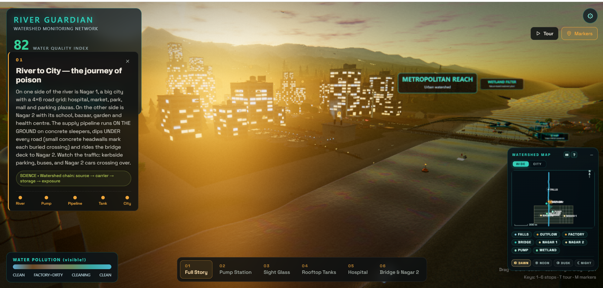
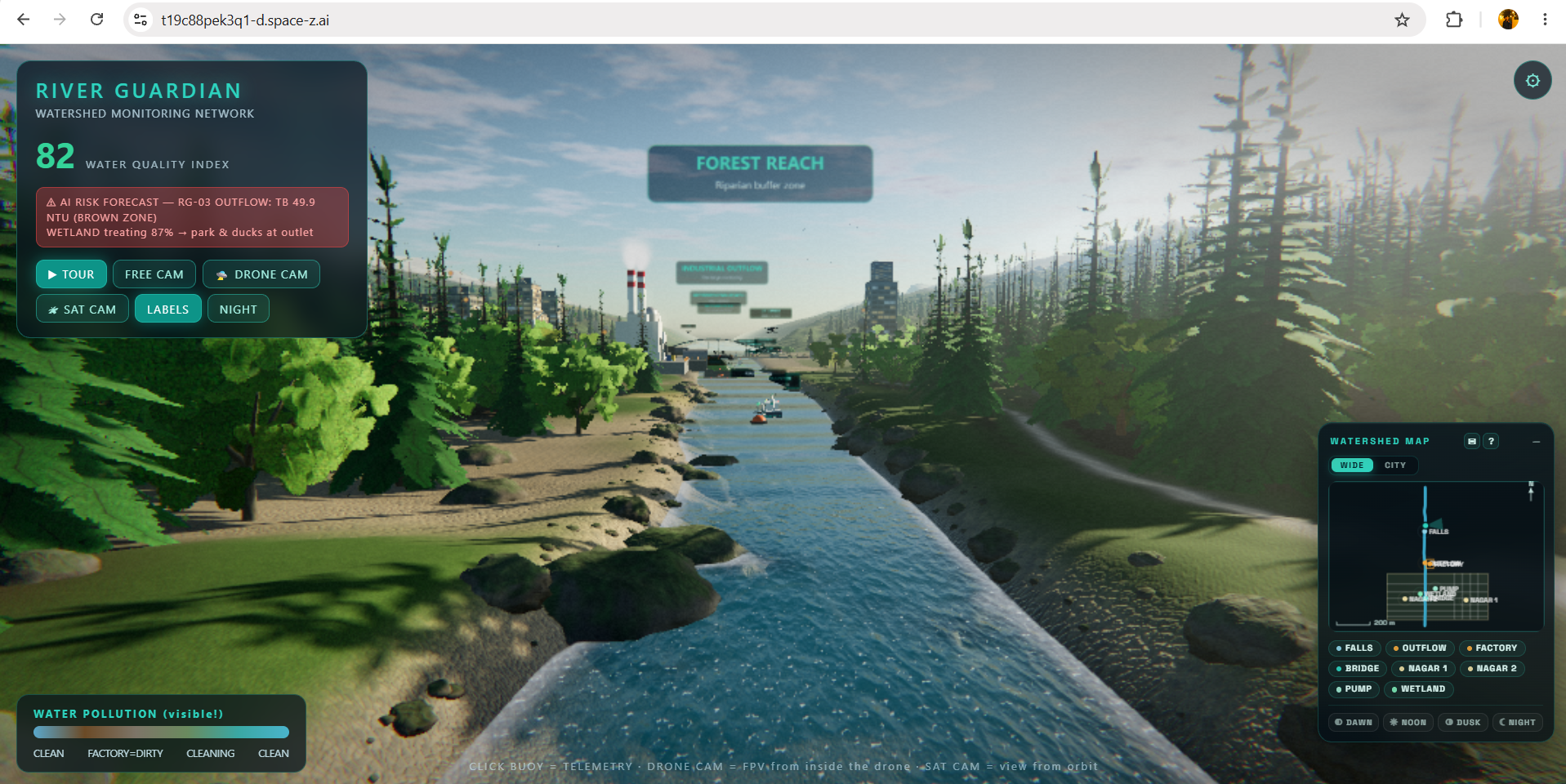
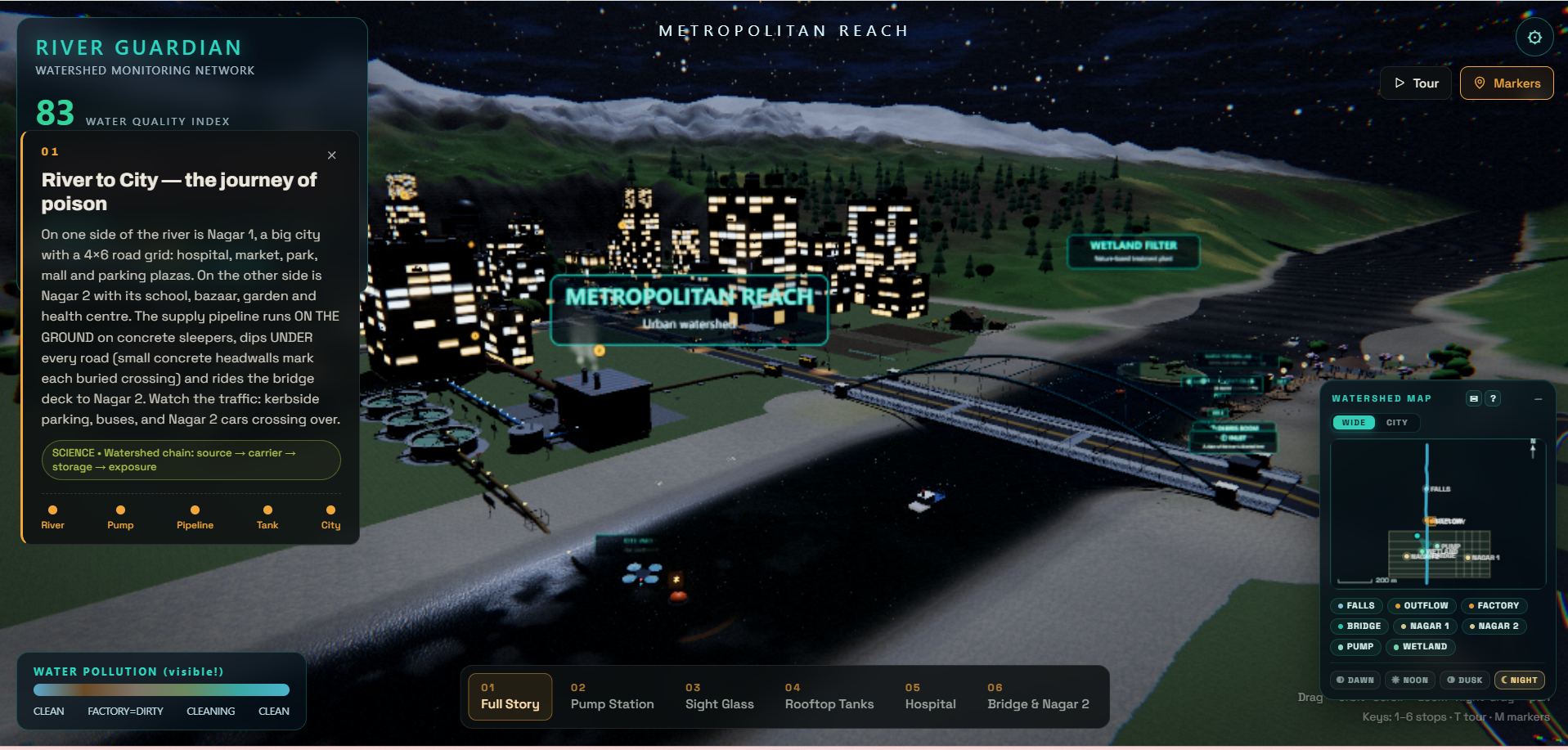
RIVER GUARDIAN is an interactive 3D watershed intelligence prototype built around a navigable WebGL environment.
The experience represents a complete watershed journey, including:
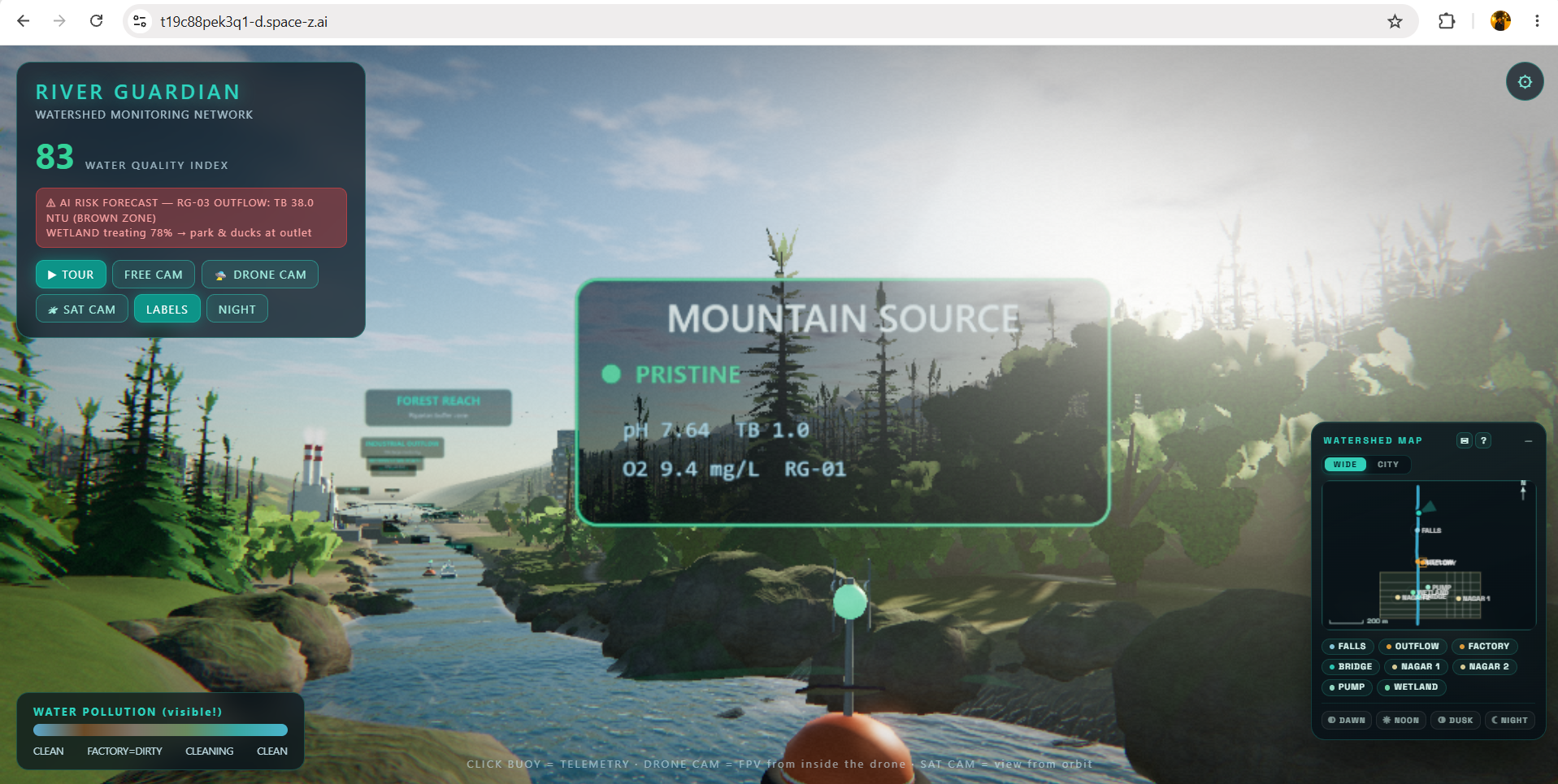
- Mountain and river source
- Flowing river systems and waterfalls
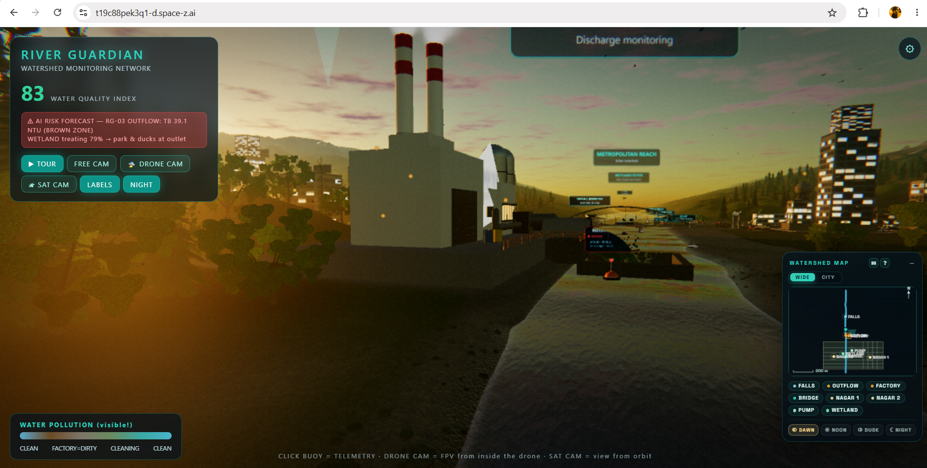
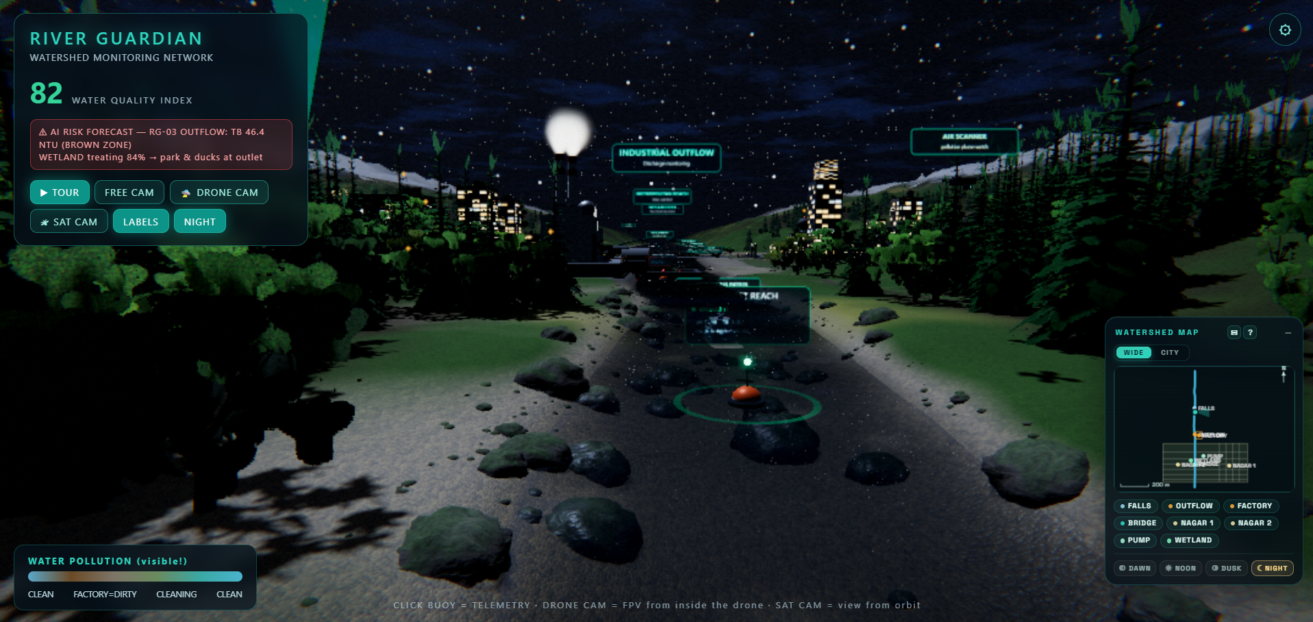
- Industrial pollution source and factory outflow
- Urban/city infrastructure
- Water-quality monitoring stations and sensors
- Environmental observation and telemetry interfaces
- Wetland and treatment infrastructure
- Ecological park and downstream environment
- Reservoir and dam infrastructure
- River port and downstream water systems
- Satellite and drone observation systems
- Interactive camera modes, guided exploration, telemetry panels, environmental states, and visual pollution indicators
Rather than making these areas separate screens, we connected them into one spatial environment so the user can understand the relationship between upstream activity and downstream consequences.
## The Core Problem
Environmental monitoring systems can become difficult to understand when users have to mentally connect separate measurements, locations, pollution sources, and response systems.
For a watershed, context matters.
A pollution signal becomes much more meaningful when a user can immediately see:
where it originated → how it affects the river → what infrastructure is downstream → what ecological areas may be affected → what action should be considered.
RIVER GUARDIAN turns that relationship into an interactive visual narrative.
## AI-Supported Assessment
Our project follows the OneAquaHealth AI-Supported Assessment direction.
AI is used as a decision-support layer rather than as an autonomous authority.
When environmental conditions indicate a potential pollution event, the system can surface an AI-supported assessment around the affected area. The interface is designed to communicate the warning, the suspected pollutant/risk, supporting context, and an AI confidence indicator in a form that is understandable to the user.
The important part is what happens next:
AI detects/supports assessment → explains the potential risk → human reviews the evidence → human verifies the event → response can be initiated.
This creates a human-in-the-loop workflow rather than allowing an AI system to make an irreversible environmental decision on its own.
The prototype also makes the distinction between machine-generated assessment and human verification explicit, which is important for responsible environmental AI.
Why 3D Matters
The 3D environment is not only a visual effect.
Spatial context is a core part of the problem.
A traditional dashboard may show that pollution exists. A spatial watershed model can help show where the pollution originates, where it flows, which infrastructure lies downstream, and which ecological zones may be exposed.
By placing telemetry, alerts, monitoring stations, industrial infrastructure, treatment systems, and environmental features inside the same navigable watershed, RIVER GUARDIAN turns abstract environmental data into a spatial story.
Users can explore the watershed from different viewpoints, move between monitoring locations, inspect infrastructure, and understand the system as one connected environment.
## Technical Implementation
The prototype is built as an interactive WebGL experience using JavaScript and Three.js.
The system combines:
- Three.js-based 3D rendering
- WebGL rendering and GLSL shader-based visual effects
- Procedural/environmental scene construction
- Interactive camera systems
- Water and terrain visualization
- Pollution visualization
- Environmental telemetry interfaces
- Monitoring-station UI
- Drone and satellite observation concepts
- Guided exploration and camera modes
- Responsive HUD and information panels
- Interactive environmental infrastructure
- Modular environmental zones within a single watershed scene
The project was designed as one connected experience rather than a collection of unrelated 3D scenes.
A major engineering challenge was maintaining continuity across a very large environment while preserving interactive systems, visual detail, camera behavior, water systems, environmental effects, and existing functionality.
## Environmental Storytelling
The project is intentionally structured as a journey.
The user can move from the natural source of the watershed toward increasingly complex human-influenced environments.
The experience moves through the relationship between:
Natural source → river → industrial activity → city → ecological/treatment infrastructure → reservoir → dam → downstream water systems.
This makes the project useful not only as a monitoring concept, but also as an awareness and storytelling tool.
A user can visually understand how one part of a watershed can influence another instead of viewing each environmental event in isolation.
## Human Health, Ecosystem Health, and One Health
RIVER GUARDIAN is designed around the One Health idea that environmental, animal, and human health are interconnected.
Water-quality degradation does not exist independently from the ecosystem around it.
Changes in freshwater systems can affect:
- aquatic ecosystems
- wildlife and biodiversity
- recreational environments
- downstream communities
- water-dependent infrastructure
- long-term environmental resilience
Our objective is therefore not simply to identify “dirty water.”
It is to create a system that helps users understand environmental conditions as part of a larger connected ecosystem.
## What Makes the Approach Different
Many environmental interfaces focus on either:
- data,
- maps,
- dashboards, or
- educational visualization.
RIVER GUARDIAN combines these concepts into one interactive environment.
The prototype brings together:
3D watershed visualization + telemetry + environmental monitoring + AI-supported assessment + spatial storytelling + human verification.
The result is a system where the user can move directly from observation to understanding.
Instead of asking:
“What does this number mean?”
the experience aims to help the user ask:
“Where is the problem, what could be causing it, what could be affected, and what should a human verify next?”
## Demo Data and Prototype Scope
This project is a prototype designed to demonstrate the complete workflow and user experience.
Where live environmental infrastructure or real-time sensor feeds are not available, the prototype uses structured/simulated telemetry and environmental states to demonstrate how the system would behave.
The purpose is to validate the interaction model, visualization approach, AI-assisted assessment workflow, and potential architecture before connecting the platform to production sensor networks, validated datasets, or live environmental APIs.
## Challenges We Faced
The biggest challenge was not simply creating a 3D scene.
It was integrating many systems without breaking the existing experience.
The project evolved into a large interactive environment containing terrain, water, industrial infrastructure, city systems, ecological zones, monitoring interfaces, transportation elements, observation systems, and multiple camera experiences.
Maintaining visual continuity, camera transitions, spatial relationships, environmental realism, interaction behavior, and performance simultaneously required careful iteration.
Another challenge was designing AI as a support layer rather than presenting it as an unquestionable authority.
This led us toward the human-in-the-loop model where AI can surface and explain a potential environmental issue while a person remains responsible for verification and response.
## Impact
RIVER GUARDIAN can serve several types of users:
Environmental researchers and analysts can use a spatial interface to explore environmental conditions.
Students and citizens can use it as an educational way to understand how watersheds and pollution pathways work.
Environmental authorities and organizations could use a future version as an operational visualization layer connected to actual monitoring infrastructure.
Communities could benefit from clearer environmental awareness and easier-to-understand water-quality information.
The larger objective is to make watershed intelligence more understandable and actionable.
## Future Potential
The current prototype provides the visual and interaction foundation for a much larger environmental intelligence platform.
Future versions could connect the system to:
- live IoT water-quality sensors
- validated laboratory measurements
- weather and rainfall data
- hydrological models
- satellite imagery
- drone observations
- historical water-quality datasets
- GIS layers
- standardized environmental data systems
- real-time alert infrastructure
The AI layer could then compare incoming observations against historical patterns, identify anomalies, generate explainable assessments, and prioritize events for human review.
The long-term architecture would allow the same concept to scale from a demonstration watershed to multiple cities, rivers, and freshwater ecosystems.
## Hackathon Alignment
RIVER GUARDIAN directly addresses the OneAquaHealth vision of healthier freshwater ecosystems and communities.
Our strongest alignment is with:
### Track 3 — AI-Supported Assessment
The project uses AI to support environmental assessment while keeping human verification in the decision loop.
It demonstrates:
- AI-supported environmental alerts
- contextual assessment
- confidence communication
- visual explanation
- human verification
- response-oriented workflows
It also naturally connects with the broader OneAquaHealth goals of monitoring, awareness, environmental sustainability, and the relationship between ecosystem health and human well-being.
## Vision
RIVER GUARDIAN is built around one principle:
Environmental intelligence should not only be accurate. It should be understandable, spatially meaningful, explainable, and actionable.
By combining immersive 3D visualization with environmental telemetry and responsible AI-supported assessment, we aim to create a bridge between complex environmental data and the people who need to understand and act on it.
From streams to systems — turning watershed signals into actionable One Health intelligence.